Australia and New Zealand, March 2017
By Henry Doenlen
After our flying safari in South Africa and Namibia during May, 2016, Liz and I were eager to look for a new adventure flying a small airplane. We actually had looked at the Flyinn web site during 2015, but we had difficulty with emailing the folks there. During June, 2016, we emailed again, and after working around some email server issues, were able to arrange a tour beginning March 21 with Jo McCaughan. In planning our trip, Liz and I thought we should visit Australia since we were in that part of the world. Our friends did not seem to be very impressed with Sydney, so we planned to go to Melbourne. There. we could see the Penguin Parade!
This web page is a combination blog and photo album. Almost all of the photos are clickable and hyperlink to a larger image. Clicking on the videos takes you to YouTube. Click here for the blog with flying info only.
A pilot needs to get their license "validated" before being permitted to fly a New Zealand registered aircraft. The validation process started 2 months before the trip to New Zealand. I had fill out a 1 page validation application and email copies of my American pilot's license, medical, recent logbook pages and passport photos to Flyinn. I also had to acquire a new Restricted Radiotelephone Permit from the Federal Communications Commission. This was not required for flying in the United States, but is required overseas. They took care of all of the details. Validation is for a specific model of airplane. Flyinn uses Cessna 172's with Penn Yan Aero Super Hawk 180 hp engines. I had experience with flying one at SkyWarriors in Pensacola.
 3/15/17: Departing the States…
Leaving Pensacola at 10:30 am, we flew a regional jet to Chicago and a 757 to Los Angeles. There, we boarded a 787 Dreamliner for Melborne. During the flights, I was able to review the pdf booklets from the New Zealand Civil Aviation Authority (CAA) on "Mountain Flying" and "In and Around Milford." I learned that it was best to fly on the upwind side of valleys, where the air was smoother, uplifting, and would give a smaller turn radius if needed. But this had to be balanced with the recommended right-of-way practice of flying on the righthand side of a valley. I wondered what happened when the upwind side was on the left and the turbulent lee side with it's downdrafts was on the right. I figured I would find out with the Flyinn instructor. Mountain saddles (dips between peaks) were passed at an angle in level flight to allow for a turn away if needed.
3/17/17 … and arriving in Melborne
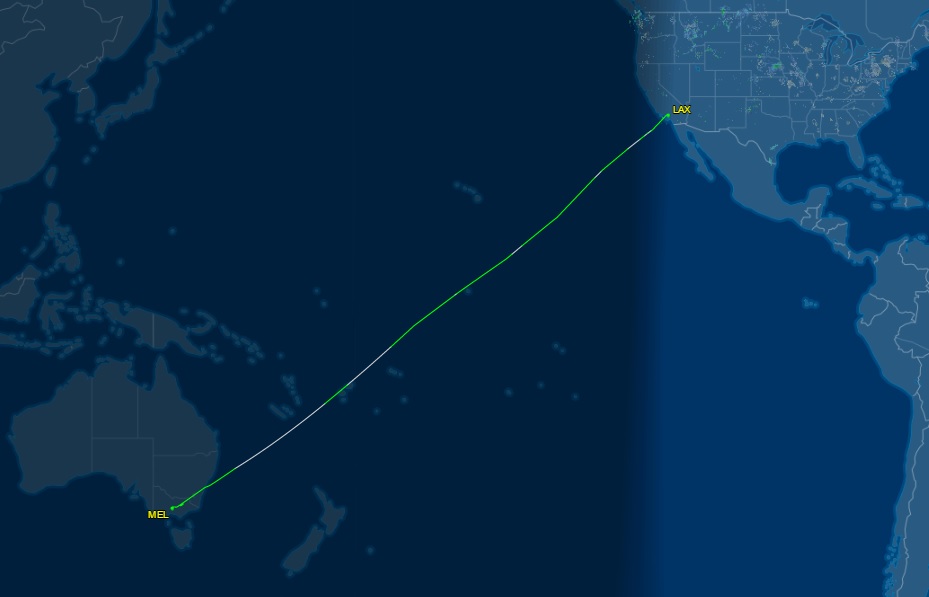
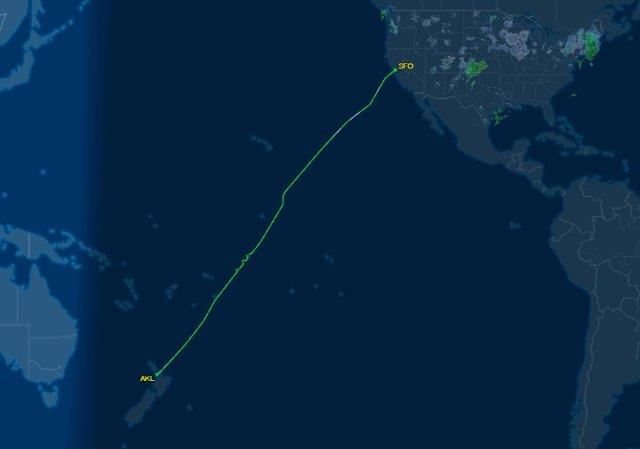
United Airlines flight 98 took us over the international date line, so we totally lost Thursday. We arrived in Melbourne Tullamarine Airport just before 9:00 am. We took Skybus from the airport to the Southern Station in Melbourne, which was less than a block from Hotel Alto where we stayed. We had traveled for 30 hours and 10,459 miles during 16 hours of flight.
3/17/17: A Melbourne Walkabout
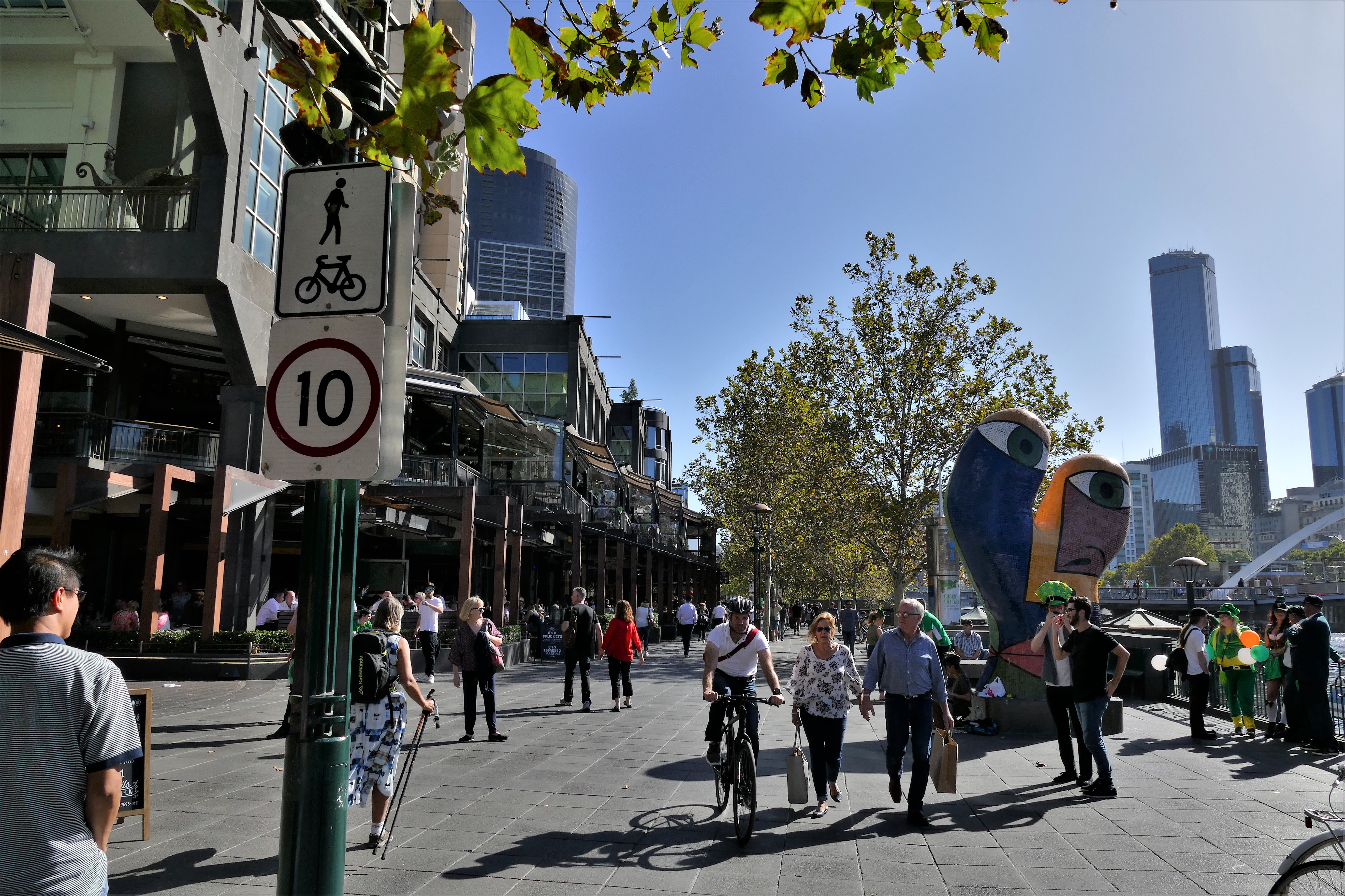
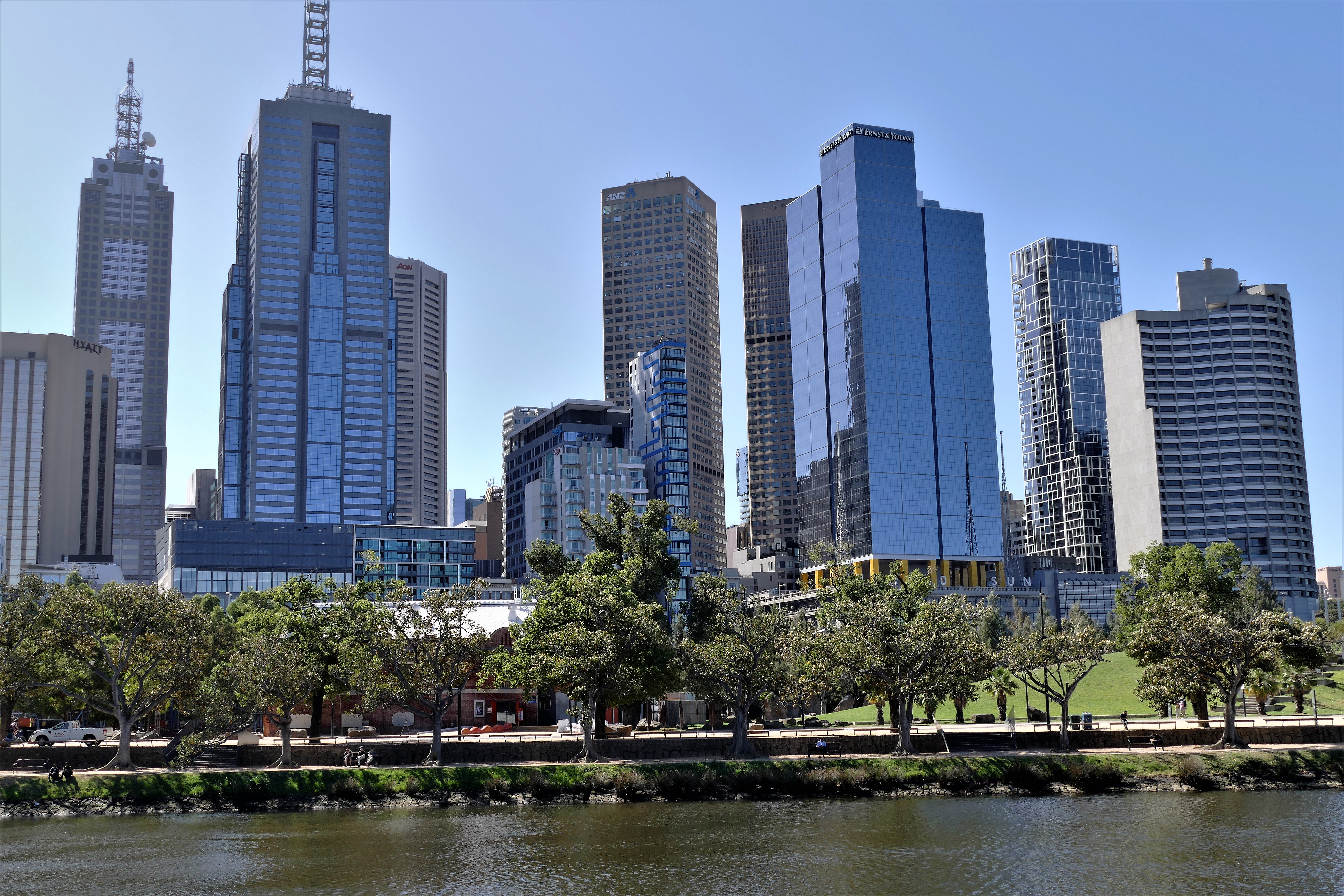
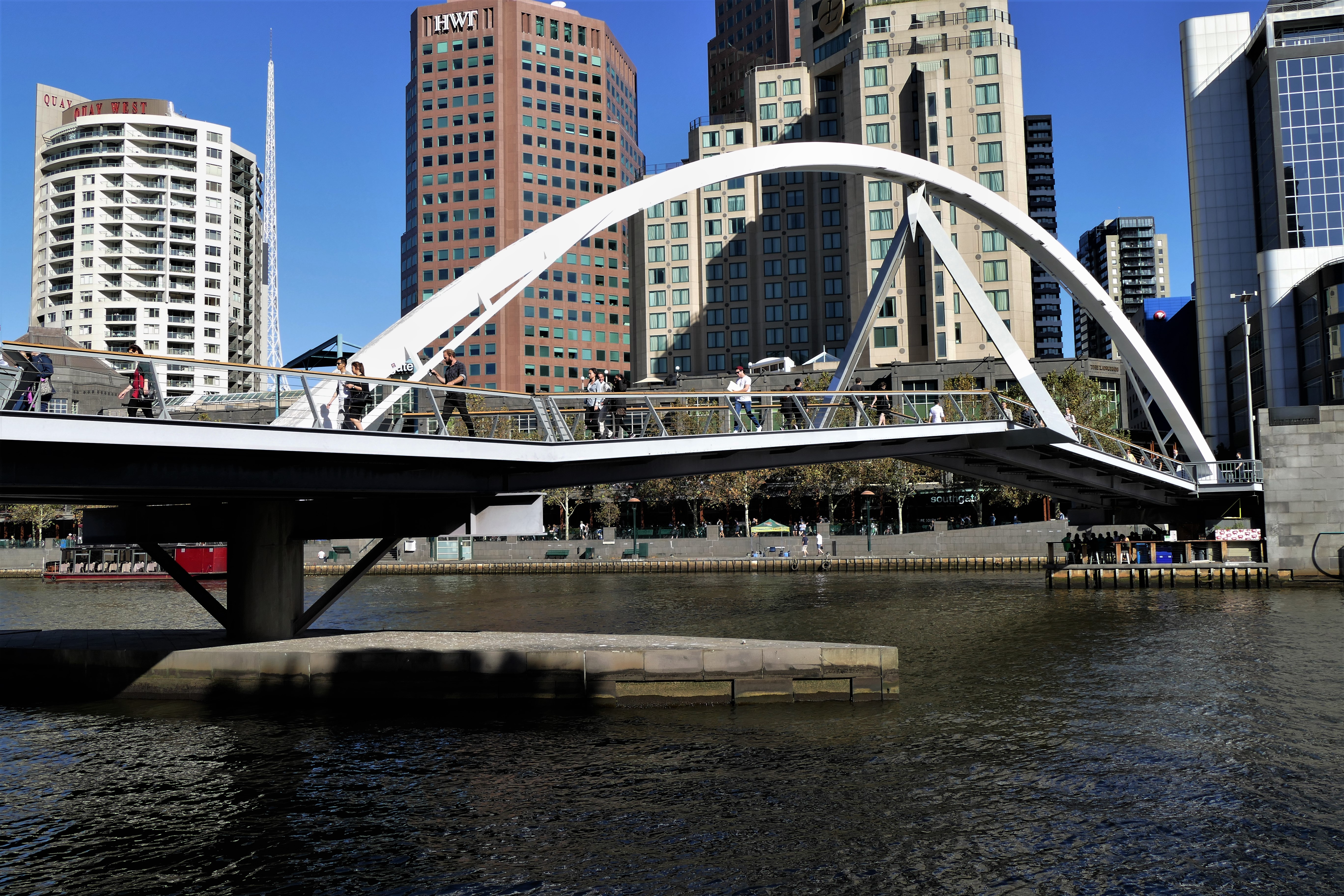
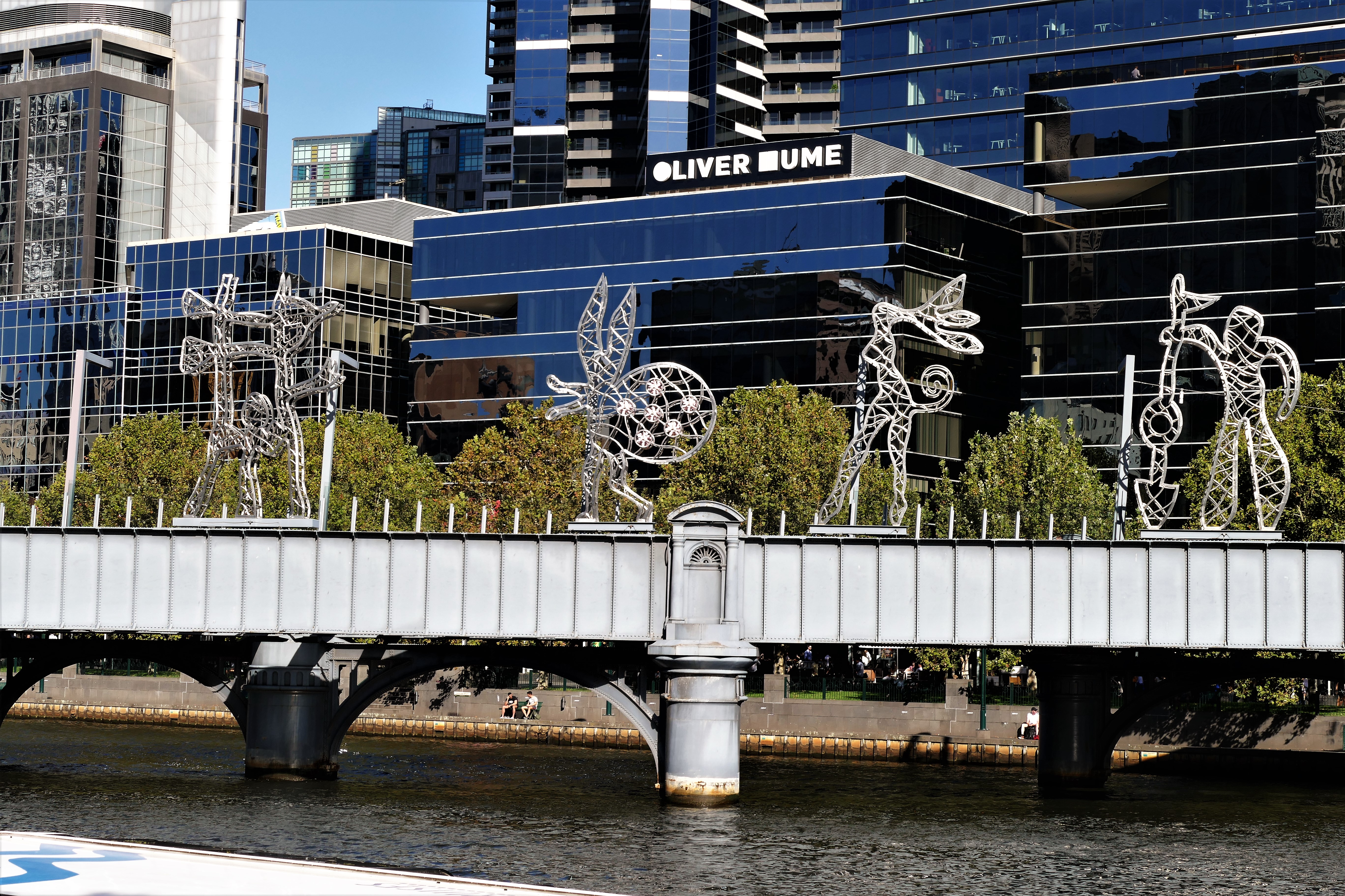
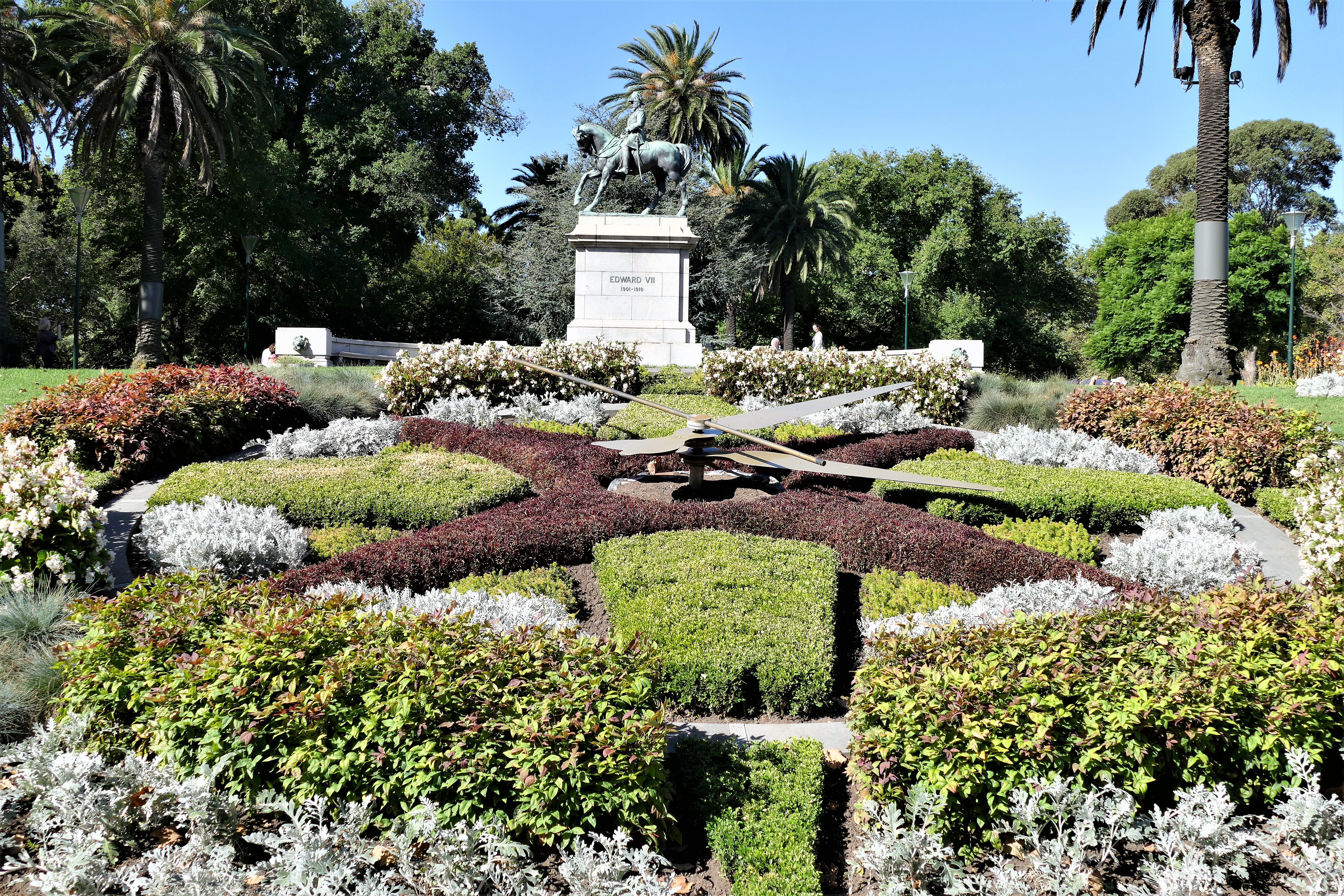
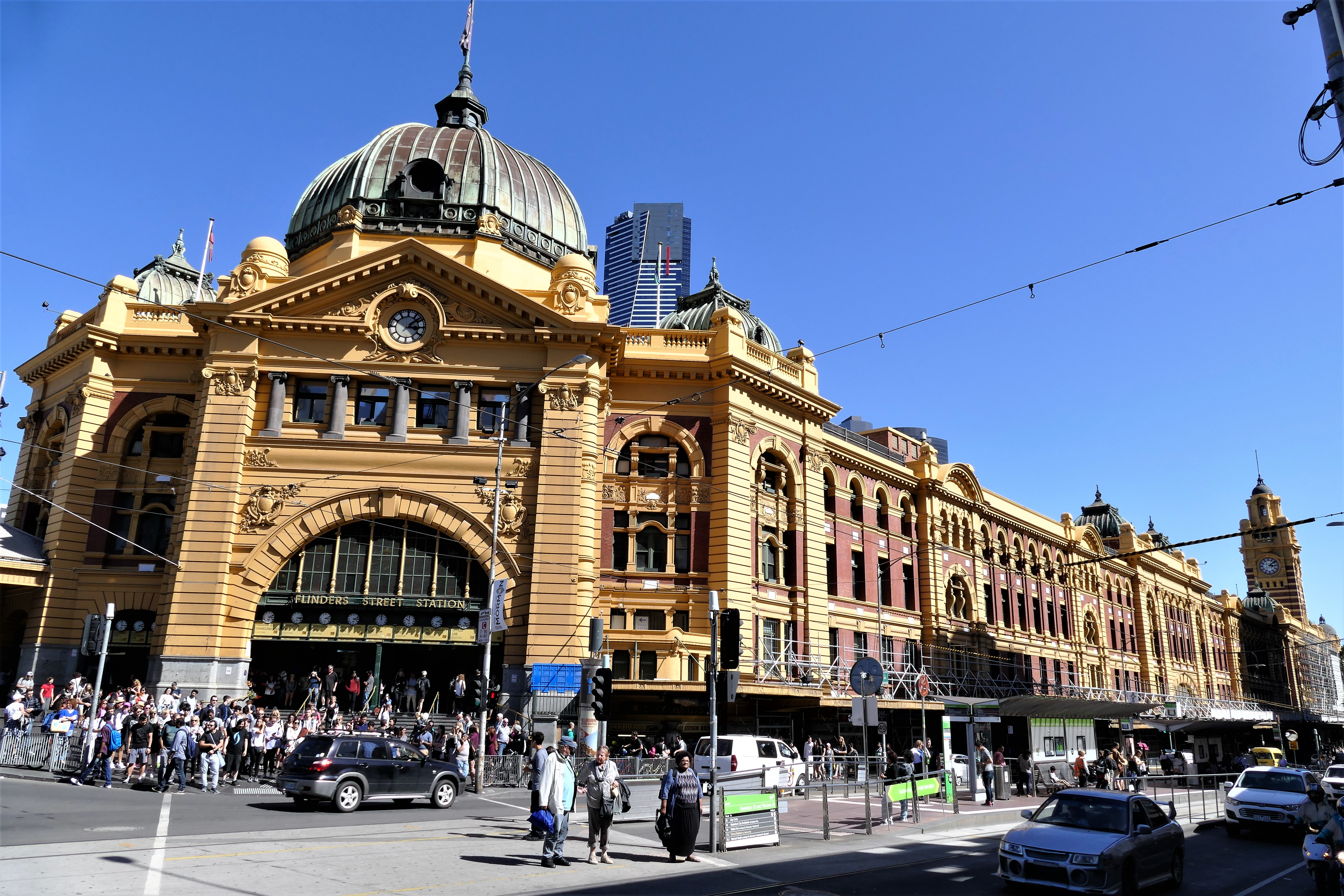
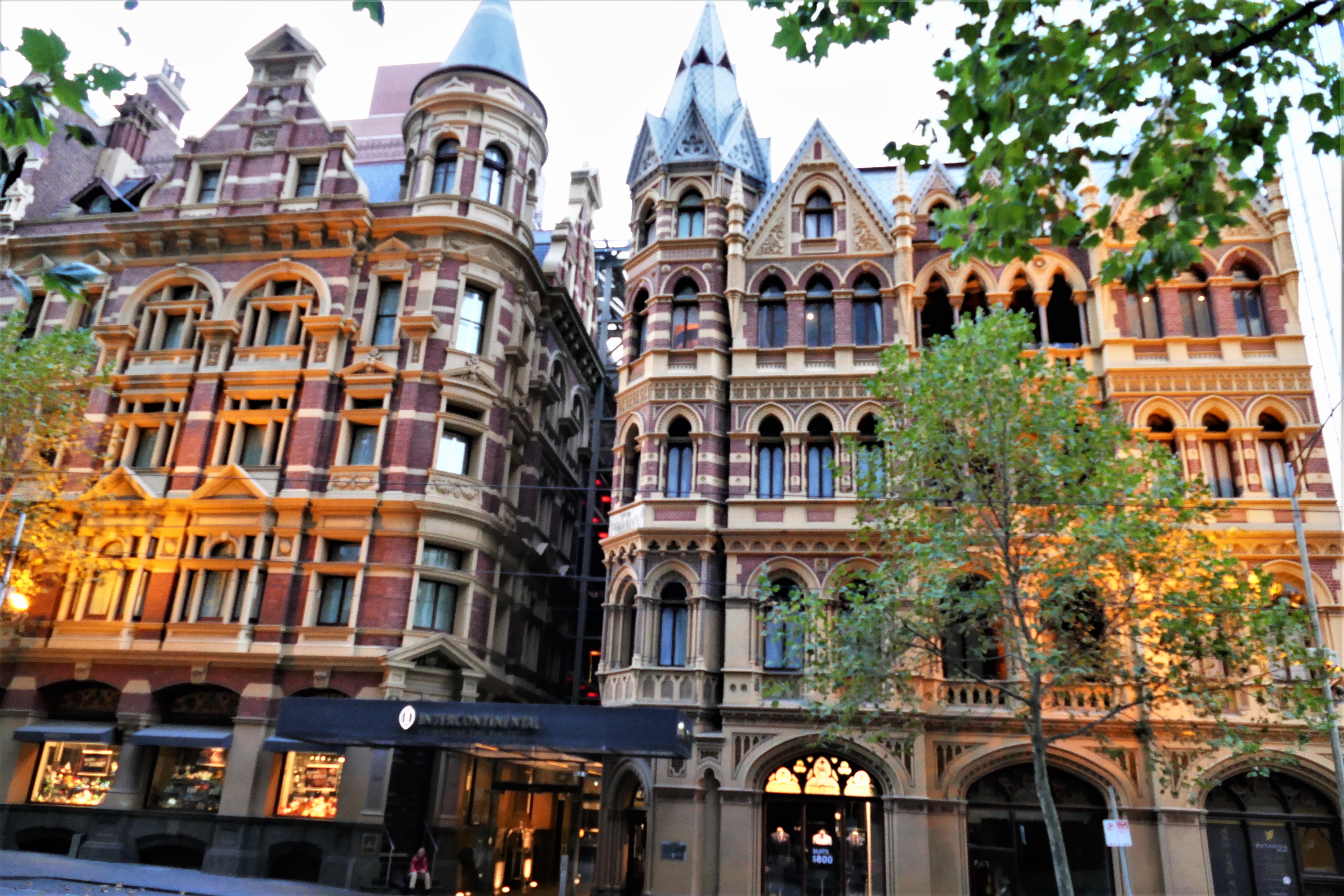
After checking into the Hotel Alto, we set out to explore Melboune by foot. We walked north on King Street, then through to the middle of Flagstaff Gardens. We exited the park to walk east on LaTrobe, turning south on Elizabeth Street. We stopped in Michael's Camera and Video store to buy an electrical outlet converter, as mine had been stolen in Los Angeles airport. We continued on Elizabeth street, drank Vietnamese ice coffee from a sidewalk vender, and looked into the Royal Arcade. We walked east on Burke Street, then south on Swanston Street to take us past St. Paul's Cathedral (Episcopal), Federation Square, and the picturesque Finder's Street Railsay Station. We crossed the Yarra River on St. Kilda road and entered the Alexandra Gardens, walked along the river past some boathouses, then crossed Alexandra Avenue to Queen Victoria Gardens. We looked at the Queen Victoria memorial, found the Floral Clock, and walked back to the bridge. We walked along the Southbank Prominade, then crossed the Yarra River on the Southbank Pedestrian Bridge. We walked west along Bananna Alley, then up Market Street, looking for a bakery. After finding a bakery and purchasing the next day's breakfast, we walked back to the hotel. We had dinner at the Scugnizzo Italian restaurant.
3/18/17:
The Great Ocean Road
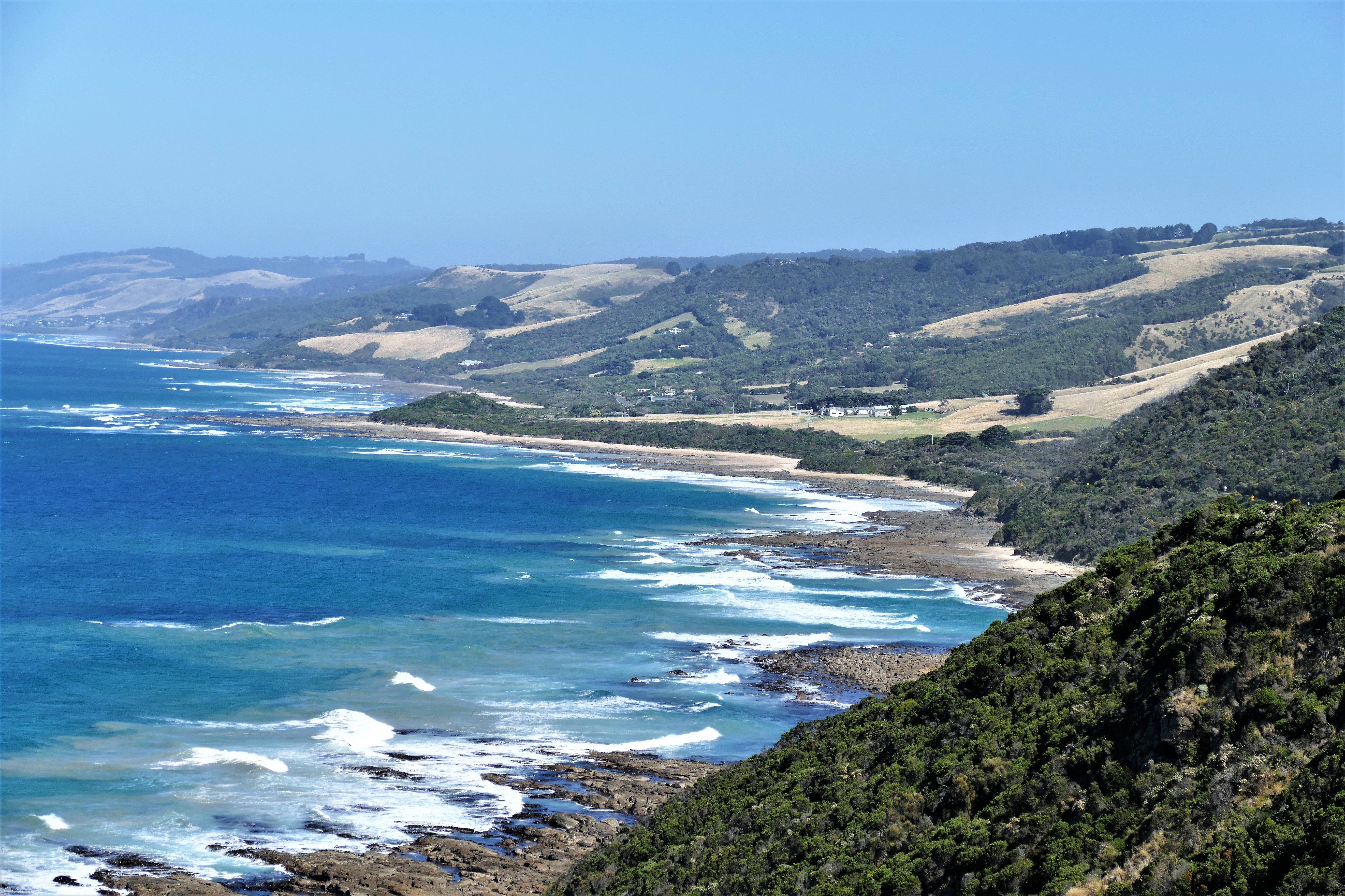
On Saturday, we were picked up by GoWest tours at our hotel, and rode in the
front of the small bus on their Great Ocean Road Tour. The bus took us over the
fabulously large West Gate Bridge, then down the M1 Princess Highway to B100,
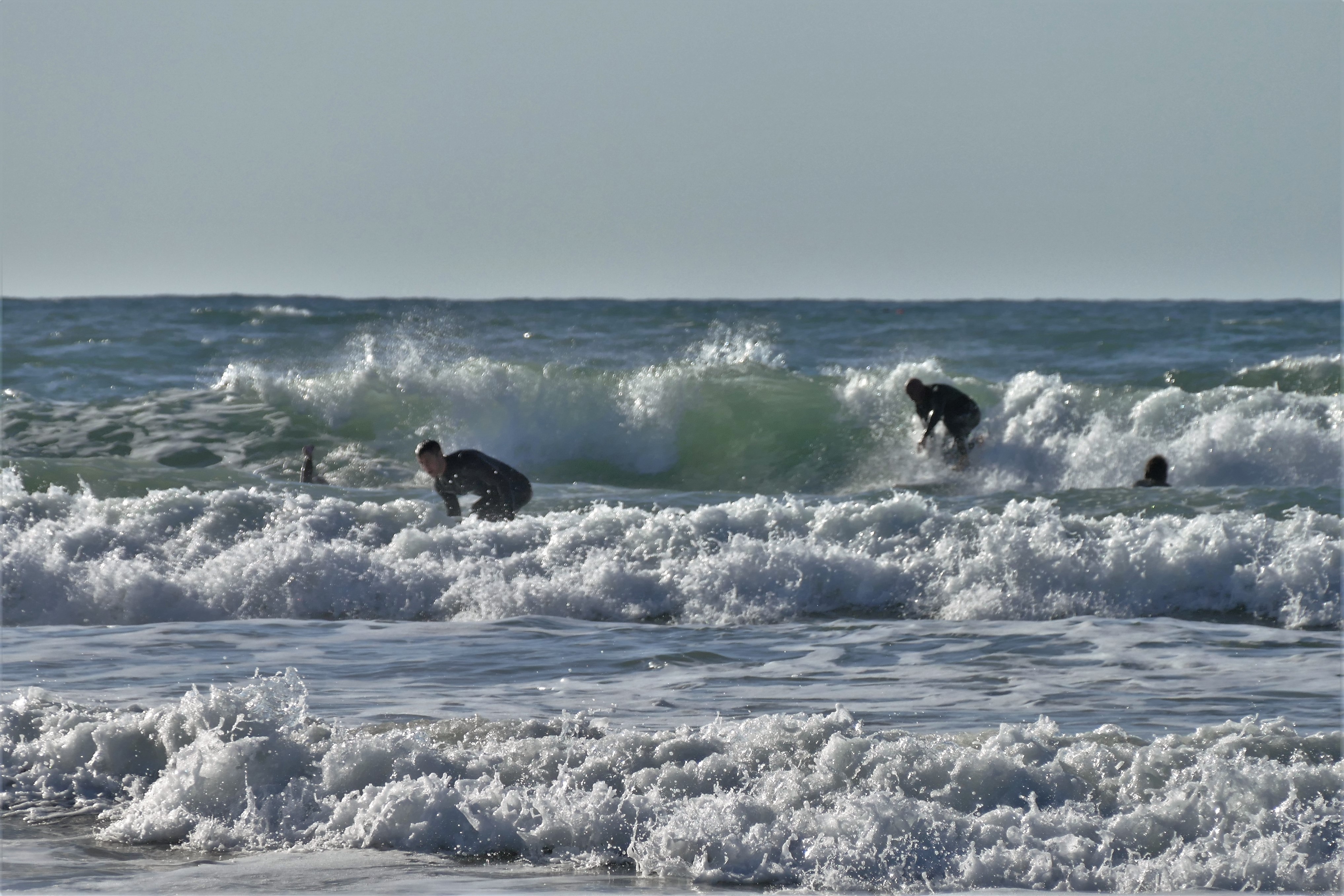
the Great Ocean Road. First stop was the surfing
beach at Torquay. Next, we stopped at the Memorial Arch, which marks the
official entry to the Great Ocean Road. After a drive, we stopped at Kennett
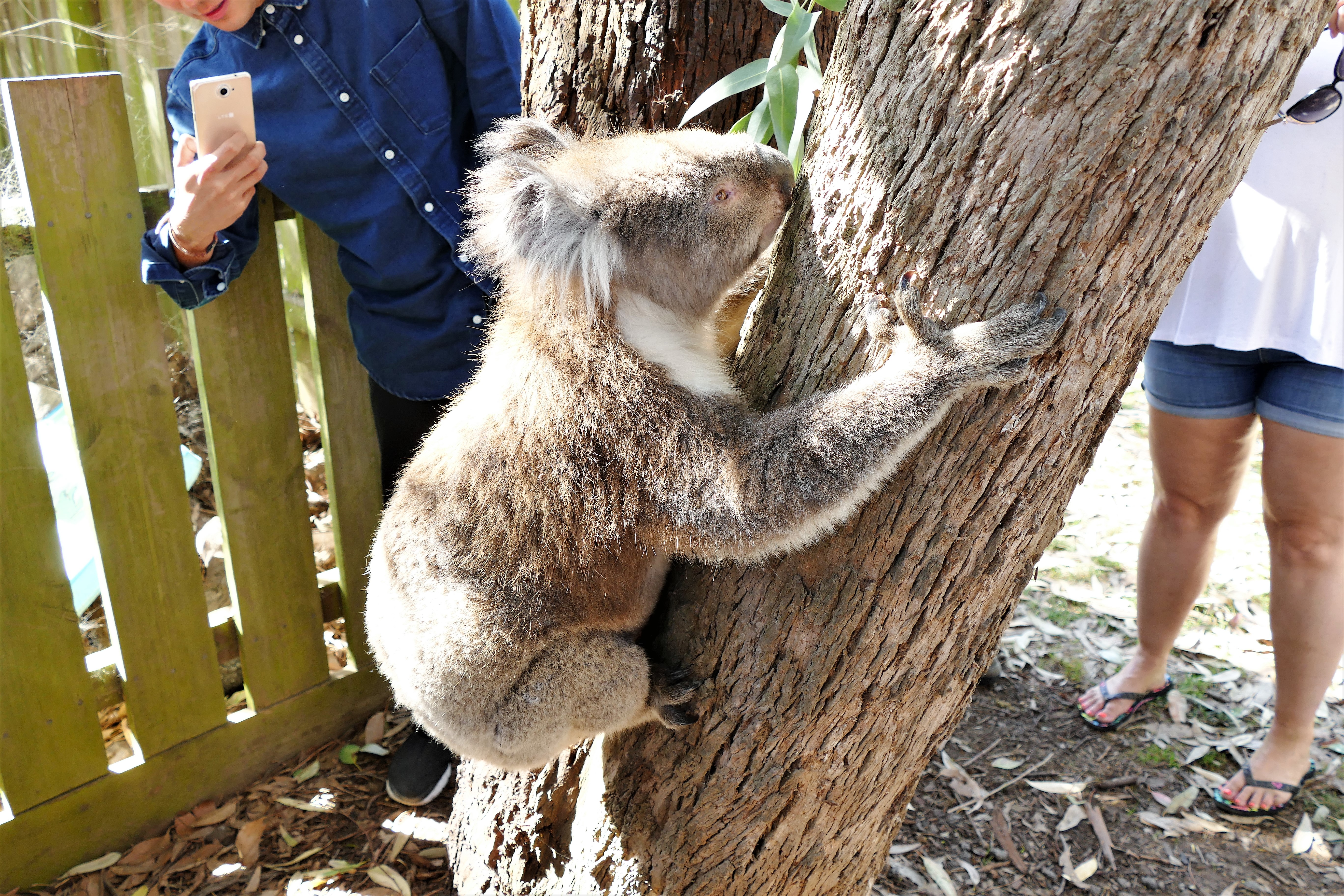
River to walk around and see Koalas. I was able to pet one, but the animal
ignored me. We had lunch in Apollo Bay, eating Thai fast food then checking out
the beach. A further drive took us to the Otway National Park where there was an
eco walking tour in the rainforest with eucalyptus trees. We drove onto the Port
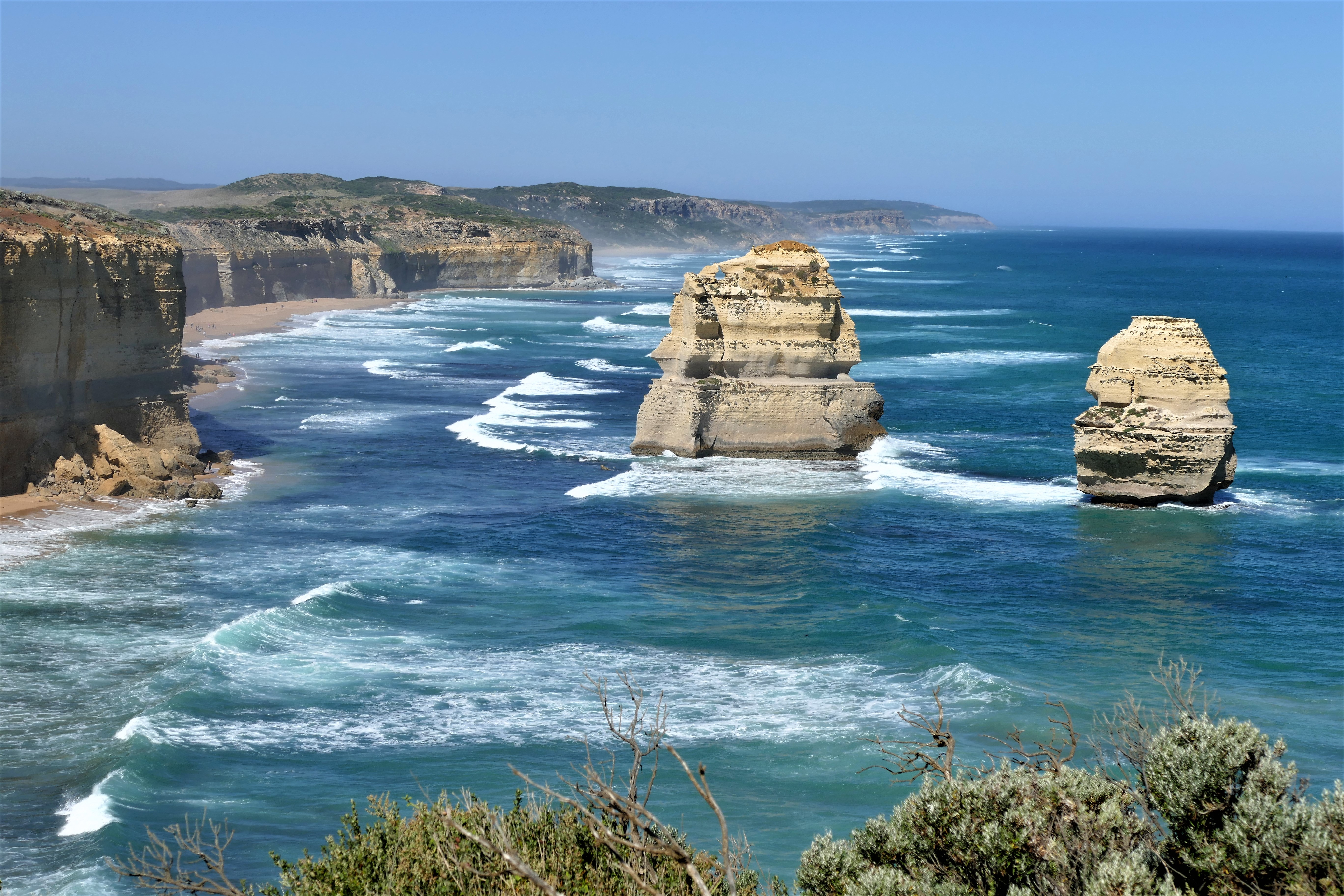
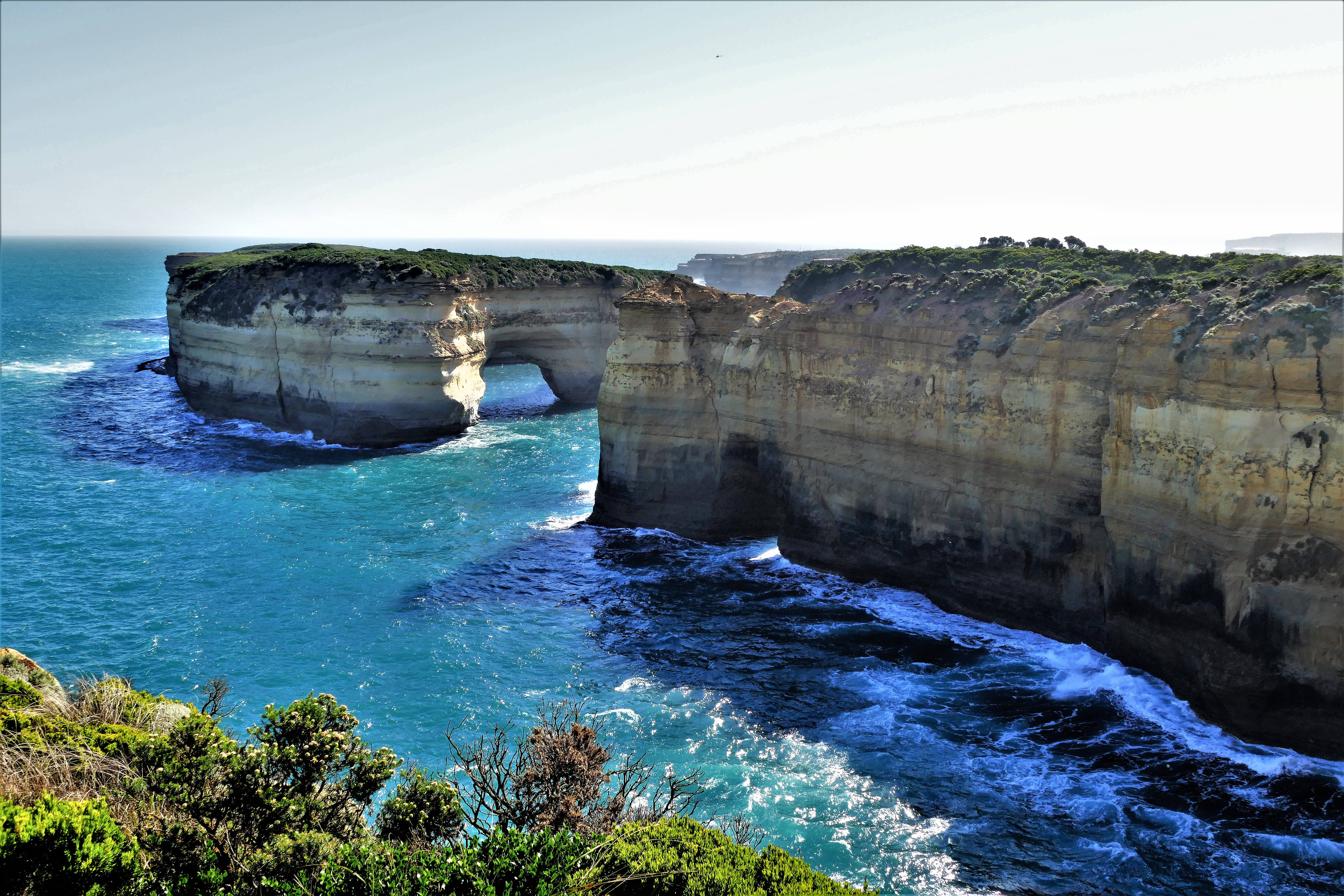
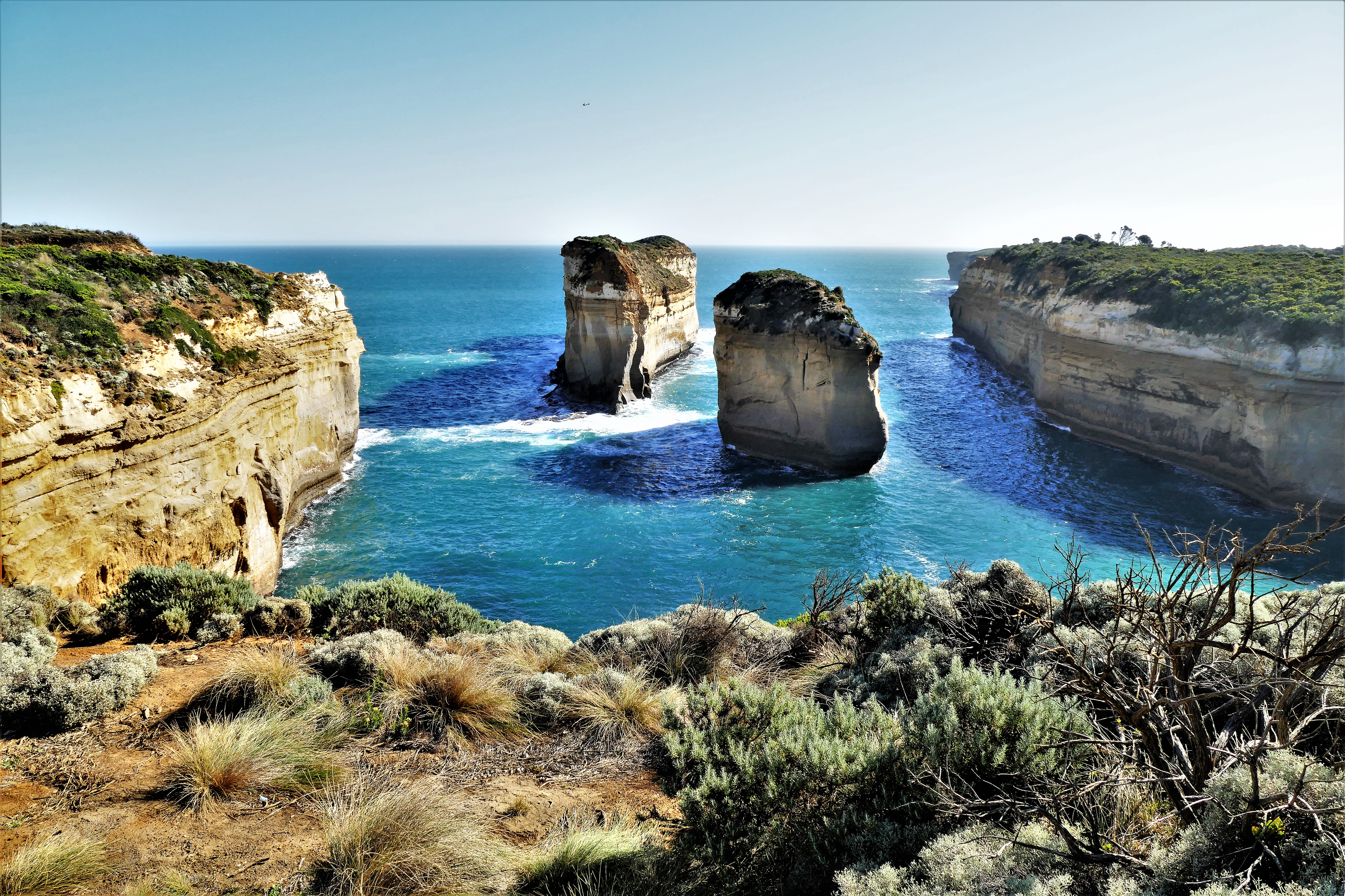
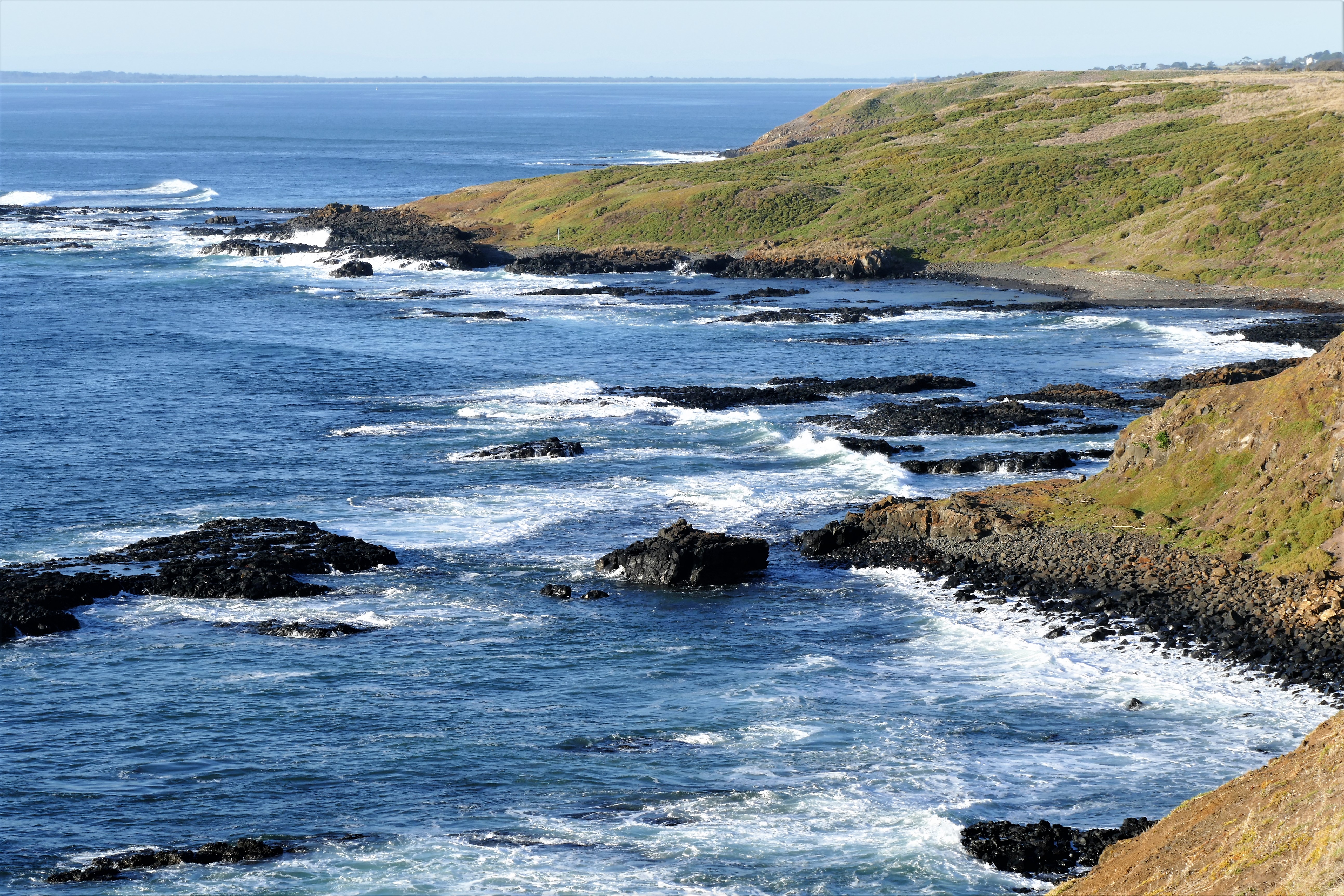
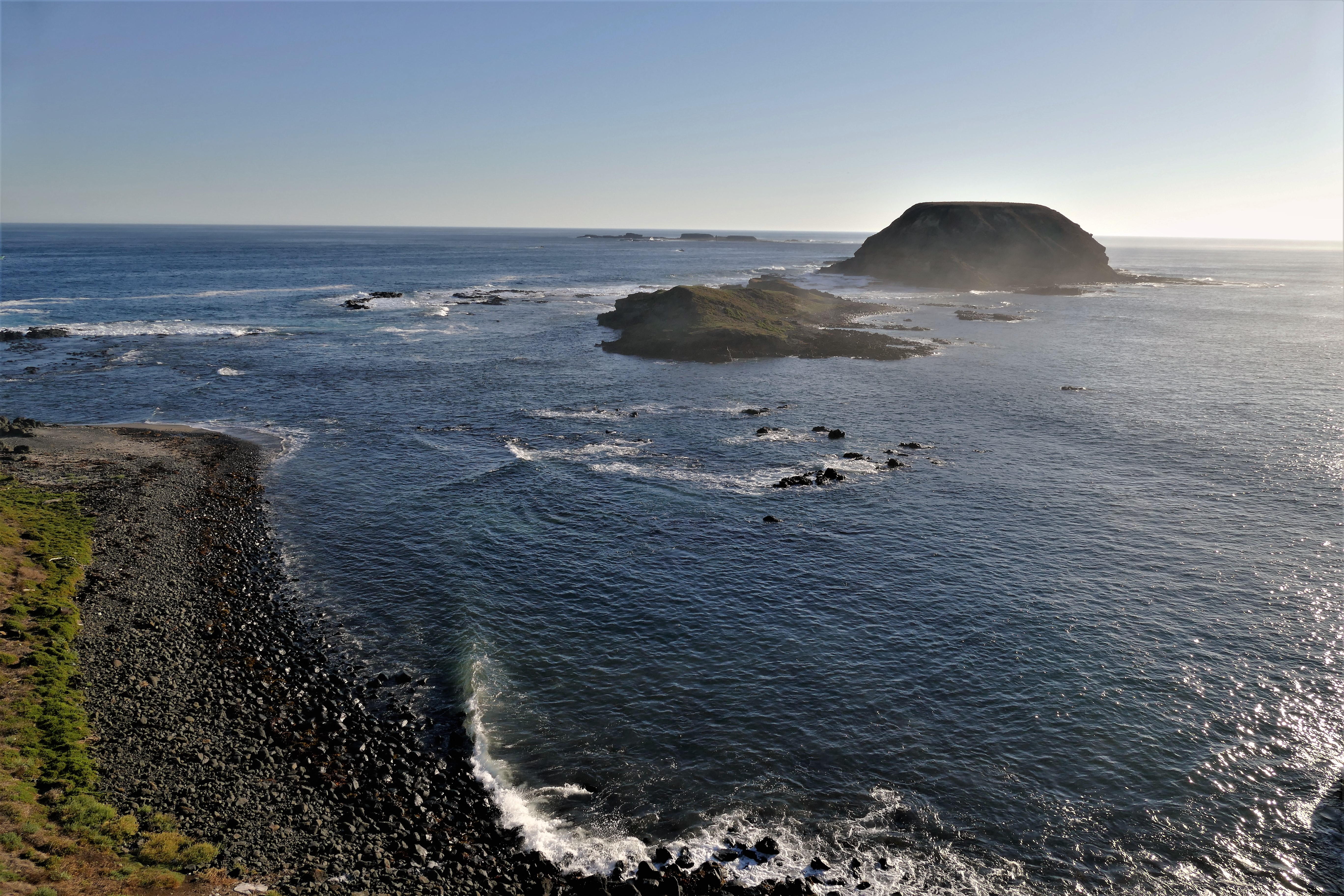
Campbell National Park, home of the 12 Apostles, which are about 8 freestanding
limestone formations in the water. We walked down Gibson's Steps to the beach
and a better view of 2 of the Apostles. The final stop was a Loch Ard Gorge, the
site of the Loch Arch shipwreck
on Mutton Bird Island in 1878. The drive back went thought Colac, were we found
a fast food stir fry at Noodle Canteen. After arriving back at the Hotel Alto,
we walke to the Melbourne Hwaro Korean BBQ for dinner
3/19/17: Penguin Parade
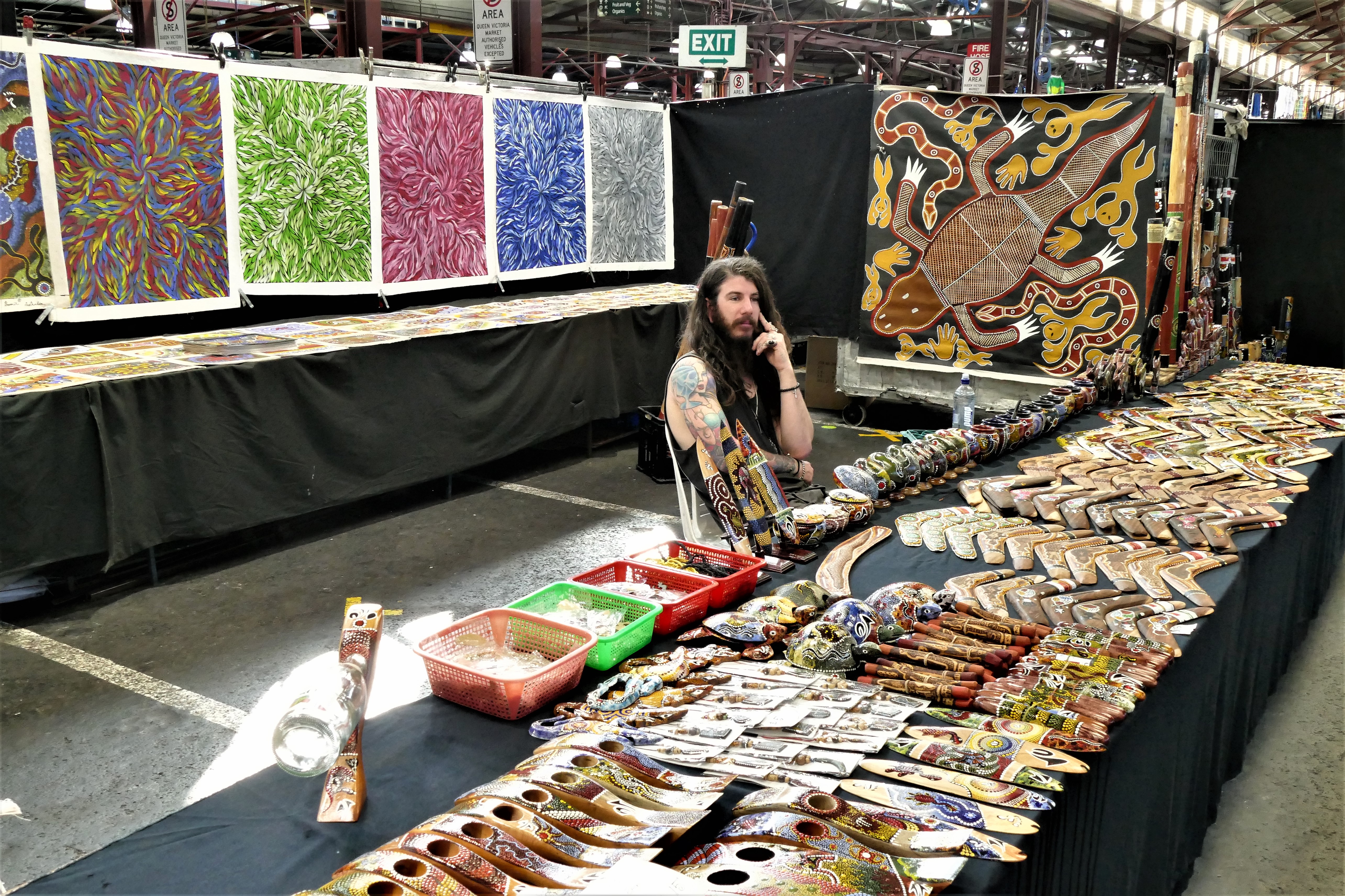
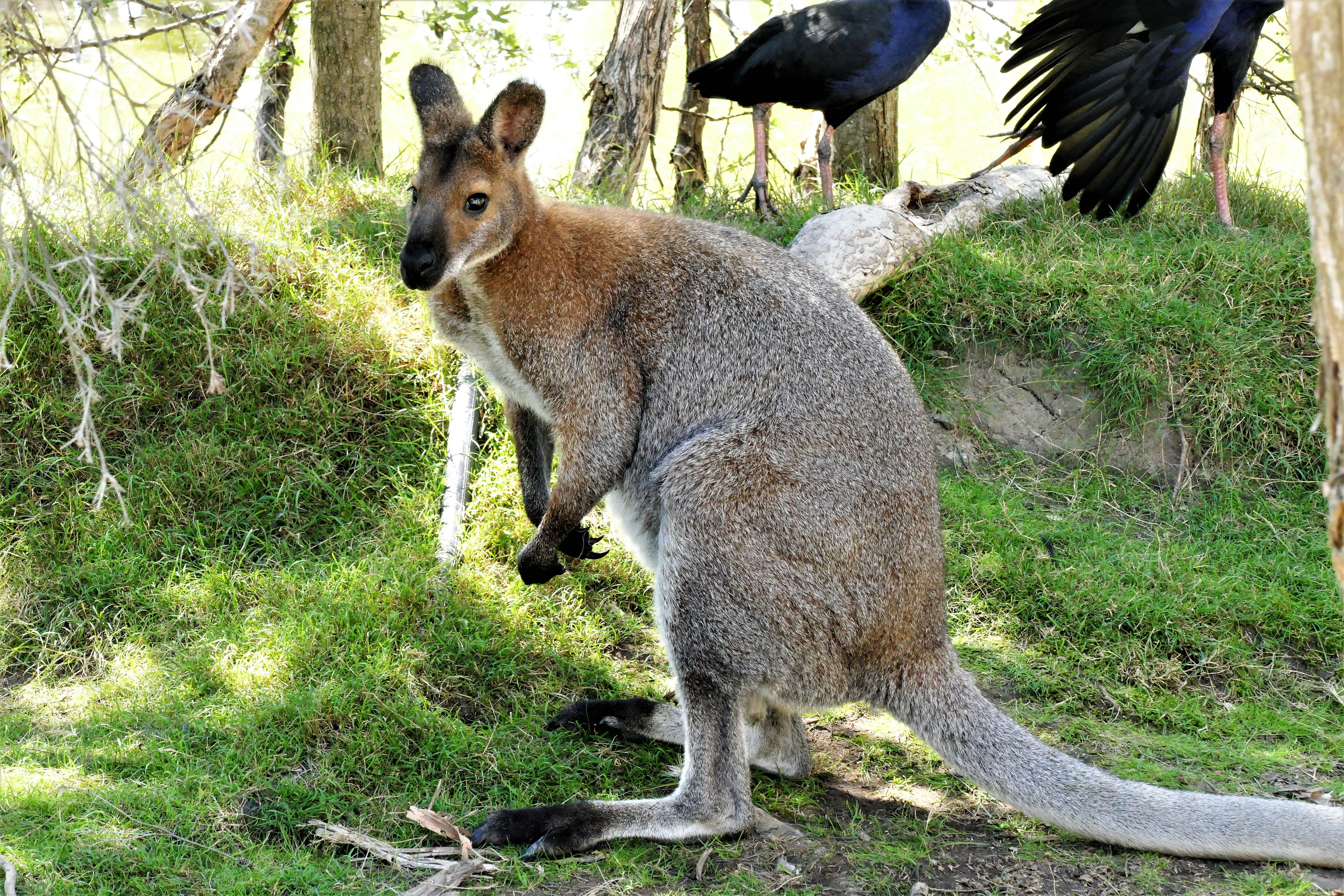
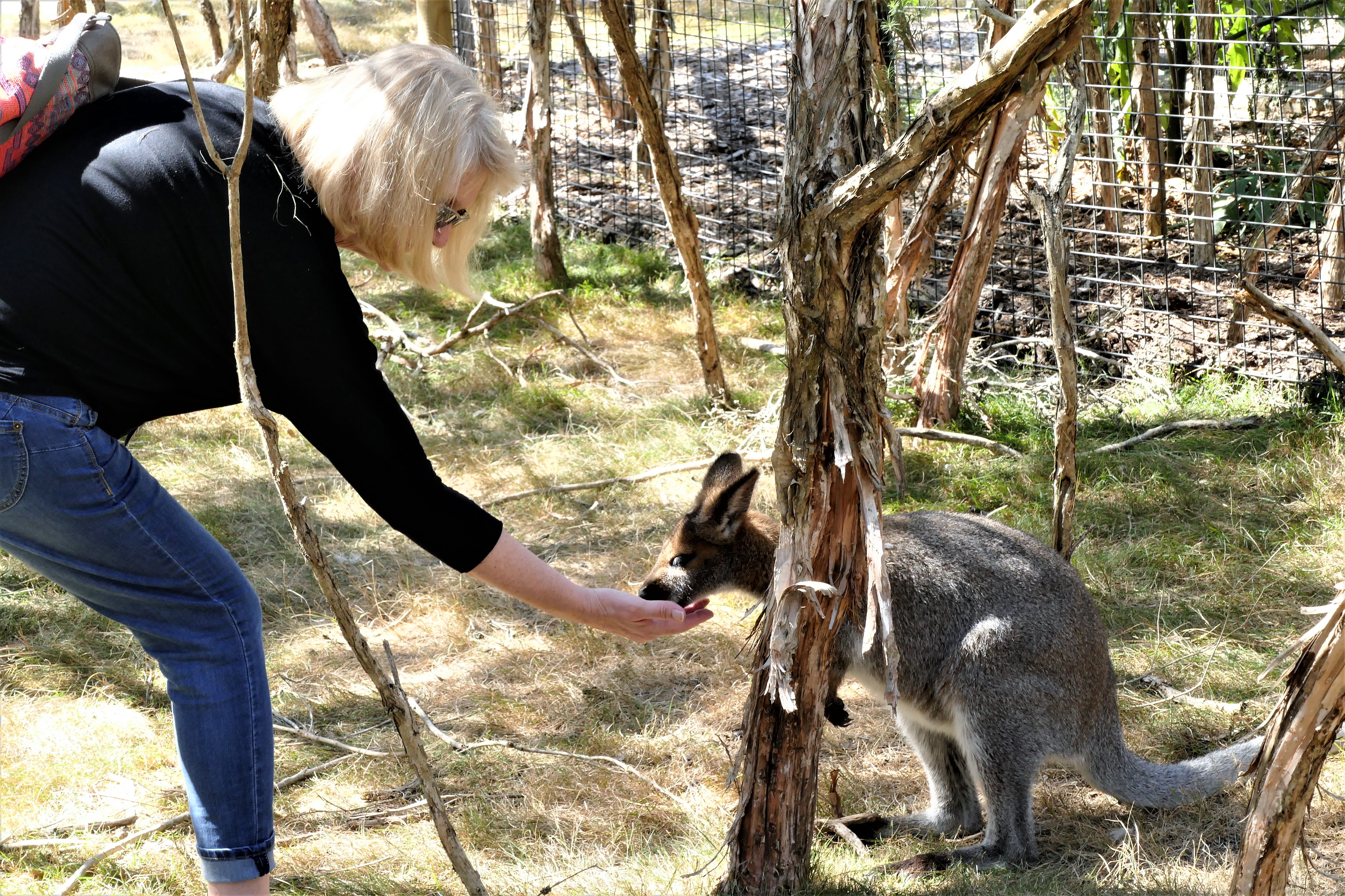
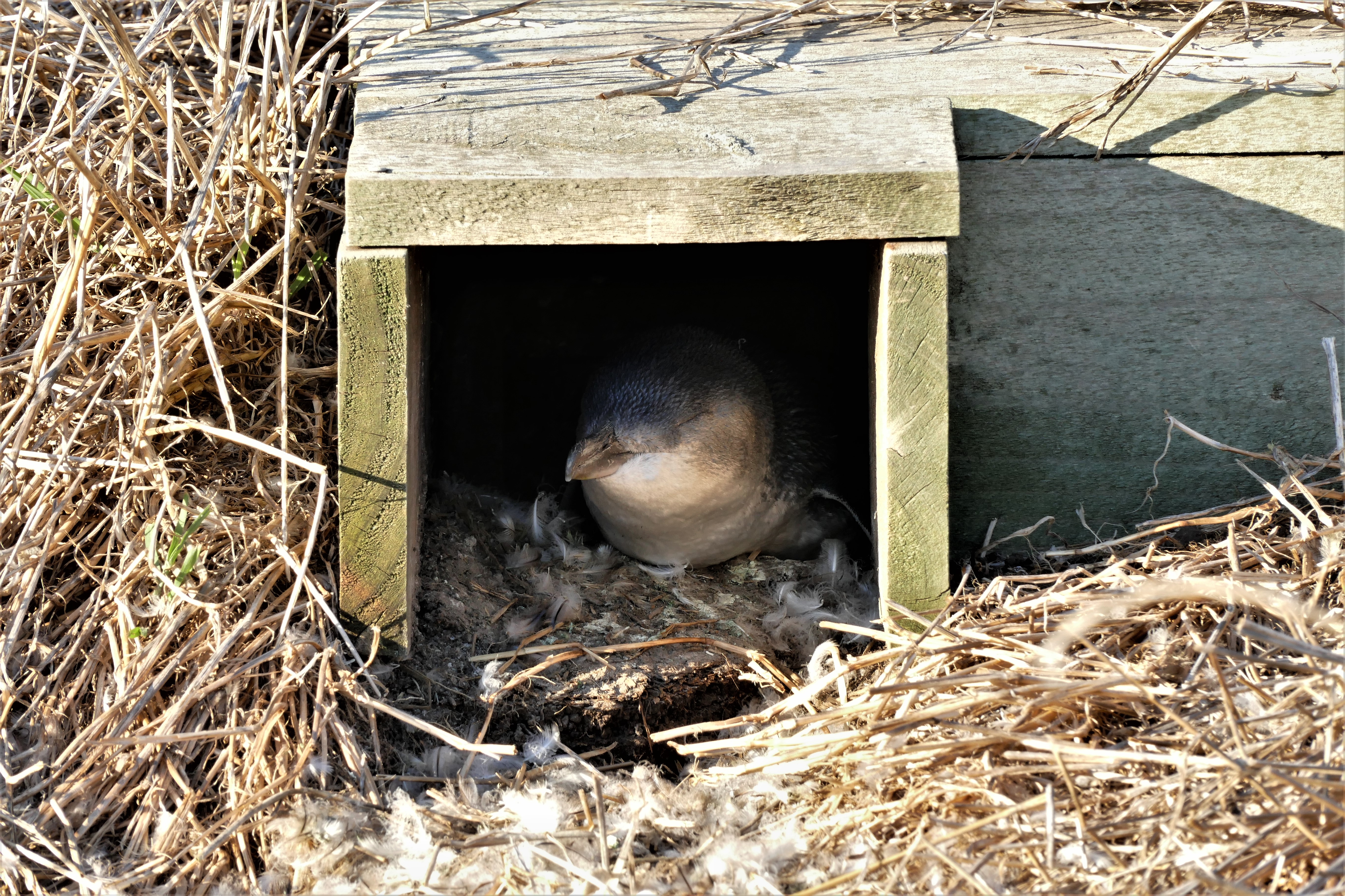
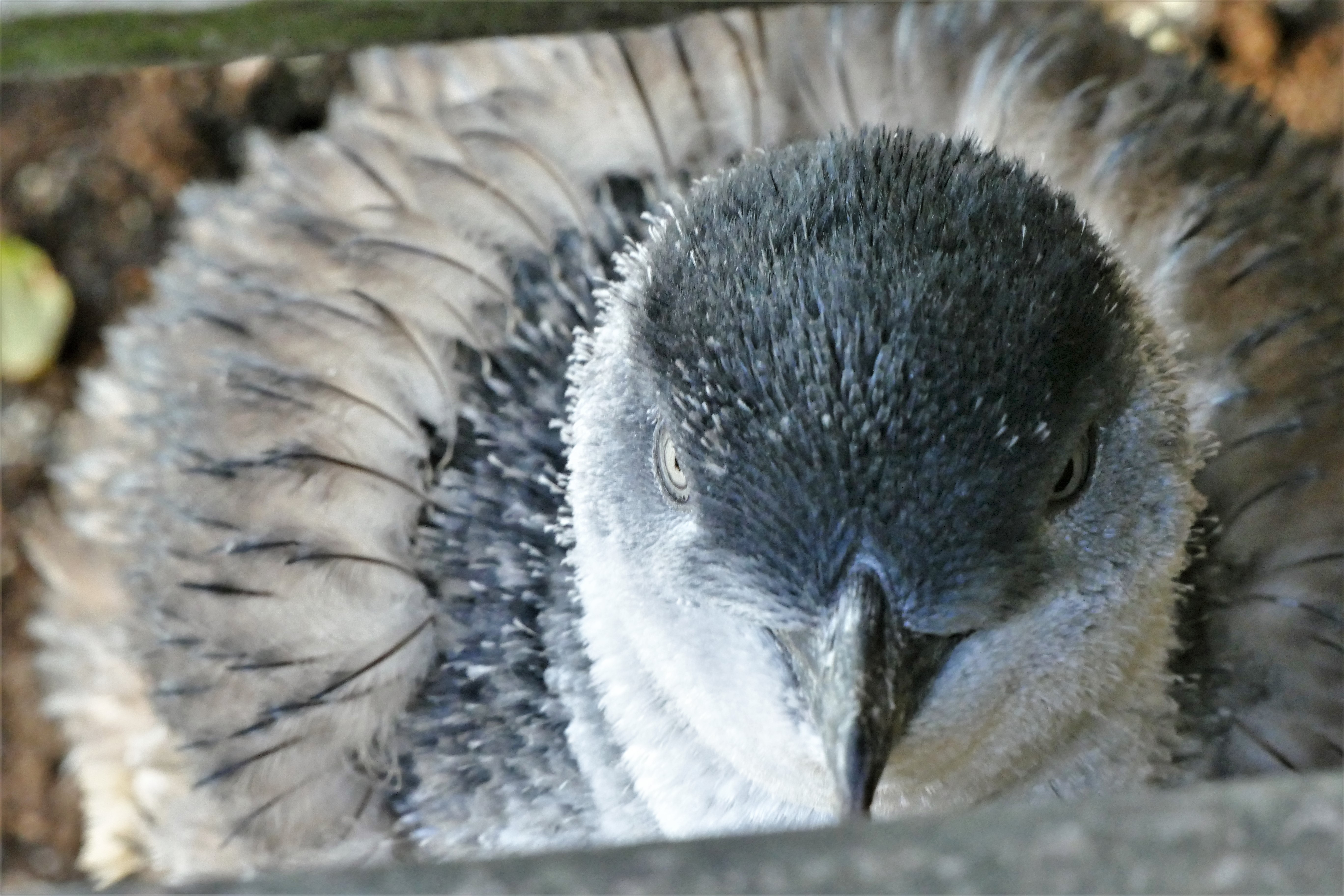
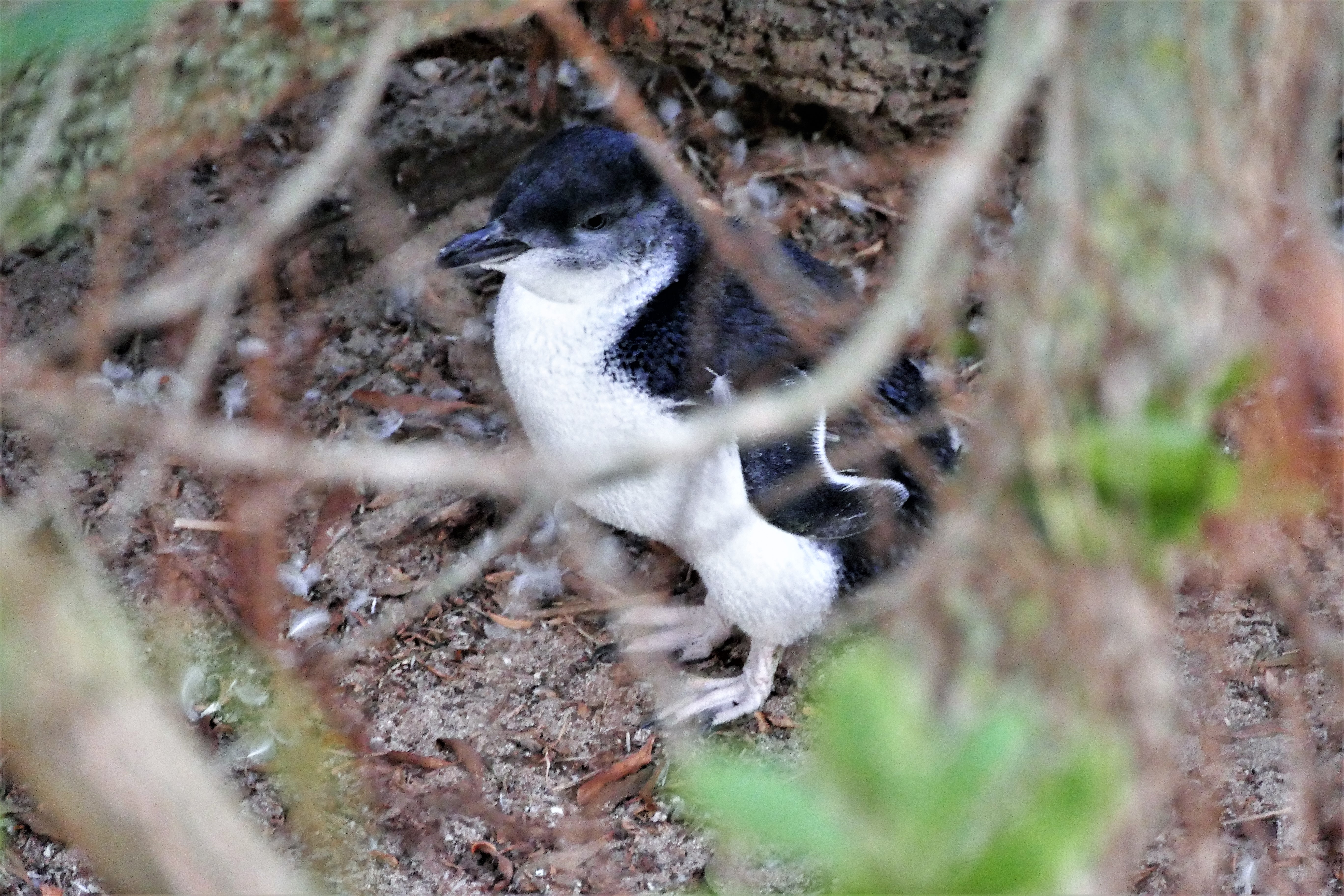
We started Sunday morning with coffee at Gloria Jean's Coffee, then walked to church at St. Francis Church, then a walk to Queen Victoria Market where I found a decorative boomerang. In the early afternoon, we were picked up again by a GoWest trours bus. We were first driven to the Moonlit Sanctuary Wildlife Conservation Park. There, we were able to feed some kangaroos who were really not in the wild although I think they thought they were. Then, we went on to the Philips Island Winery for some wine tasting and a chance to buy their wine, which we didn't. We were then taken to the southwestern tip of Philips Island, the Knobbies, which referred to rock formations just off the coast. Along the hill above the beach, there were small wooden box structures and holes in the ground which were homes for the juvenile Little Penguins. We were encouraged to look around and see if we could find the juvenile penguins We got some photos of little penguins in the boxes, apparently waiting for their parents to come home with their dinner. As sunset approached, we were taken to the nearby Philip Island Nature Center where we met with one of the rangers for the Ultimate Penguin Tour. We had previously paid extra for this, and were escorted by a ranger in groups of 10 people to an "excluded" beach which was between the between the two other beaches. Still we were up pretty close for the big event. Shortly after sunset, we saw several groups of Little Penguins surface and cross the beach. Unfortunately, we were not allowed to take any photographs for fear that someone would use a flash and hurt the penguins eyes. The penguins could then be watched that they hurried up the path to their little homes.
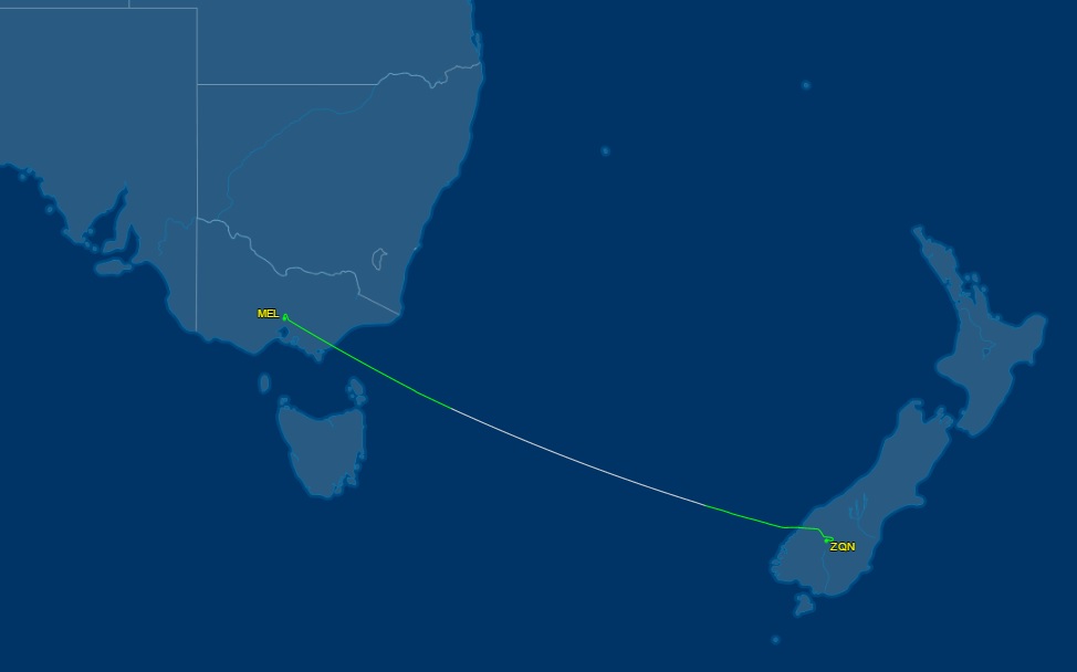

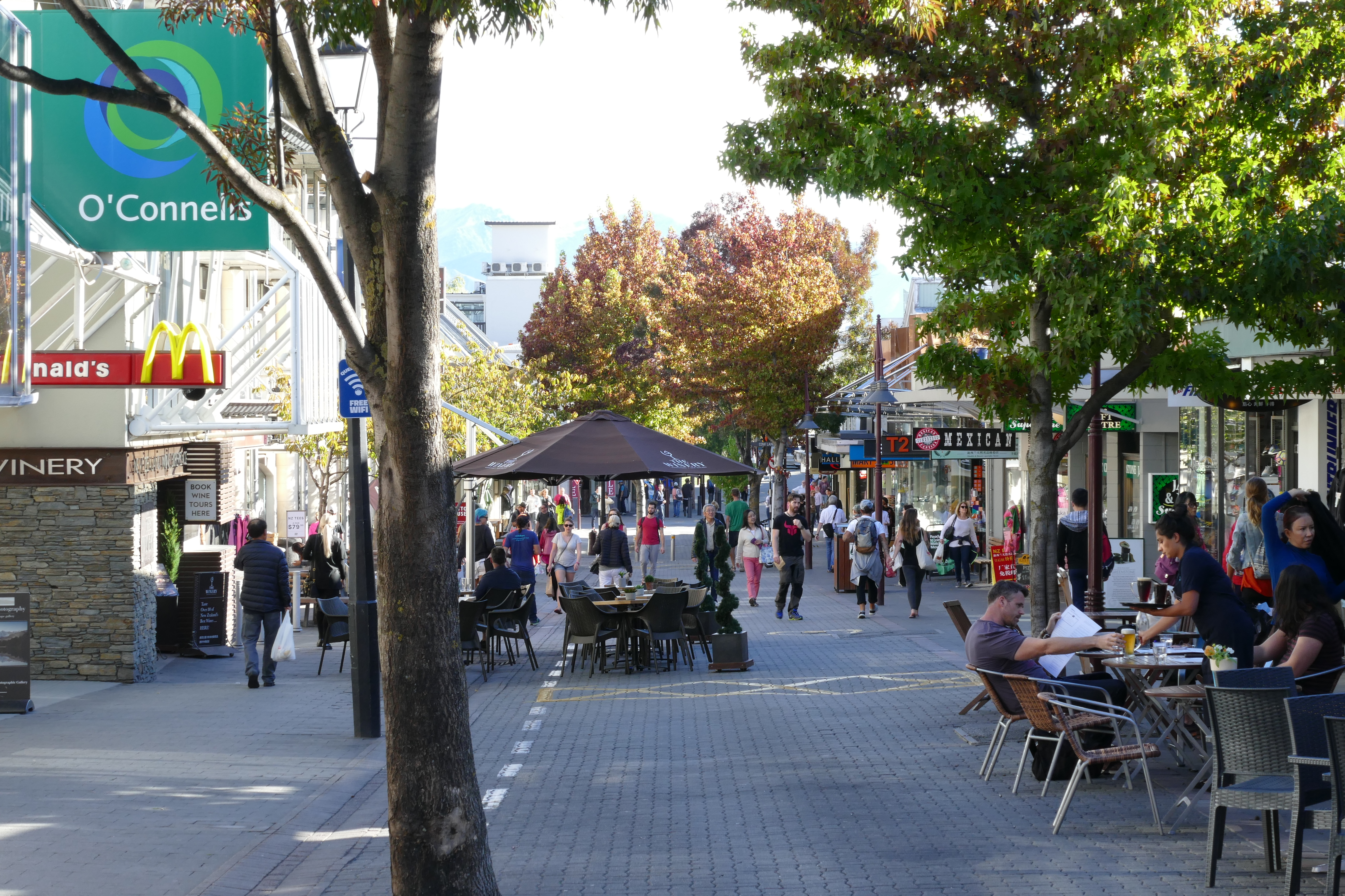
3/20/17: Queenstown
We took Air New Zealand for the 3 hour, 1311 mile trip to Queenstown. When we checked-in at the airport, we found our carry-on was limited to 7 kg (about 15.4 pounds), so we had to redistribute and move some items to checked. Arriving at Queenstown, it was scary to see how close the Airbus flew to the mountainside on it's approach to the airport.
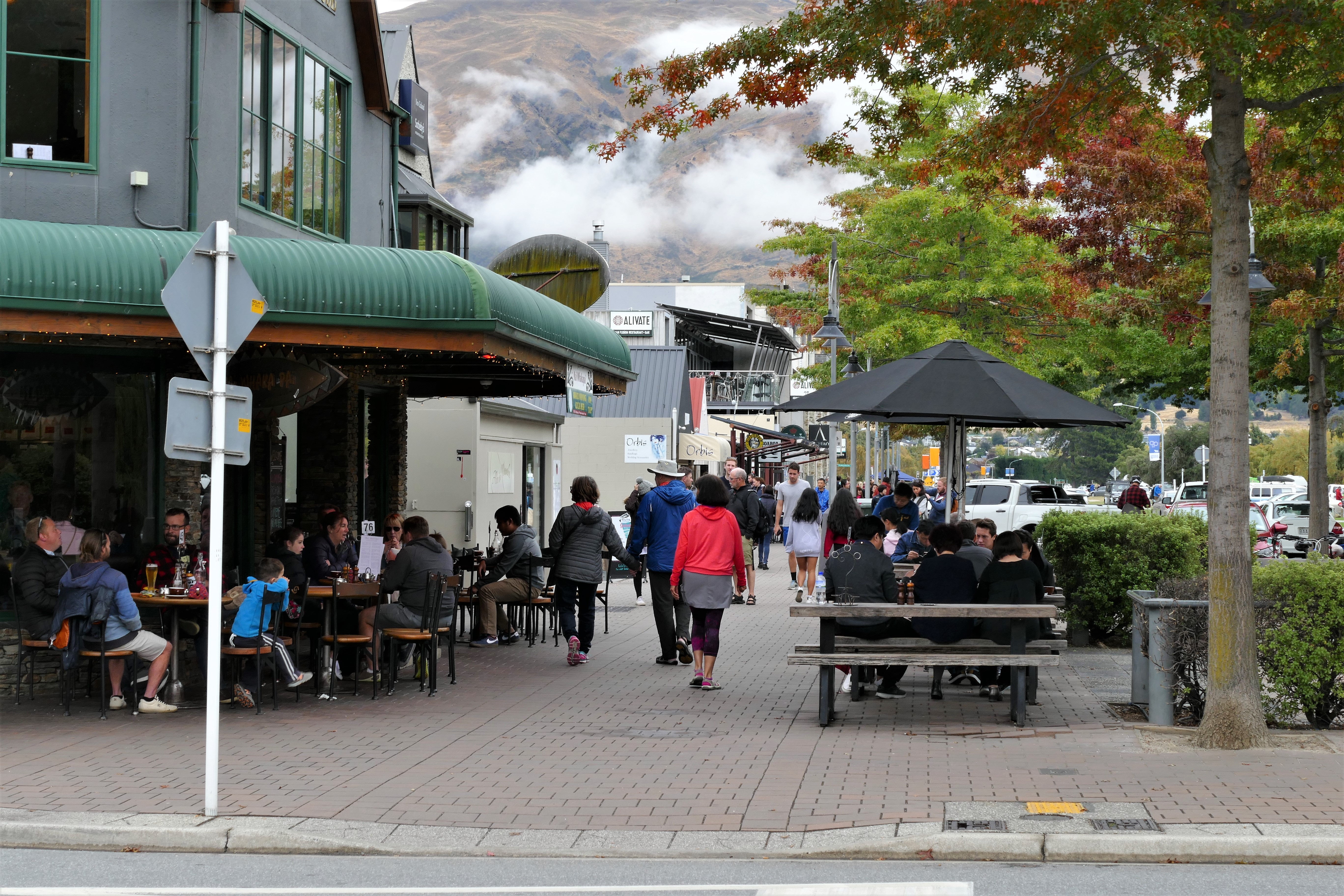
After a $50 NZ ($35 US) taxi ride from the airport, we arrived at the Hotel St Moritz. We were given a nice room on the 7th floor, which was a stair climb from the 6th floor where the elevator stopped. We walked around Queenstown and waited 20 minutes for a Fergberger, which was quite good. Once filled on the large hamburger, we shopped in some small stores and walked around the botanical gardens. We then stopped at Patagonia Chocolates for ice cream, then returned to the hotel for a glass of wine to toast our adventure.
Before New Zealand, I thought I could manage flying in the mountains. I had done a lot of flying VFR and IFR up and down the Appalachians, having lived in Roanoke, Virginia for 4 years. Roanoke is in a bowl after all, surrounded on all sides by mountains. I had also done my share of flying in the Rocky Mountains, with VFR flights north of Denver, Colorado, as well as VFR and IFR in New Mexico, Arizona and California. I could handle low clouds that covered the mountain tops. I would just file an IFR flight plan, do the published instrument departure, fly above the peaks at the minimum enroute altitude, then do the published instrument approach. That would keep my airplane safely away from the hard stuff.
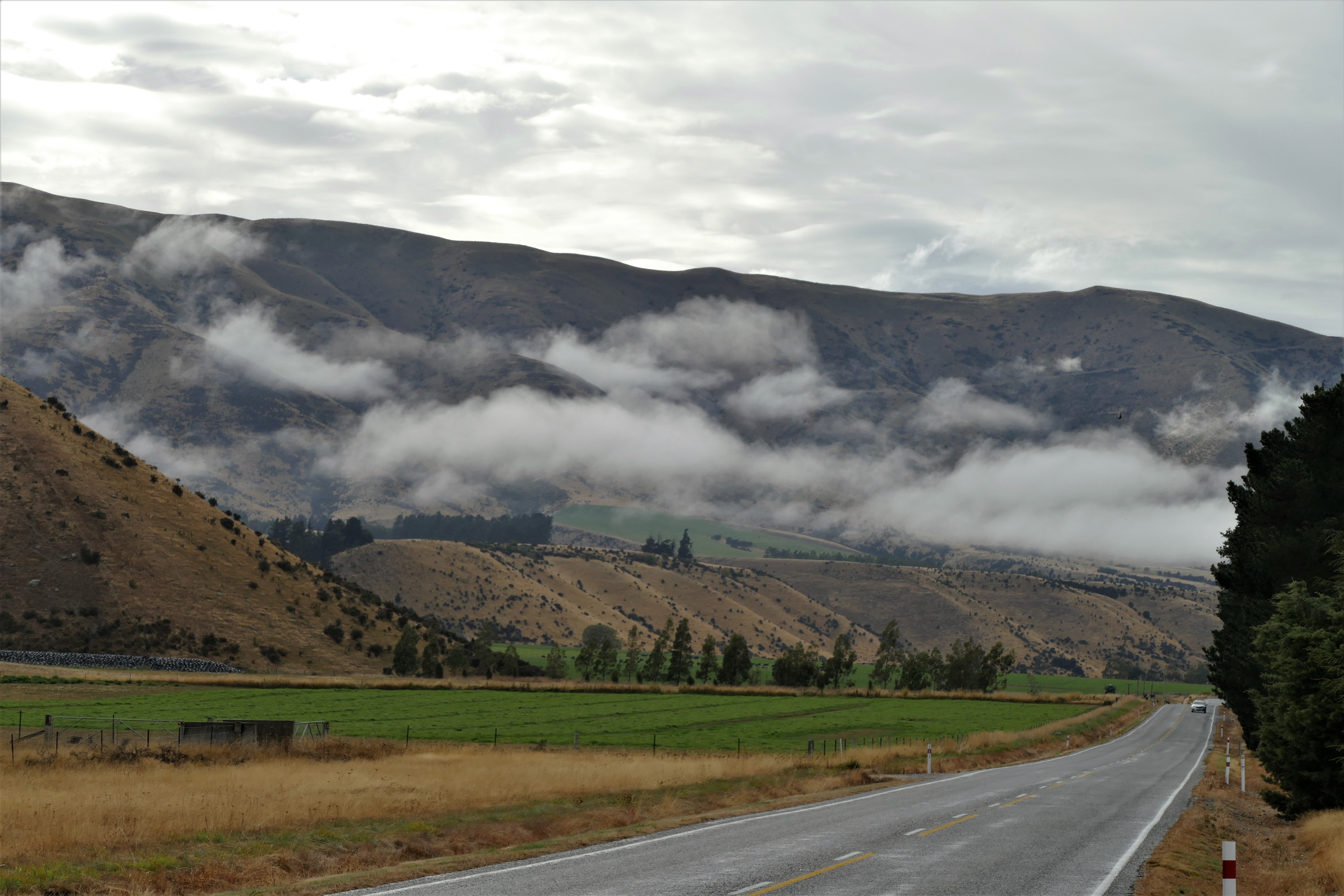
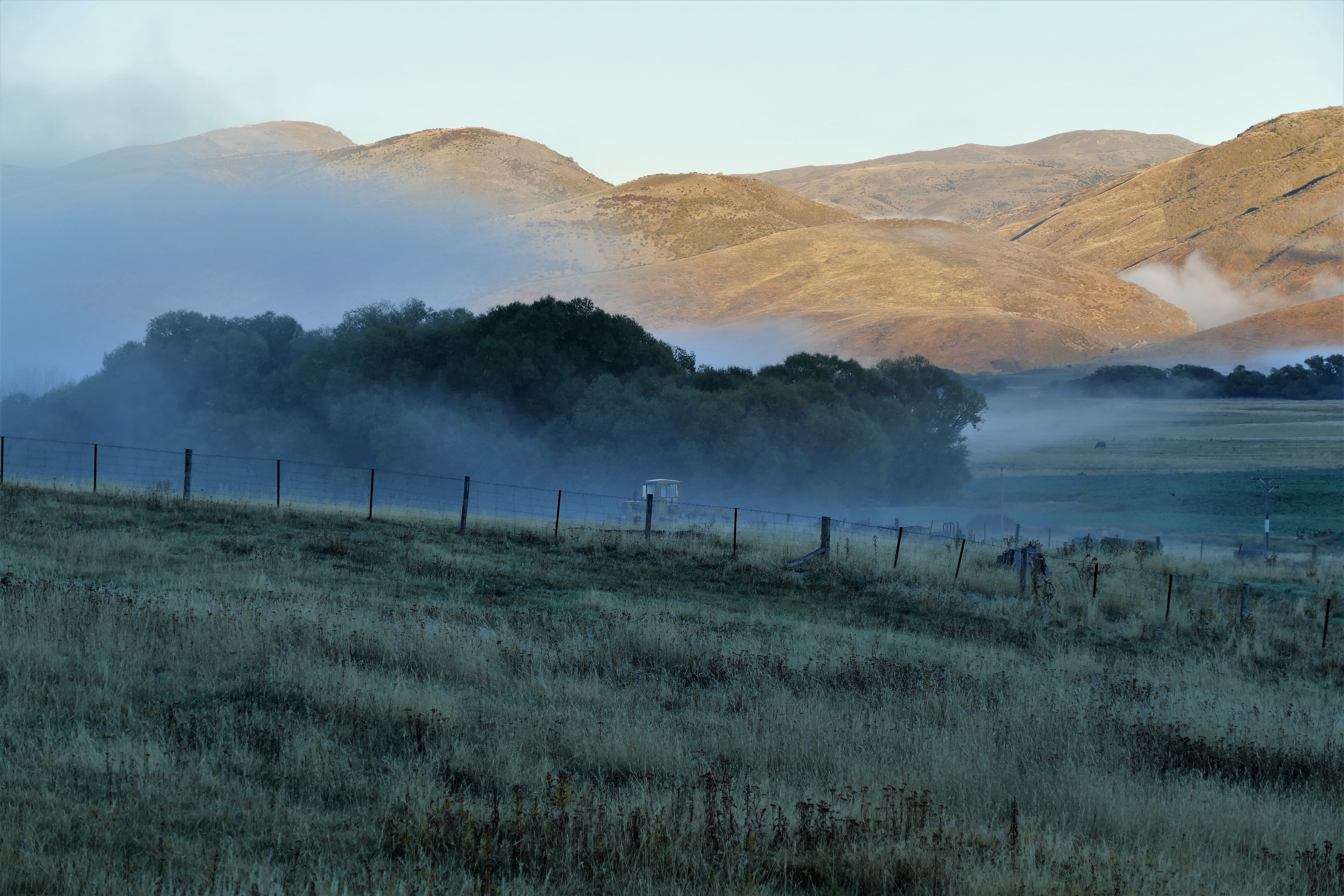
The next two days would introduce me to mountain flying, New Zealand style. When the clouds are low enough to cover the mountain ridges, they use their maps to find a route through the valleys to their destination. They fly VFR, staying below the clouds. And they fly along the valley walls, next to the hard stuff. The cloud cover and weather was a constantly changing factor. It seems that there is always somewhere in New Zealand where the weather interferes with VFR flying, and that somewhere changes from day to day. Jo emailed us to tell us that there was "a lovely weather window" and we would be heading to Stewart Island overnight instead of to Geordie Hill Station as originally planned.

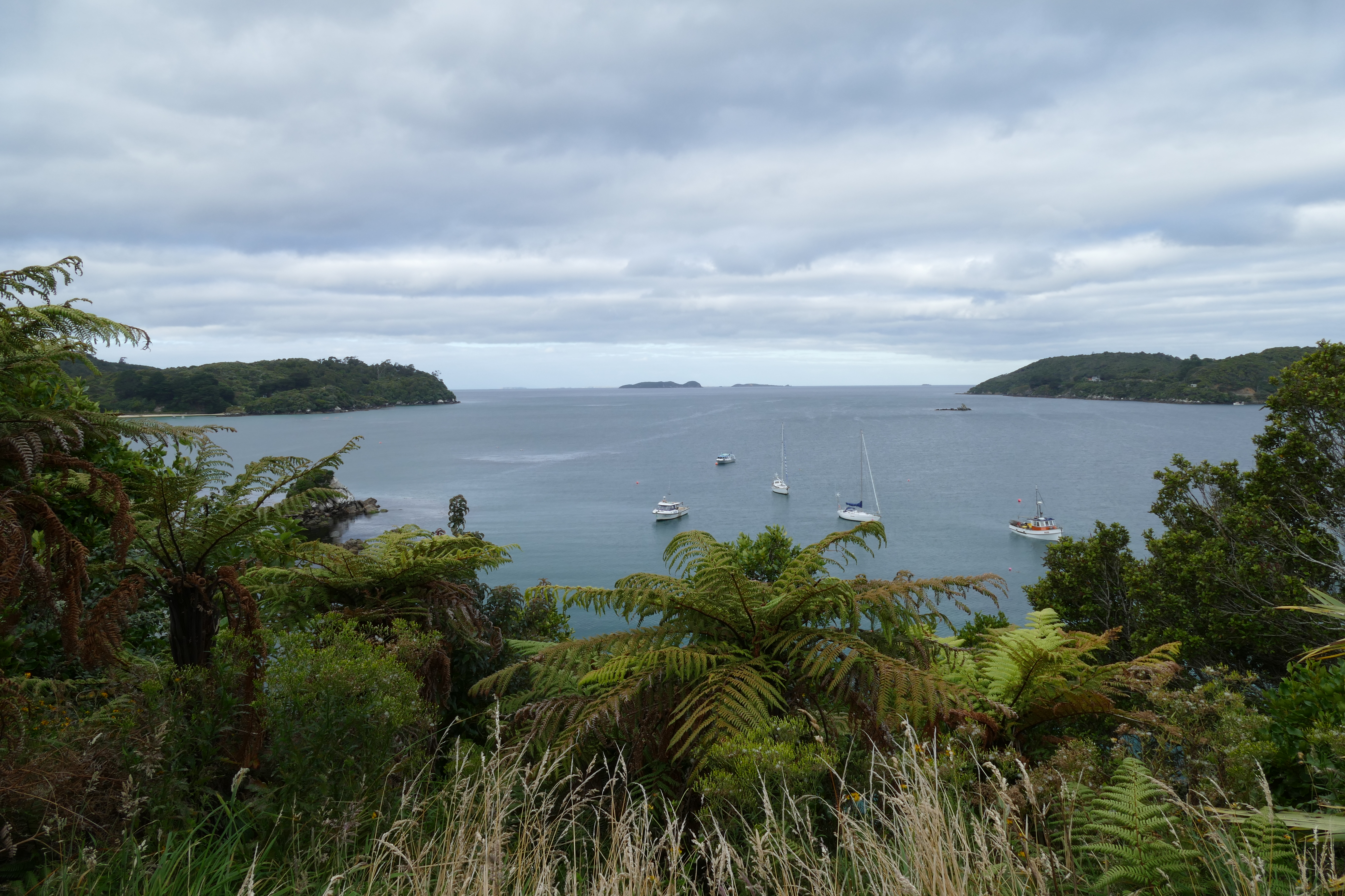
3/21/17: Stewart Island
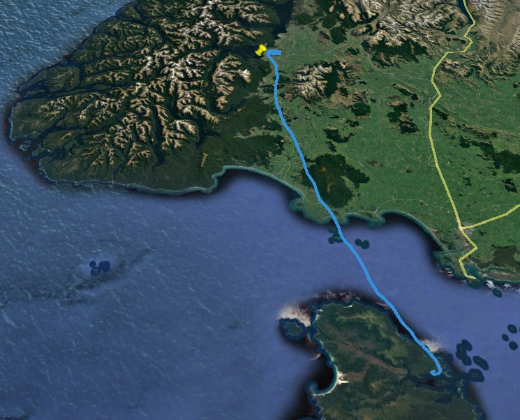
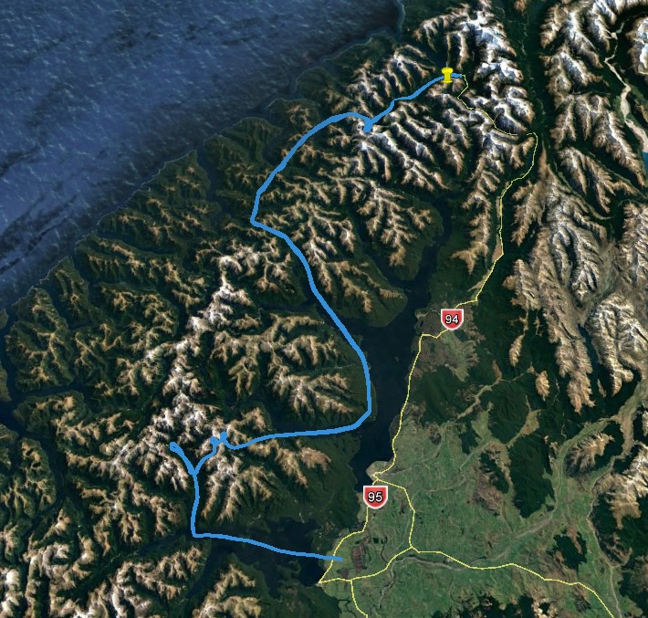
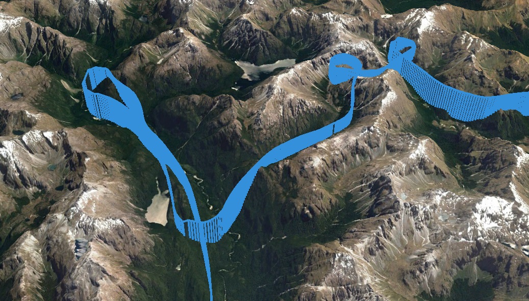
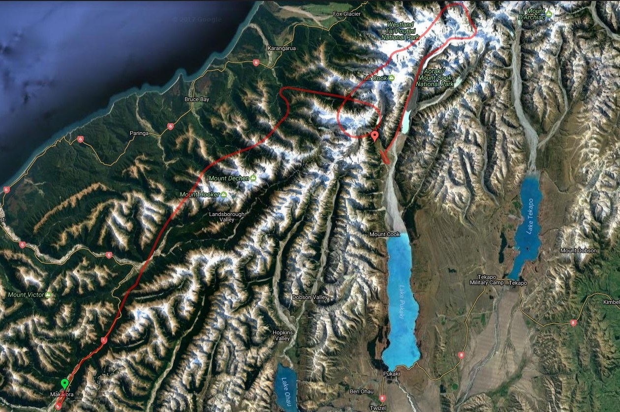
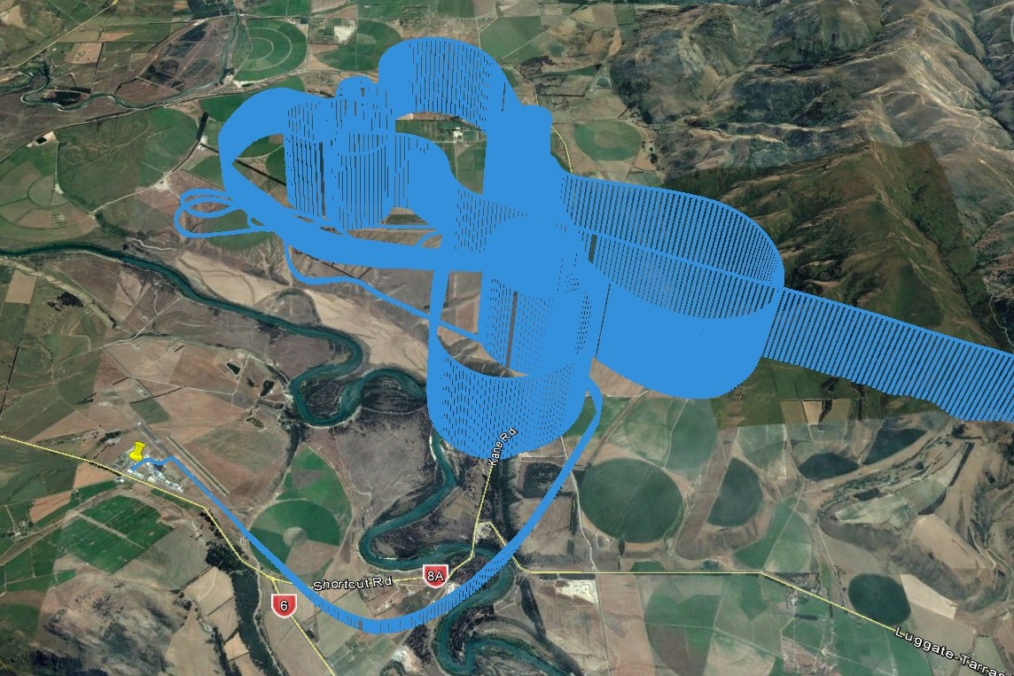
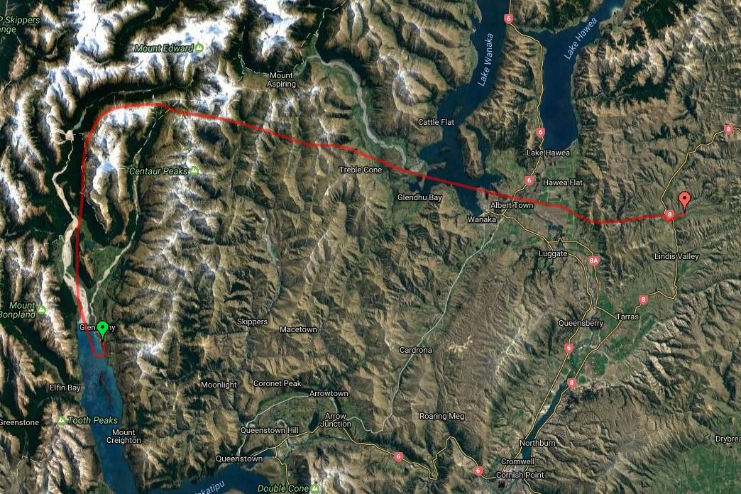
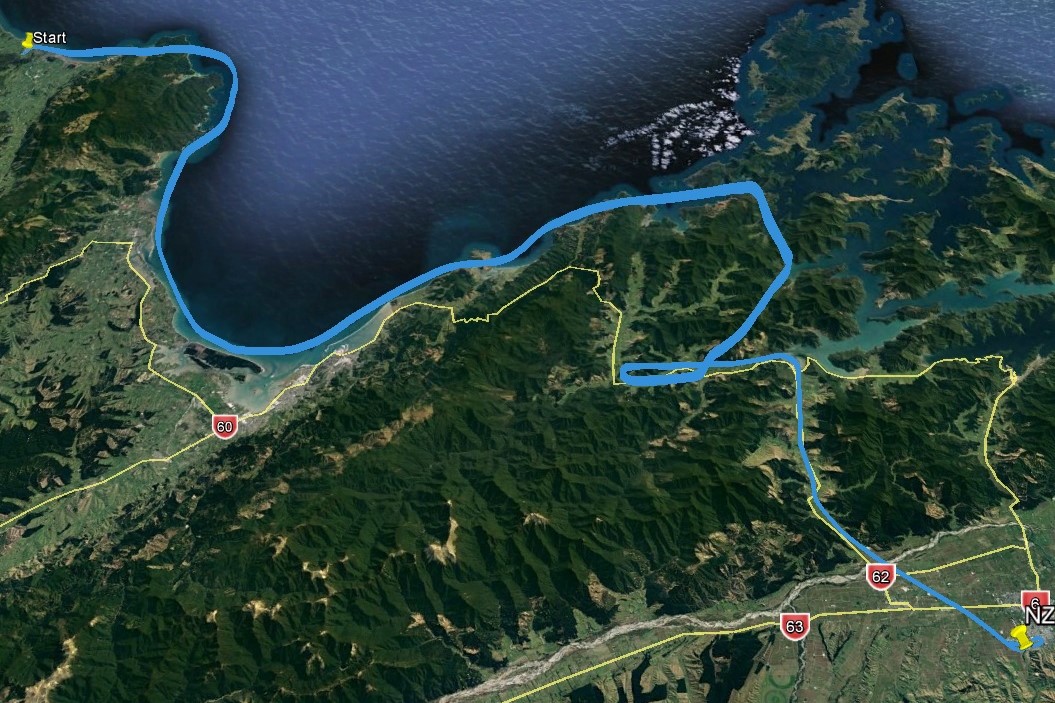
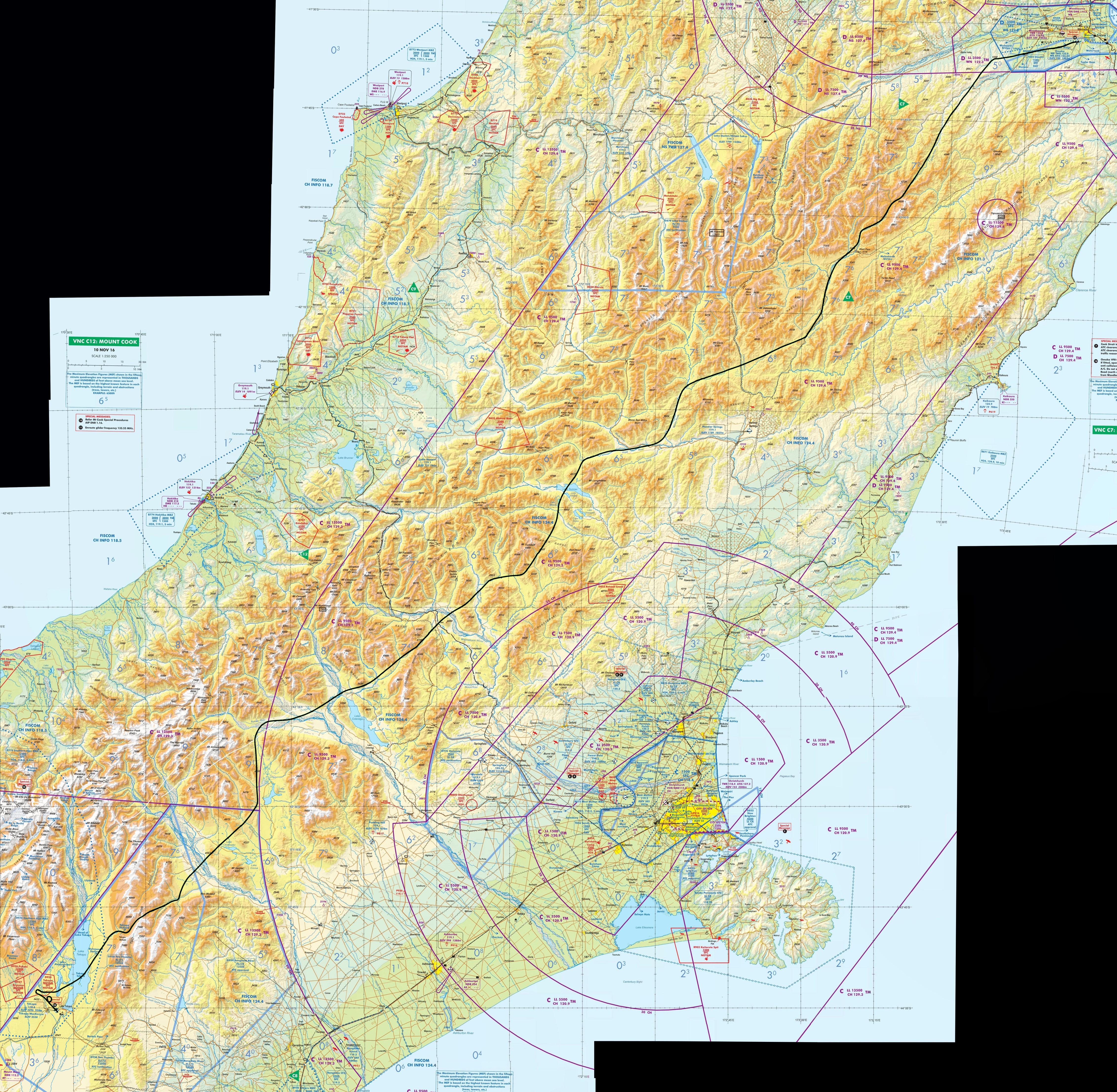
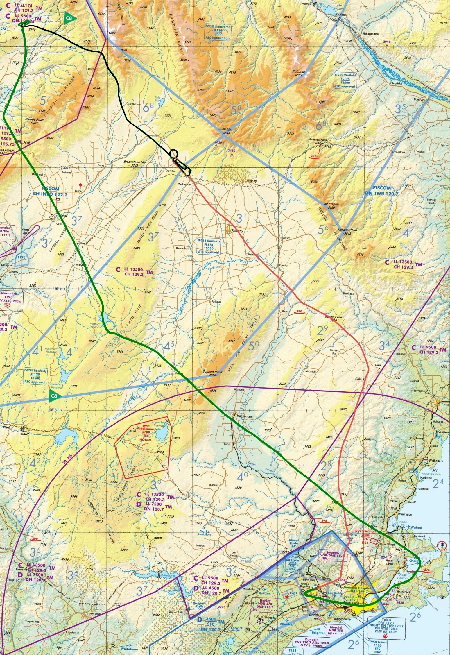
Several of the flight paths, generated by ForeFlight, are available for download on the Google drive link below. The TrackLogs are kml files, which allow exploration of the valley flights with Google Earth.
https://drive.google.com/drive/folders/0B19EFZNBWa2rNEtSUlN0YUlnZG8
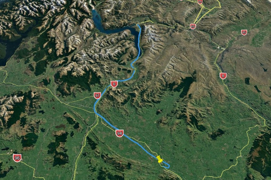
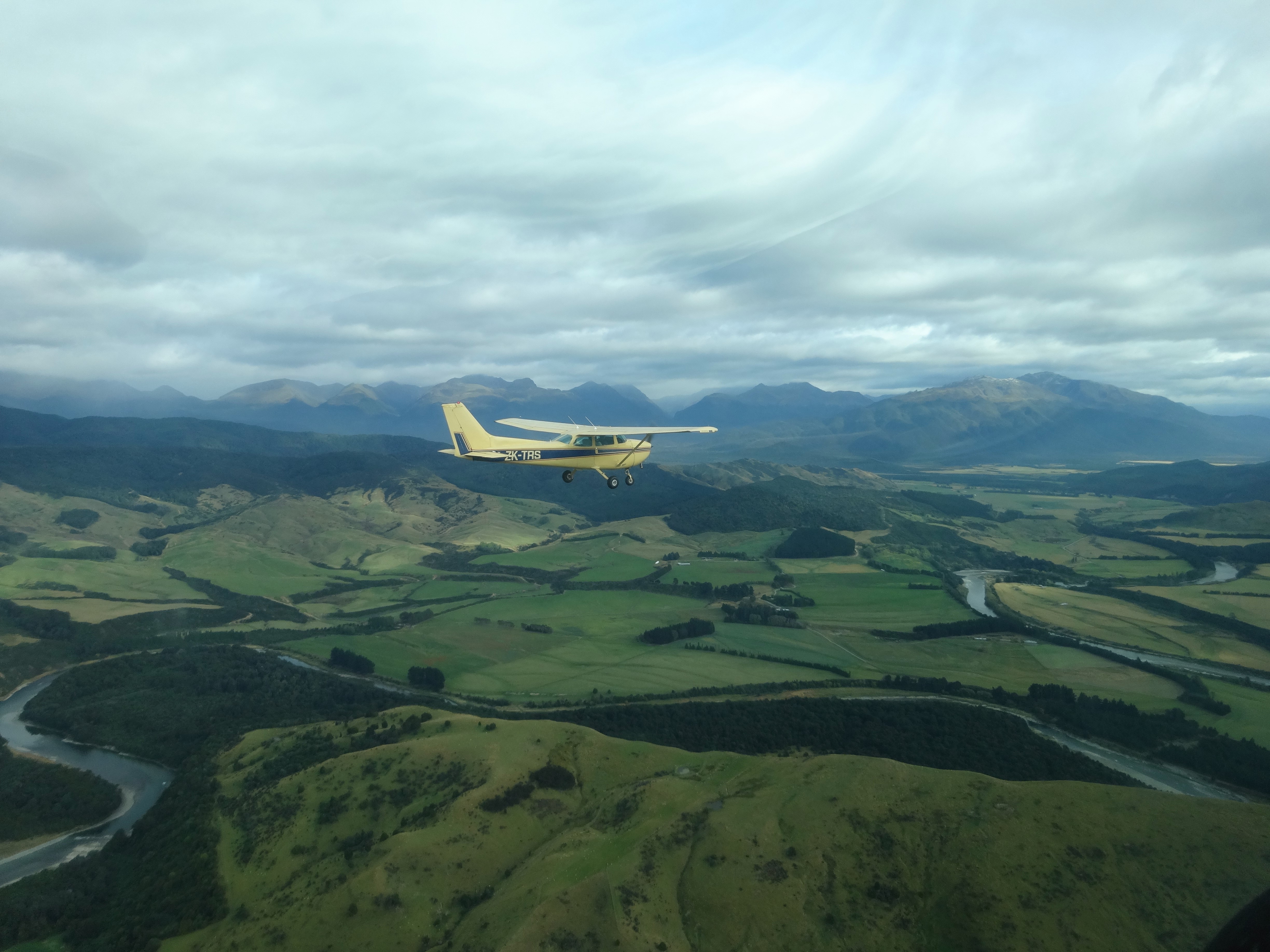
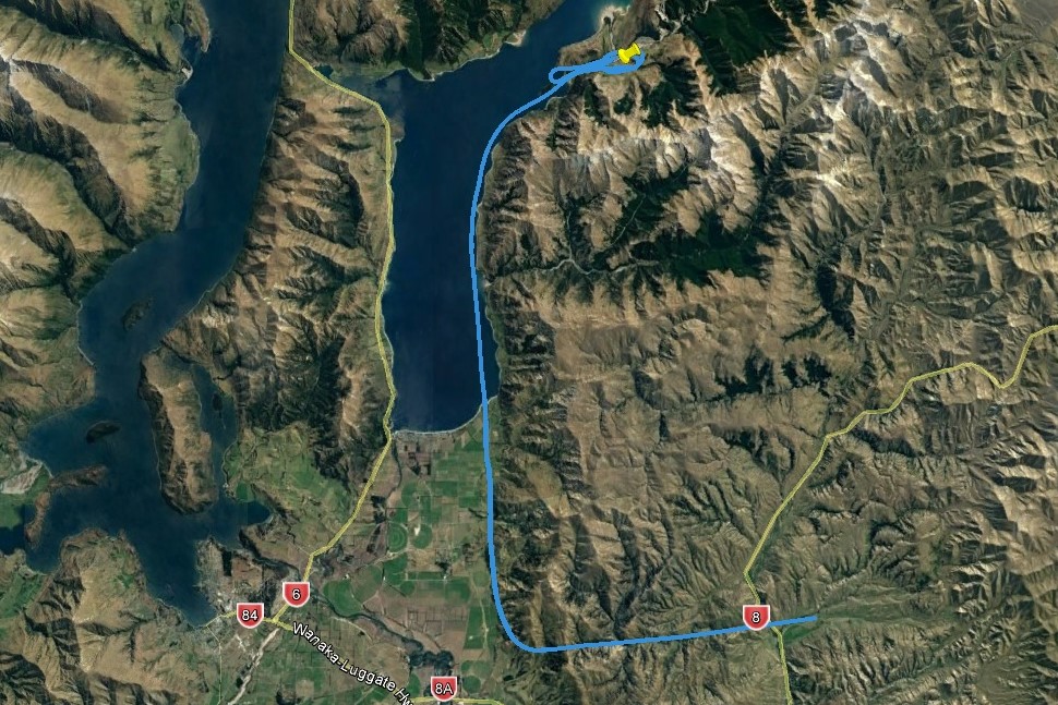
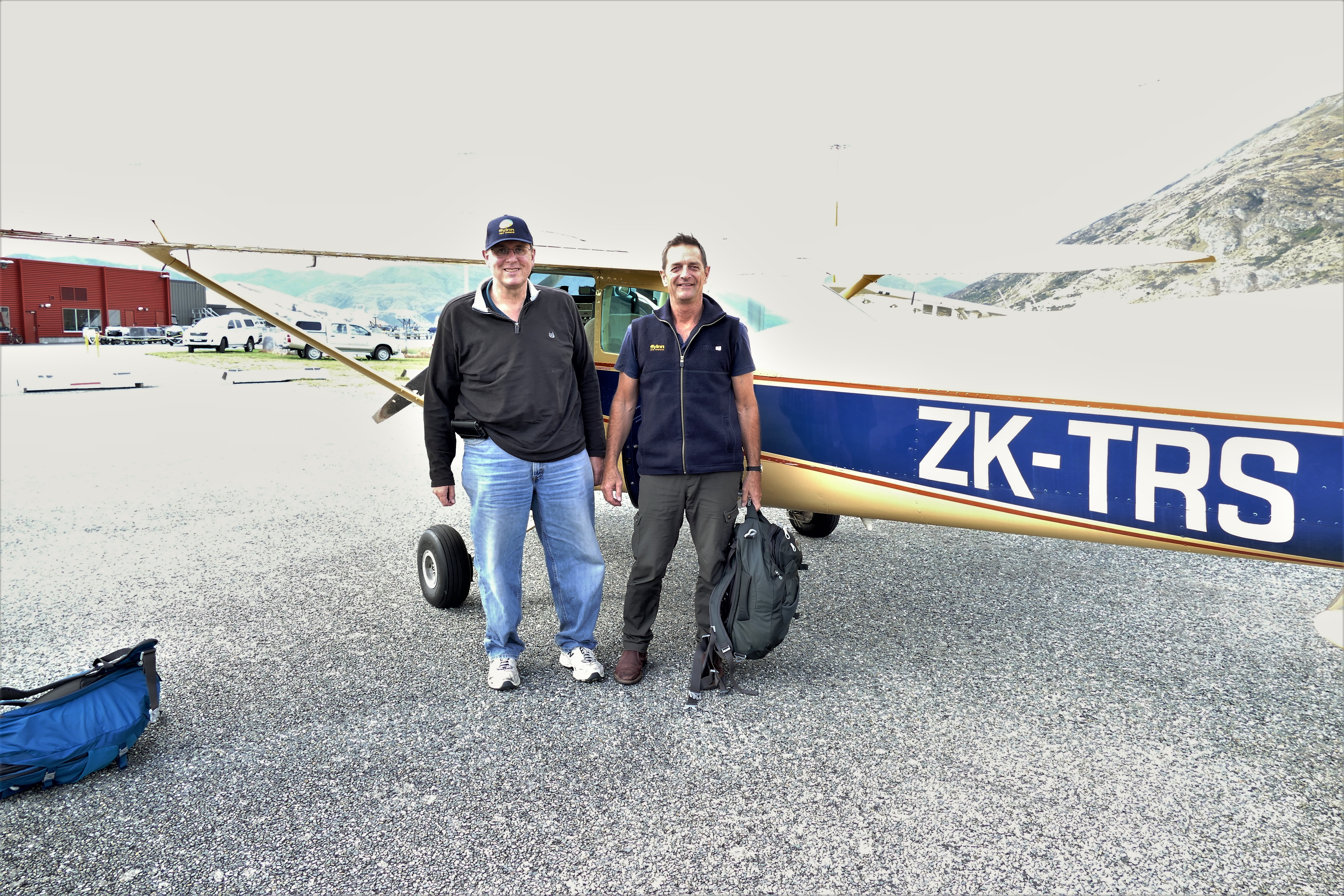
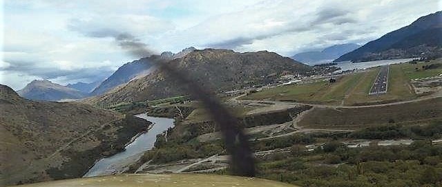
(Day 1, flight 1) Flight instructors (and guides) Nick Taylor and Pete Clulow met us at the Airspresso Café in the Queenstown Airport terminal. After a quick briefing, we walked to the general area to find our airplanes. Pete was carrying one of our bags, and he led us to ZK-WAX, a bright yellow Cessna-172M . Nick took Craig and Betty to ZK-TRS, a light yellow Cessna-172N. After pre-flight and loading the luggage, we started the 180 hp engine. Pete got our clearance from Queenstown Tower, and took off on runway 14. The clouds were low, only about 2000 to 3000 feet above ground ground level, obscuring the ridges of the mountains that were on both sides of Lake Wakatipu. We flew south along the right side along the lake, about 2500 above sea level (or 1500 above ground level), past the Devil's Staircase check point and on to the south end of the lake. We continued flying in the valley, following route 6 southbound to Castlerock, then southeast following route 94 to Mandeville. There, we landed on the NZVL grass runway, finishing my first 1 hour flight, "valley flying" in the New Zealand mountains.
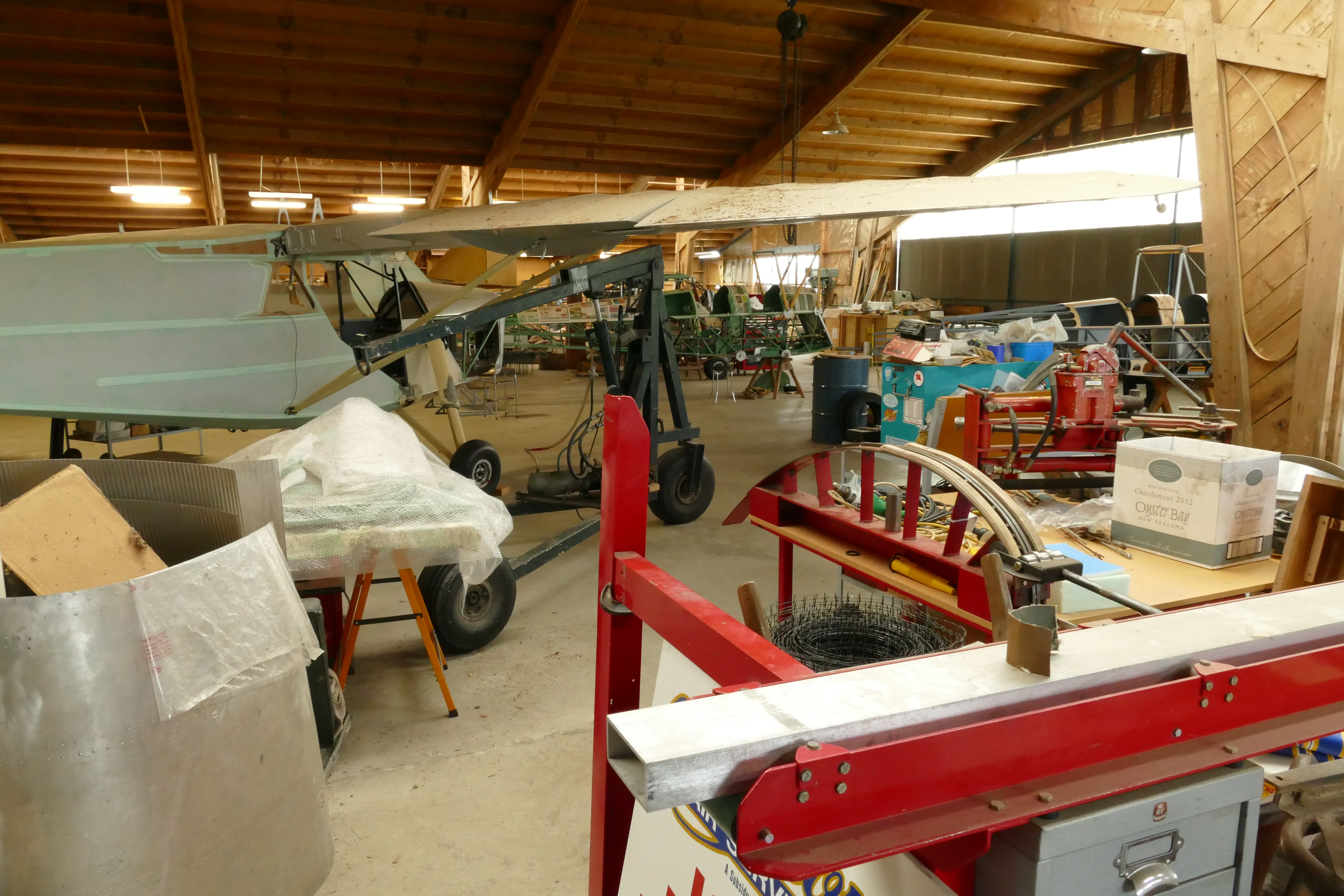
The Mandeville Aerodrome was home to the Croydon Aircraft Company where vintage aircraft are restored and an adjacent hanger museum containing old aircraft that are still flown. After some coffee, I visited both and took pictures.
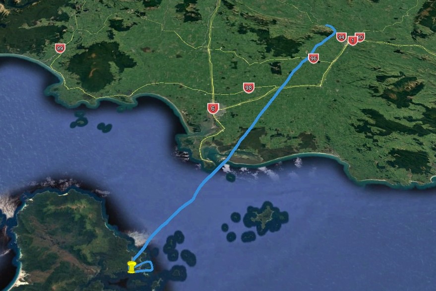
(Day 1, flight 2) We took off from Mandeville airport and flew a direct route over the Bluff waypoint to Ryan's Creek Aerodrome on Stewart Island. This took us to the south of the Invercalgill class D airspace. Invercalgill Information provided flight following over the Foveaux Strait. Because of the scattered to broken cloud layer about 3000 feet, we flew about 2500 above sea level. After circling Ryan's Creek Aerodrome, NZRC, and checking it's paved runway, we landed after a 50 minute flight.
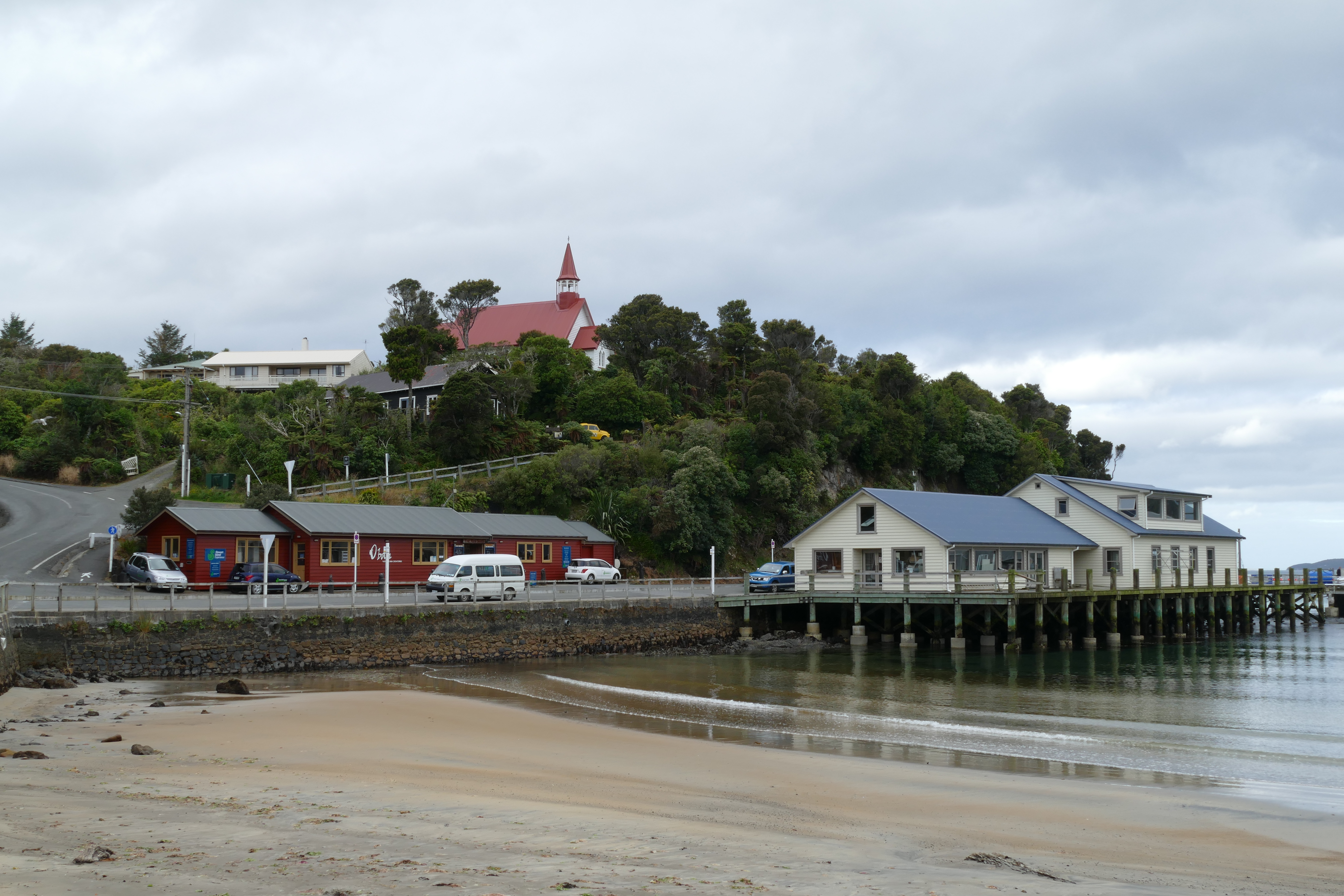
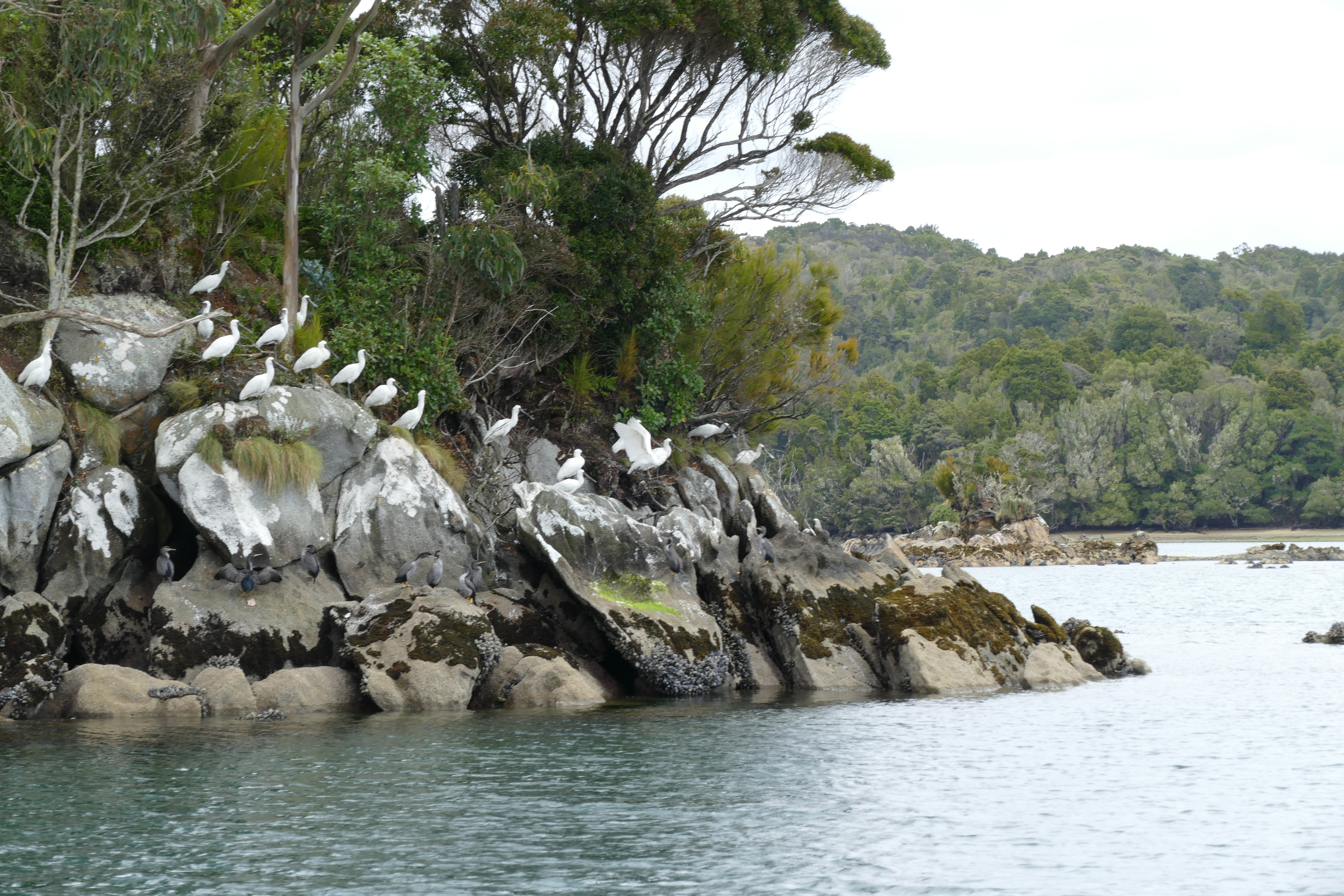
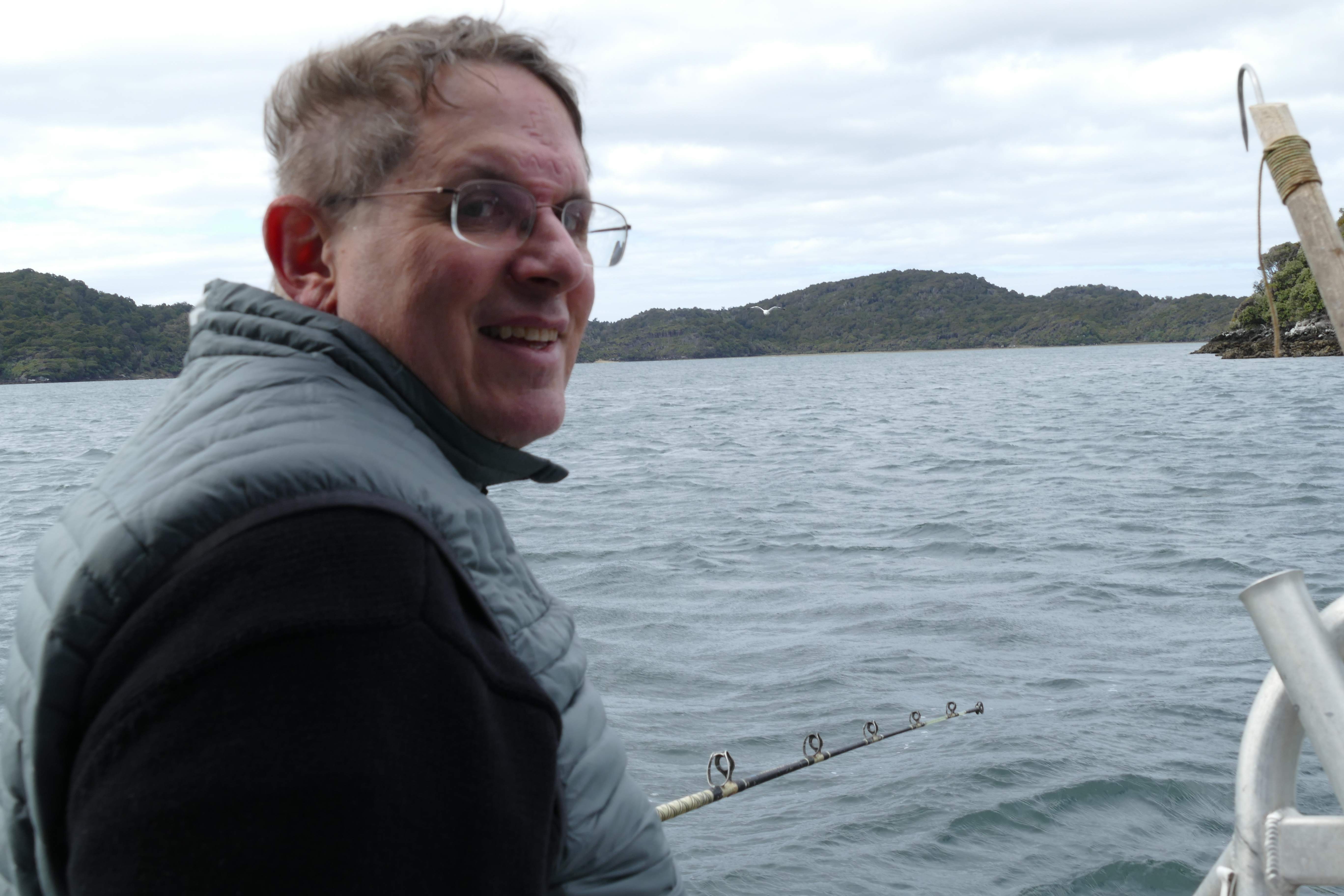
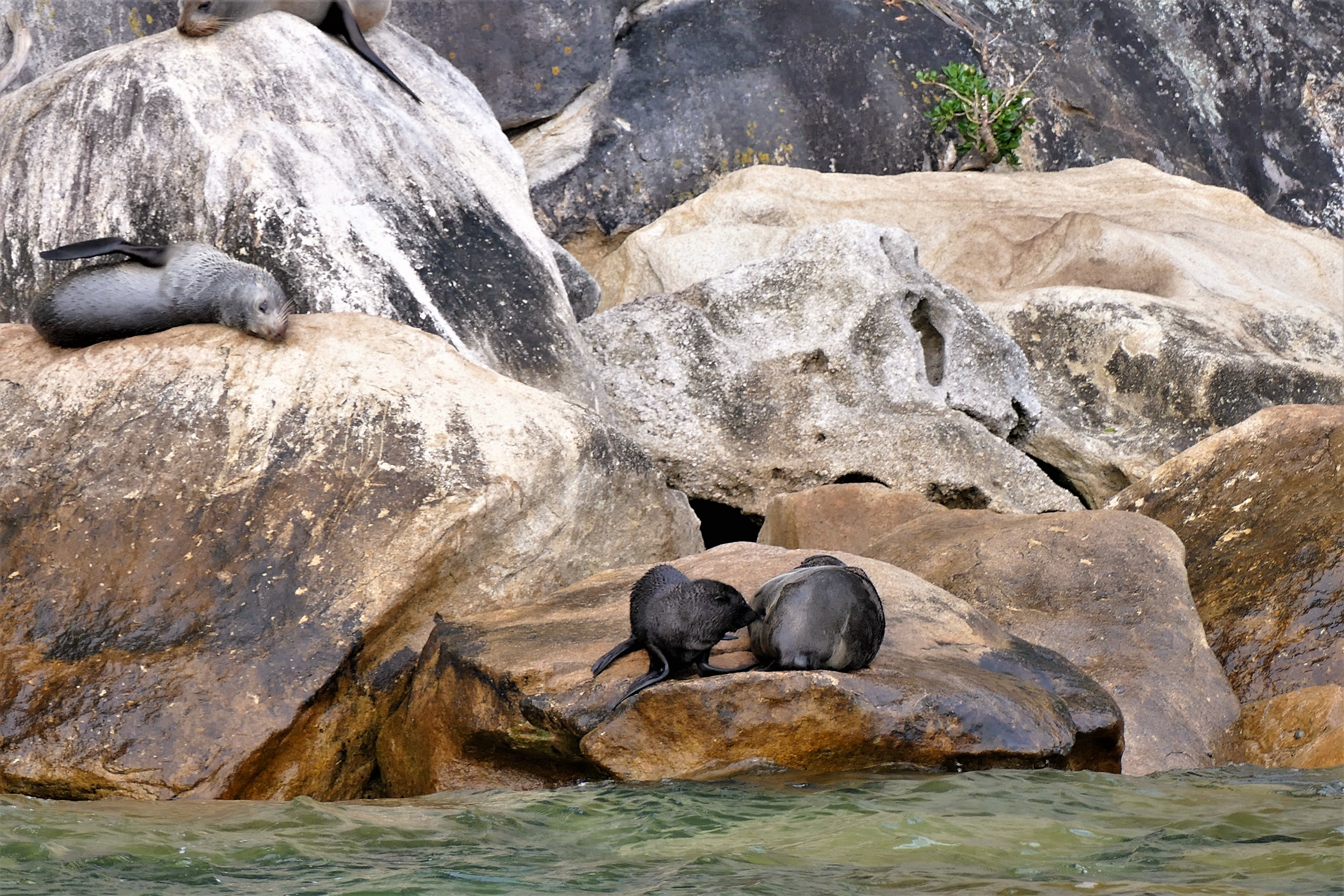
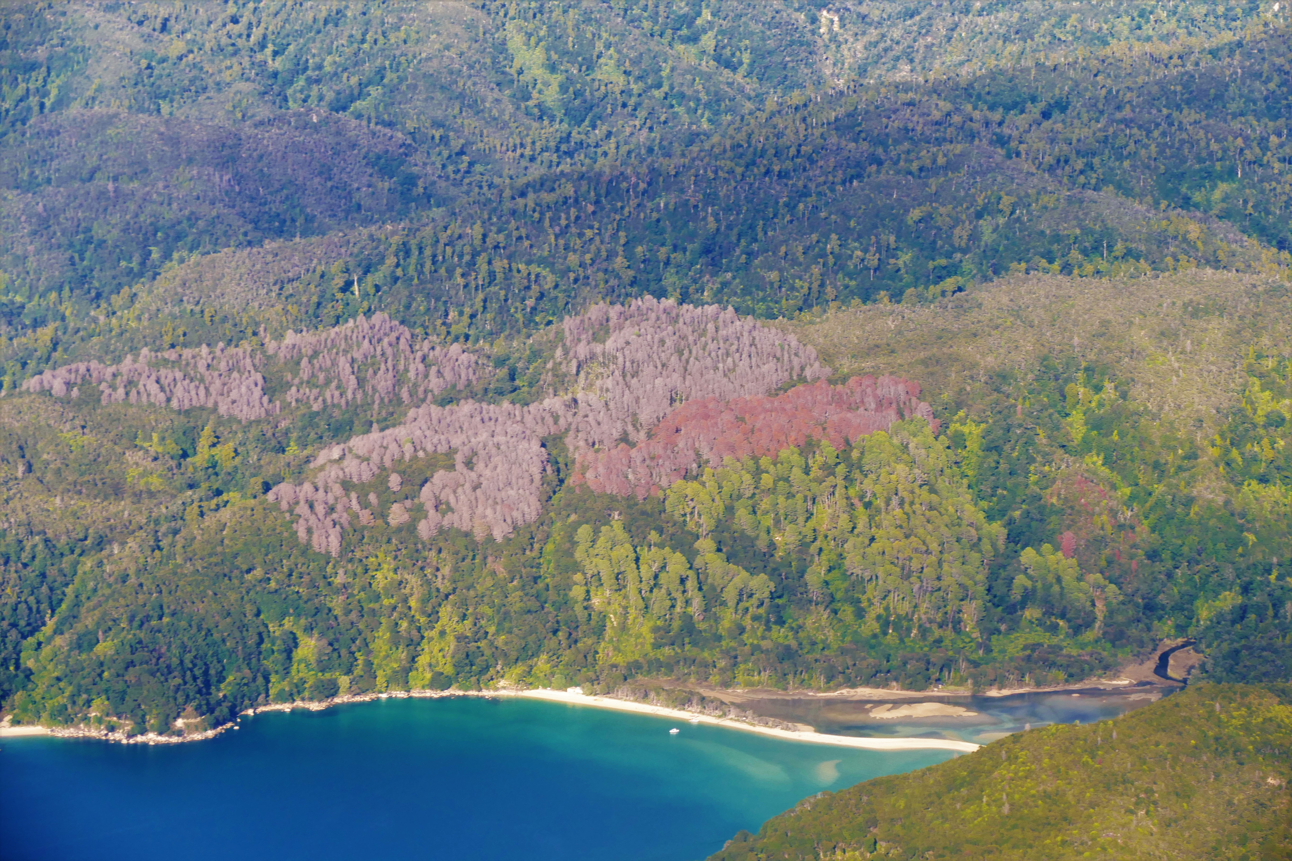
We were picked up and taken to the town of Oban on Half Moon Bay, a short distance from the aerodrome. There, we checked into the South Seas Hotel, which looked like the only lodge in the town. Liz and I went on a boat ride for fishing in the Patterson Inlet. I caught my first fish, a blue cod and a salmon, which we took back to eat. We looked at an abandoned whaling station, then were dropped off for a nature walk on Ulva Island. After returning to Oban, we walked up the hill to see the church with the red roof on the hill, then back down the hill in time for dinner.
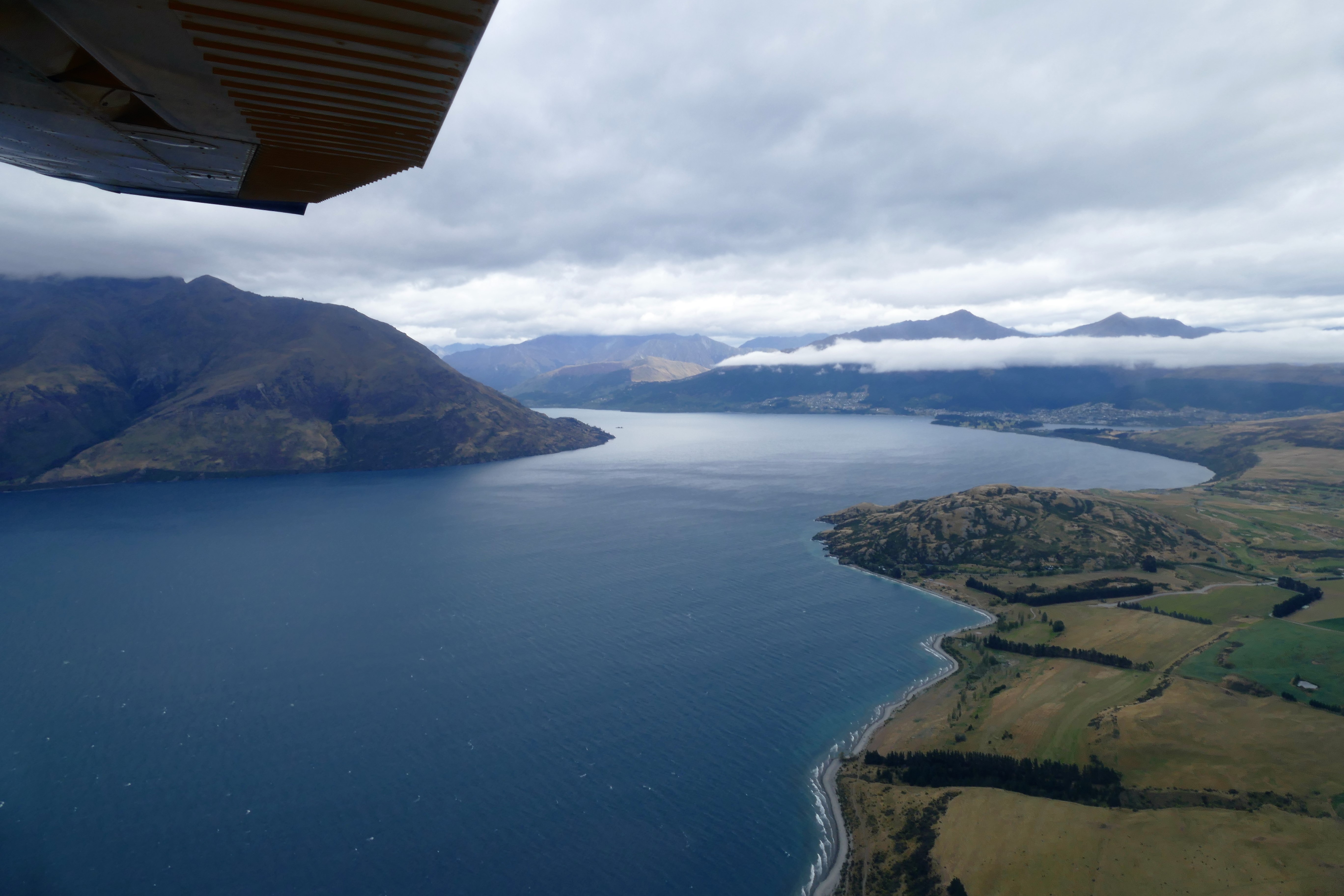
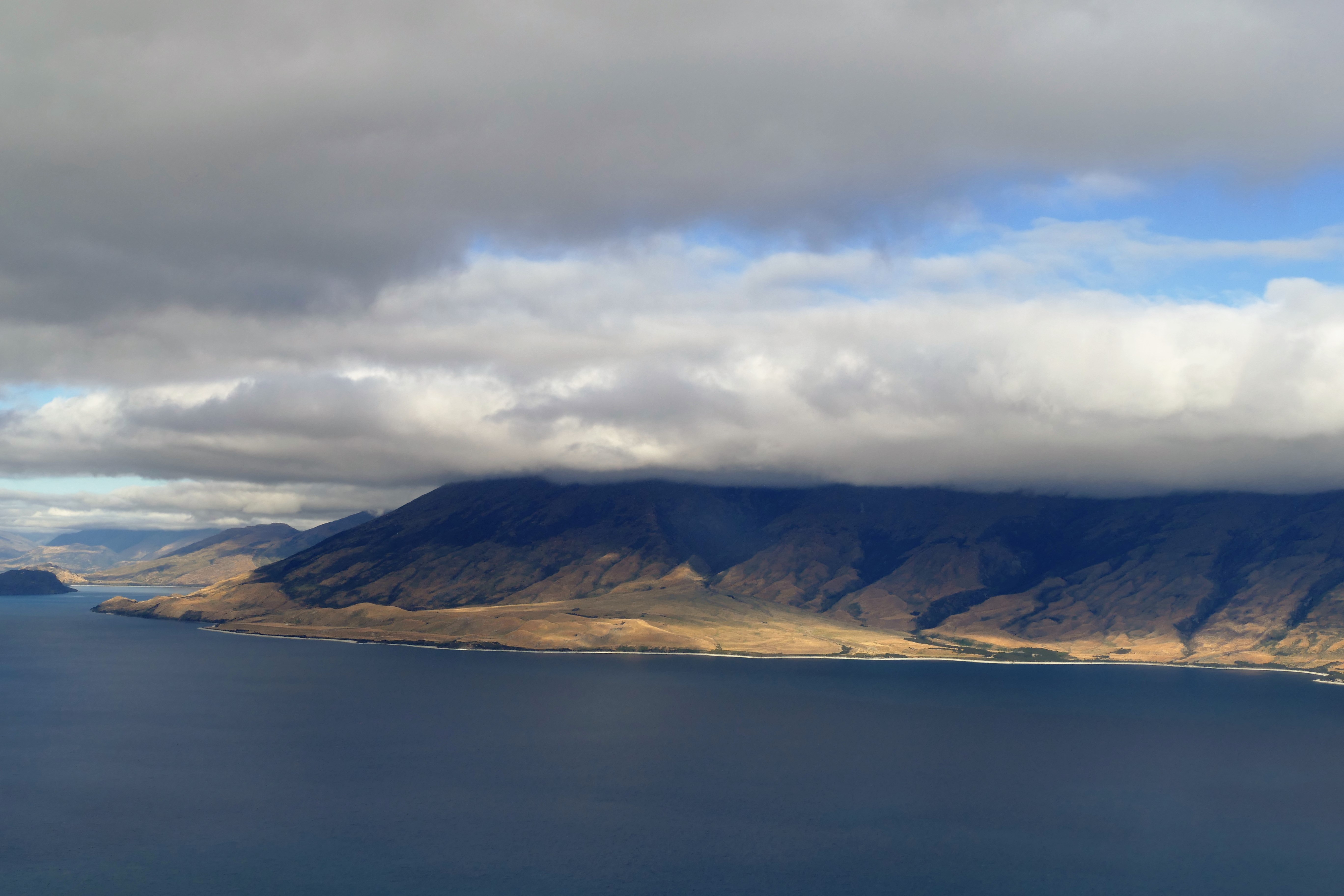
(Day 2, flight 1) With Pete as instructor in ZK-WAX, we departed Ryan's Creek Aerodrome, climbed to 2500 and initially flew close to the northern coast of Steward's Island, so we could cross Foveaux Strait at the narrowest point. Except for small course changes to avoid rain showers, we flew under the 3000 foot clouds into the Southland. After a 1 hour flight, we landed at the Manapouri Airport's paved runway.
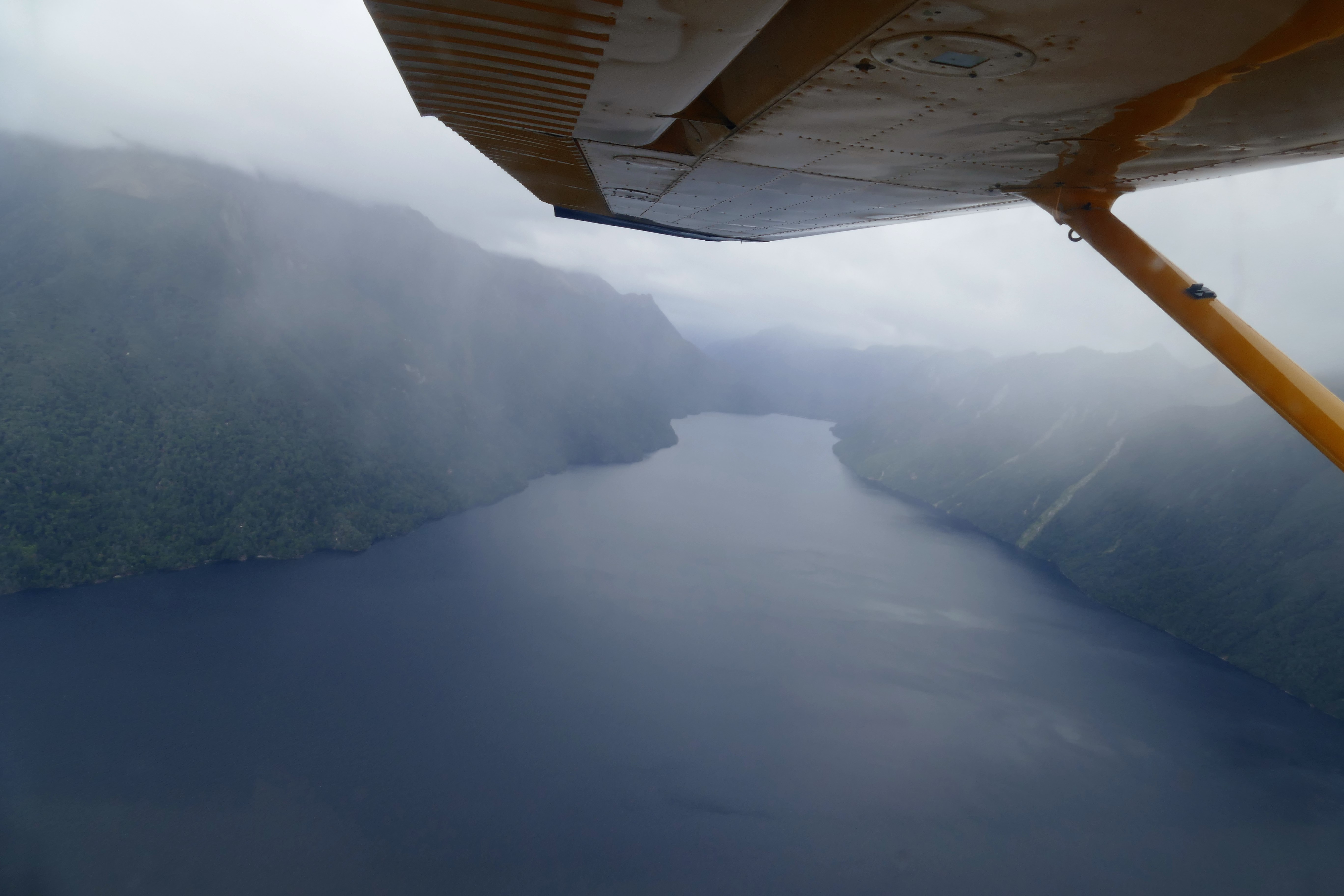
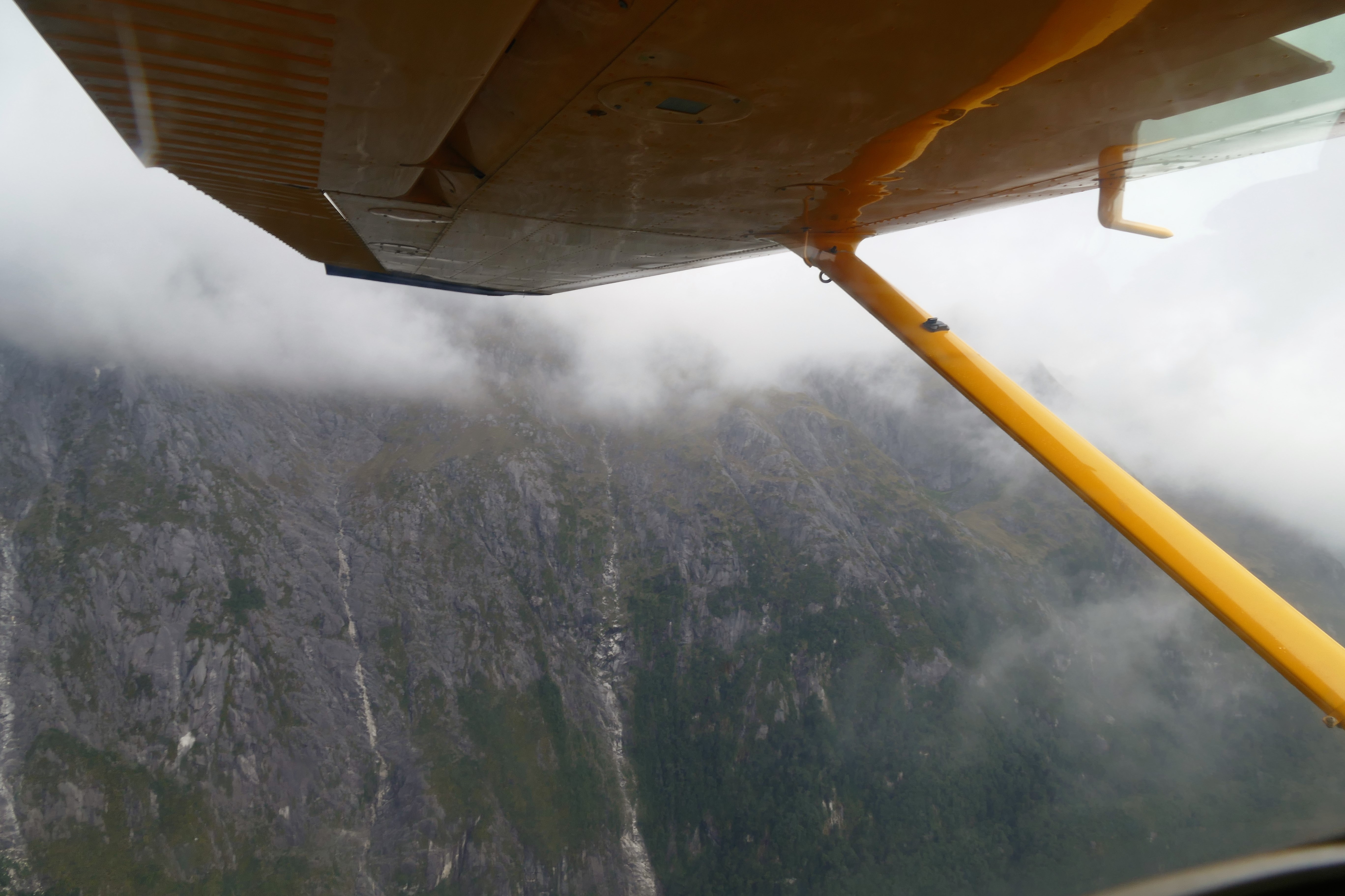
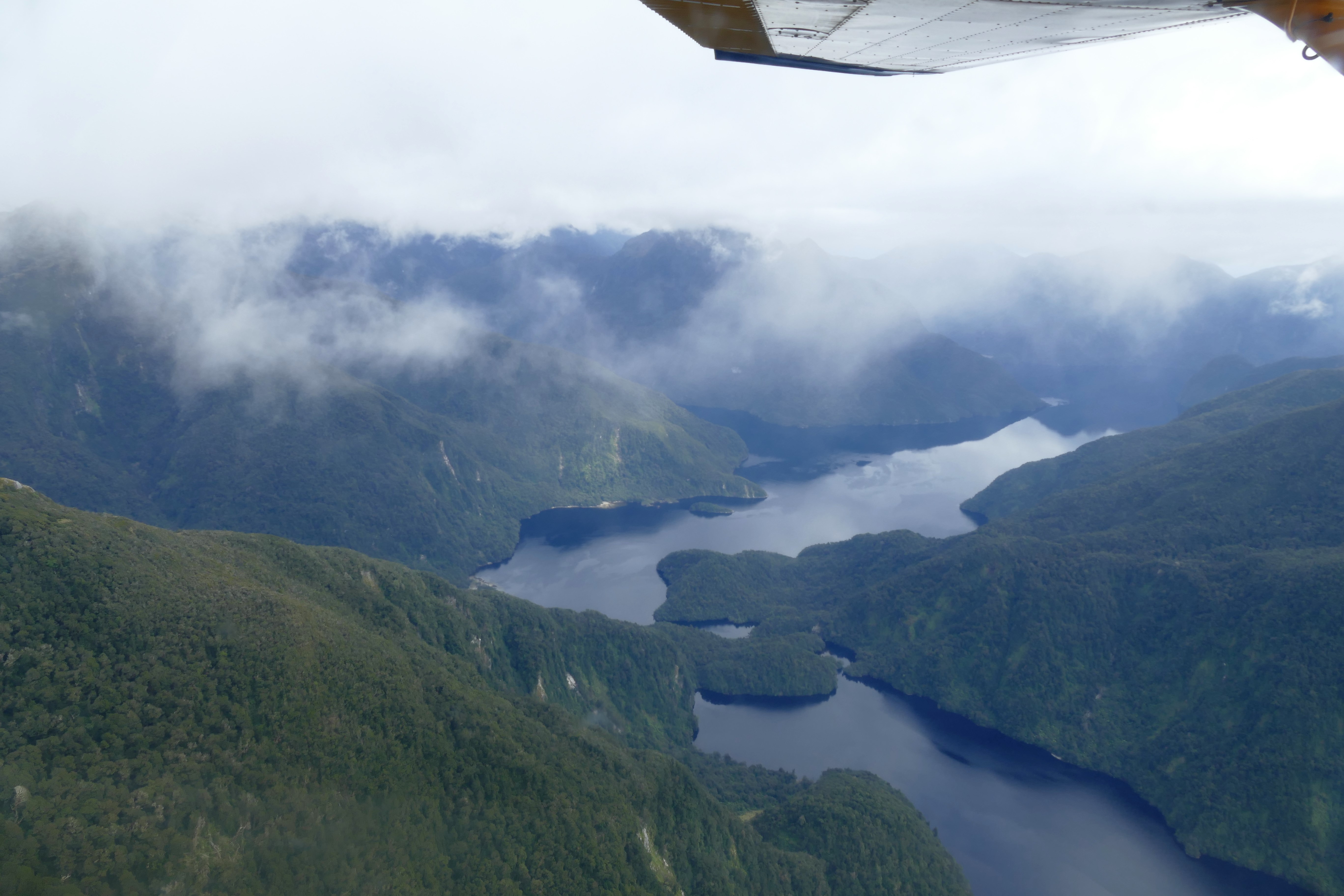
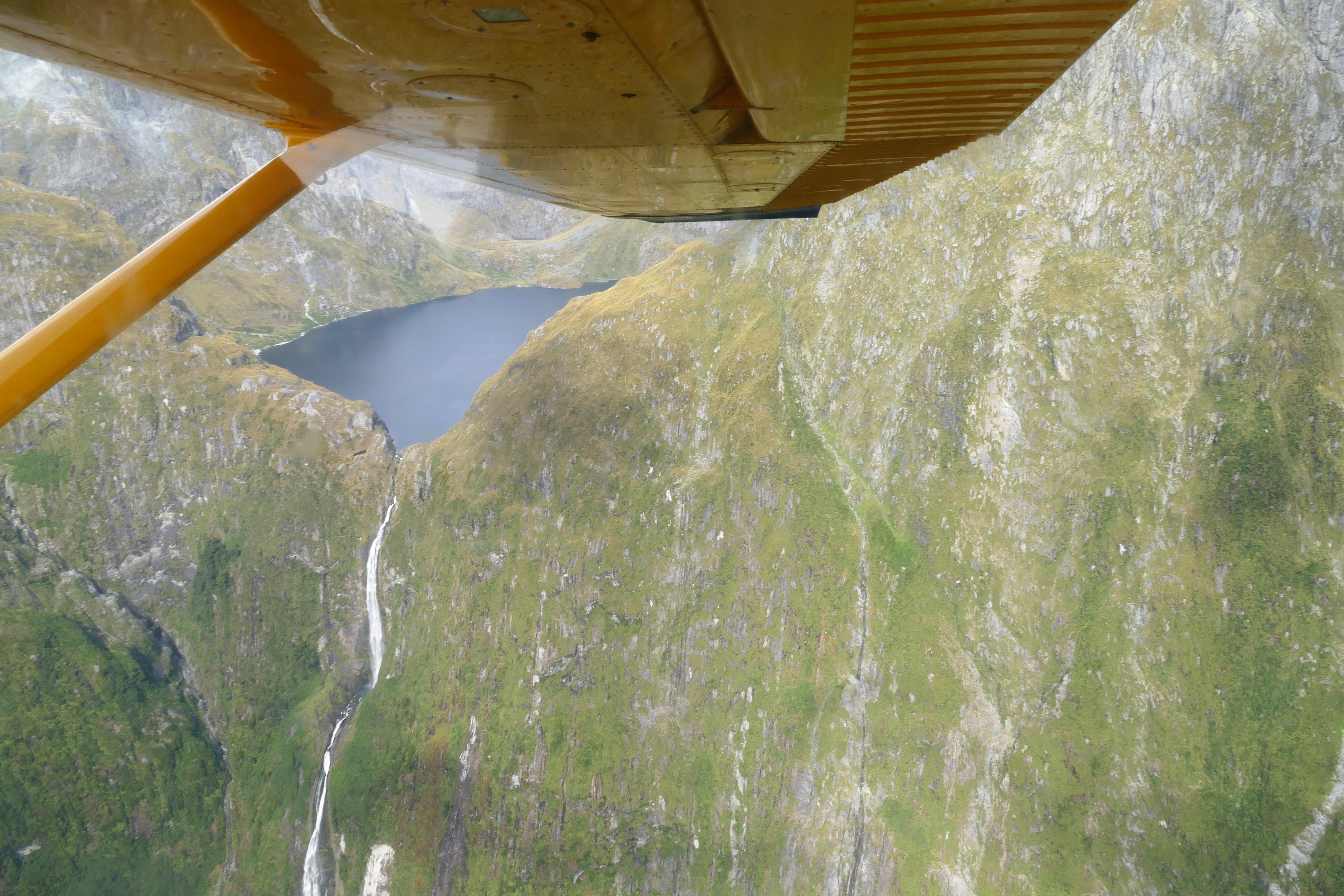
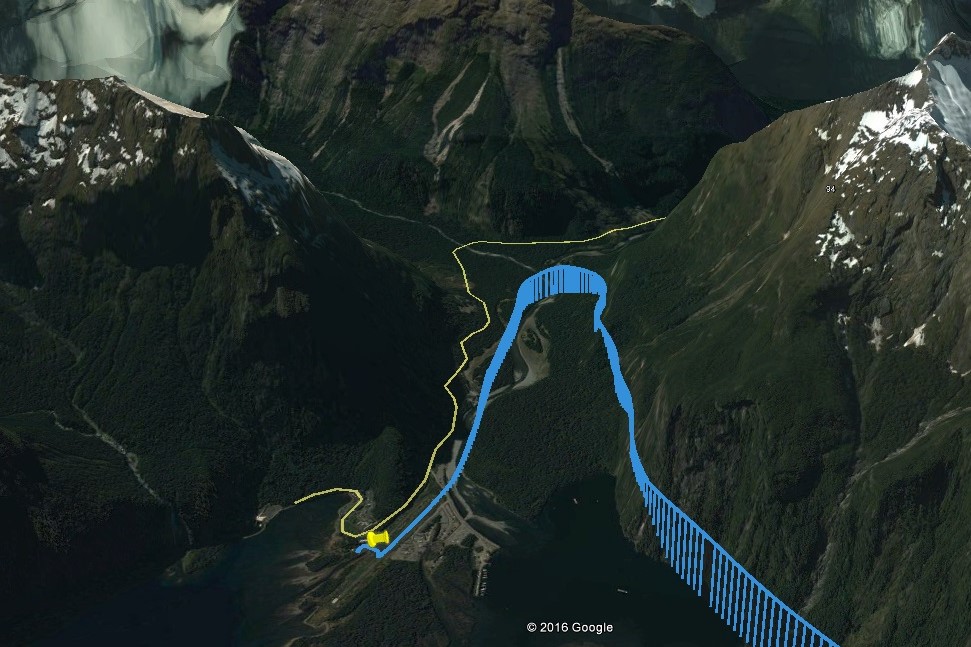
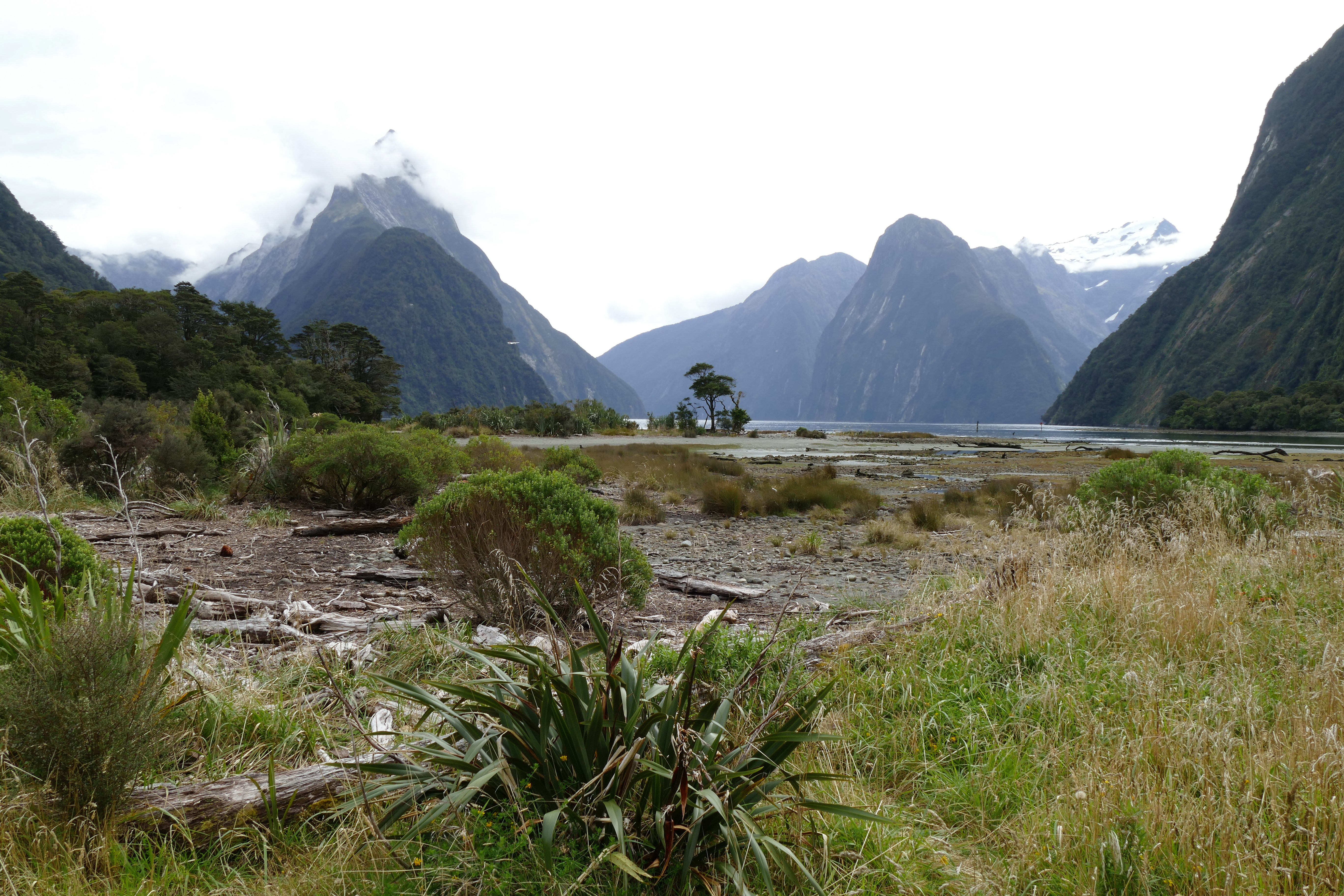
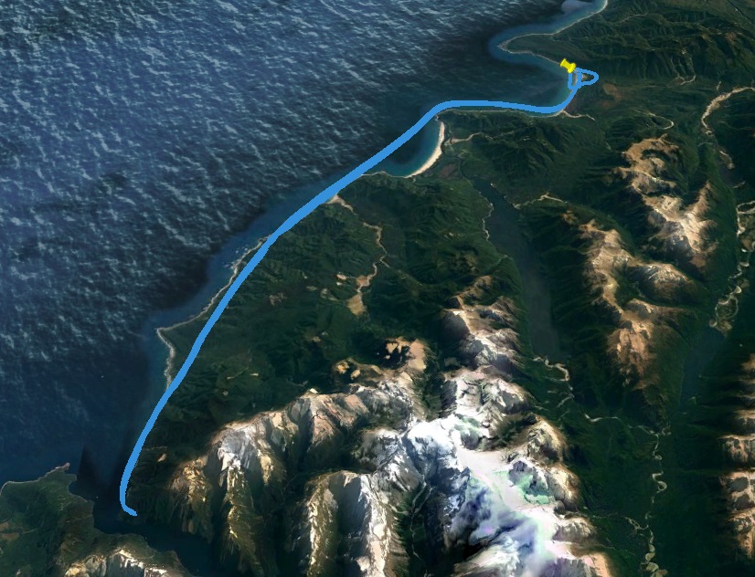
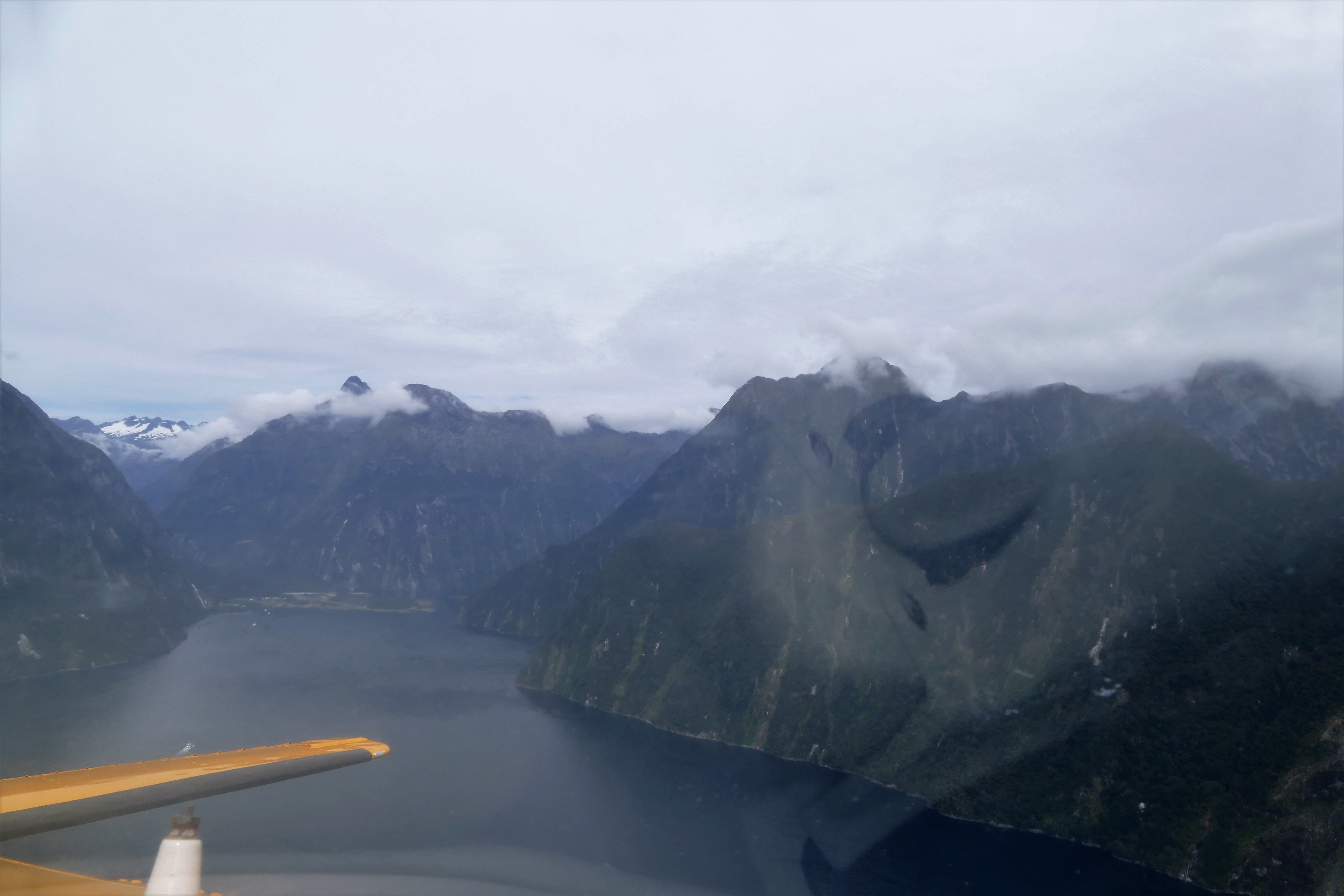
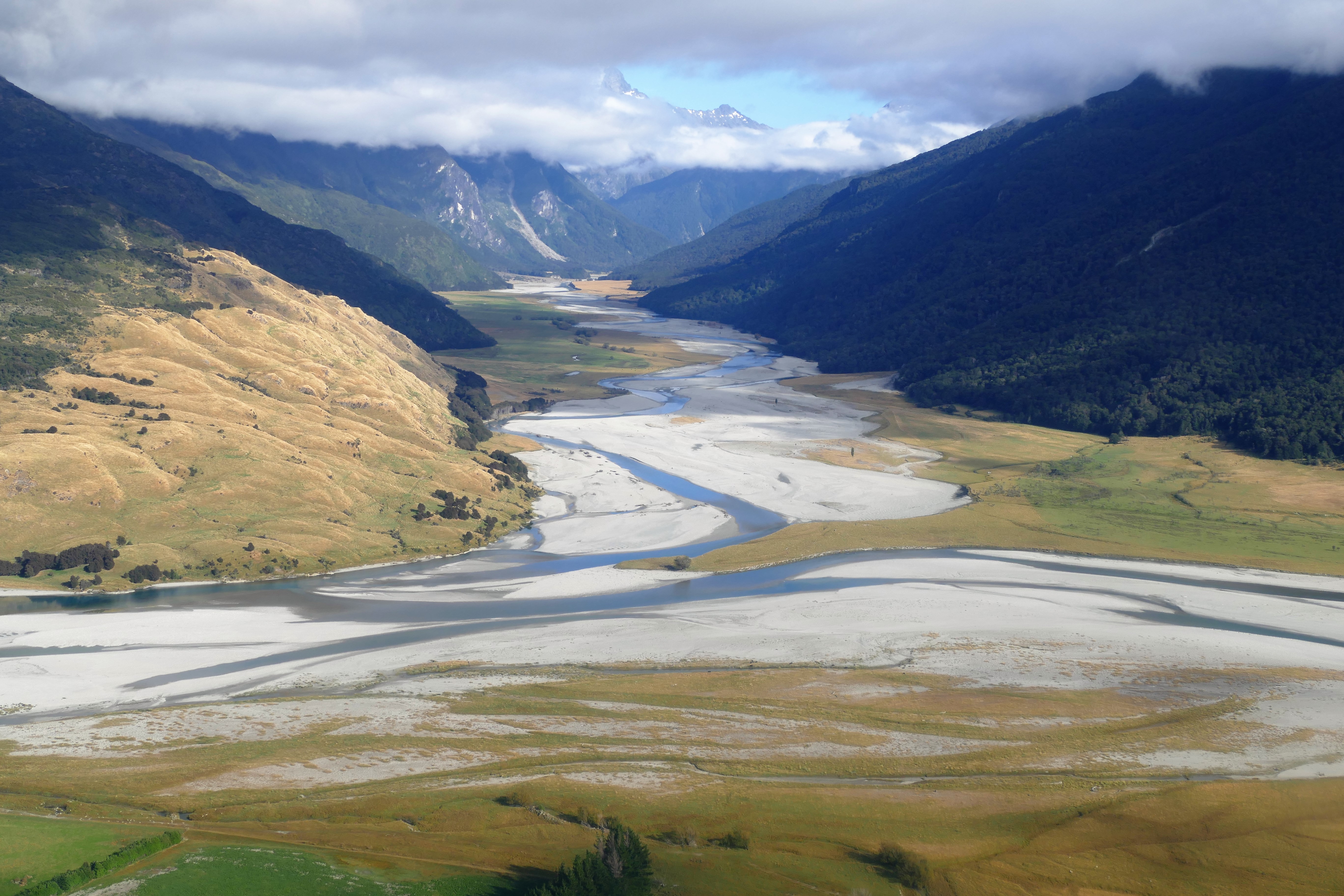
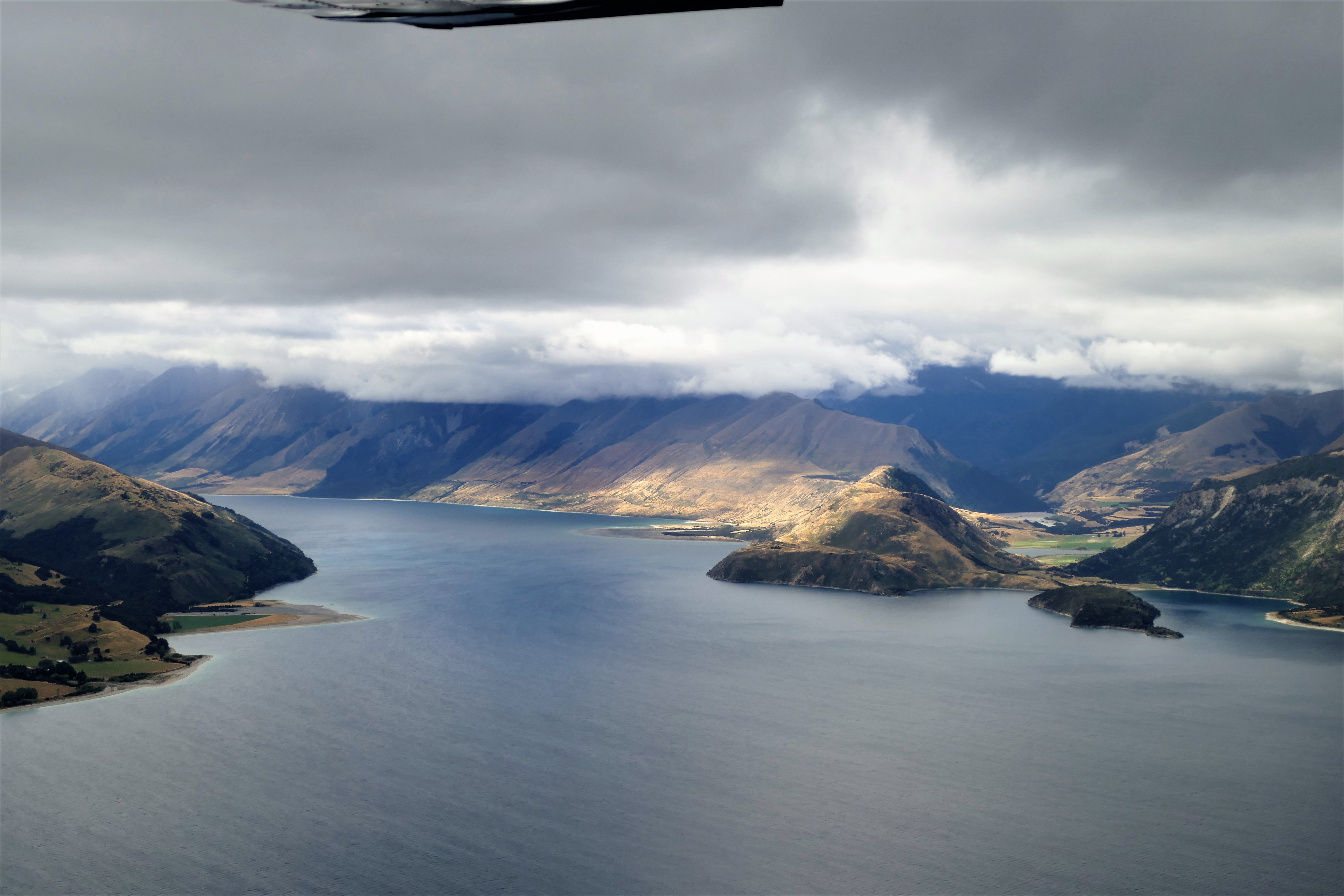
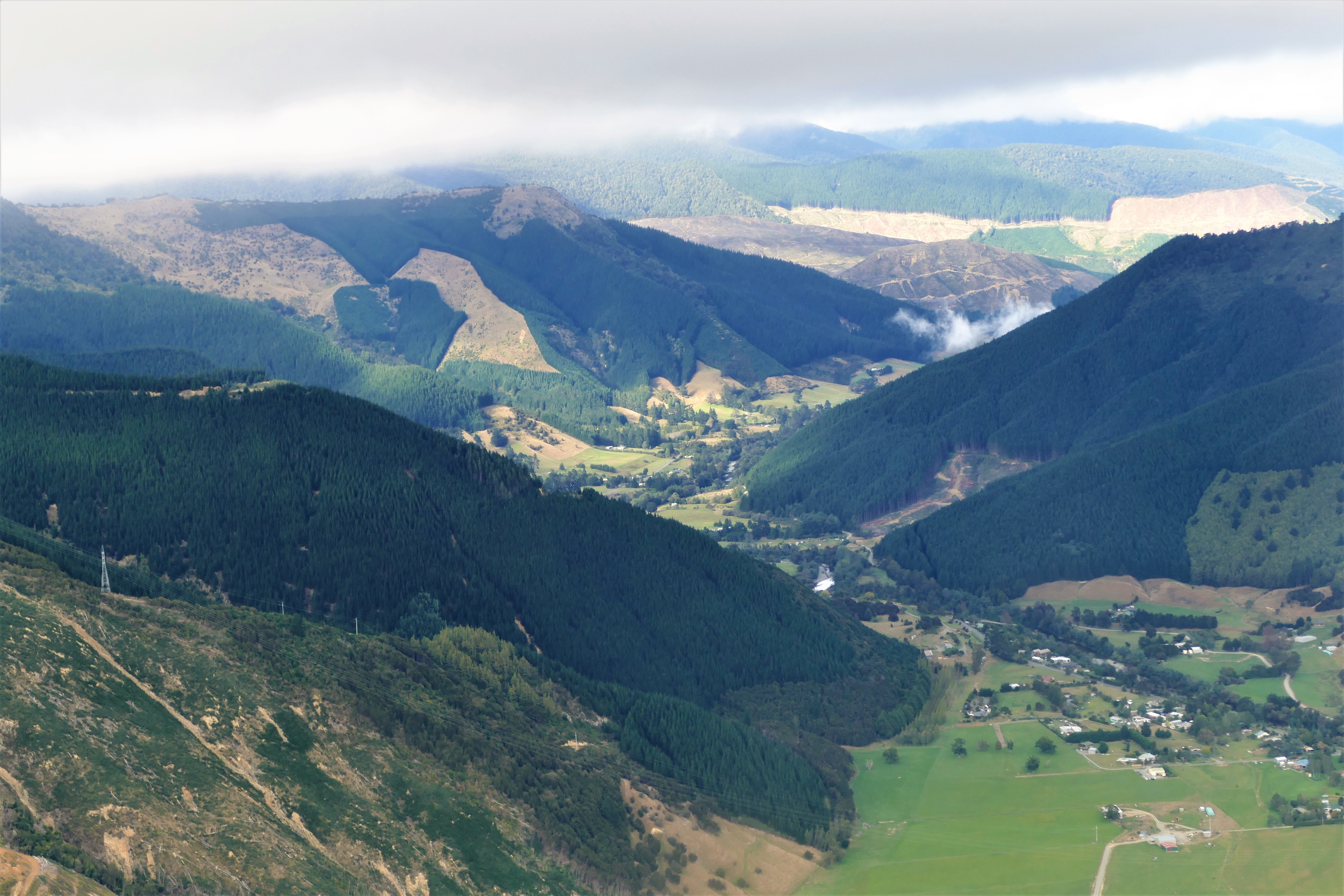
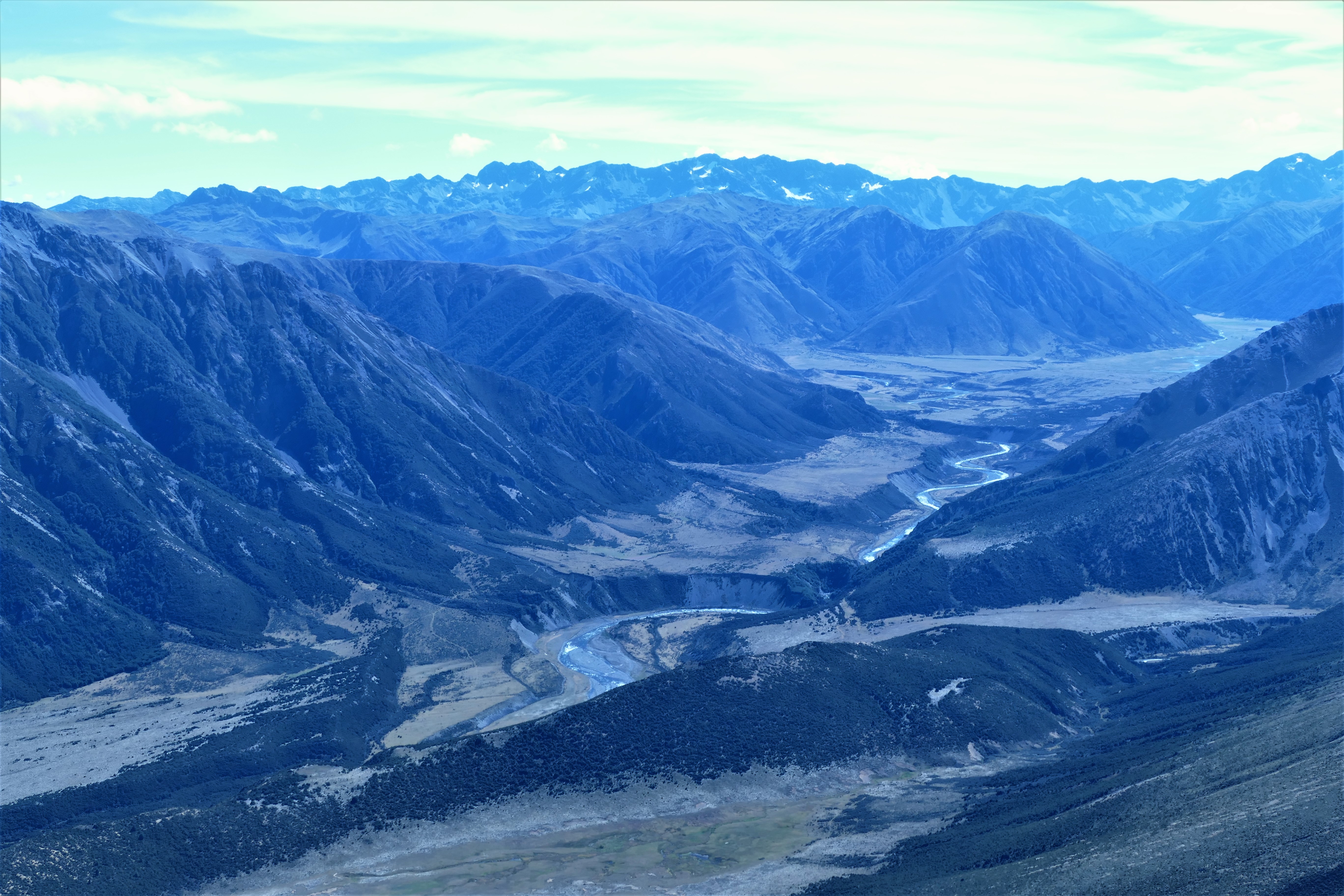
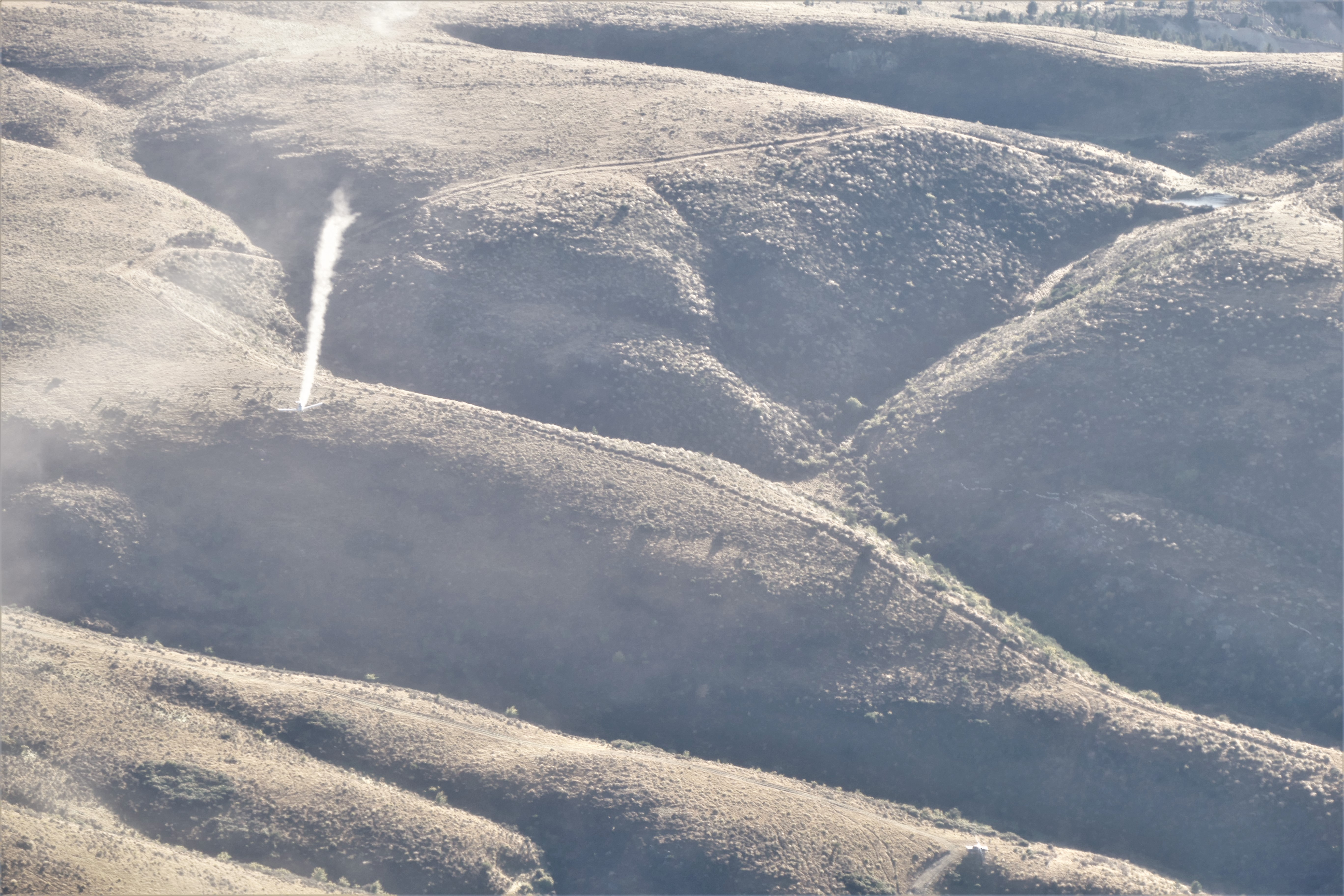
(Day 2, flight 2) After topping off the tanks with fuel, we discussed how we would cross the Fiordland and approach Milford Sound Airport. Nick and Craig took off first, heading west up the west arm of Lake Manapouri toward the power station. With a cloud ceiling of 4000 feet, we planned to cross the Wilmot Pass at 2200 feet. After Pete and I took off, we heard from Nick on the radio that the could not reach the pass due to clouds. Nick and Craig in ZK-TRS headed up the north arm of Lake Manapouri, and we followed in ZK-WAX. From the north arm of the lake, we were able to climb to 4500 just under the cloud base and continue north, following the Freeman Burn, hoping to get to Fowler Pass, 3560 feet. Tthe clouds quickly dropped to 4000 as did we, and we had to turn back about 7.5 km from the north arm due to clouds. Here, Pete taught about hugging the right side of the valley so there would be enough space to turn 180. A danger was the absence of a horizon due to the surrounding mountains. We followed another valley northwest for 4.5 km, circled a high valley about 2.5 kg southwest of Lake Herries, then saw a narrow clearing over a saddle in the Kepler Mountains. Pete taught me about approaching the saddle at an angle, so what we could circle to safety if clouds blocked the path to the other side. We were then in a high valley which was the origin of the Iris Burn. We turned north to see if we could get through to the small lakes that were the beginning of the Delta Burn, but turned back southwest after seeing this route was blocked by clouds. We tracked downstream on Iris Burn, then noticed a saddle to the northeast was clear. We flew over the high mountain dips, north of Spire Peak and south of Mount Maury, then down the South Fiord until we could turn northwest over Lake Te Anau, up the Middle Fiord, then the northwest arm, over Lake Hankinson, then Lake Thompson, through the Henry Pass. Here, the cloud bases were higher and the mountain ridges were lower. We turned northeast at Lake Alice, crossing the George River, the Wild Natives River, and over Lake Graves. I climbed to 3500 feet and turned east up the Light River, over a saddle north of the Twin Sisters, and up Staircase Creek to look at Lake Quill and Southerland Falls. Pete took the controls for the tight turn over Lake Quill so Liz and I could look and photograph. From there, I began a hurried decent down Arthur River to 1000 feet traffic pattern altitude, arrived at the end of Milford Sound. With the airport in front of me, I turned right along the rock wall and entered a left downwind. Pete guided me as I entered the Cleddau River valley to turn base then final for the landing on runway 29. After the 1 hour, 10 minute flight. Pete told me that I was one of the few private pilots to land at Milford Sound Airport NZMF.
We walked around Milford Sound area, eating lunch, taking in the views and capturing photos.
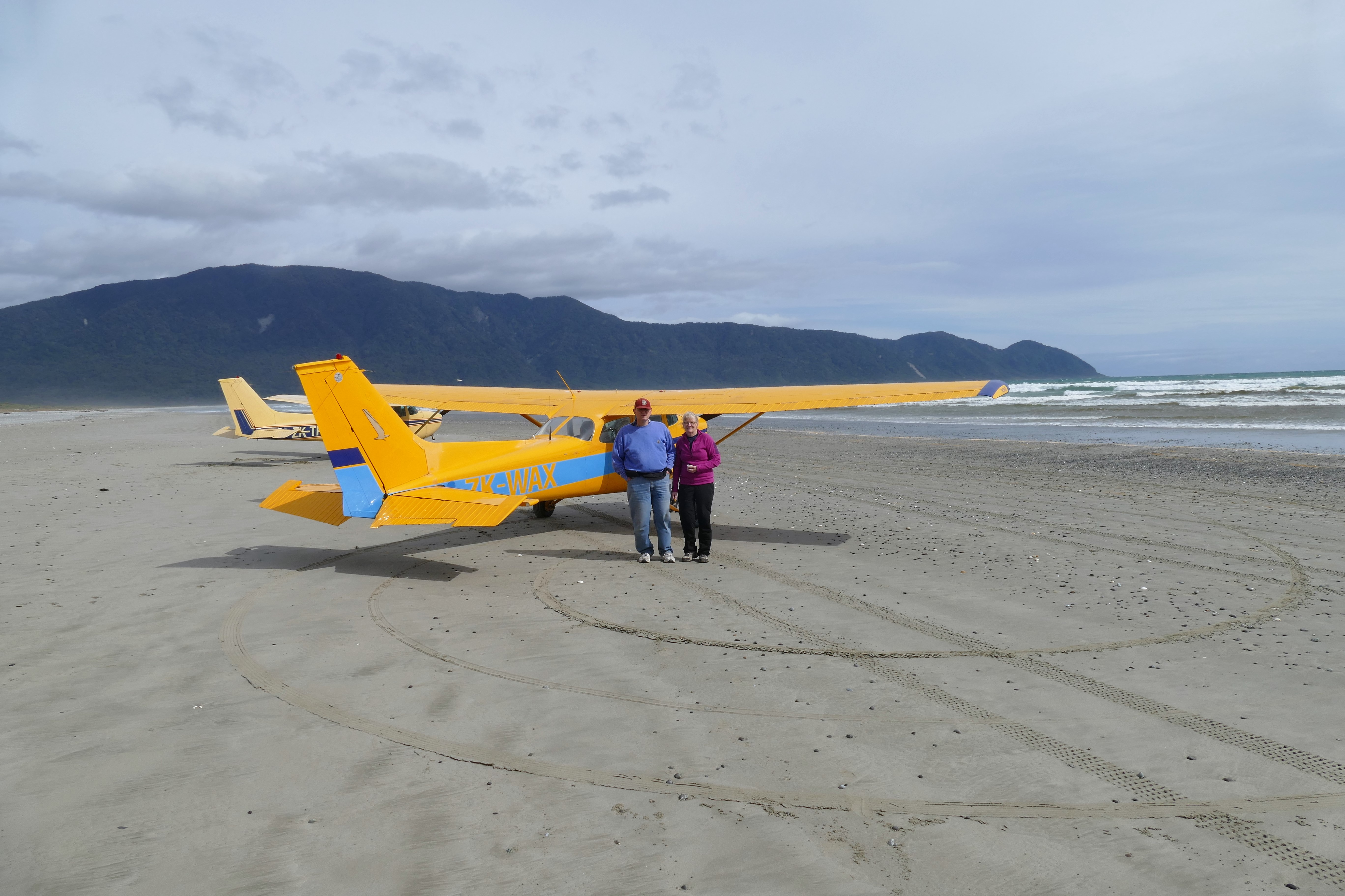
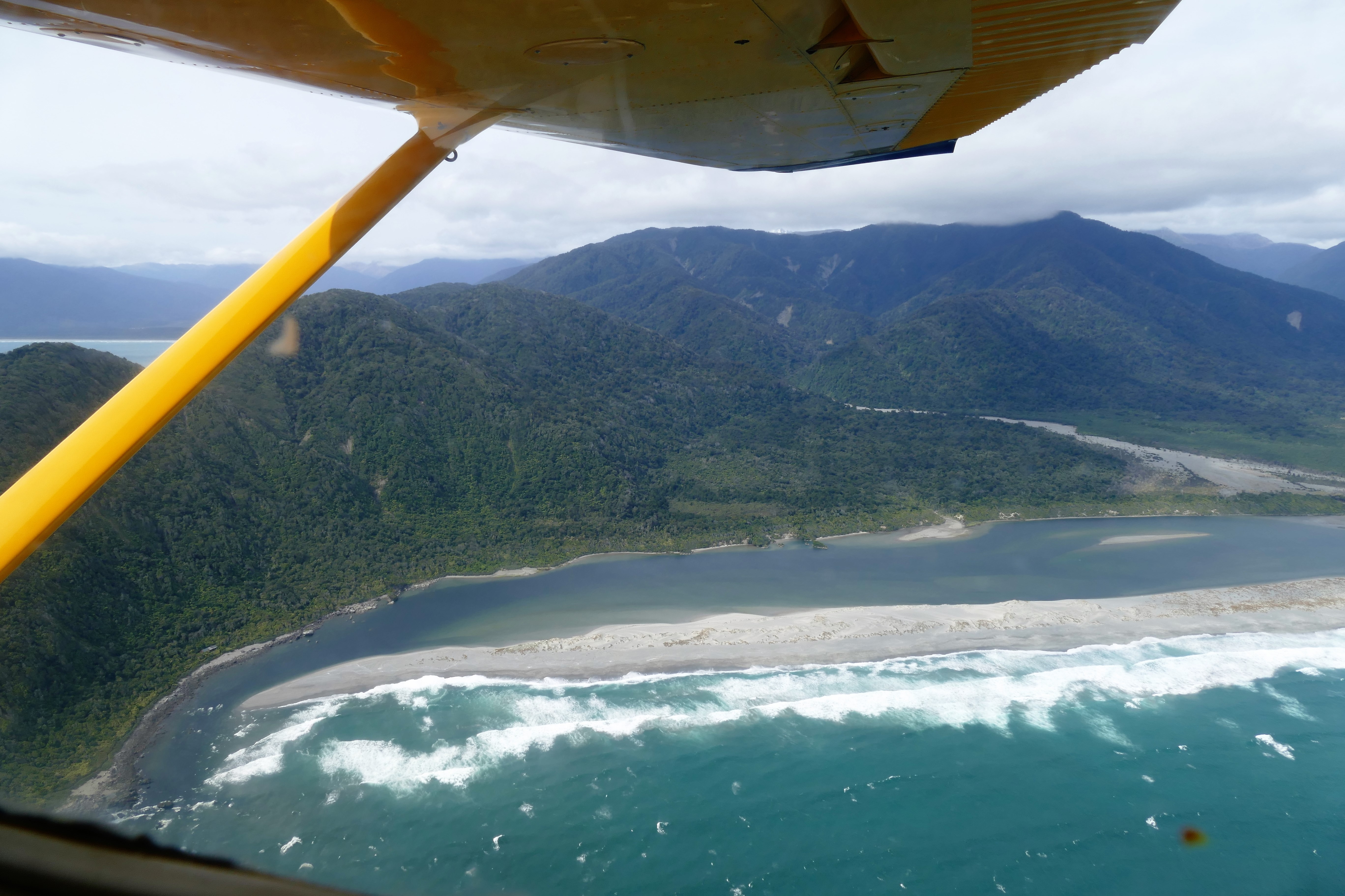
(Day 2, flight 3) We took off on runway 29, and departed Milford Sound Airport to the northwest, flying along the right side of the canyon. We climbed to 2500 while rounding Dale Point. At the opening of the sound, we turned north along Brig Rock and vacated the NZMF traffic area. We continued north along the coast, passing Martins Bay and entering Big Bay along the shore line. Pete tried to explain where to land, but I had difficulty understanding considering that there was nothing that looked like a landing strip on the sand. Pete directed my flying base along the ridge on the north side of Waiuna Lagoon, and turning final, but I was not lined up were we were supposed to land. I then heard Pete say, "I have the controls," and the turned left, right, and landed on the sand. I was disappointed as I had expected that this would be my landing on the beach. I would have wanted Pete to have be go around, and try again.
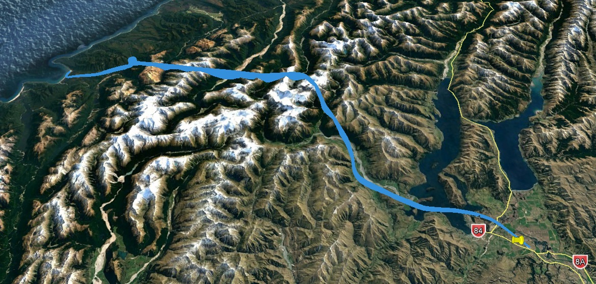
(Day 2, flight 4) We took off from the Big Bay Beach Strip to the south, then turned east, circling once to gain altitude during the climb to 7500 feet. This allowed us to pass to the north of Mount Aspiring for a good look and photographs, before turning southeast and descending through the _ valley and over Lake Wanaka before setting up for a straight in approach to Wanaka Airport NZWF. Flight time was 50 minutes when we landed at NZWF were we topped off with fuel.
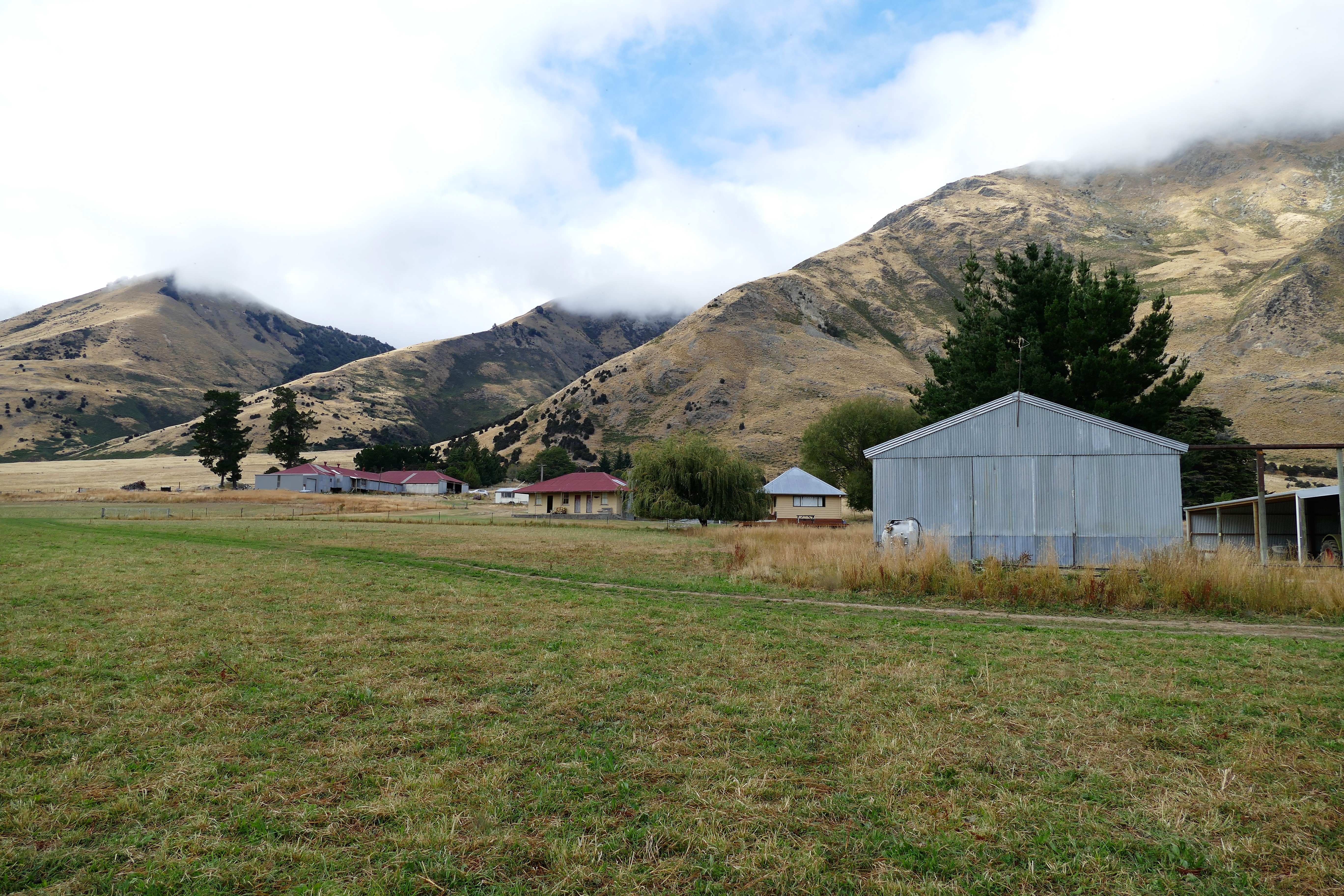
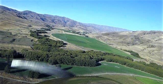
(Day 2, flight 5) The final 15 minute flight was a straight line after turning to the east from Wanaka Airport. A climb to 3500 put us over a saddle just south of Trig Hill in the range on the east side of the Clutha River. We then flew a descent to 2200, it looked exactly like it did on Microsoft Flight Simulator. We flew around grass strip at Geordie Hill Station and checked it before landing.
We were shown our cottage where we unpacked and relaxed until the 7 pm dinner time. Jo prepared a wonderful dinner and we talked until 9:30 pm.

3/23/17: Mount Cook
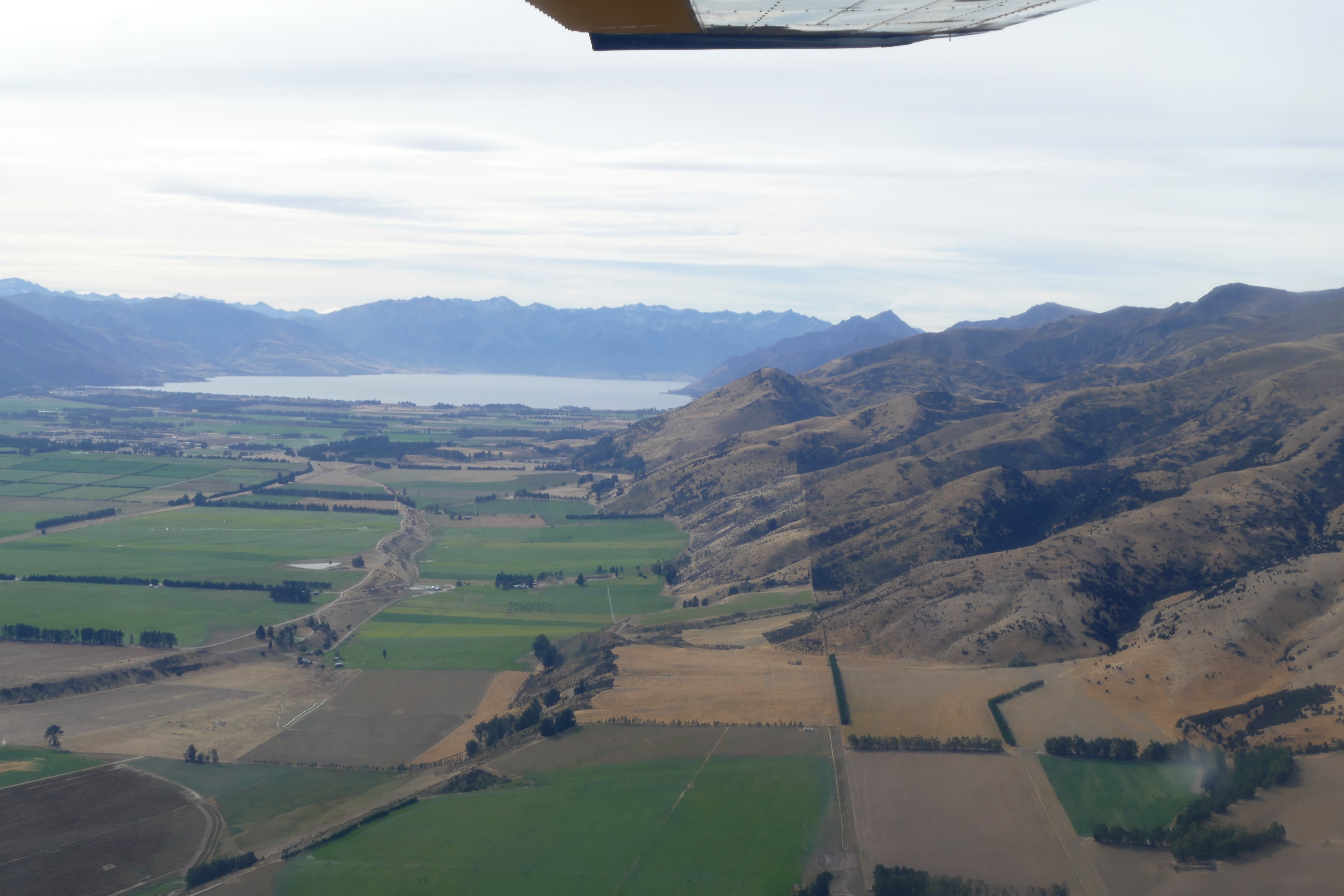
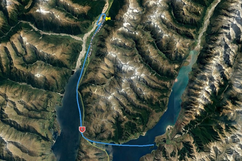
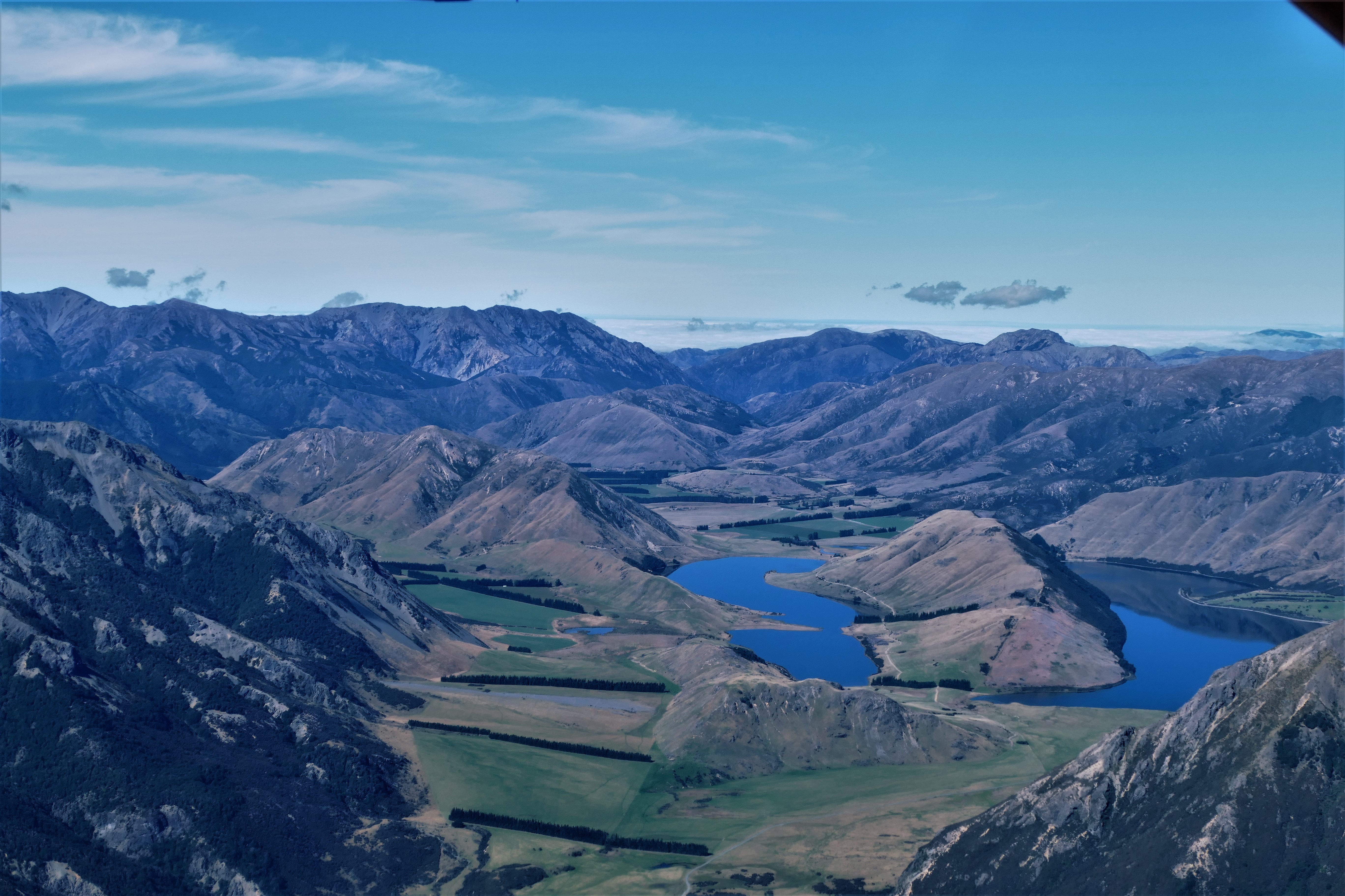
(Day 3, flight 1) With Pete as instructor in ZK-WAX, we took off from the strip Geordie Hill Station, and climbed west until 3500 and clear of the hills. We turned north over the east side of Lake Hawea until we were abeam The Neck on the west side of the lake. Turning right, we could see the grass trip on Dingle Burn Station we descended on the upwind, then turned downwind at 50 feet above ground level to inspect the strip. Satisfied that it was safe, we landed after a 25 minute flight.
(Day 3, flight 2) We took off from Dingle Burn Station for a 20 minute flight at 2500 feet to Makarora NZMK. The route was west across Lake Hawea, over The Neck, then turning north Lake Wanaka and up the Makarora river. We circled and landed on the grass strip which was across the road from the Makarora Country Cafe where we stopped for a coffee break.
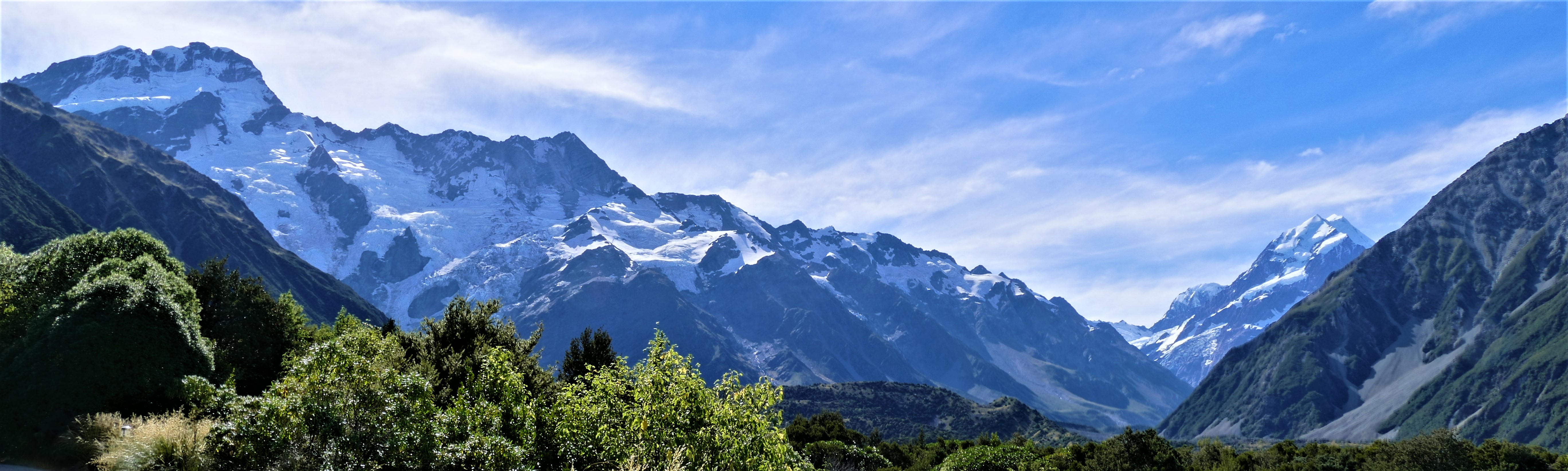
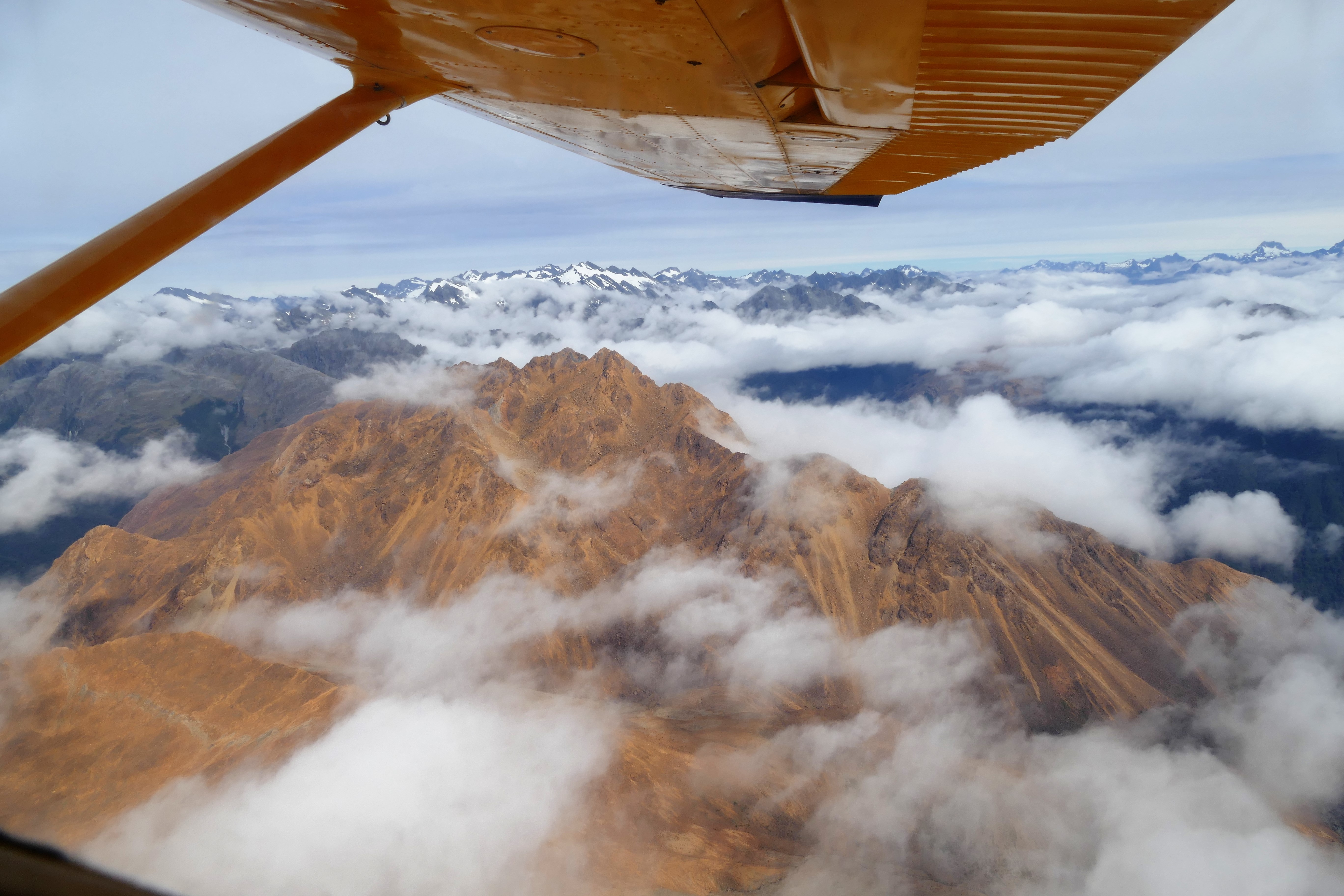
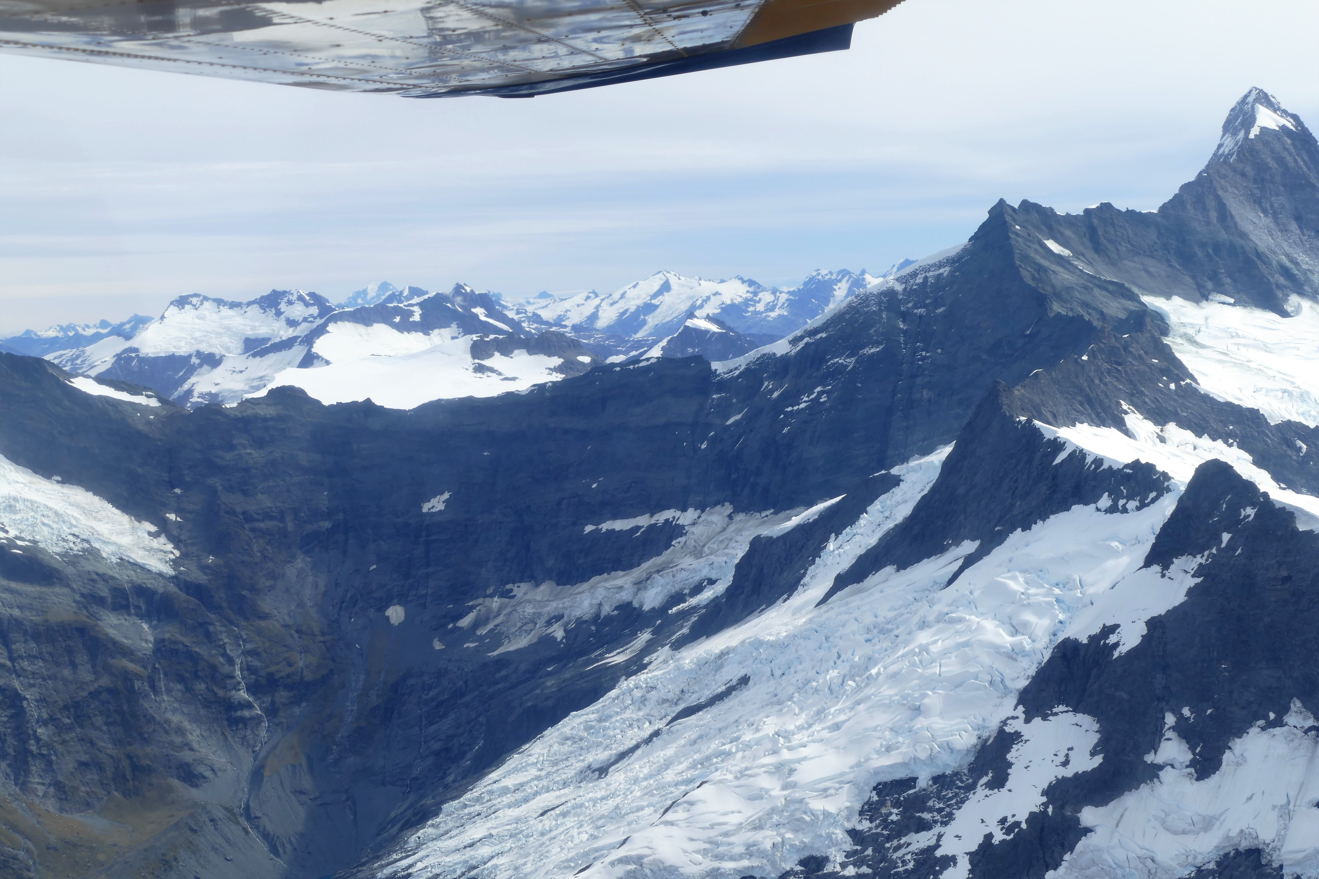
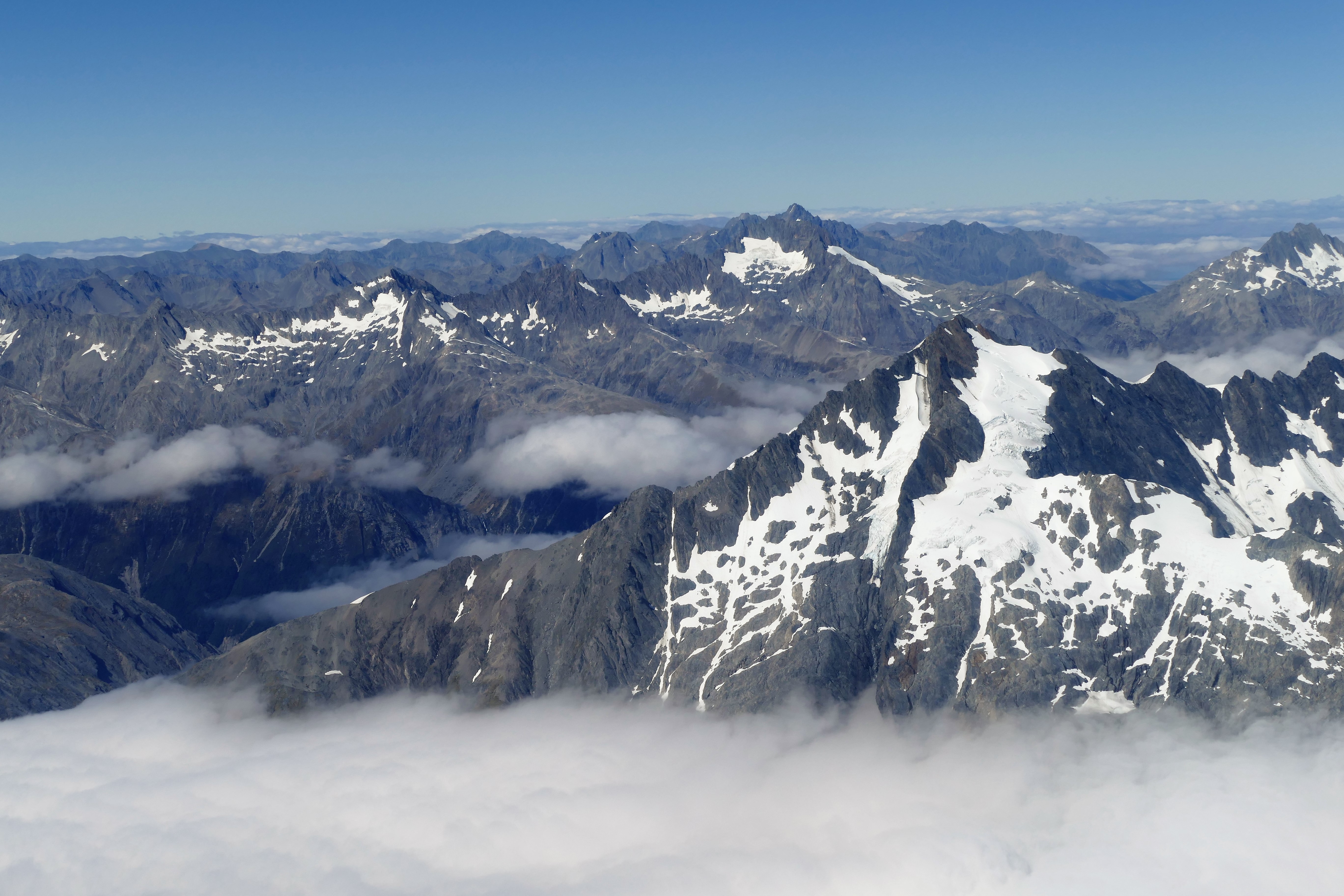
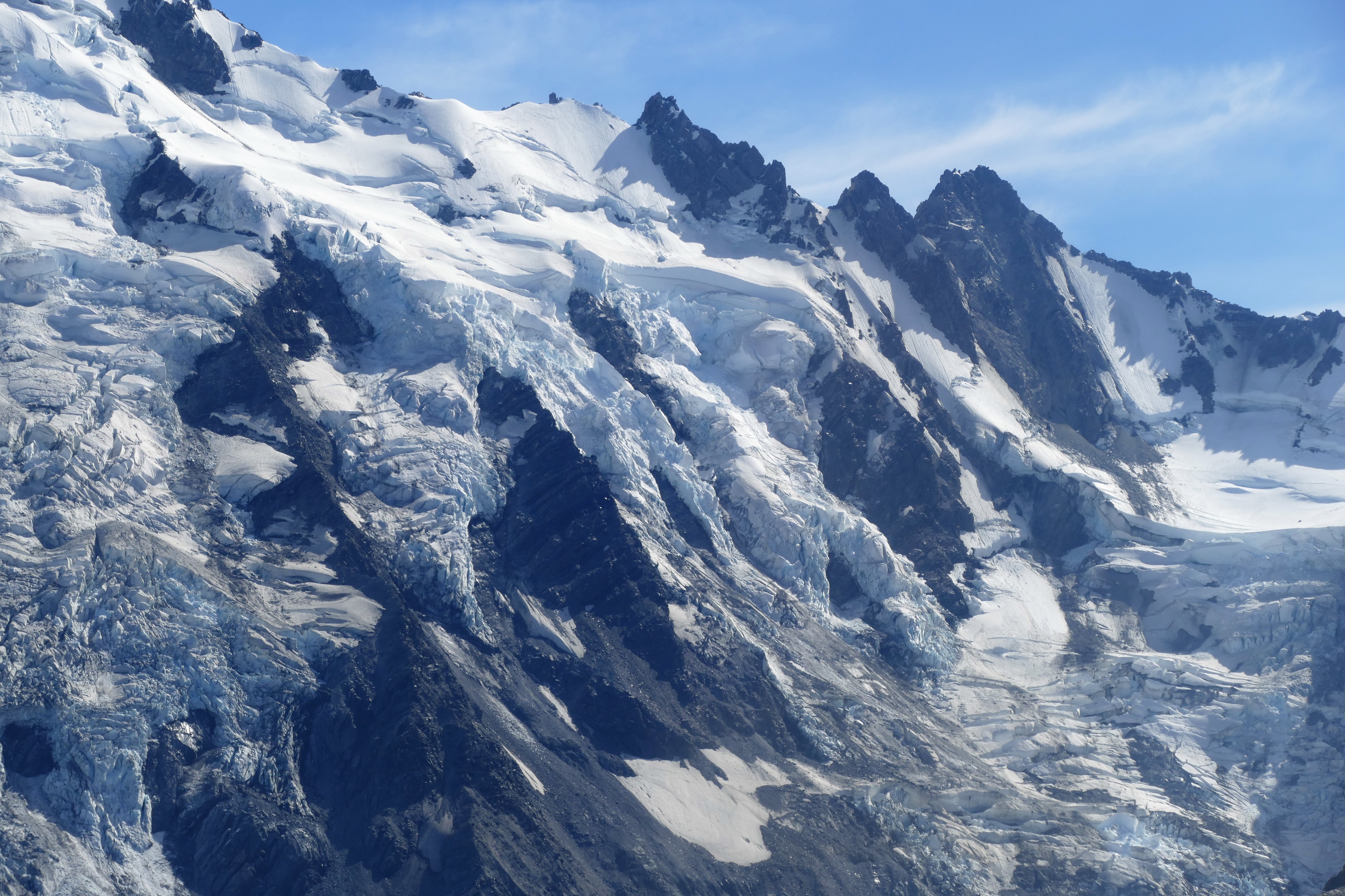
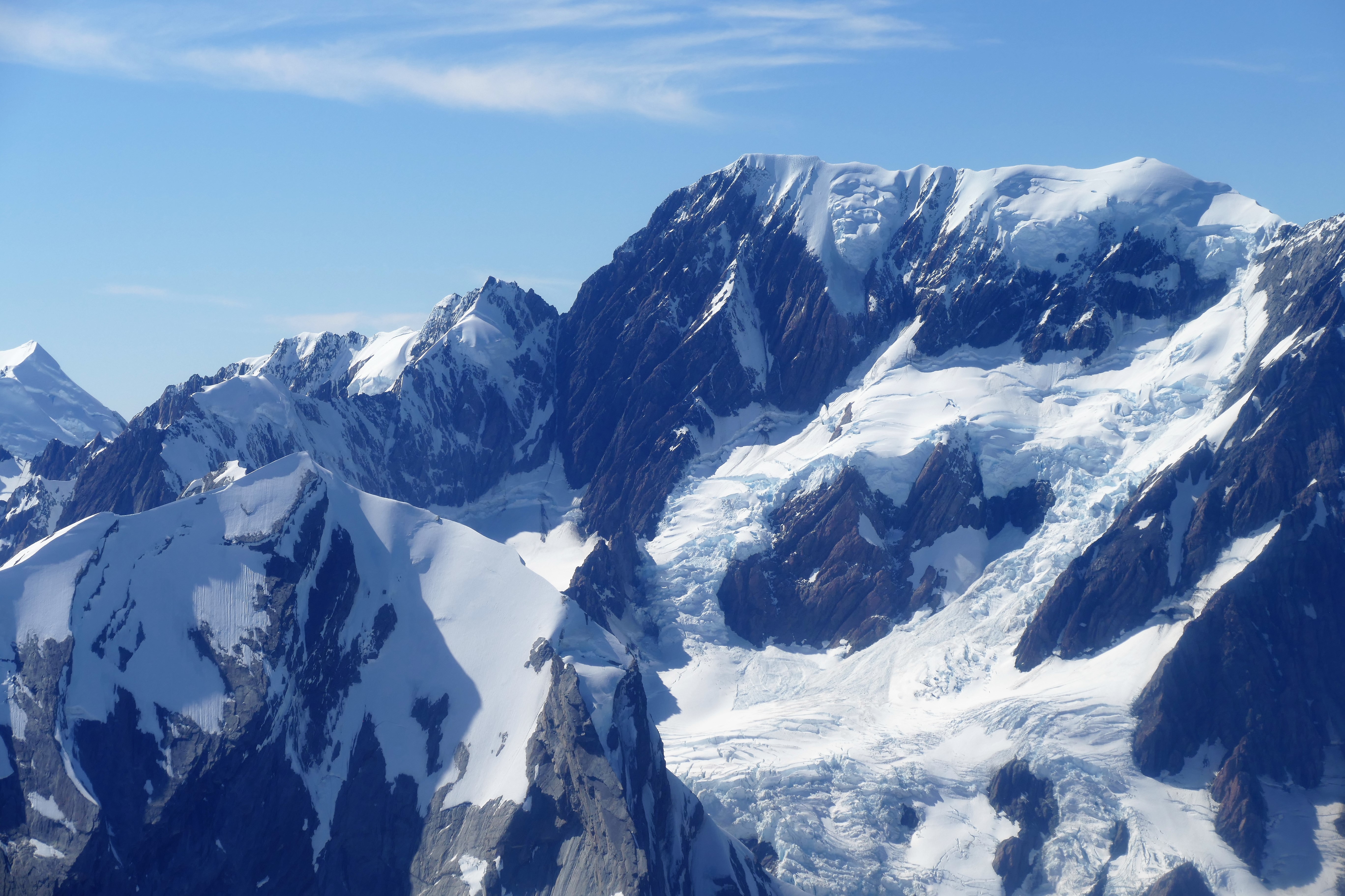
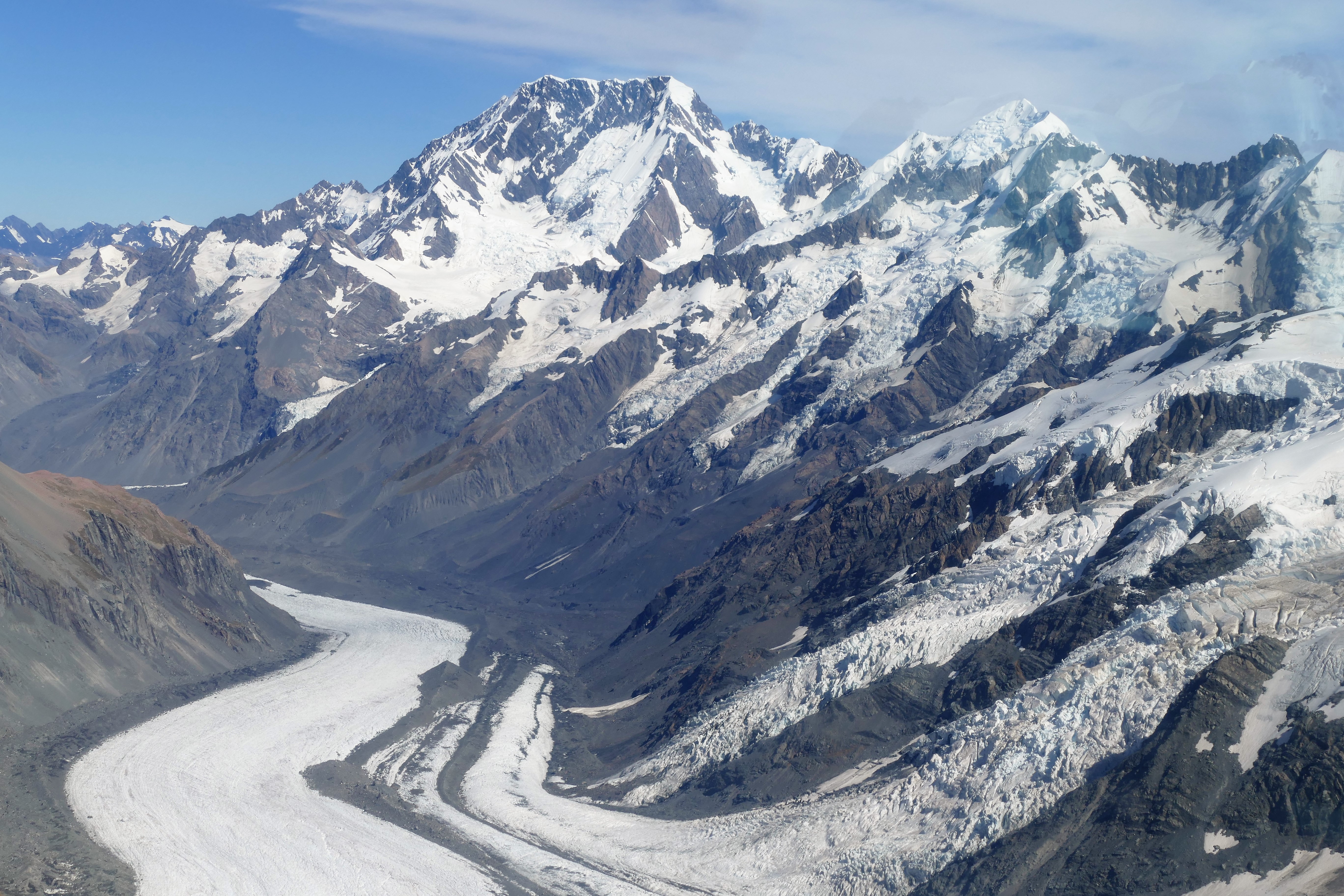
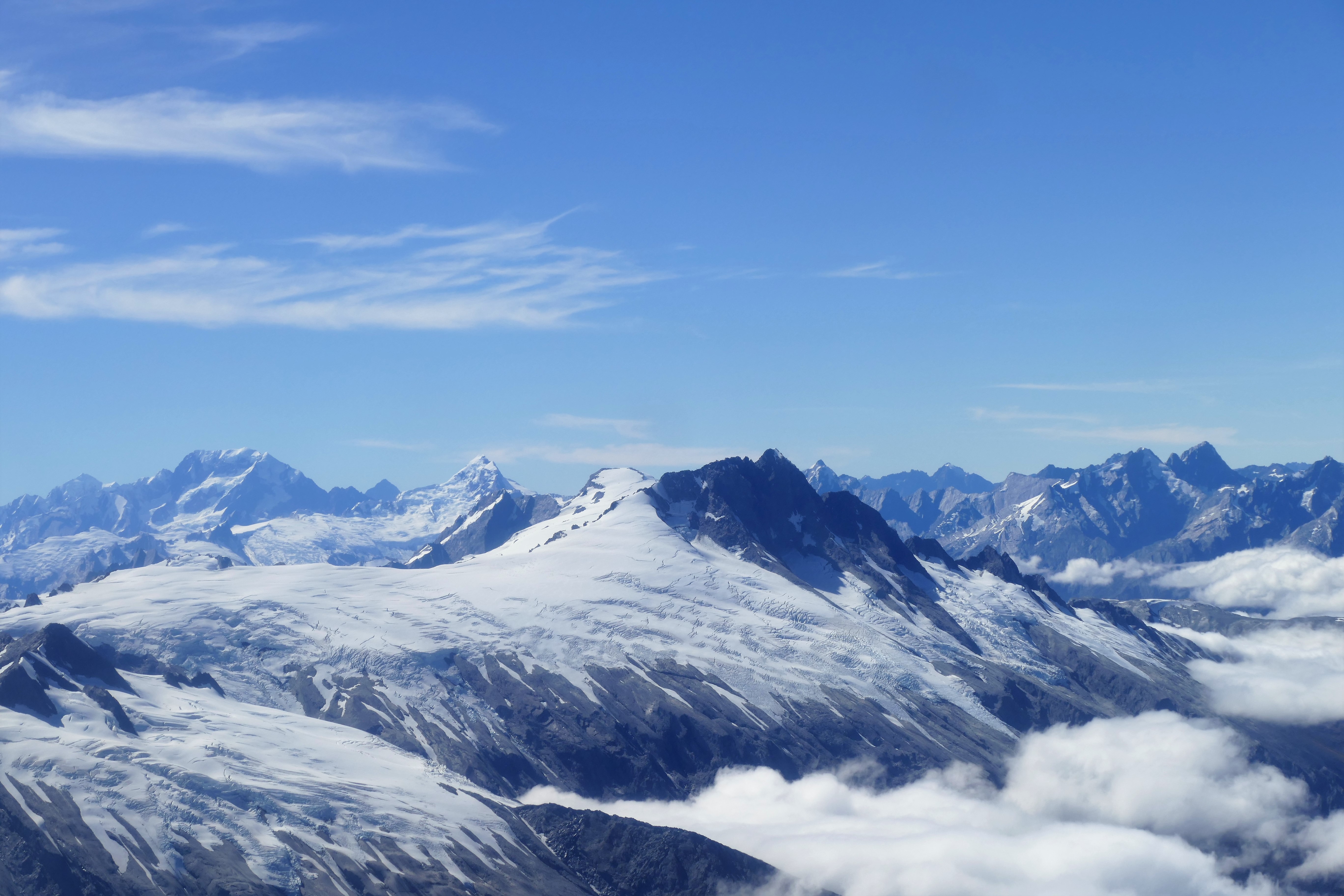
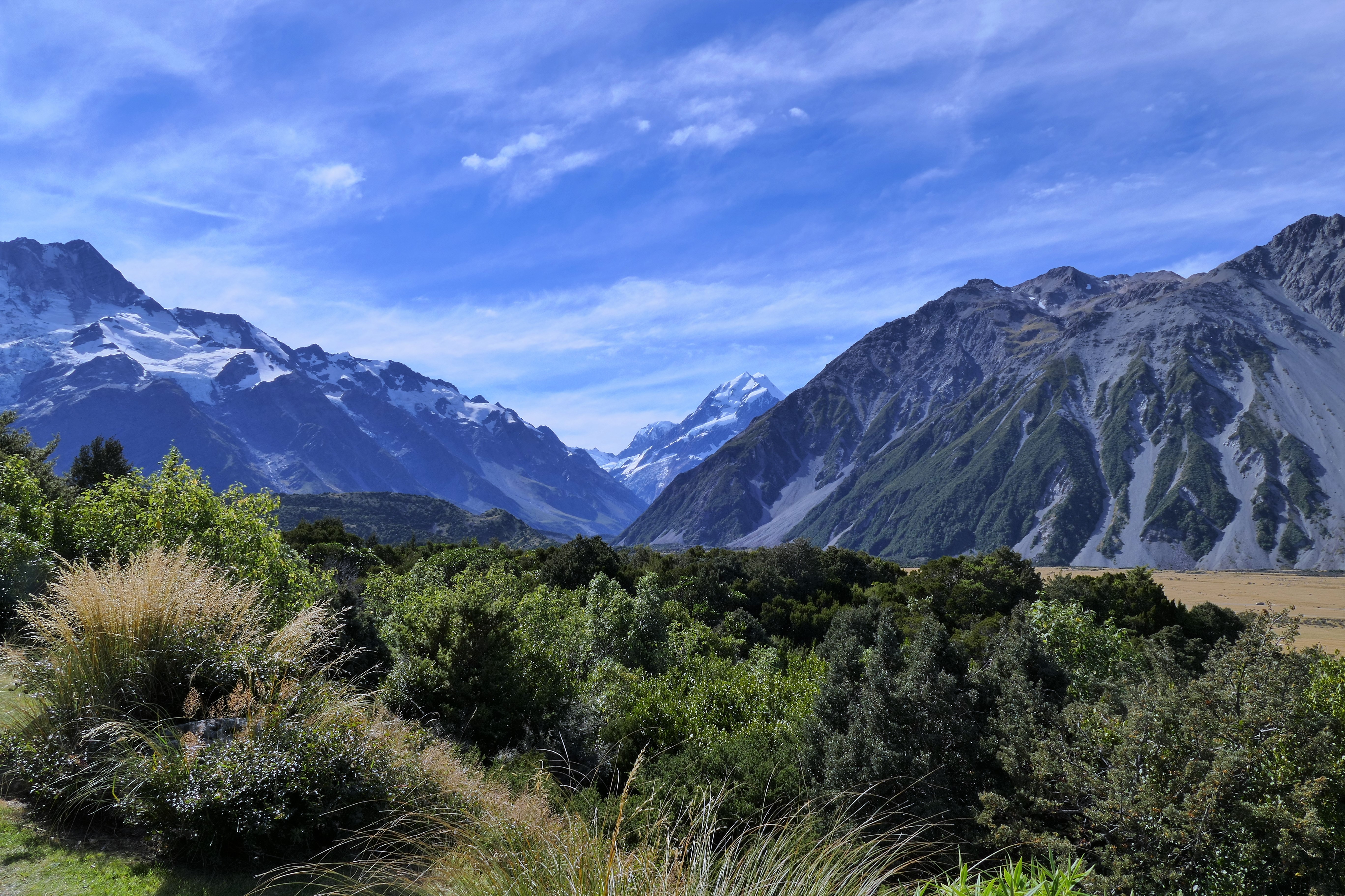
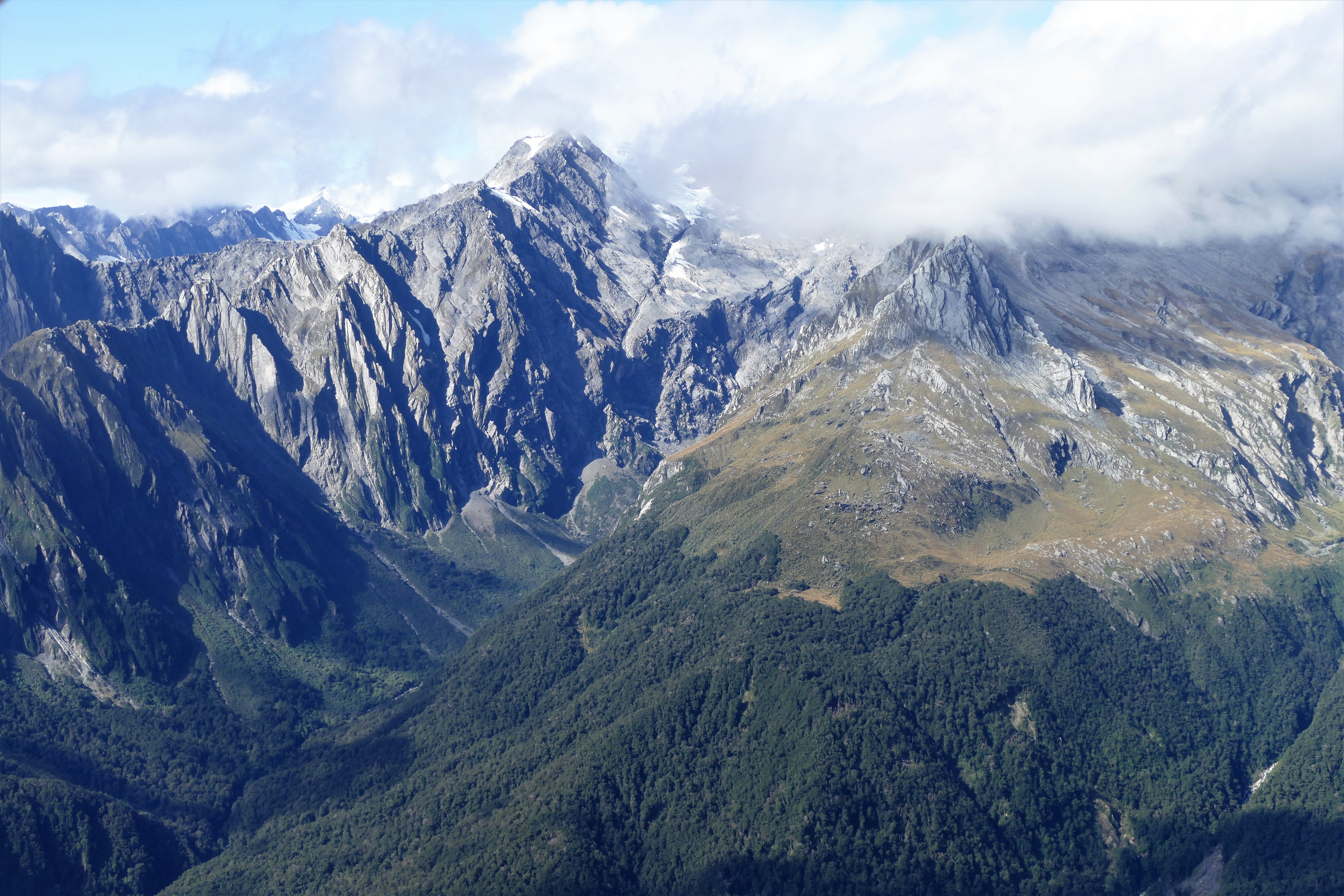
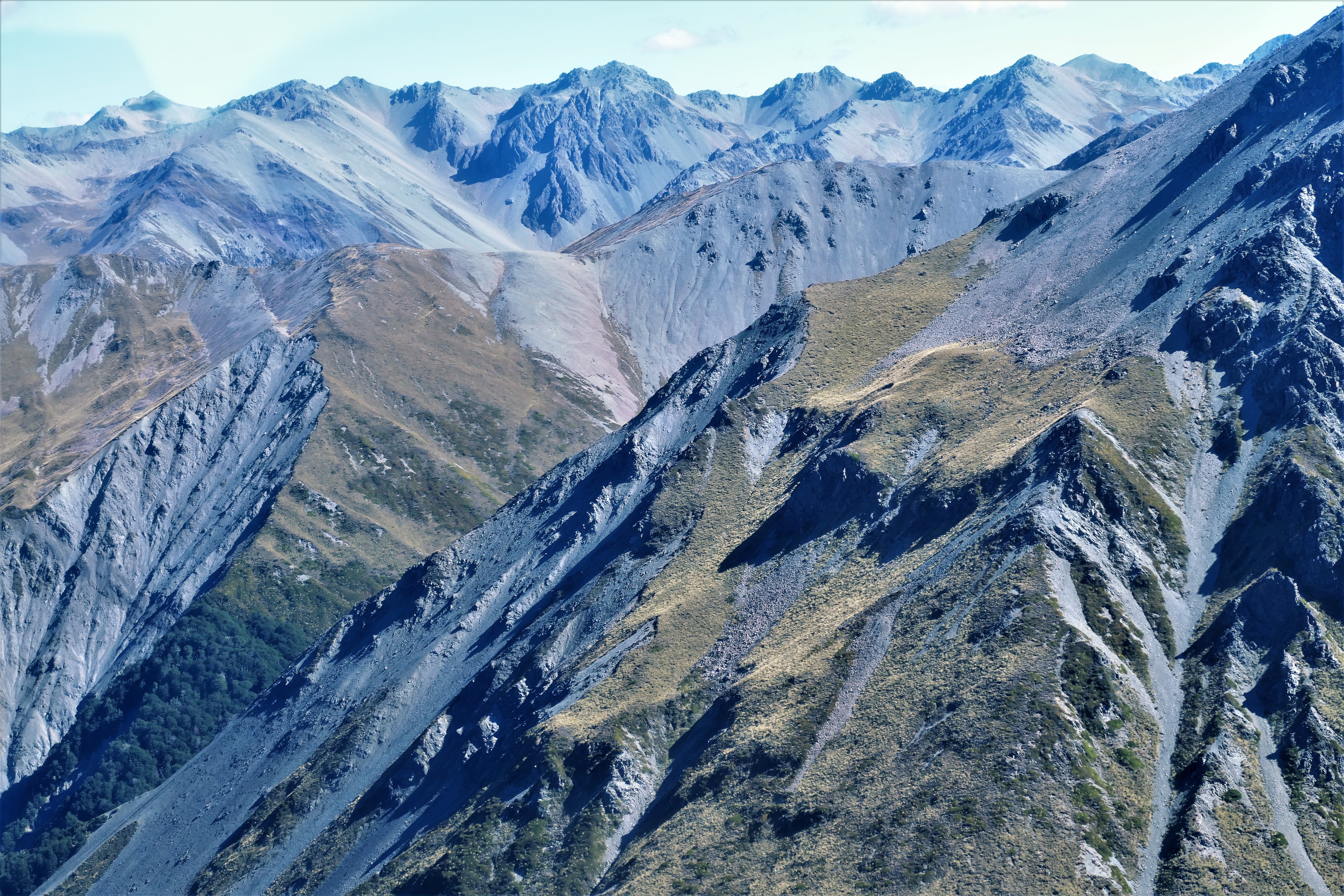
(Day 3, flight 3) We took off from NZMK and flew north over route 6 and the Makarora river while climbing through a break in the 3000 foot cloud base. We continued our climb, VFR on top, to 9500 feet to view and photograph the Southern Alps. We passed to the west of Mount Brewster and Mount Ward, then circled around the glaciered peak of Mount Shefton. Climbing further to 10500 feet, we passed to the west of Mount Cook continuing north to circle around Mount Elie De Beaumont, then descending over the Whymper Saddle and Tasman Saddle. This was followed by a rapid descent down the Haupapa Tasman Glacier for a left base to runway 13 at the Mount Cook Airport NZMC, completing the 1 hour 15 minute flight.
We walked around, looking for wonderful photo opportunities. Some college students doing tourist polling stopped Liz to ask her some questions, and told her about the ducks walking around who mated for life, and about the face on Mount Cook.
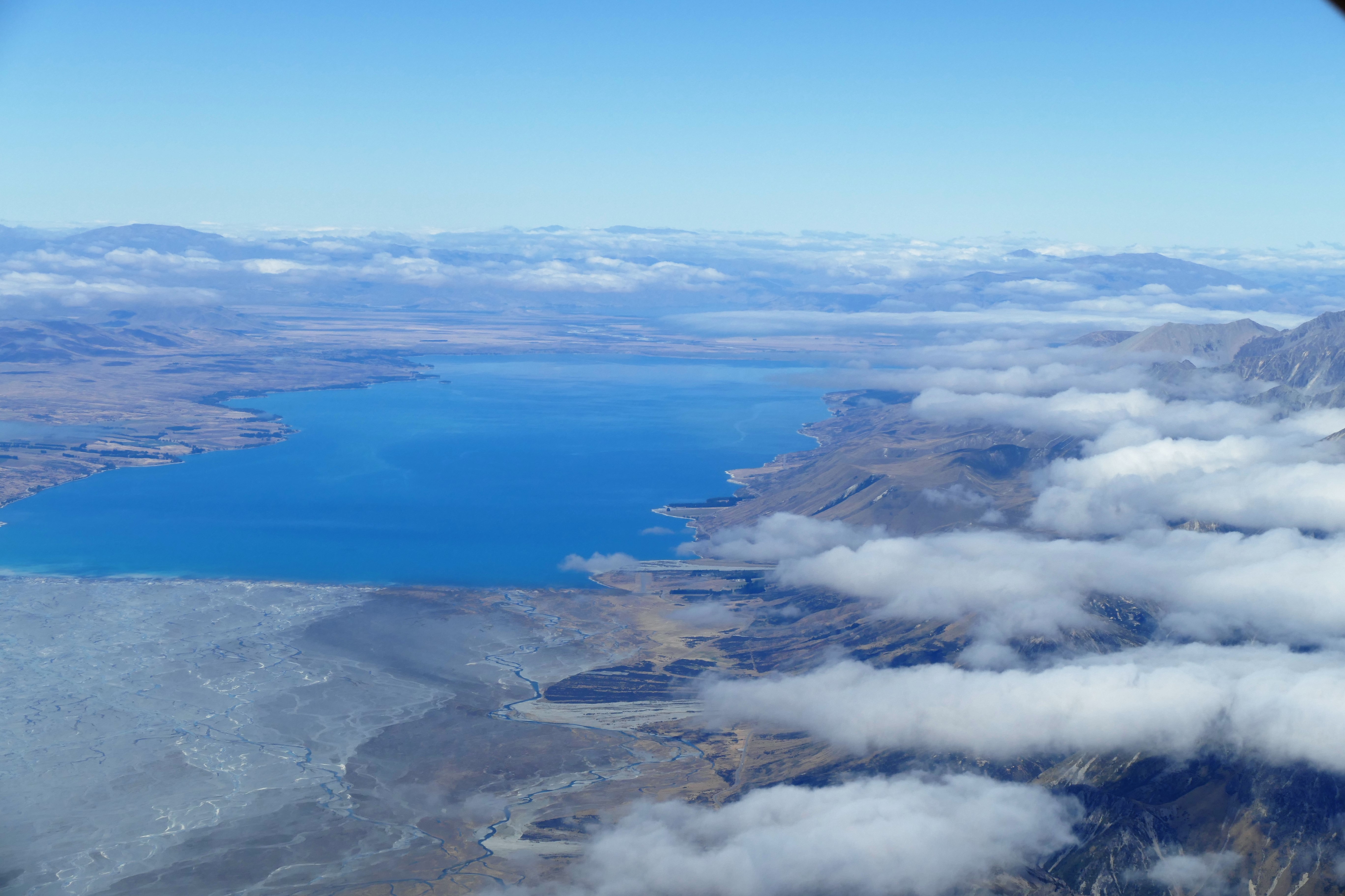
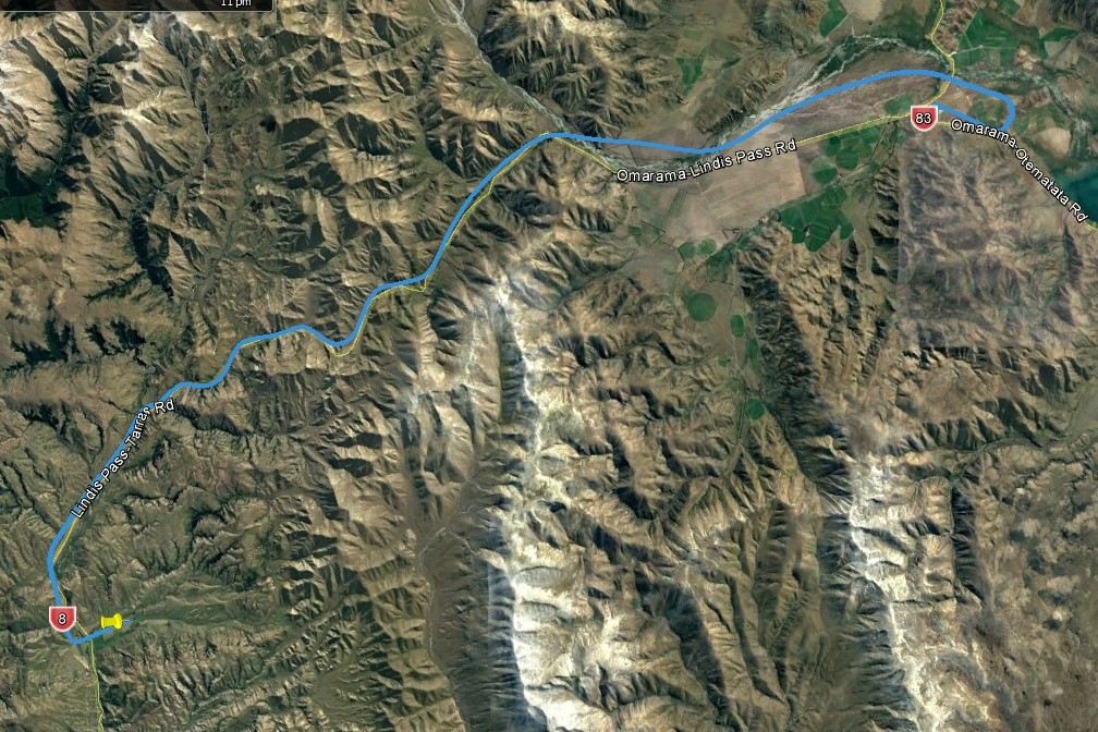
(Day 3, flight 4) We departed NZMC and flew south along the mountains on the western shore of Lake Pukaki. We then followed the water canal into Lake Benmore, south to view the Benmore dam which supplies hydroelectricity to much of New Zealand. Then, turning northwest, we came Omarama Airport, NZOA, where glider flying is popular. After the 50 minute flight, we refueled.
(Day 3, flight 5) The last flight of the day was 25 minutes from NZOA, following route 8, Lindis Pass Road, back to Geordie Hill Station.
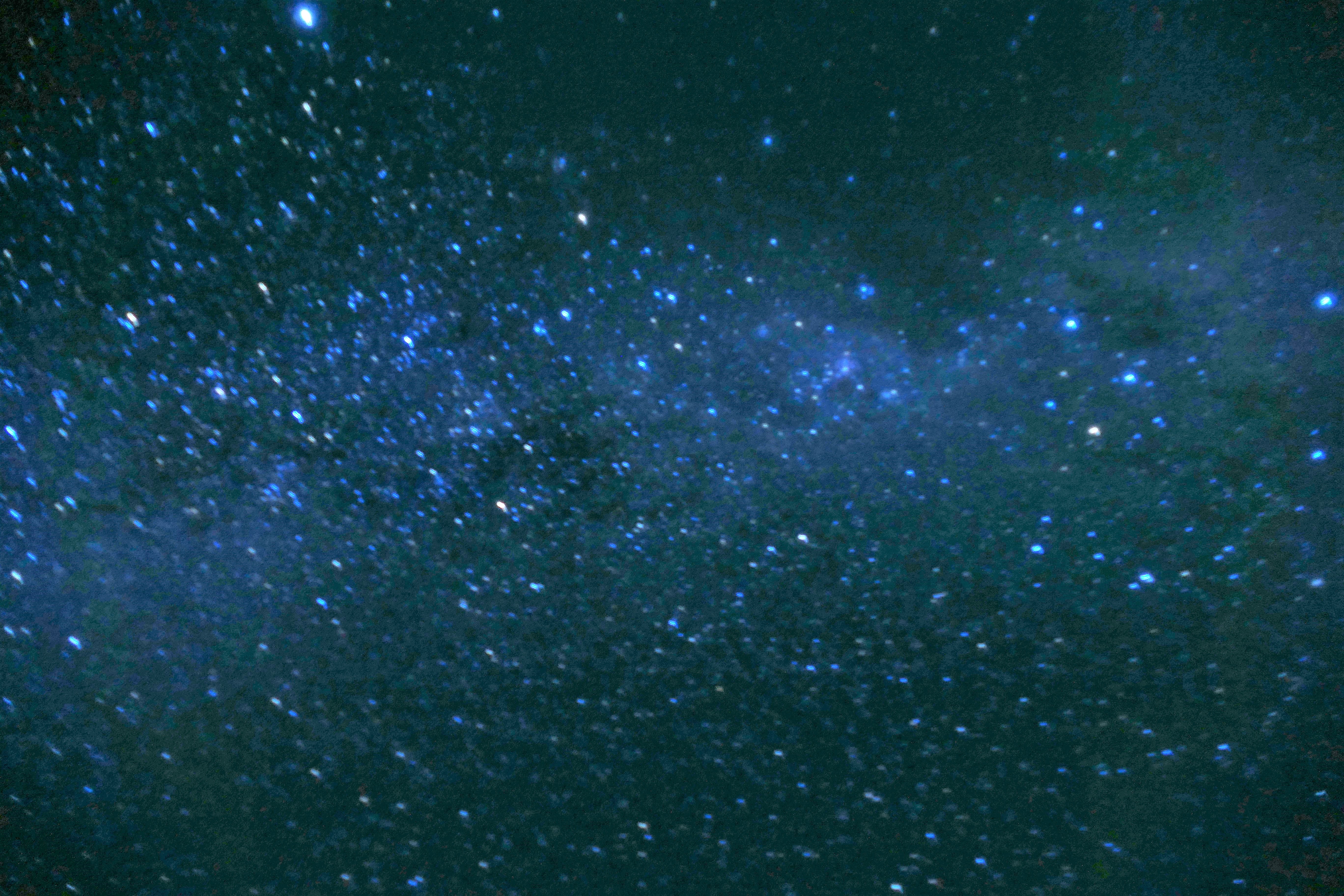
The sky was clear of clouds on most on most nights after sunset, and after allowing for 5 minutes of dark accommodation, the sky was just full of starts. The Milky Way galaxy was clearly visible making an almost white path across the sky. Constellations were visible, with a lot of faint stars between the brighter stars. The sky was so bright with starts, it was possible to see the path on the ground and walk without a flashlight, using only the illumination from the stars.
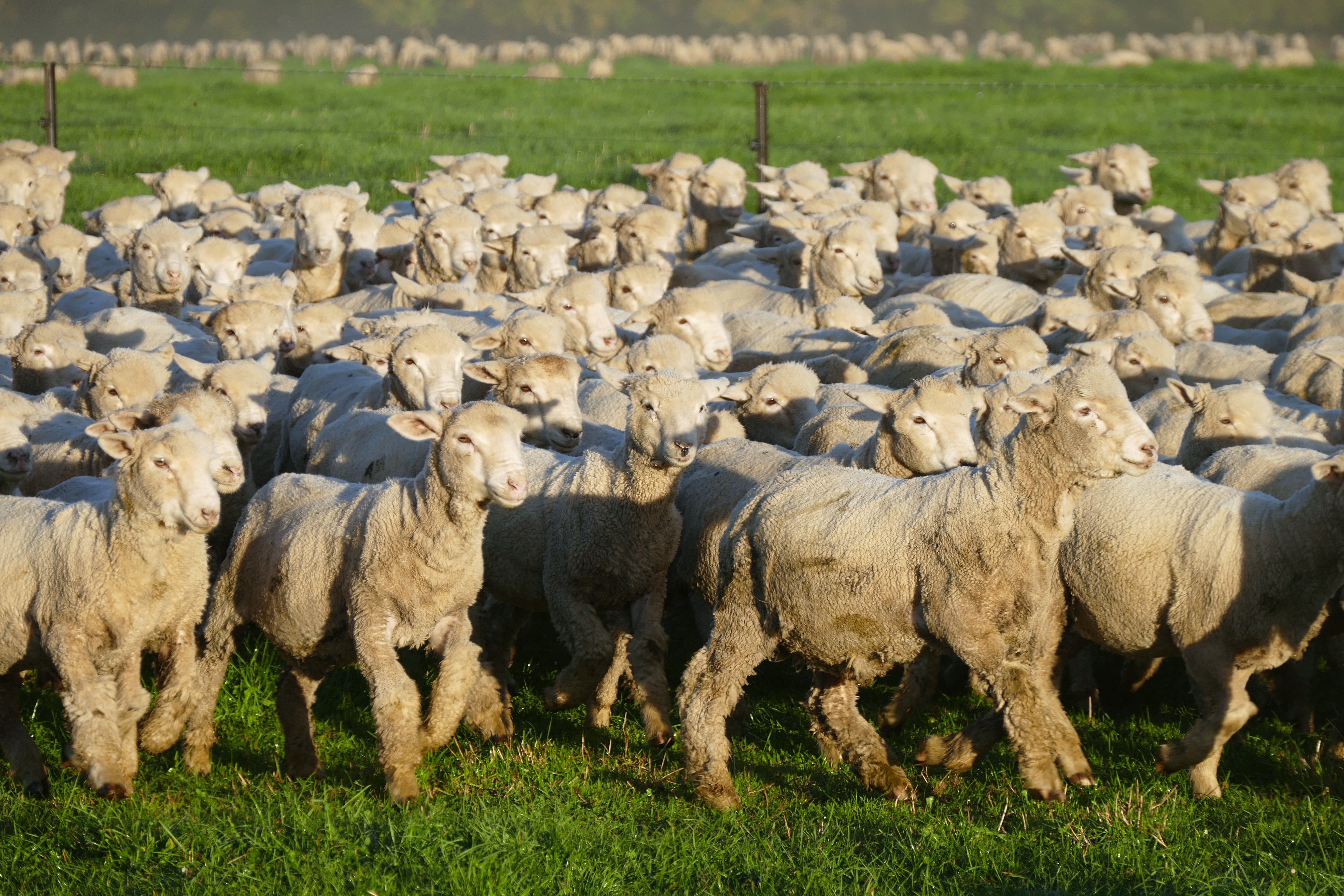
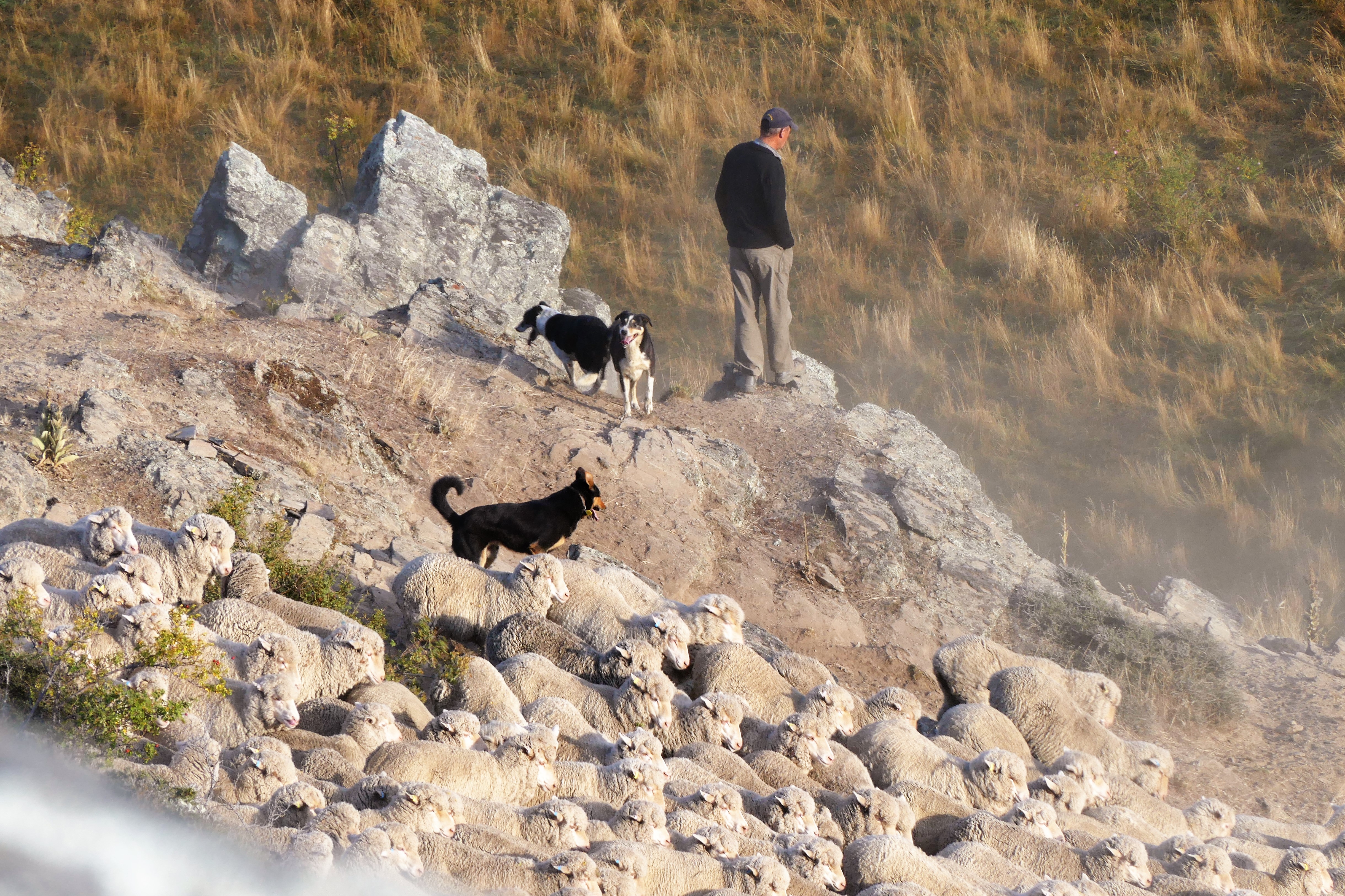
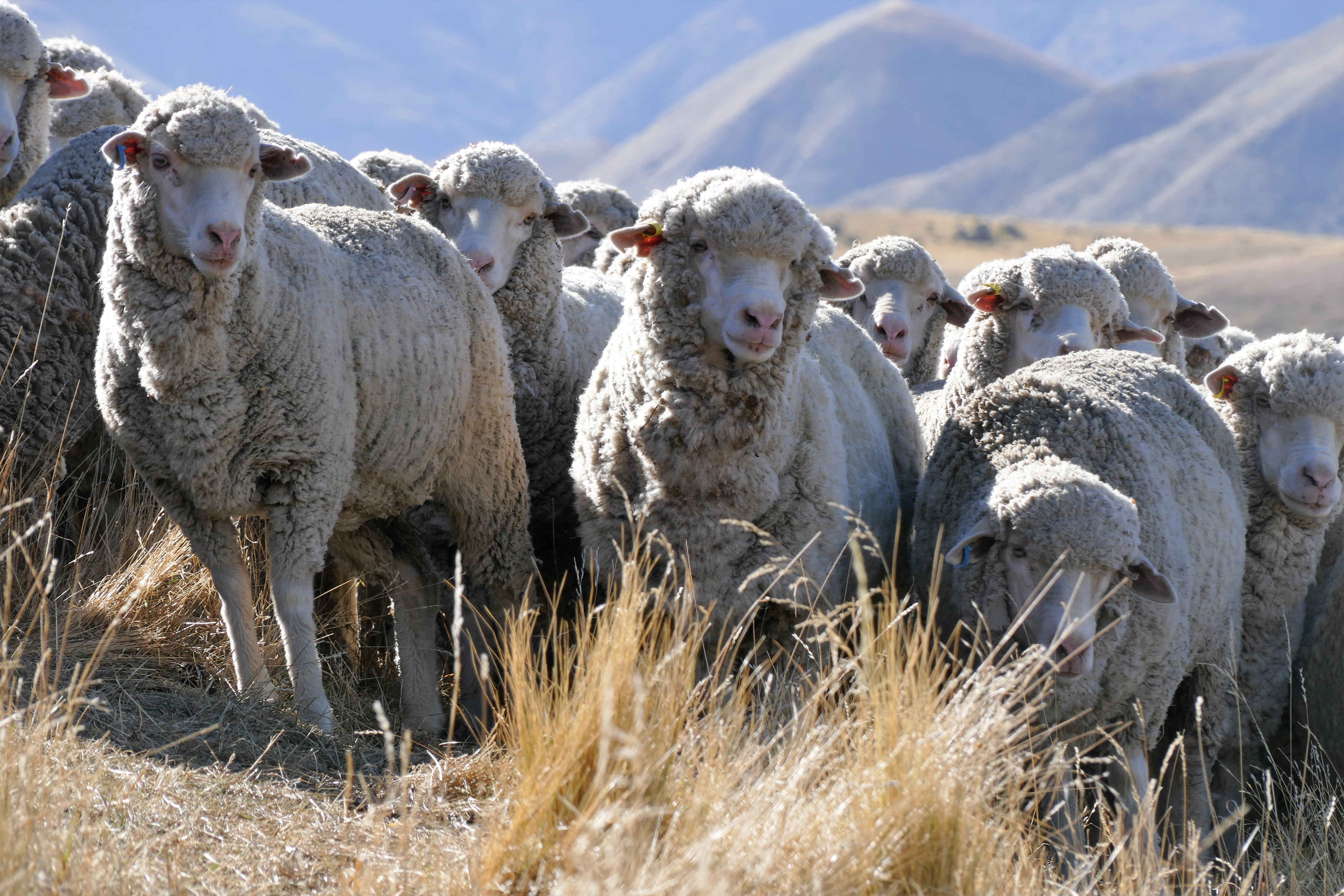
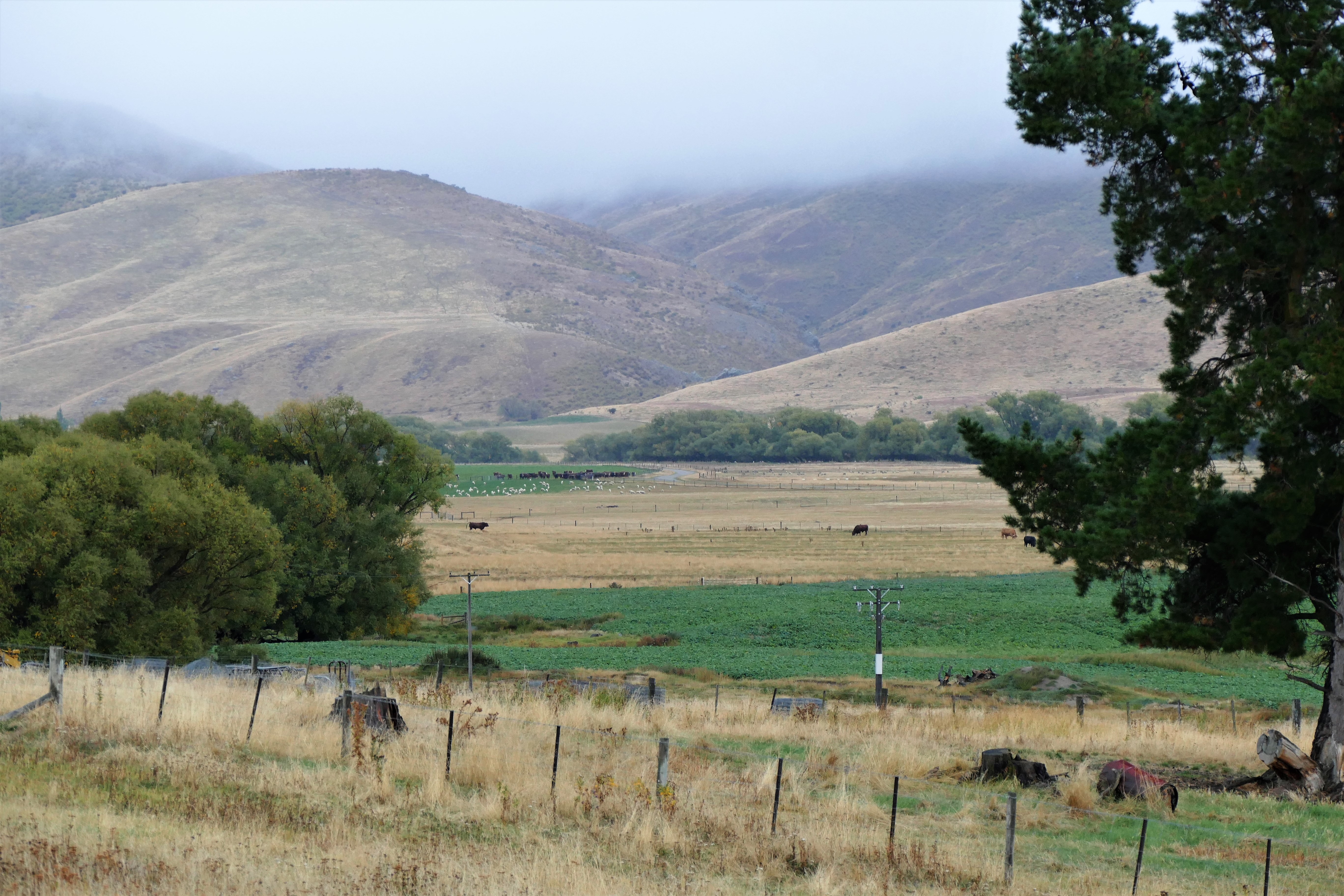
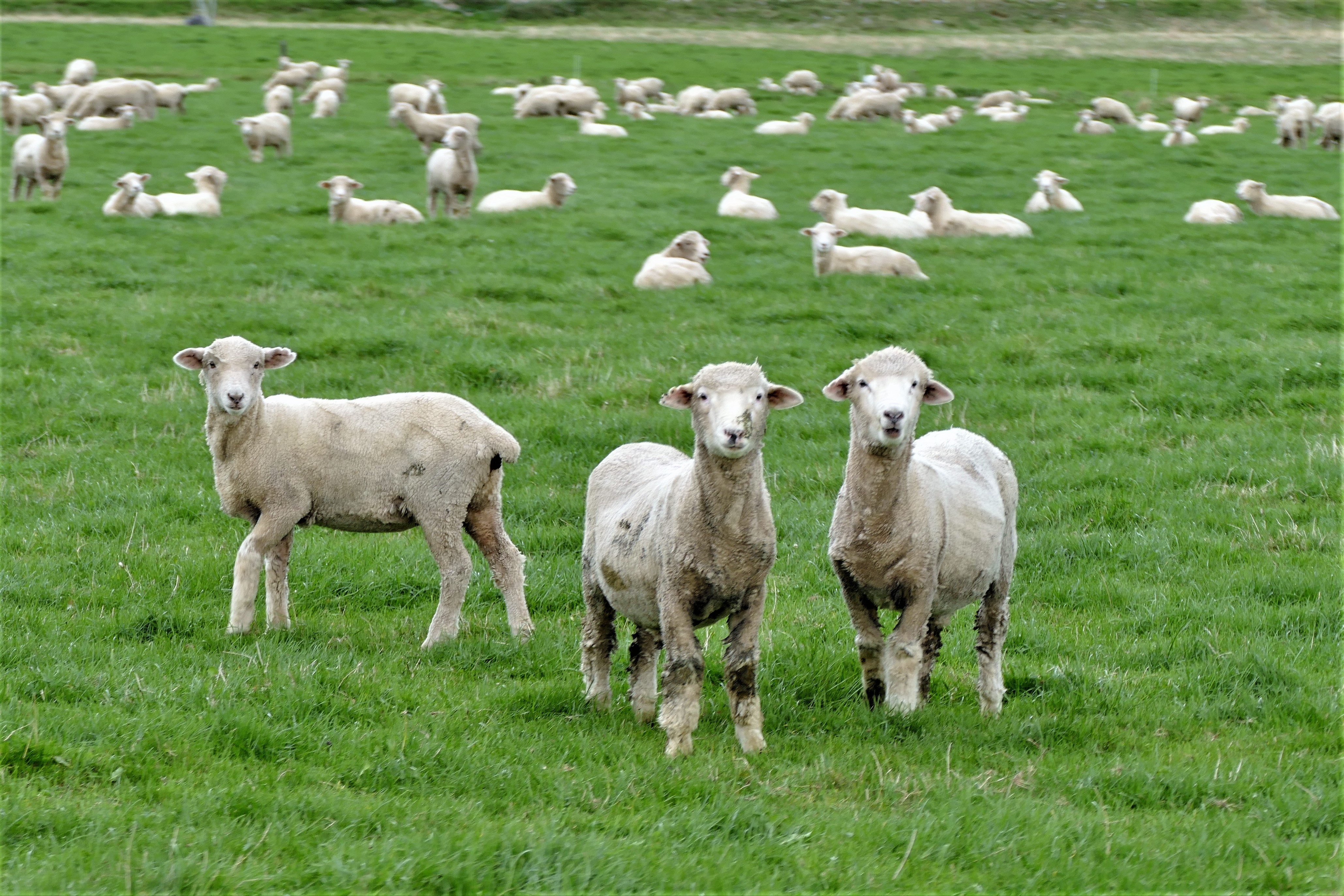
3/24/17: Sheep
Matt took us all with him to watch him and his 3 dogs move sheep. We drove to a green paddock where the lambs, running from the car and the dogs, moved into an adjacent paddock. We then drove to a paddock in the hills where sheep were widely spread apart grazing. On foot, Matt and the dogs chased the sheep down one hill and then up the next which had the gate to the adjacent paddock.
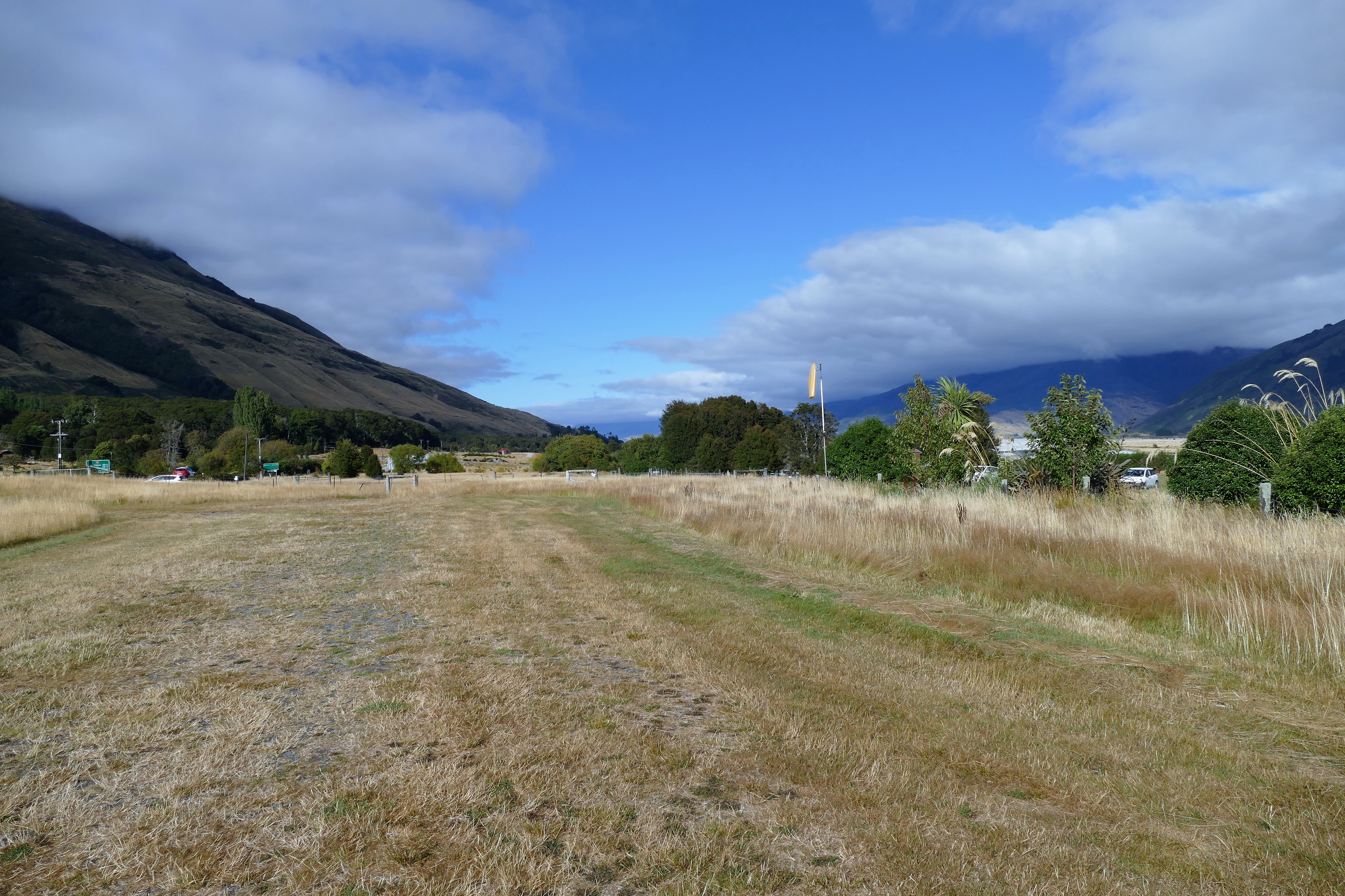
(Day 4, flight 1) With Nick in the right seat to do my New Zealand Biennial Flight Review, we took off in ZK-TRS from Geordie Hill Station and flew west climbing to 4500 to practice area L966 between Wanaka Airport NZWF and Hawea Flat. Nick had me do steep turns, slow flight, and stalls. We then did a simulated engine failure approach to a landing, then did low altitude flight just above the tree tops to review low visibility maneuvers. Once the BFR requirements were completed, we landed at NZWF completing a 50 minute flight.
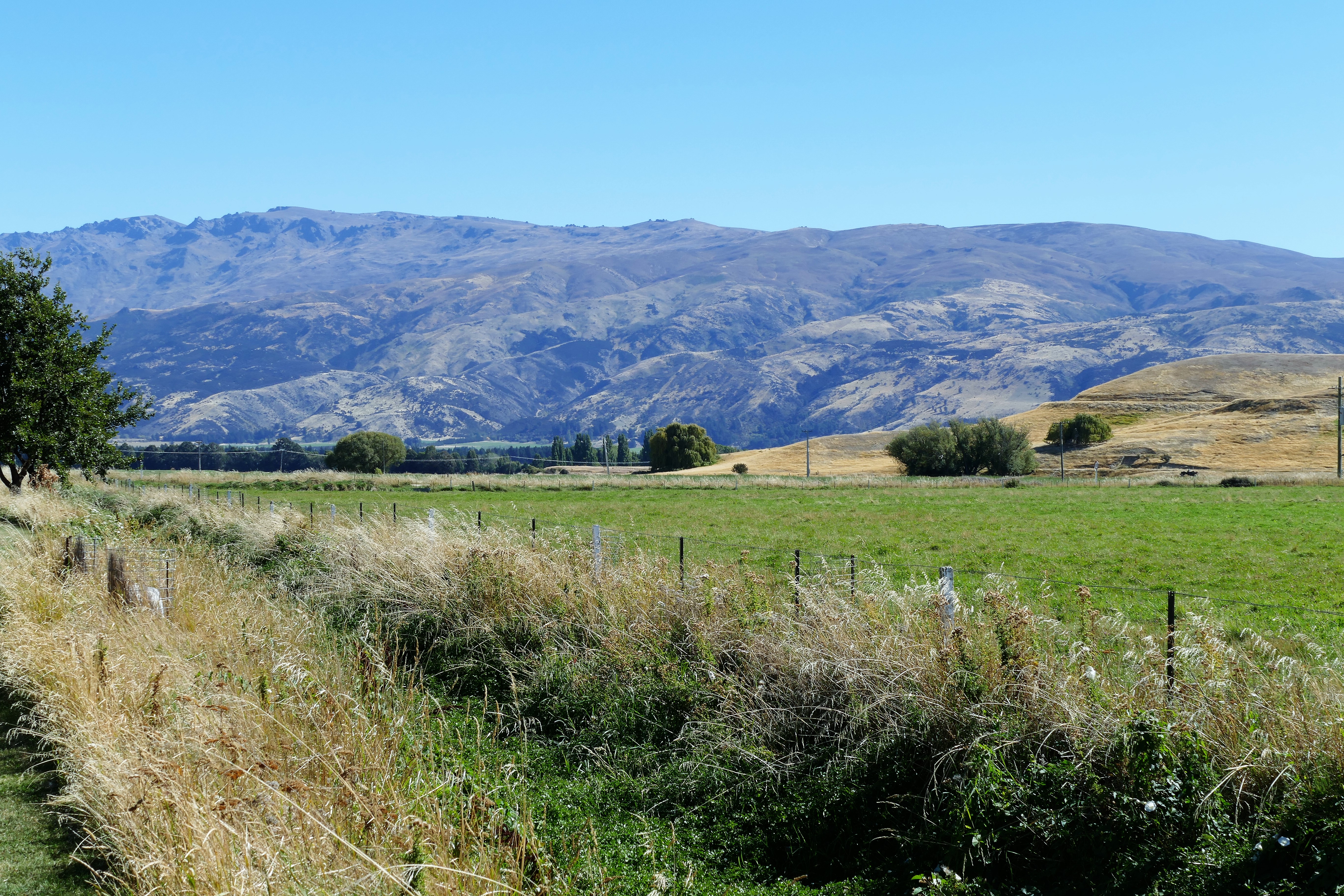
Day 4, flight 2) After ZK-TRS had it's spark plugs replaced, we took off from NZWF and climbed southeast to 2500. During this 20 minute flight, Nick gave me the chance to practice landing in two farm grass strips along route 8 north of Tarras. We then followed route 8 north to Goodger Rd and circled to land at Geordie Hill Station.
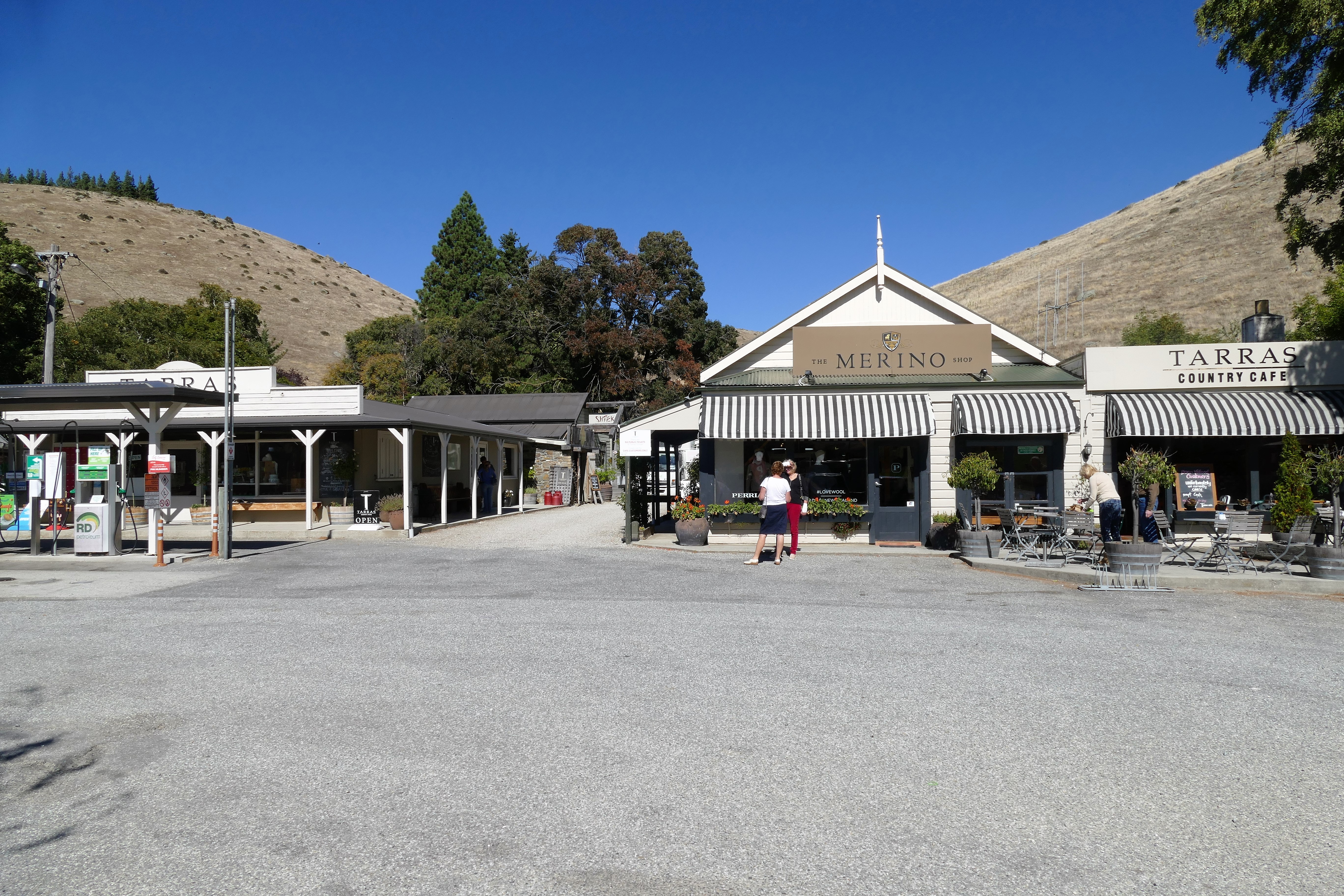
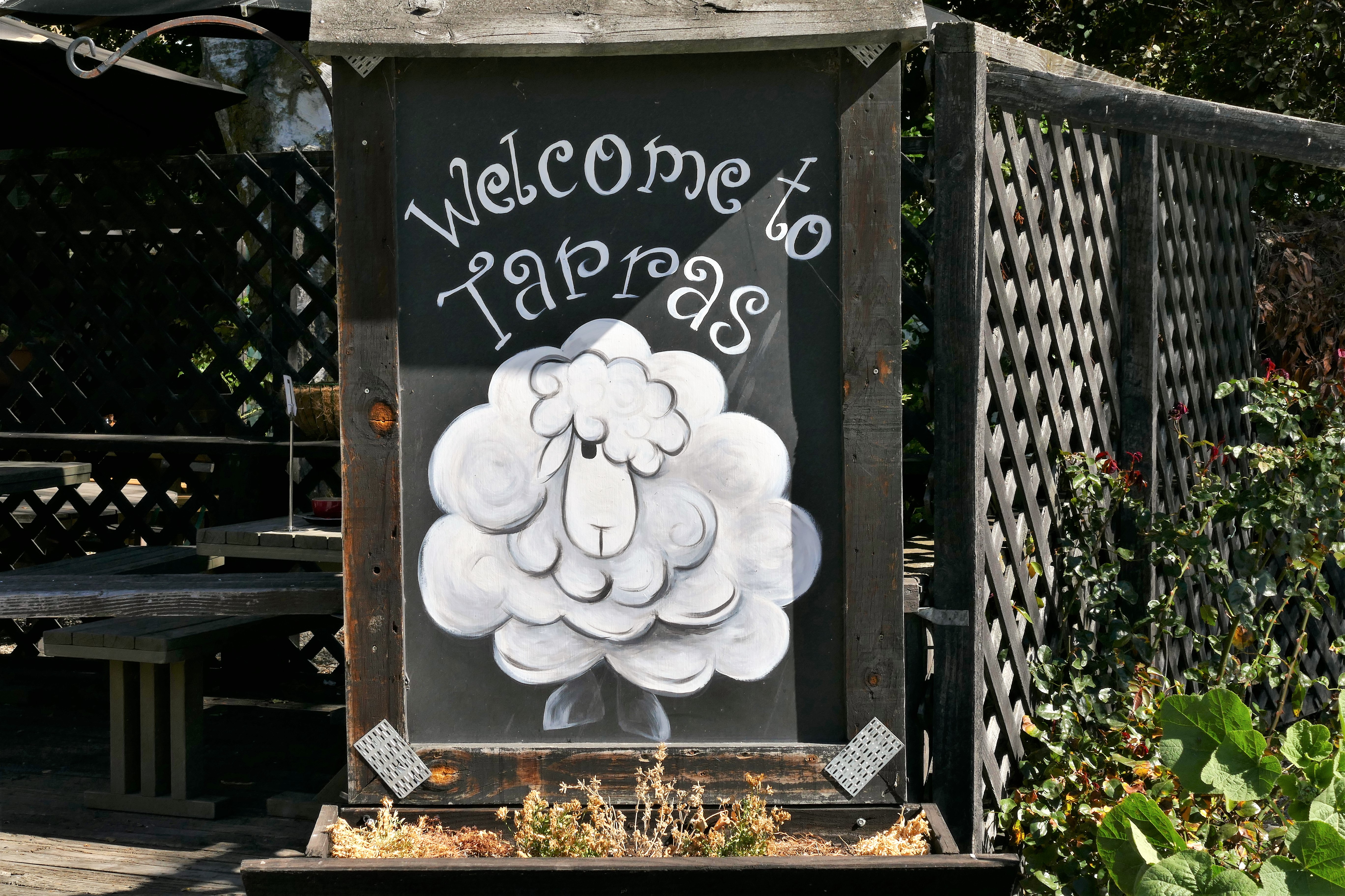
After the flights, Nick drove us into Tarras for lunch at the Tarras Country Cafe. It was inside a small store strip mall collection. After lunch, we looked thought the Morino Store before driving back.
3/25/17: Dart River
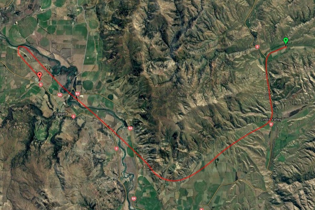
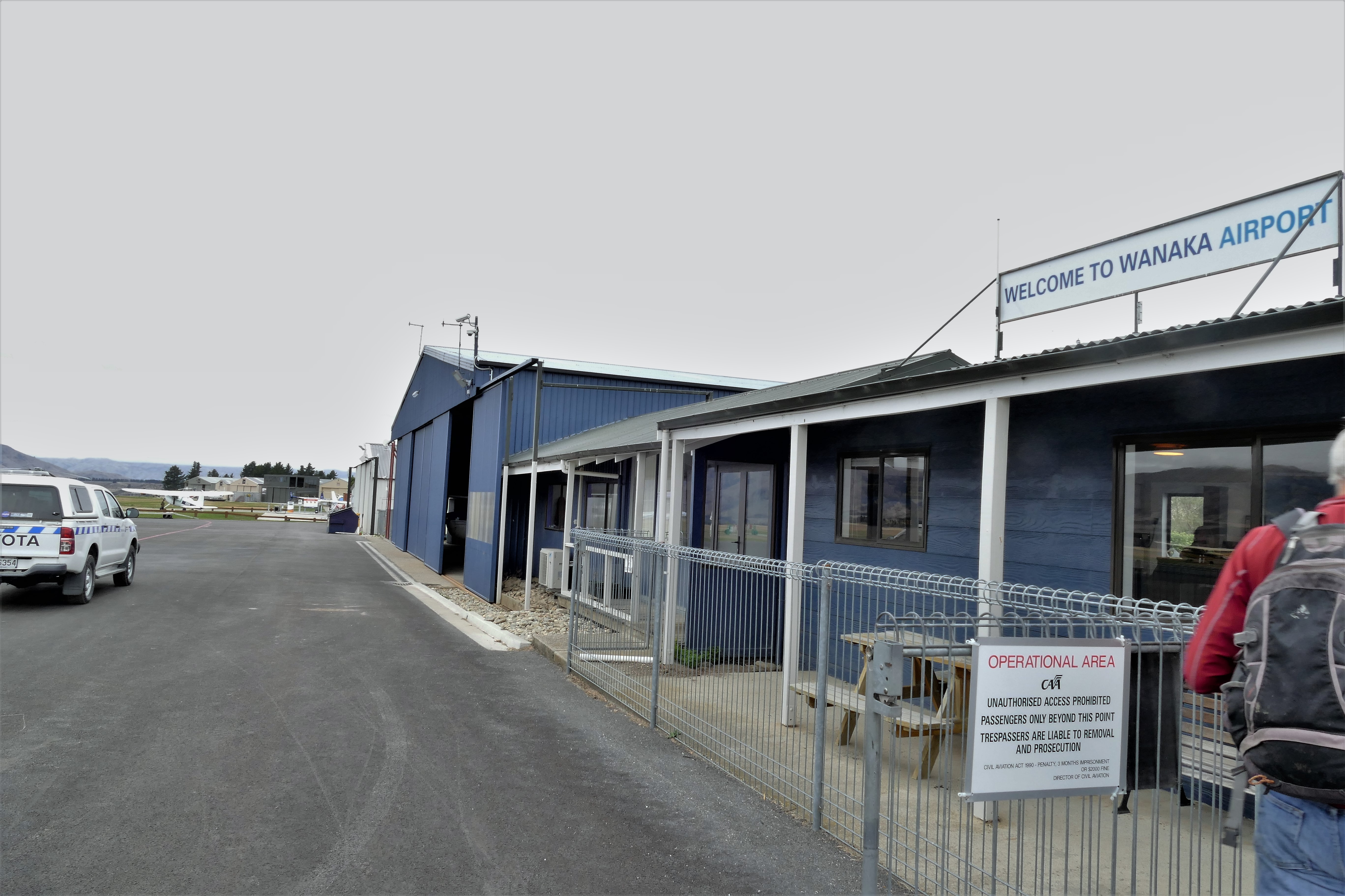
(Day 5, flight 1) With Pete as instructor in ZK-WAX, we departed Geordie Hill Station under low clouds which prevented a direct route over the hills to NZWF. We flew south down route 8, the Lindis Pass Rd, to get out of the hills, then followed the base of the Eastern Ridge hills to gradually turn northeast to Wanaka Airport, NZWF. After a 50 minute flight, we landed and got fuel.
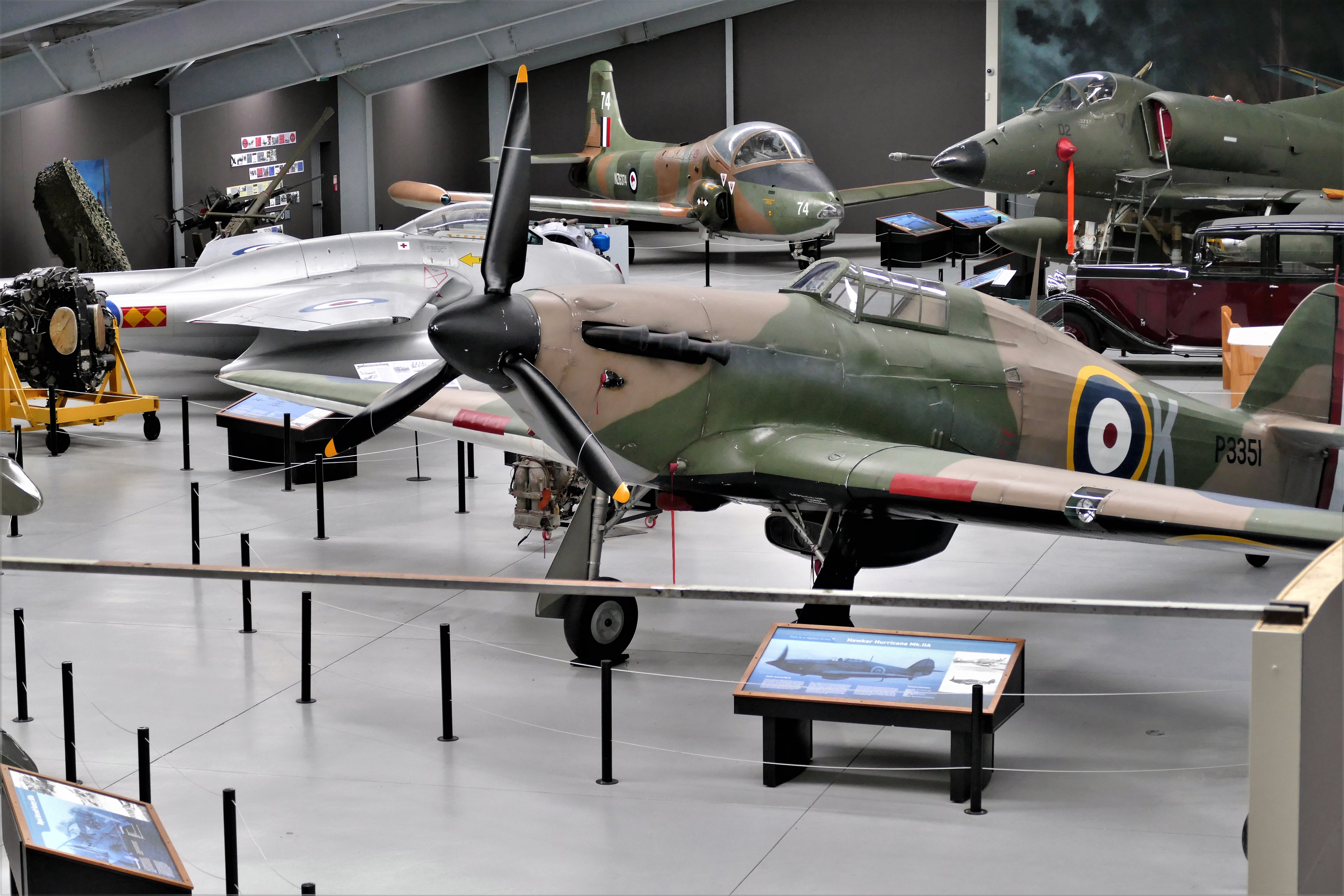
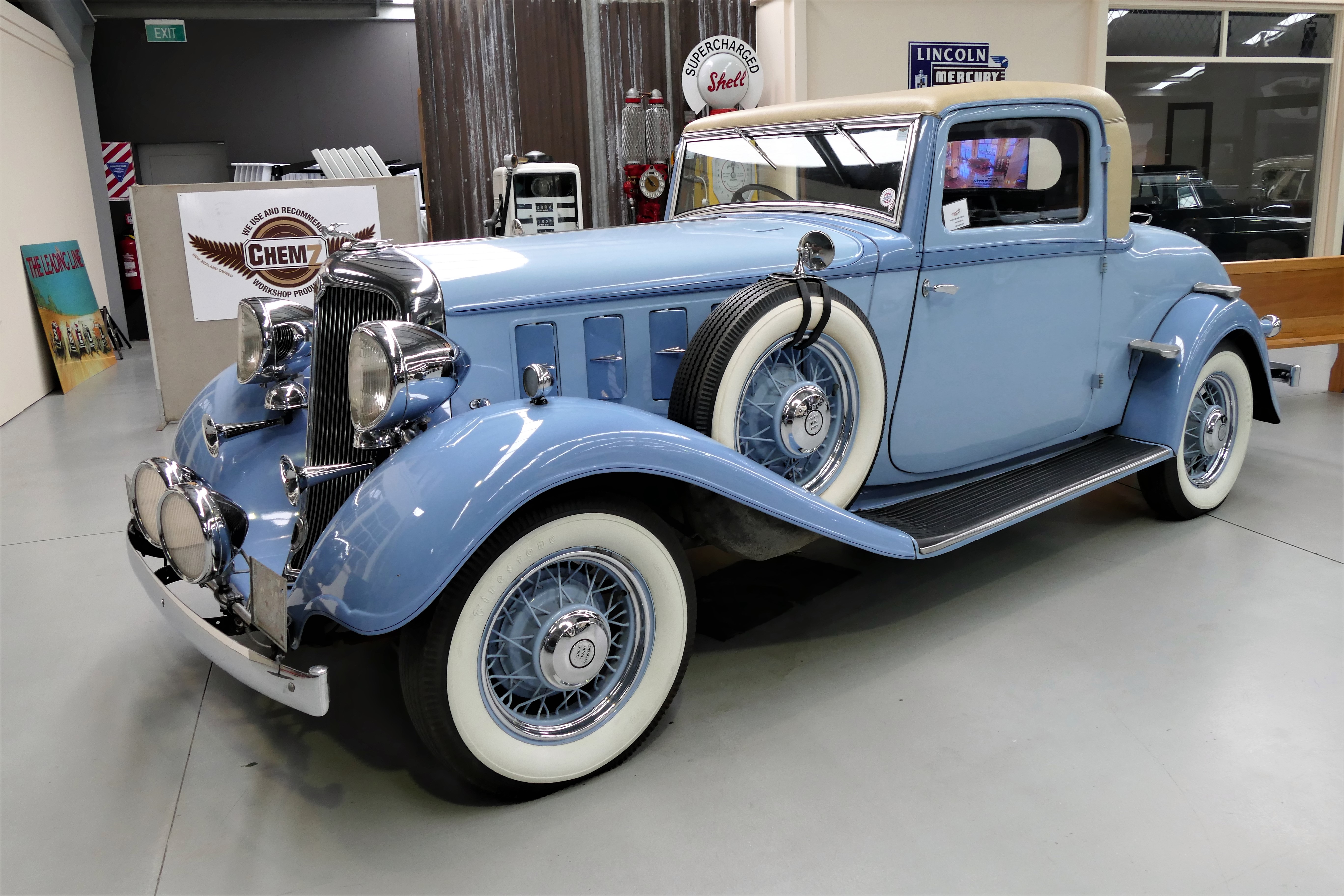
Waiting for the clouds to give way, we took the opportunity to visit the Warbirds and Wheels museum. It displayed several aircraft from around the World War II years, as well as numerous well preserved vintage automobiles
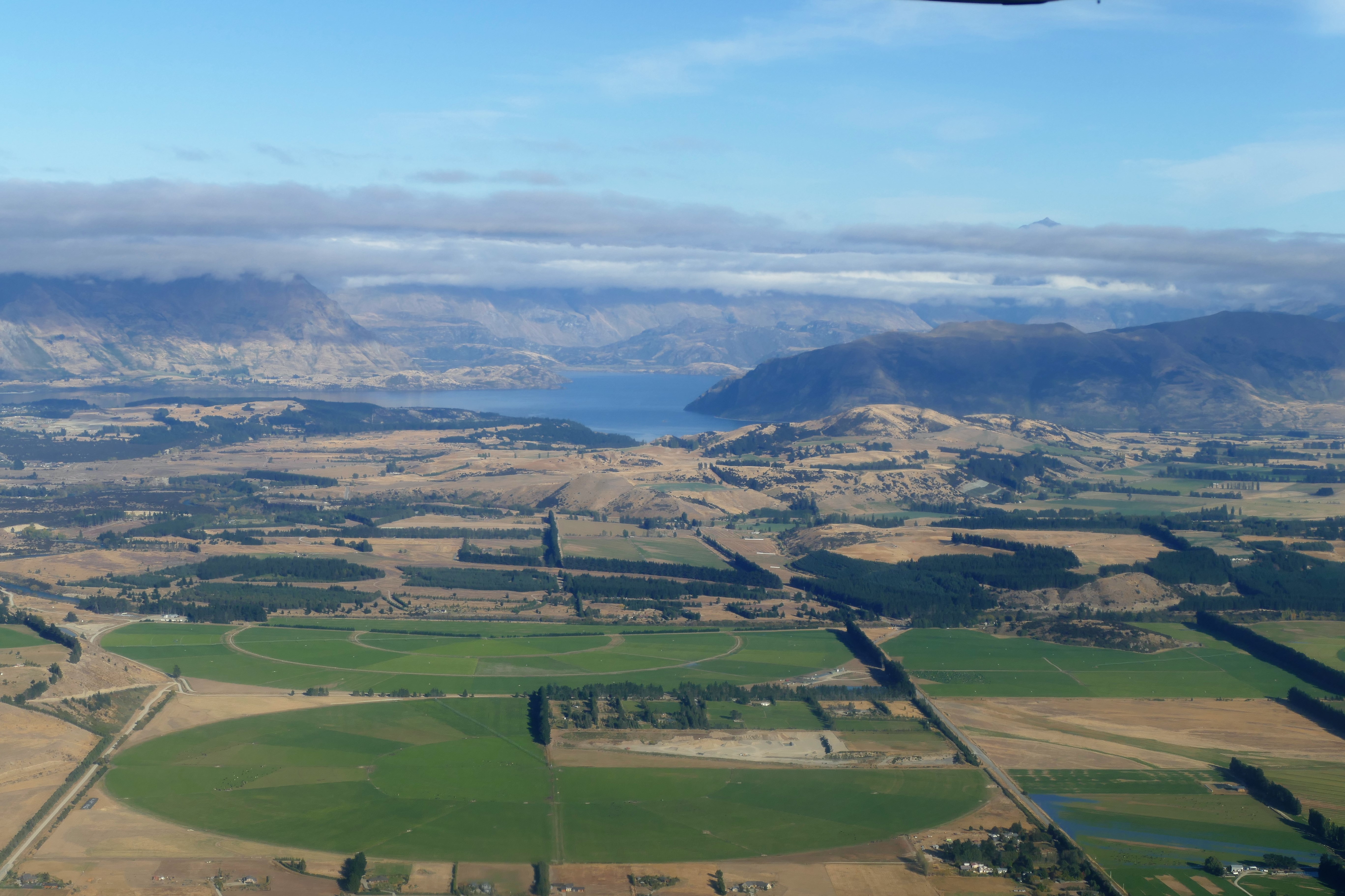
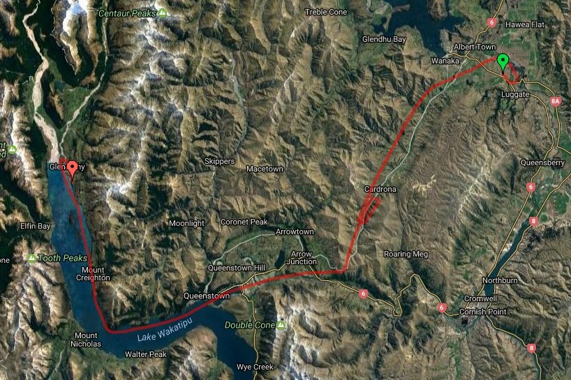
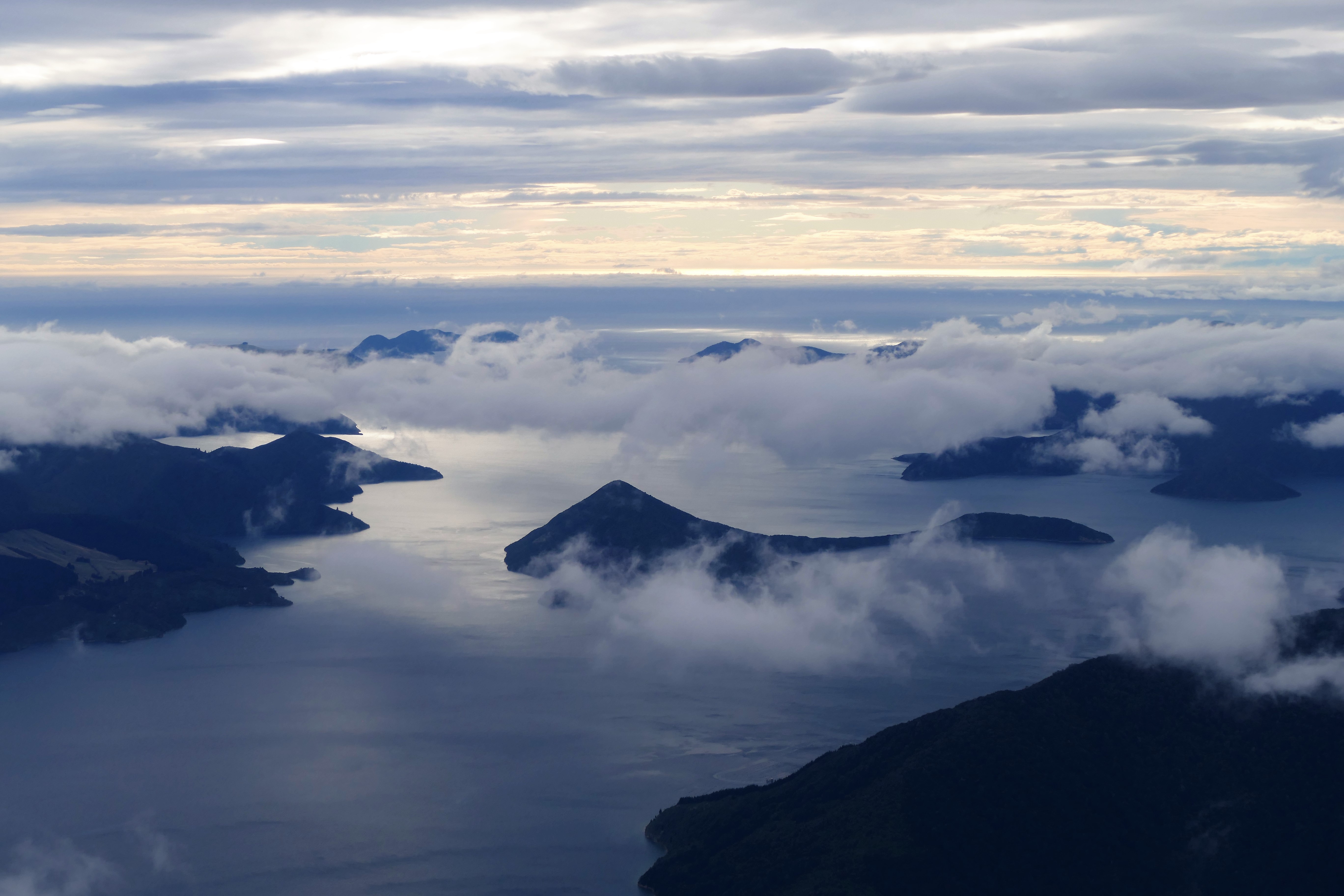
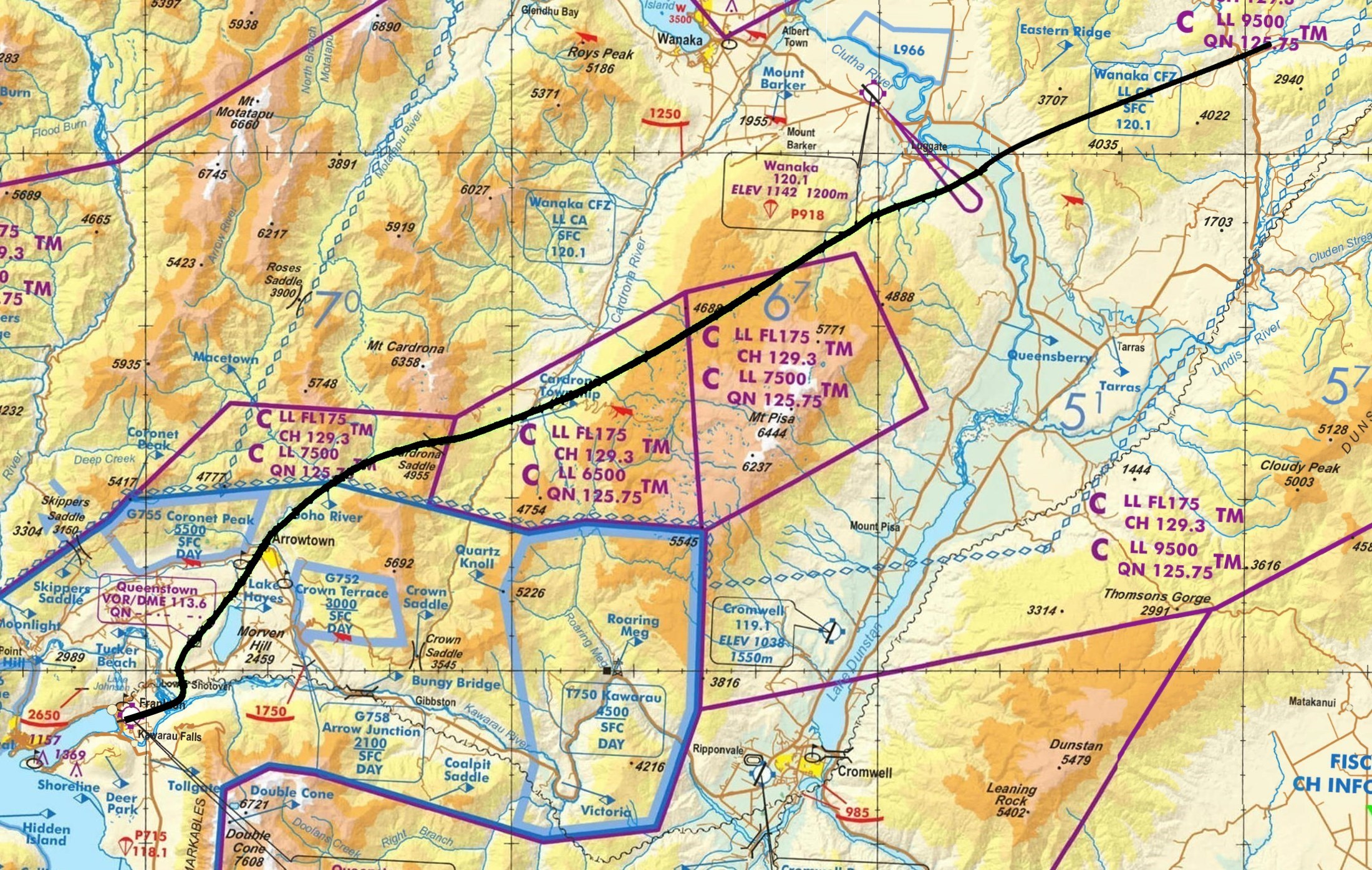
(Day 5, flight 2) By the time we took off from NZWF, the cloud base rose to 4000 above ground level (or 5500 above sea level). Heading toward the north shore of Lake Wakatipu, we could not take a direct route because of numerous mountain peaks higher than 6000 feet. We flew southwest at 3500 feet down the Cardrona River valley heading for Queenstown. At the Cardrona Township reporting point, we contacted Queenstown information, then circled once in the valley waiting for clearance from Queenstown tower into their airspace. With clearance, we crossed the Crown Saddle, 3545 feet, and turned west to fly over the Queenstown Airport to the north and east shore of Lake Wakatipu. After a 50 minute flight, we landed at Glenorchy Airport, NZGY.
We were taken to the Glenorchy Cafe for lunch. It was busy, perhaps because the food was so good. We then walked east on Mull Street, stopping to shop at the Made in Glenorchy Store. Then, we we on to the Dart River Wilderness and Funyaks. We had tickets for a jet boat ride up the Dart River, and were taken by bus to the boat launch.
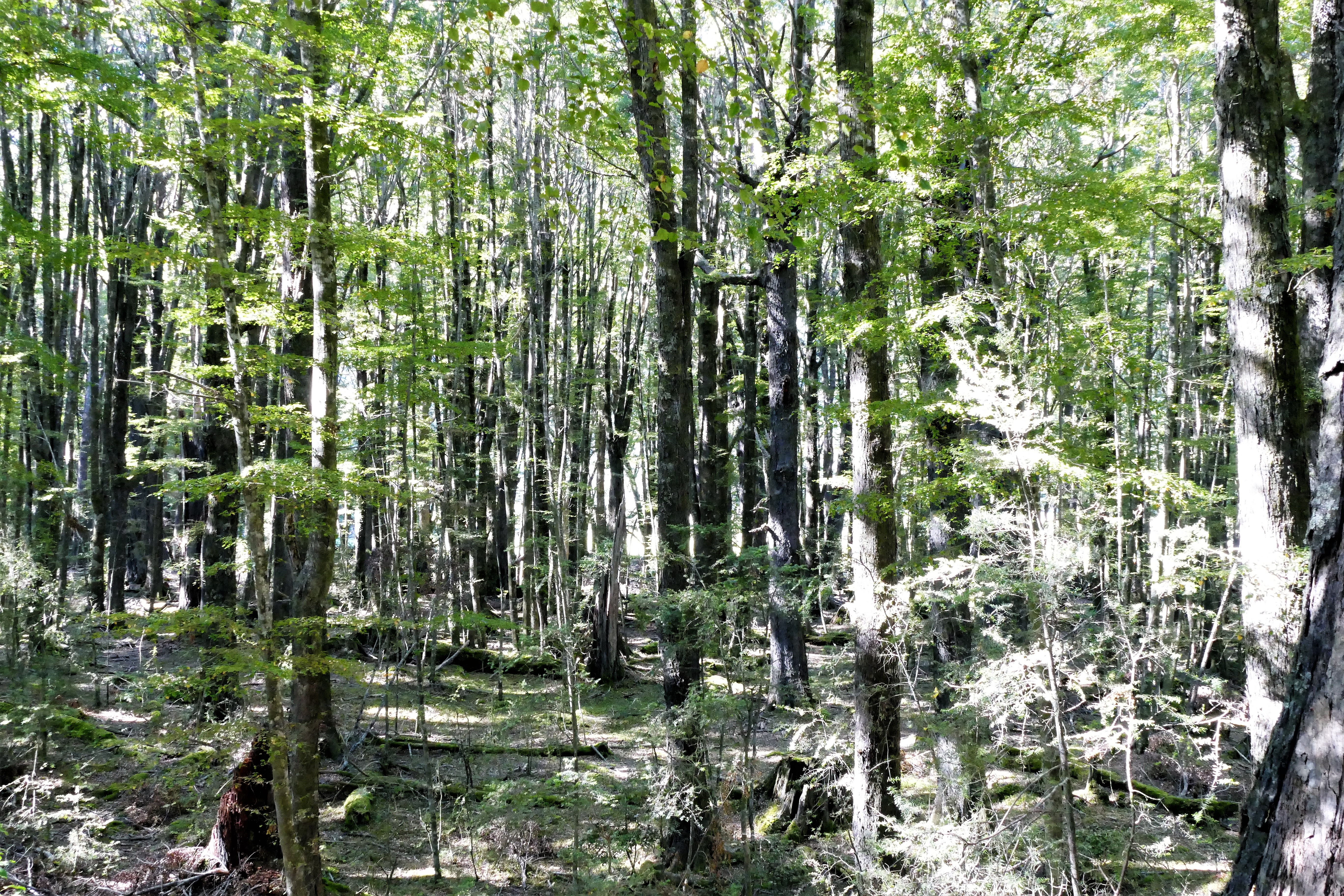
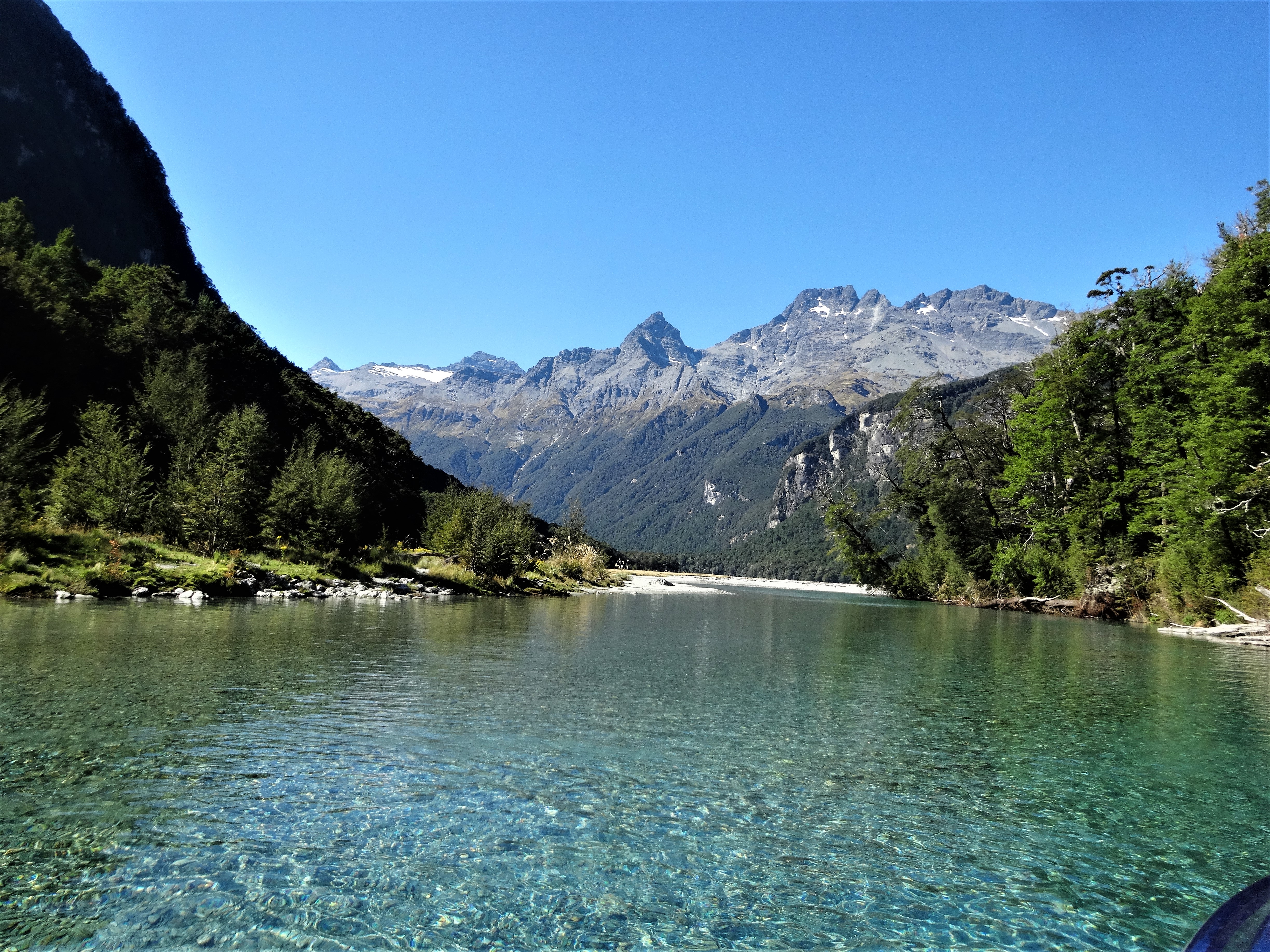
The jet boat ride itself was fun and the scenery was breathtaking. With the many twists of the river, the boat made frequent sudden turns. The pilot of the boat would stop quickly with a 360 degree turn before which he gave a finger signal. This all made the boat ride like a horizontal roller coaster, and the passengers loved it. The boat ride ended up river, after which a bus took us to a nature walk through part of an ancient forest in the Te Waipounamu World Heritage Area. On the bus ride back, some scenes from Lord of the Rings and other movies were pointed out.
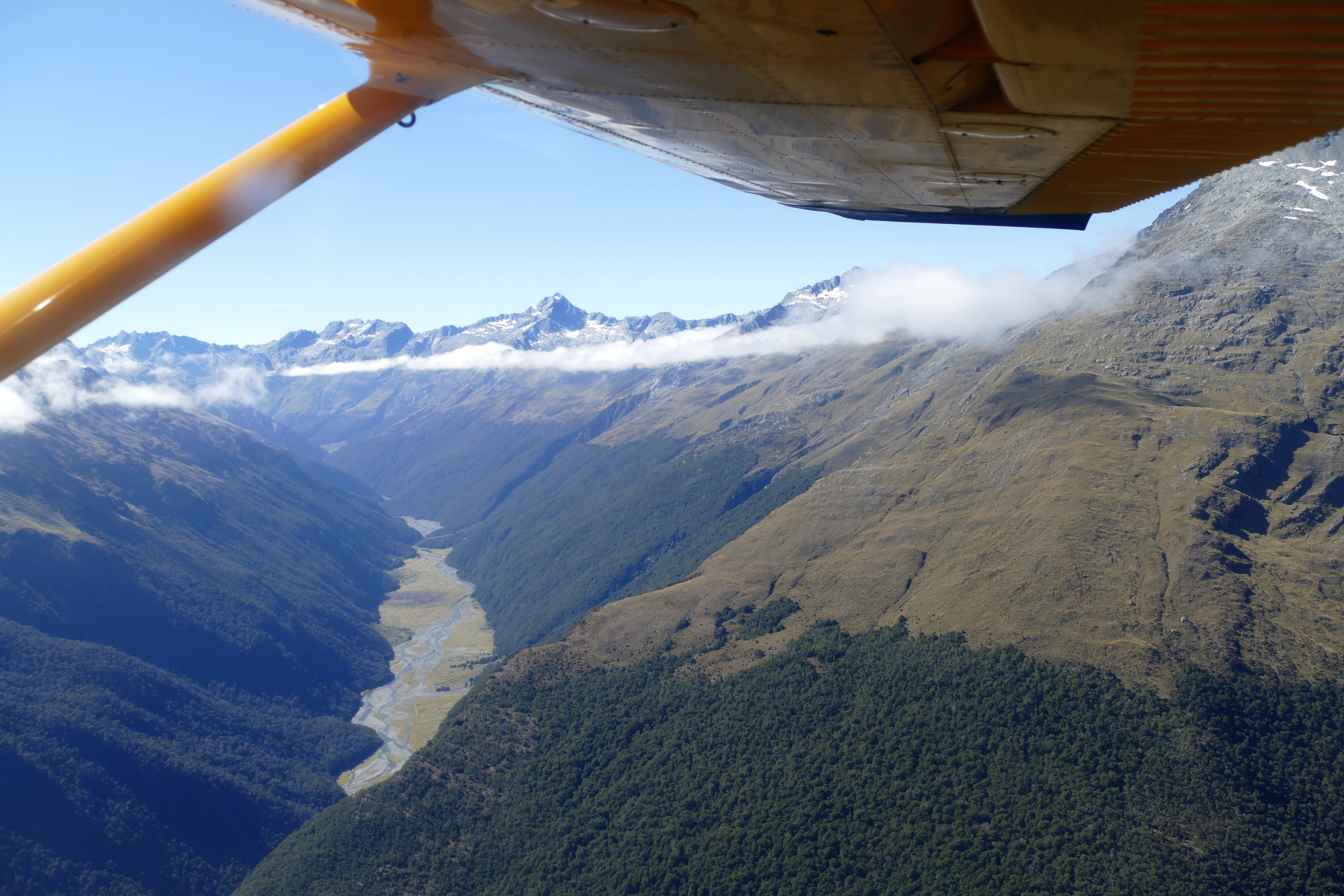
Day 5, flight 3) The clouds had all but dissipated by the time we got back to the airport after our boat ride. We departed NZGY to the north, following the Dart River which we had explored by boat only a few hours before. We climbed to 6500, passing Mount Earnslaw and seeing the Earnslaw Glacier and Grant glacier. We got another view of Mount Aspiring and Mount Edward as we descended toward south Lake Wanaka. Continuing our descent over the Eastern Ridge, we landed at Geordie Hill Station after a 50 minute flight.
Matt and Jo had left town to go to an Adele concert in Aukland that evening, so Nick took us to the pub at the Luggate Hotel for dinner. The dinner was good, but the pub was rather quiet. It was not the busy bar that we expected to see in a pub.
3/26/17: Rainy Day
We could see that Sunday was going to be a rainy day from earlier in the week. We had initially planned the long fight to Golden Bay for 3/25, but realized that the bad weather coming in would make flying difficult. Matt had described New Zealand weather as "good, average, and bad." Nick described it is "average, quite average, and very average." The first would be good enough for flying anywhere. The second was meant that you might not be able to fly where you wanted, but you could get home. The last was to forget about taking off in the airplane.
Nick and Jo were gone to the afternoon, but hey left us a car to go exploring the area. Liz and I set off for Wanaka, to attend 11 AM mass at the Holy Family Catholic Church. To get there, we drove down route 8 to Tarras, then up route 6 to Wanaka, about 45 minutes. By Wanaka, the cell phone picked up a data source to lead us to the church.
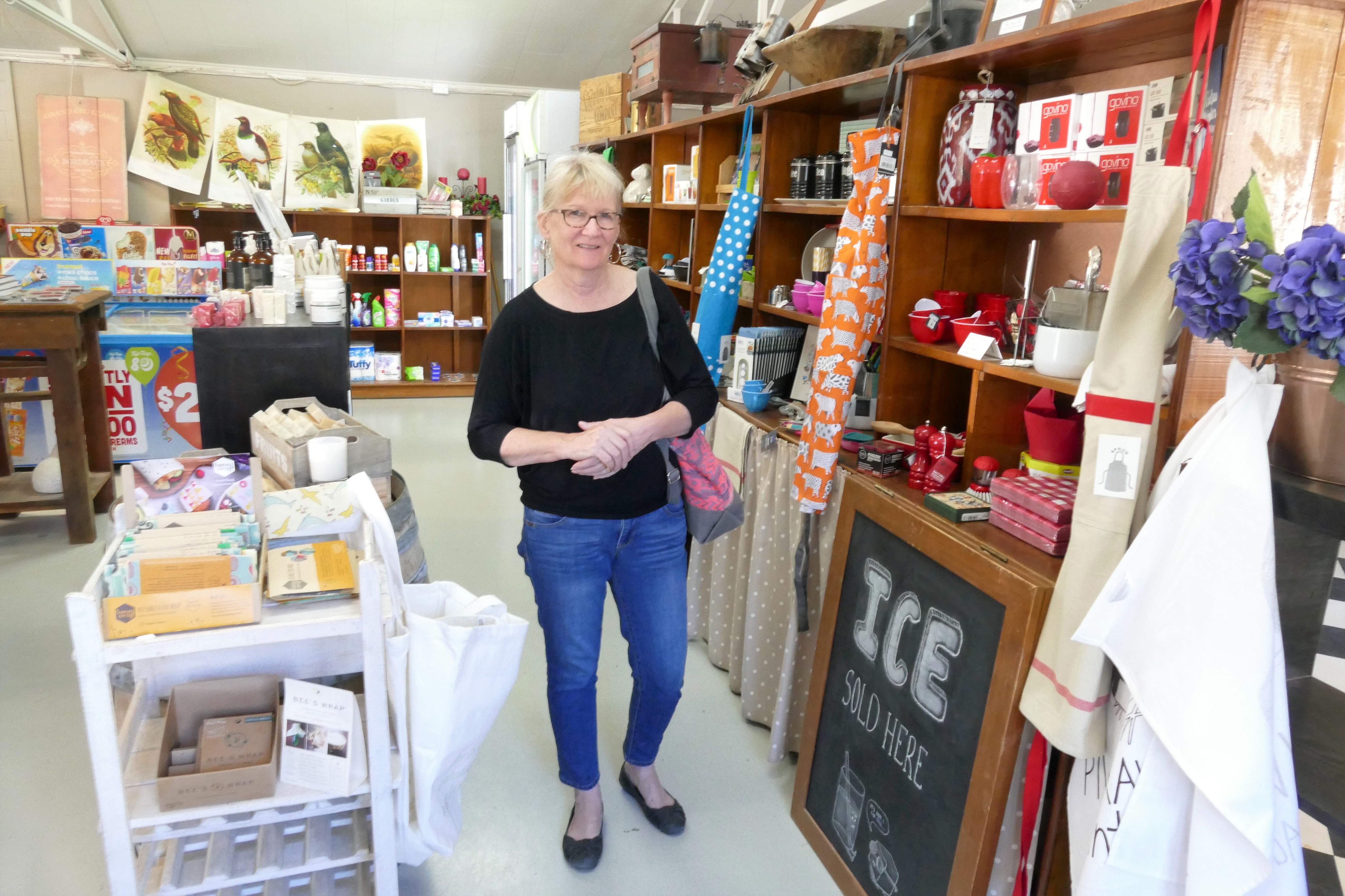
After church, we walked around the small downtown Wanaka, along the lake, and found lunch at Relishes Cafe. We looked around town, and bought some Marino wool clothing items in the Wools of Wanaka store. Who knows, the clothes might have had wool from Geordie Hill Station. We then droved down route 6, past Tarras, to Cromwell, about 50 minutes drive. Upon arriving, we thought that there wasn't much to do in Cromwell, but by checking Trip Advisor, we found the Cromwell Heritage Precinct. This was a restored area of town with new shops inside the older building. We had coffee, poked around in some of the shops and took photos. We drove 40 minutes back to Geordie Hill Station to find that Matt and Jo had returned.
For dinner, Jo made Kiwi burgers. This was a special version of lamb-burgers, with lettuce leaves, slices of tomato,beetroot and onion, topped with a special mayonnaise based sauce. All this on a bun, toasted on the inside. It was a tall burger, required 2 hands, and delicious.
3/27/17: Up the west coast
(Day 7, flight 1) With Matt as the instructor in ZK-WAX, we departed Geordie Hill and climbed to 3500 over the eastern ridge, then descending for a landing at Wanaka NZWF after a 25 minute flight. While taxing to get fuel, Matt found a problem with the airplane's solenoid starter. Fortunately, ZK-WAX's mechanic was located at NZWF, and the solenoid was replaced in 2 hours.
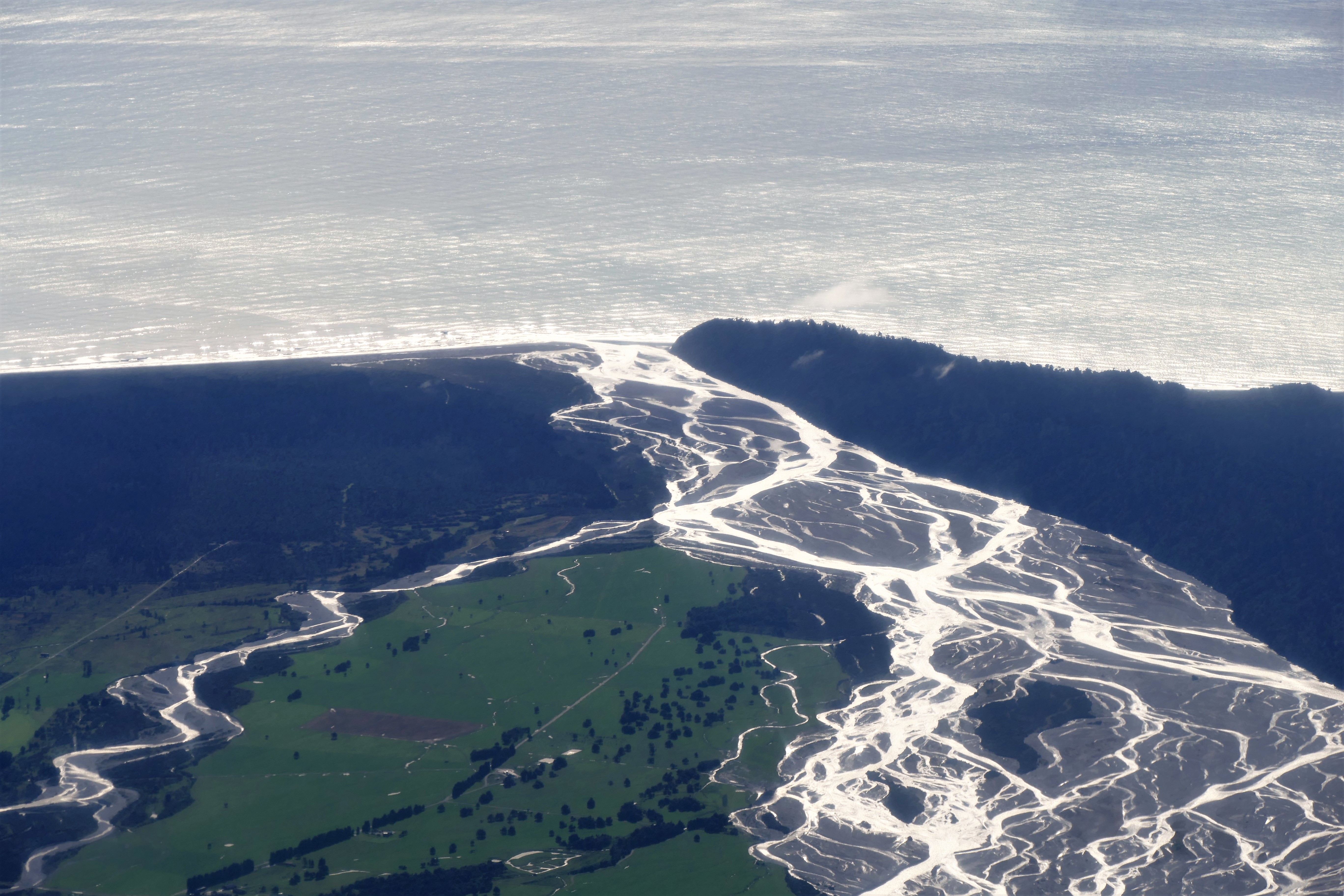
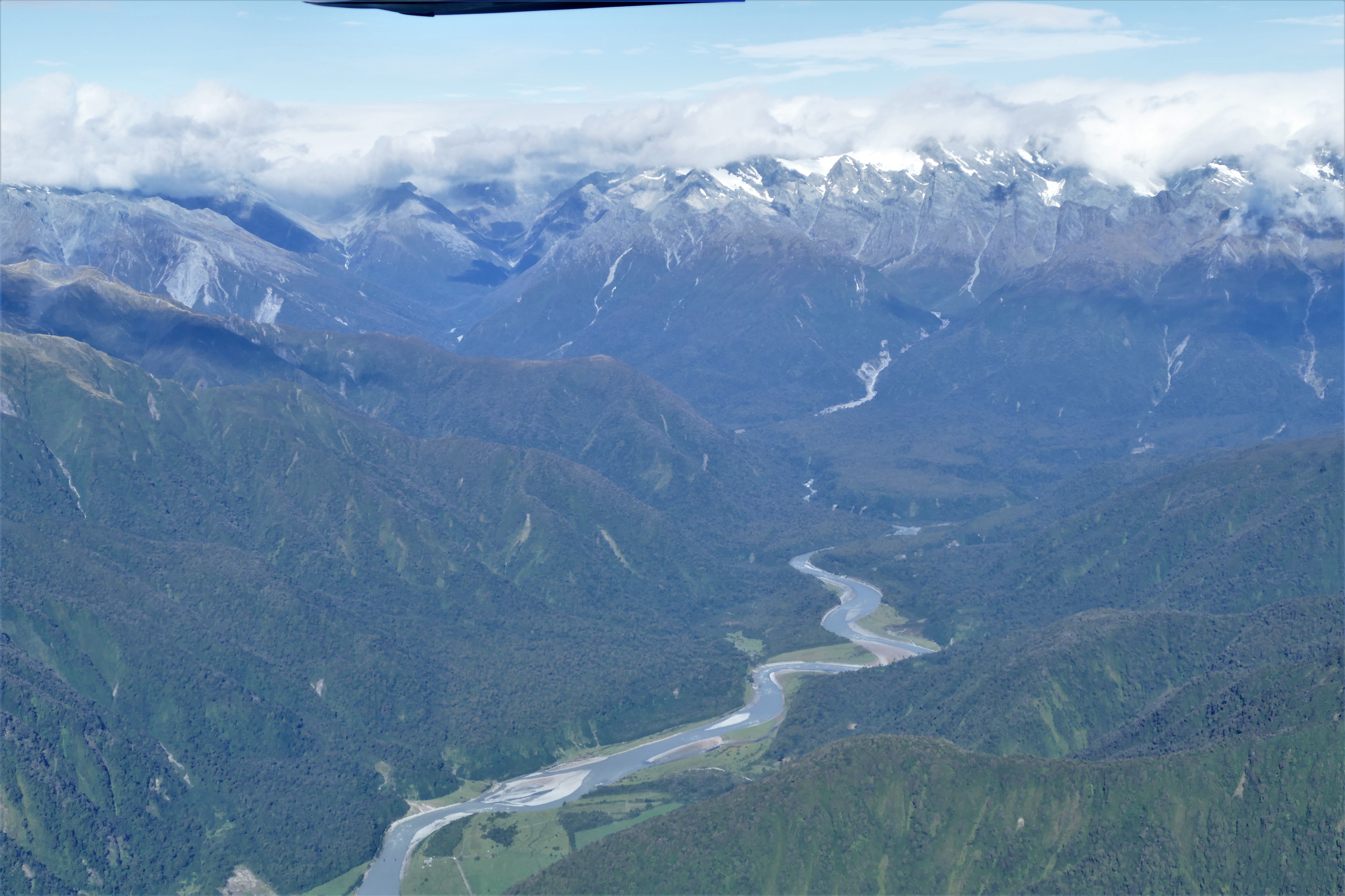
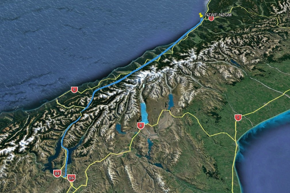
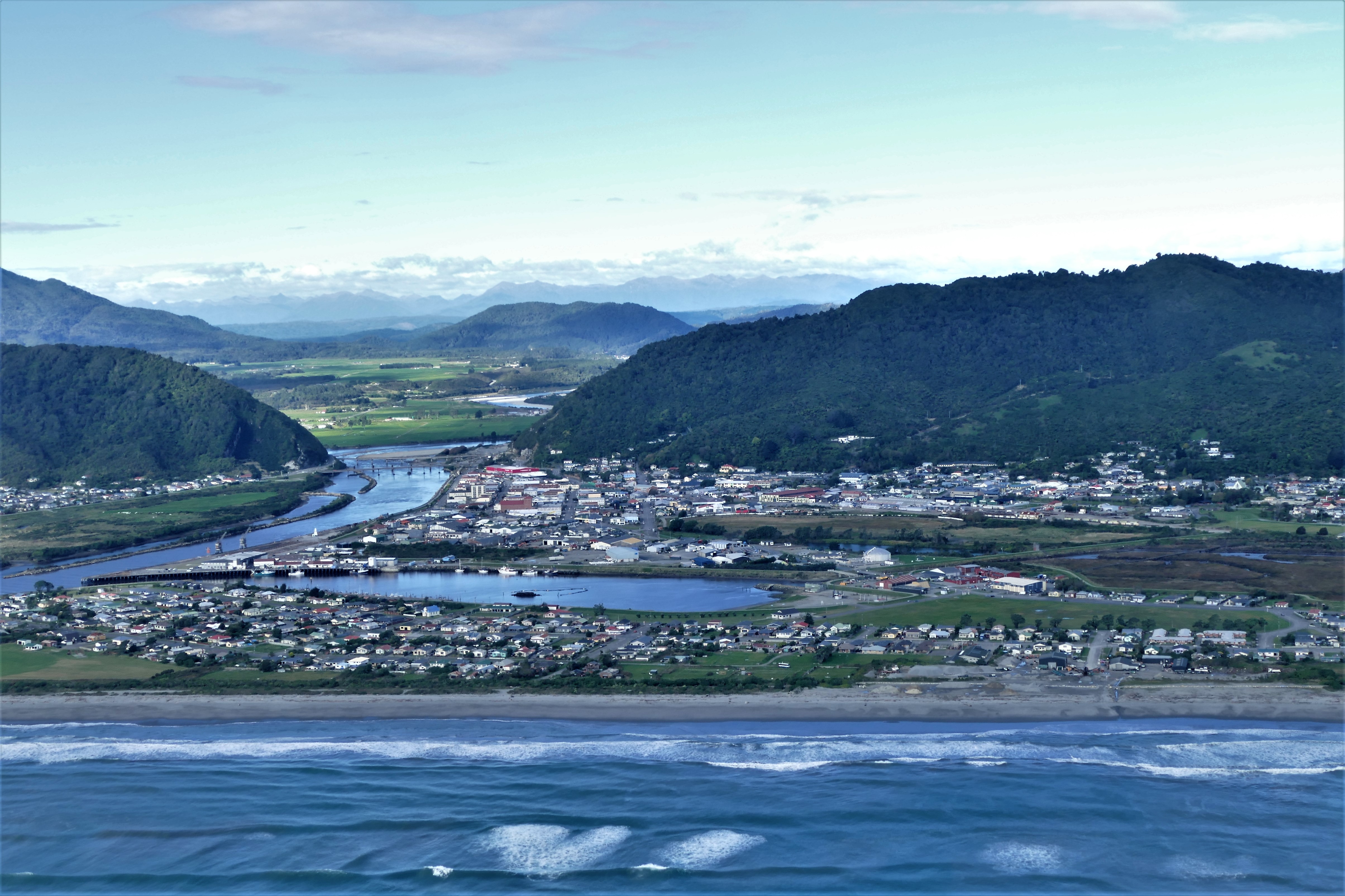
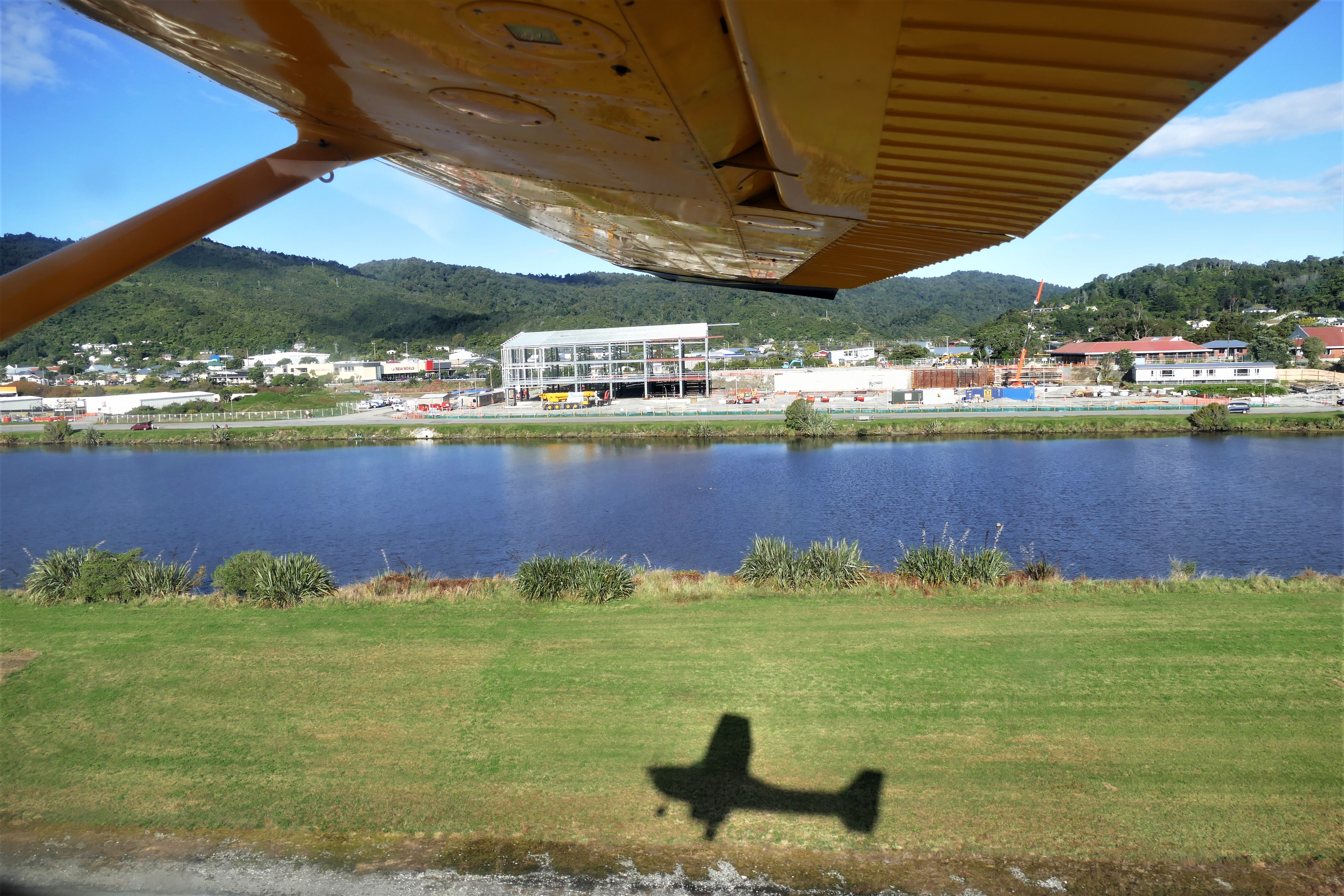
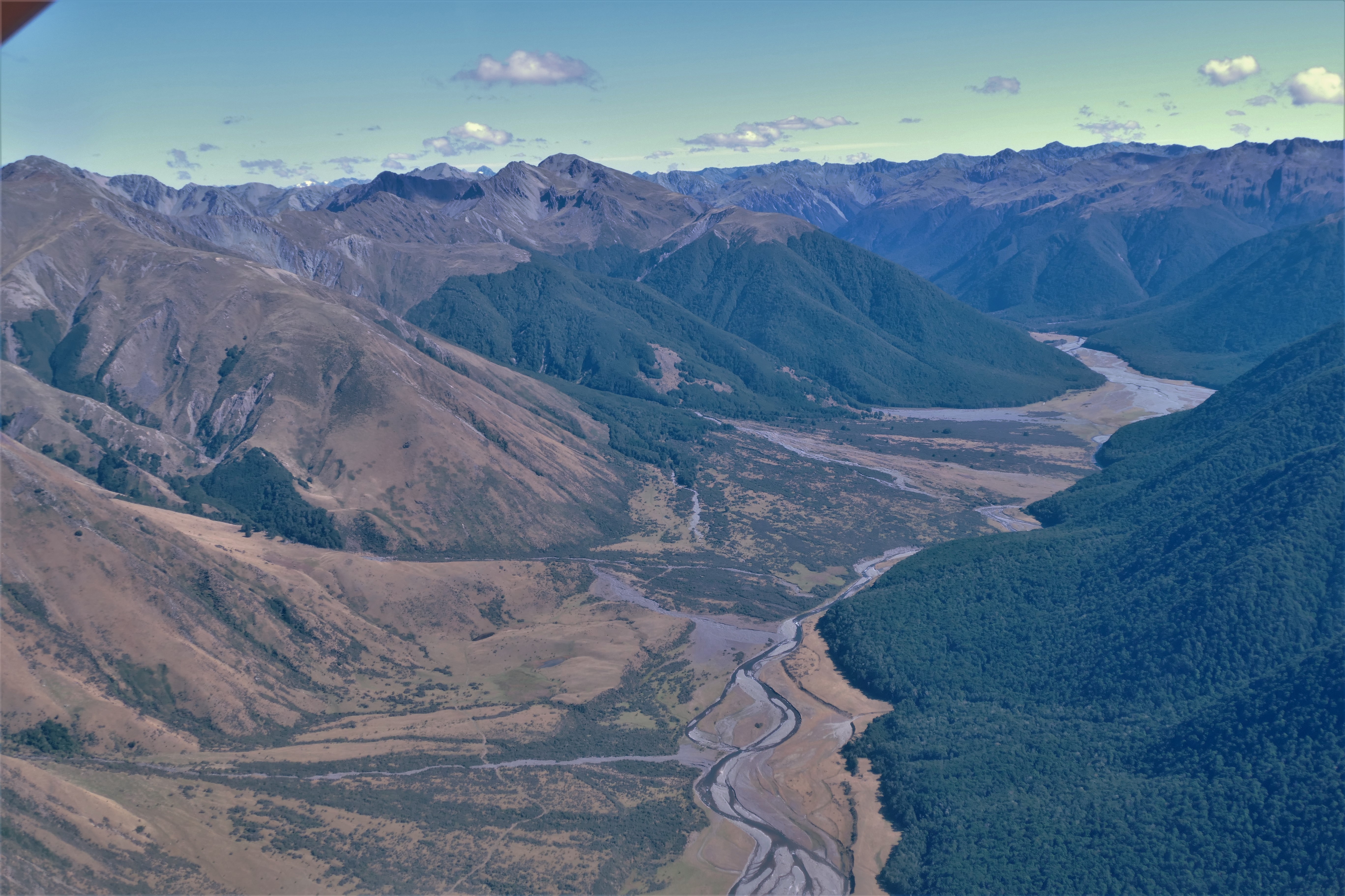
(Day 7, flight 2) It was after 2 pm in the afternoon when we departed NZWF, climbing to 7500 following route 6 while routing over Lake Hawea, the neck, and Lake Wanaka where we were able to get above the clouds. We passed over the Southern Alps where we were able to get another look at Mount Cook and various glaciers. Descending, we followed the western coast until landing at Greymouth NZGM for fuel after a 1 hour 50 minute flight.
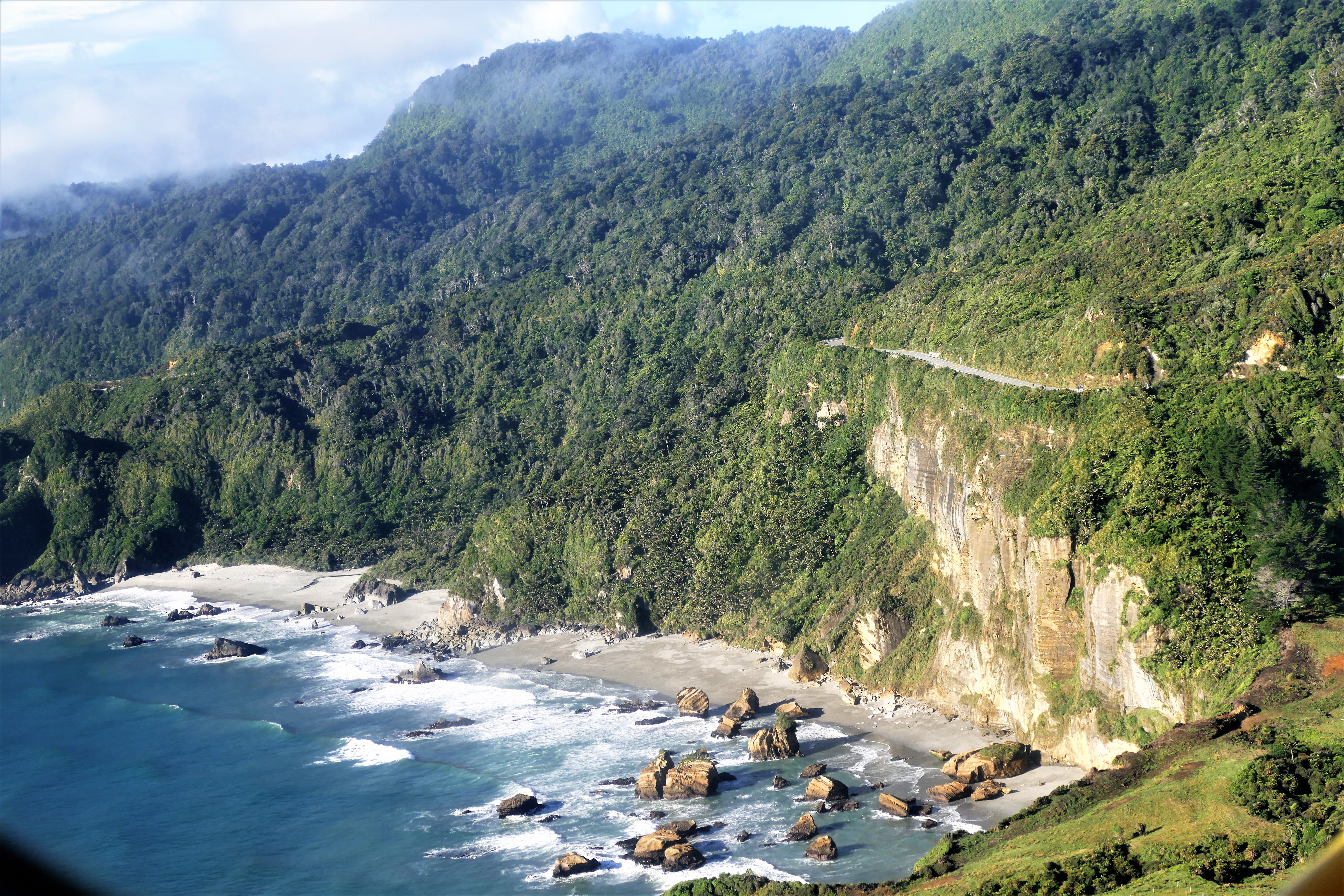
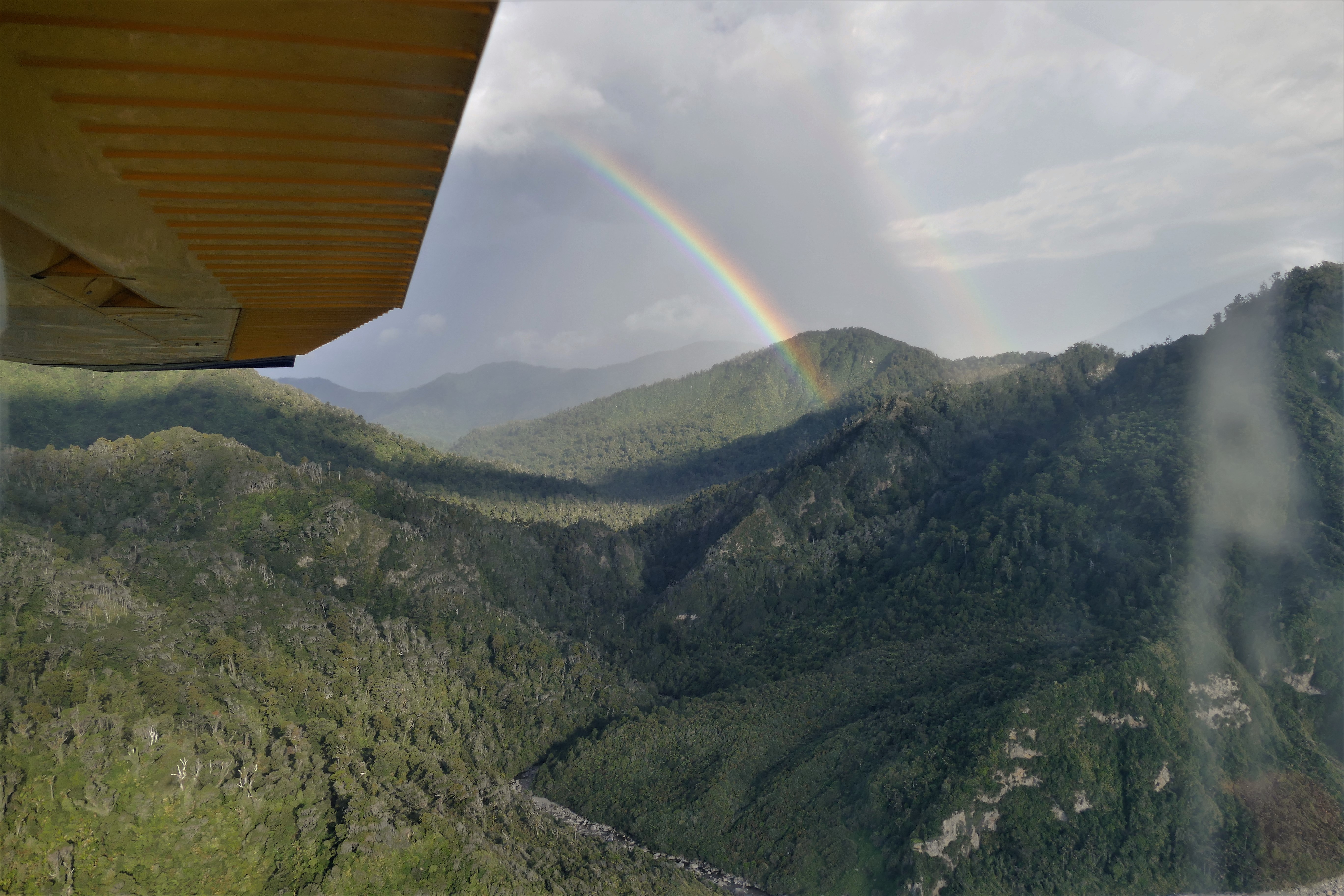
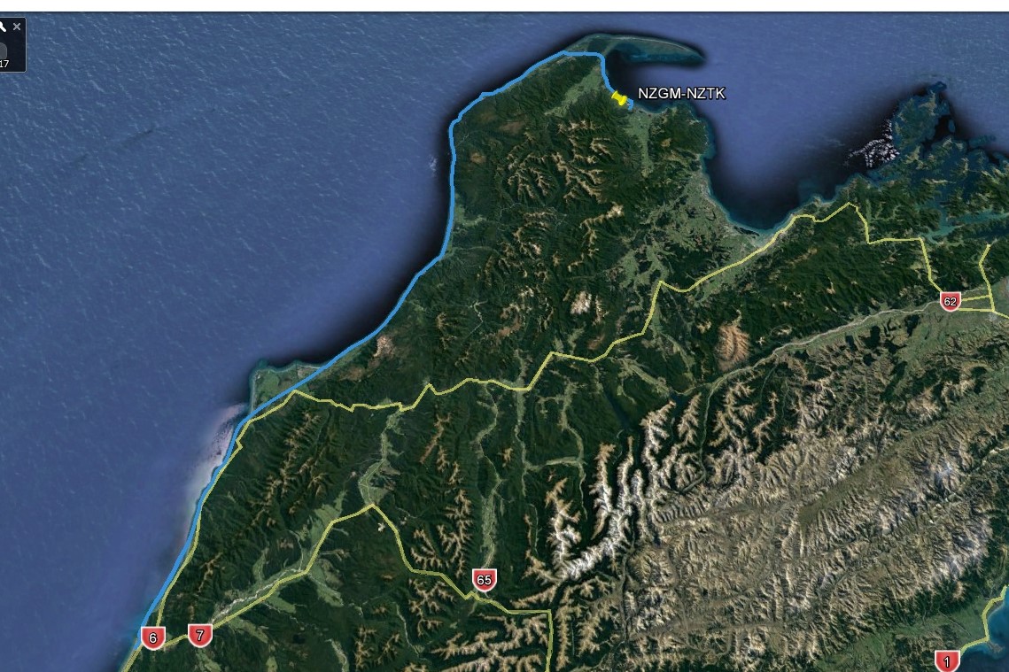
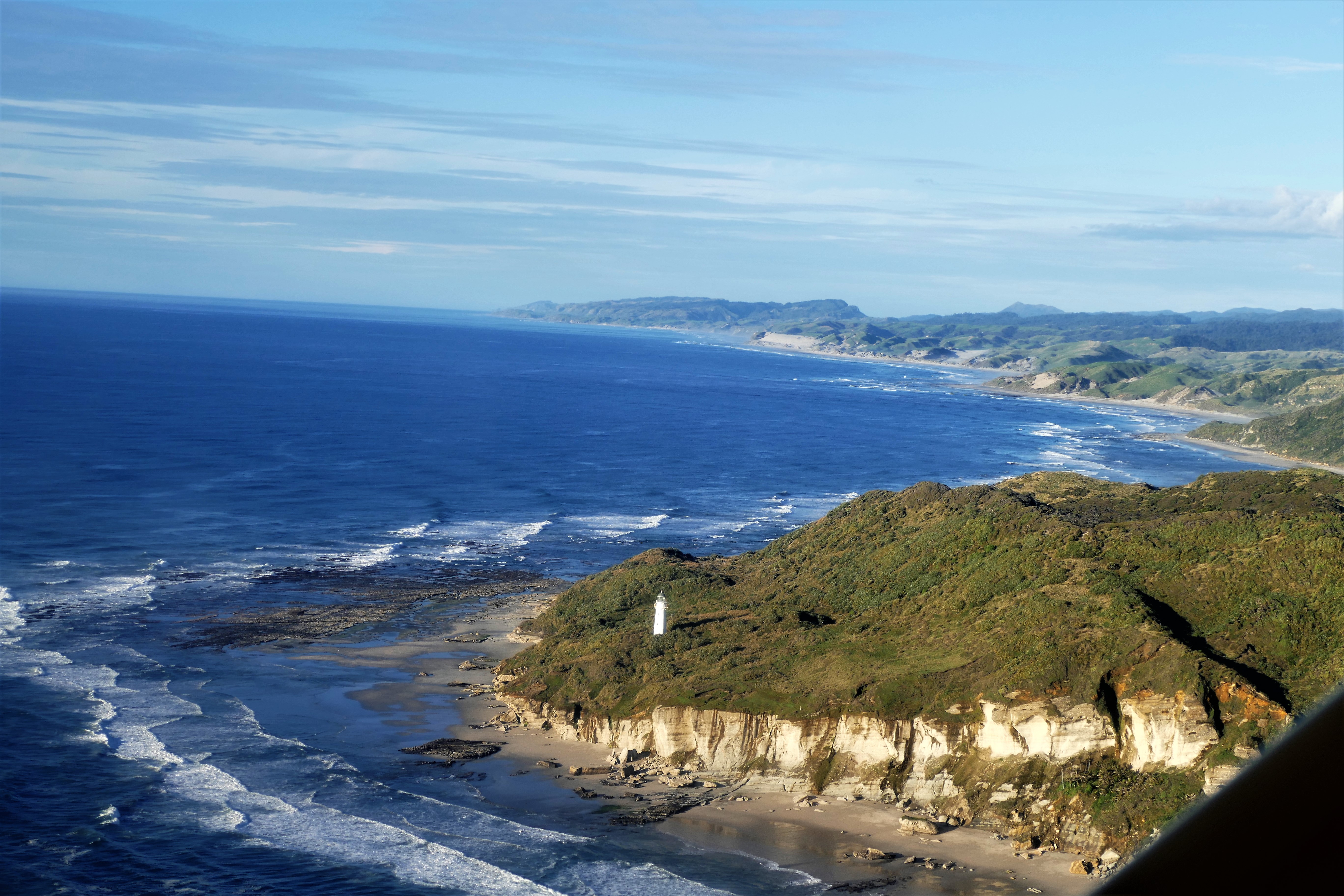
(Day 7, flight 3) Departing NZGM, we climbed to 3500, where it was quite bumpy, causing me to hit my head on the ceiling of the cockpit. Matt suggested trying to fly low over the water, on the idea that the turbulence caused by the westerly winds on the lee side of the hills and mountains would not go as low. Descending to 500 feet above the water, we found smooth air. We followed the west coast up to the Whangauni Inlet. The sun was getting low in the west, brilliantly illuminating the coast. A nearby rain shower gave us a double rainbow. At the Inlet, we climbed over the low mountains, then followed the coast of the Golden Bay for a landing at Takana, NZTK. Flight time was 1 hour 40 minutes.
Matt and Nick were allowed to use the airport's minivan, and we drove to the Ratanui Lodge. It was late, but the Plan B Cafe and Bar stayed open for us for dinner
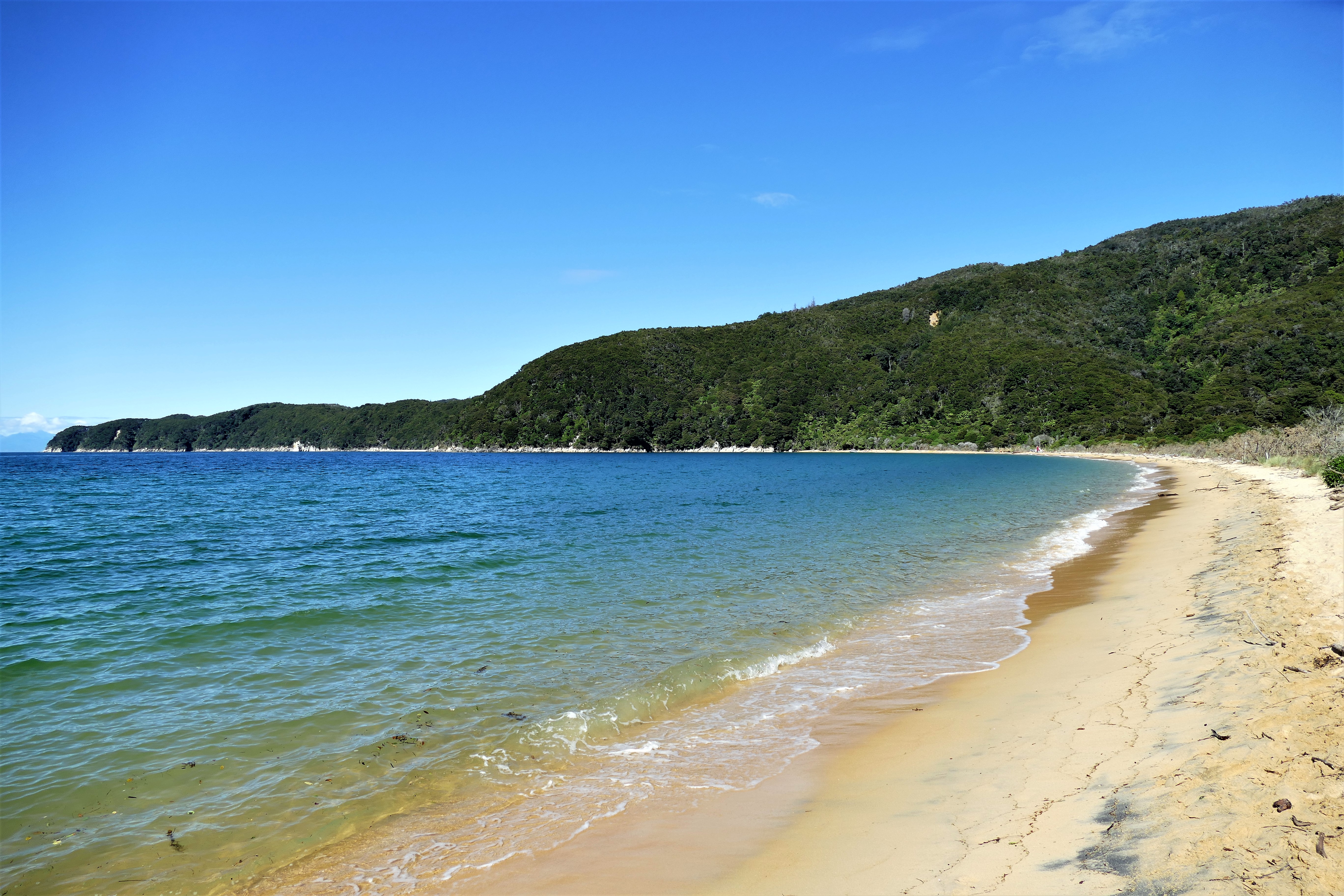
3/28/17: Able Tasman National Park
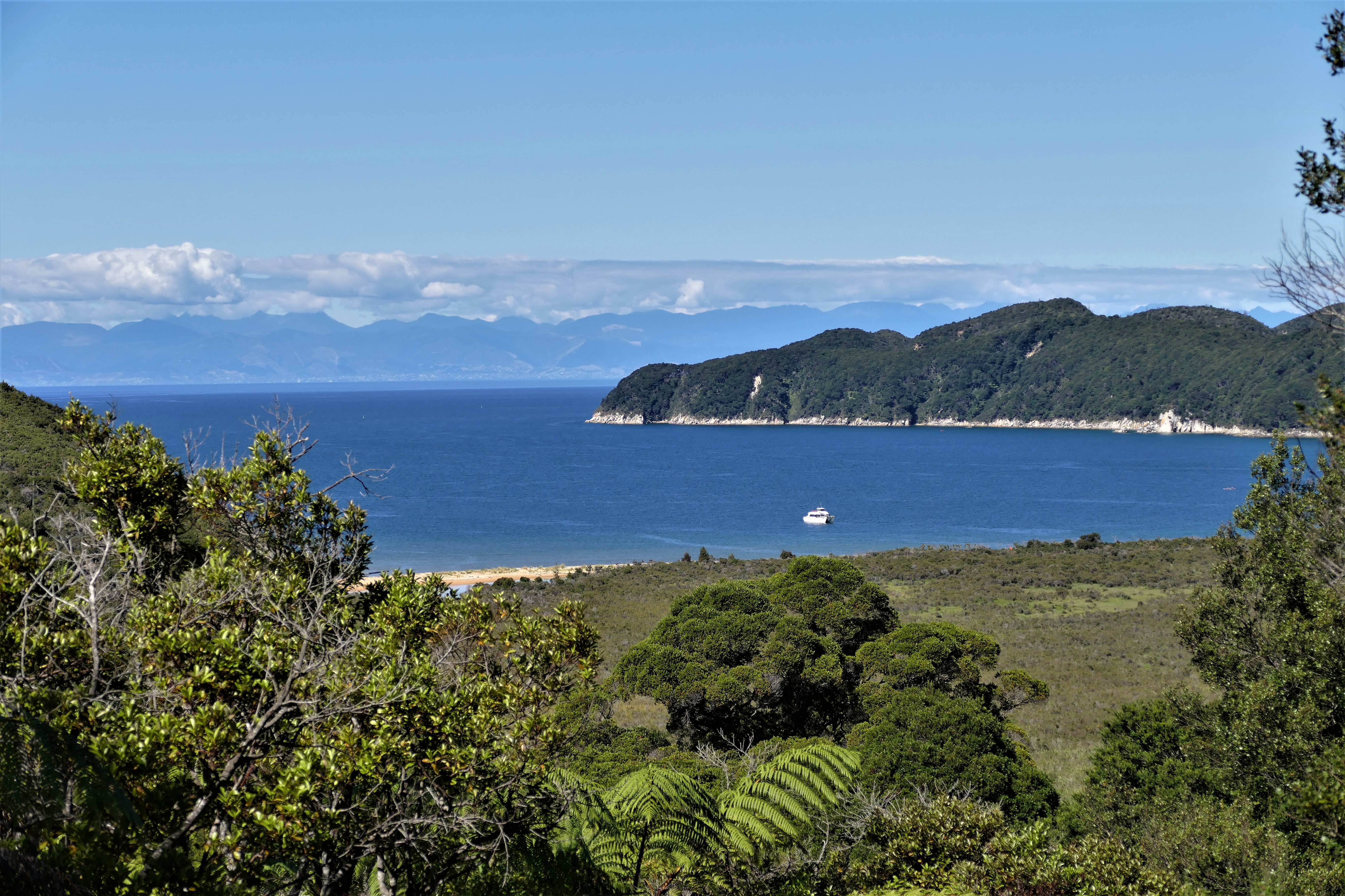
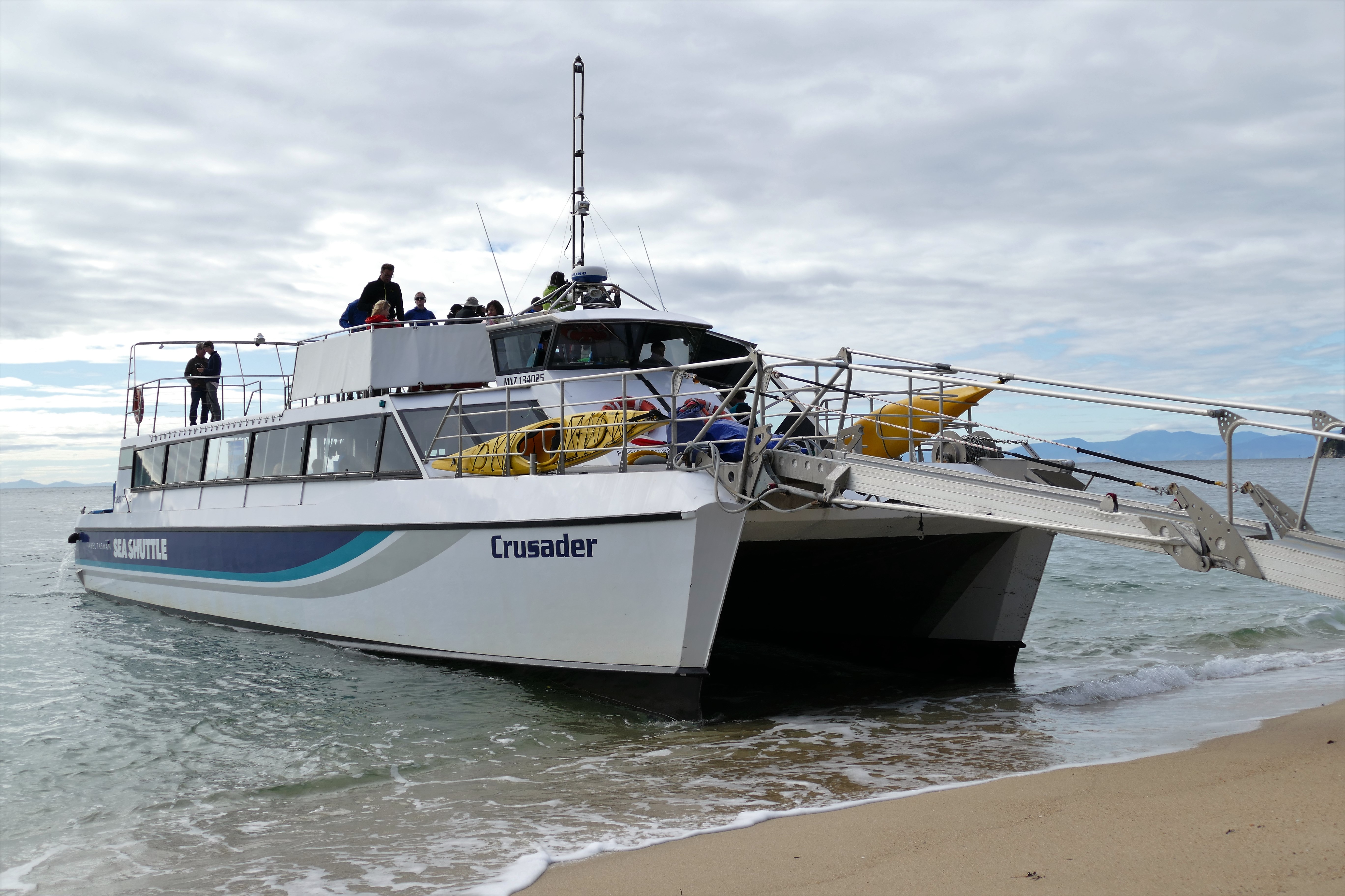
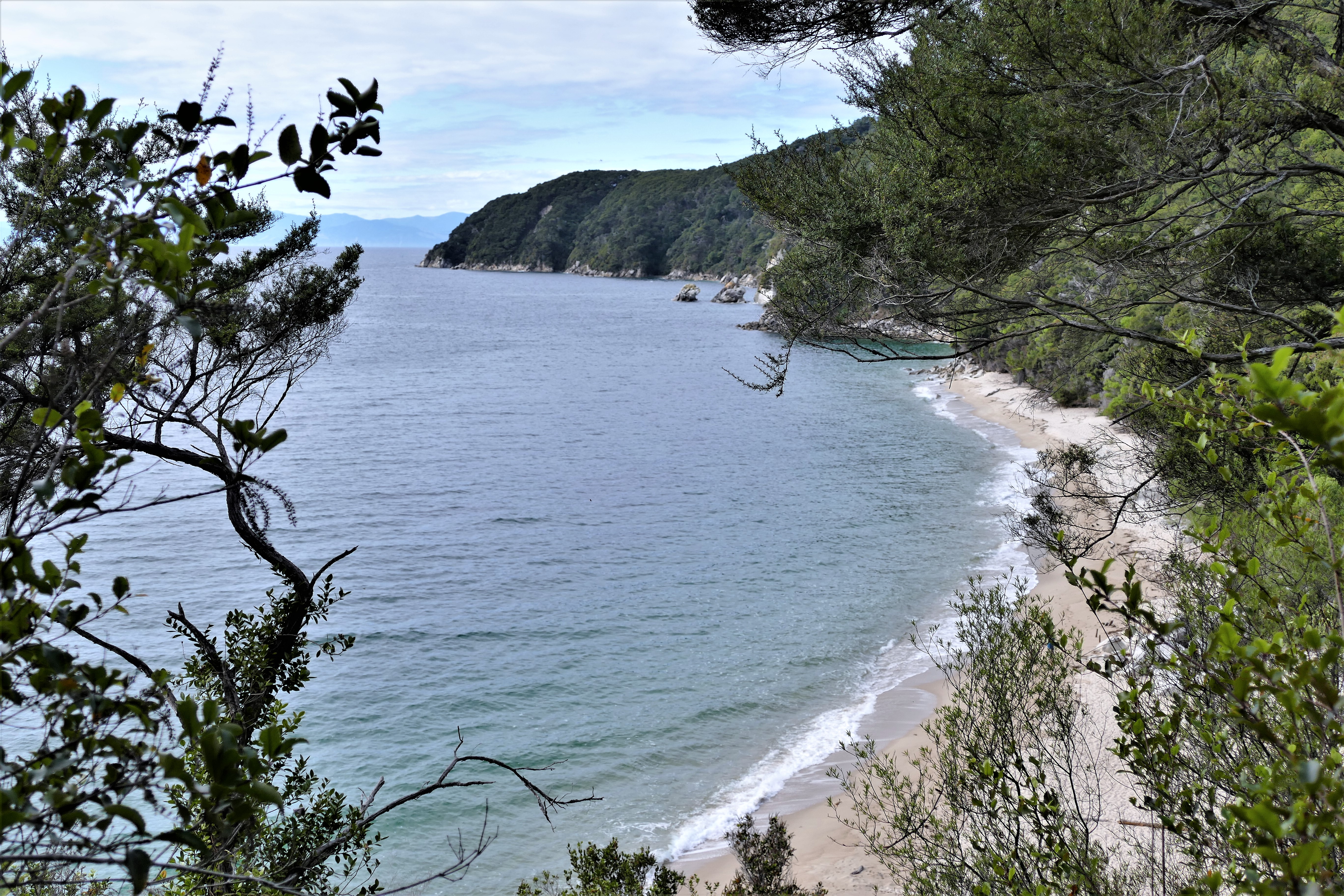
Steve. the Ratanui Lodge's owner, prepared an amazing breakfast for our flight teams. Then, Nick drove us over route 60 with it's winding road and hairpin turns to Kaiteriteri. During the drive, we saw the rising sun light up the tops of the mountains, causing them to turn a bright orange color. At Kaiteriteri, Nick gave us tickets for the sea shuttle, and soon a catamaran powered up to the beach and extended a gang plank. We boarded an Able Tasman Sea Shuttle for the 9:00 am trip north. The sea shuttle acted like a bus, making 3 stops along the way until we were dropped off on the beach at the Tonga Quarry camp site around 10:15 am.
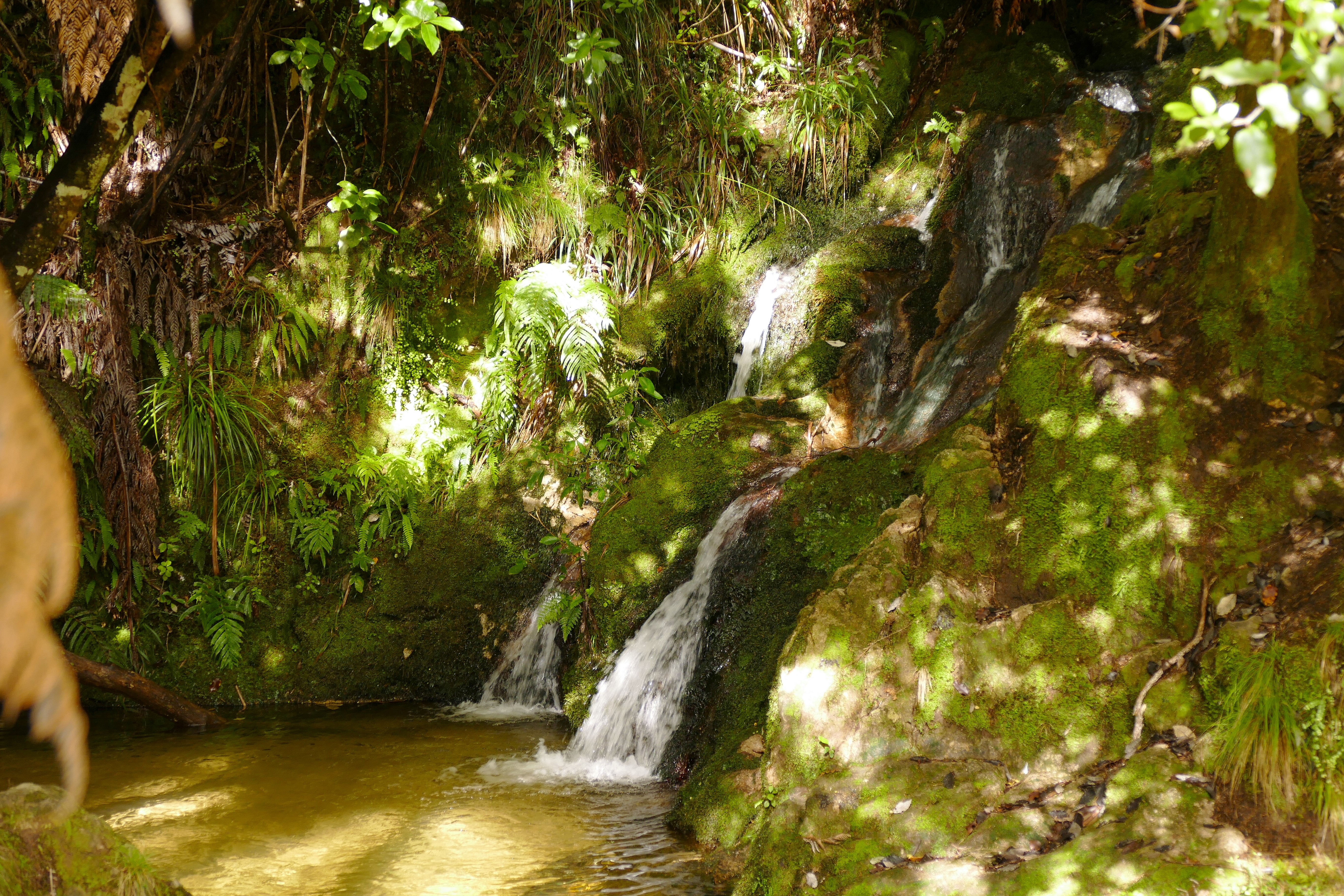
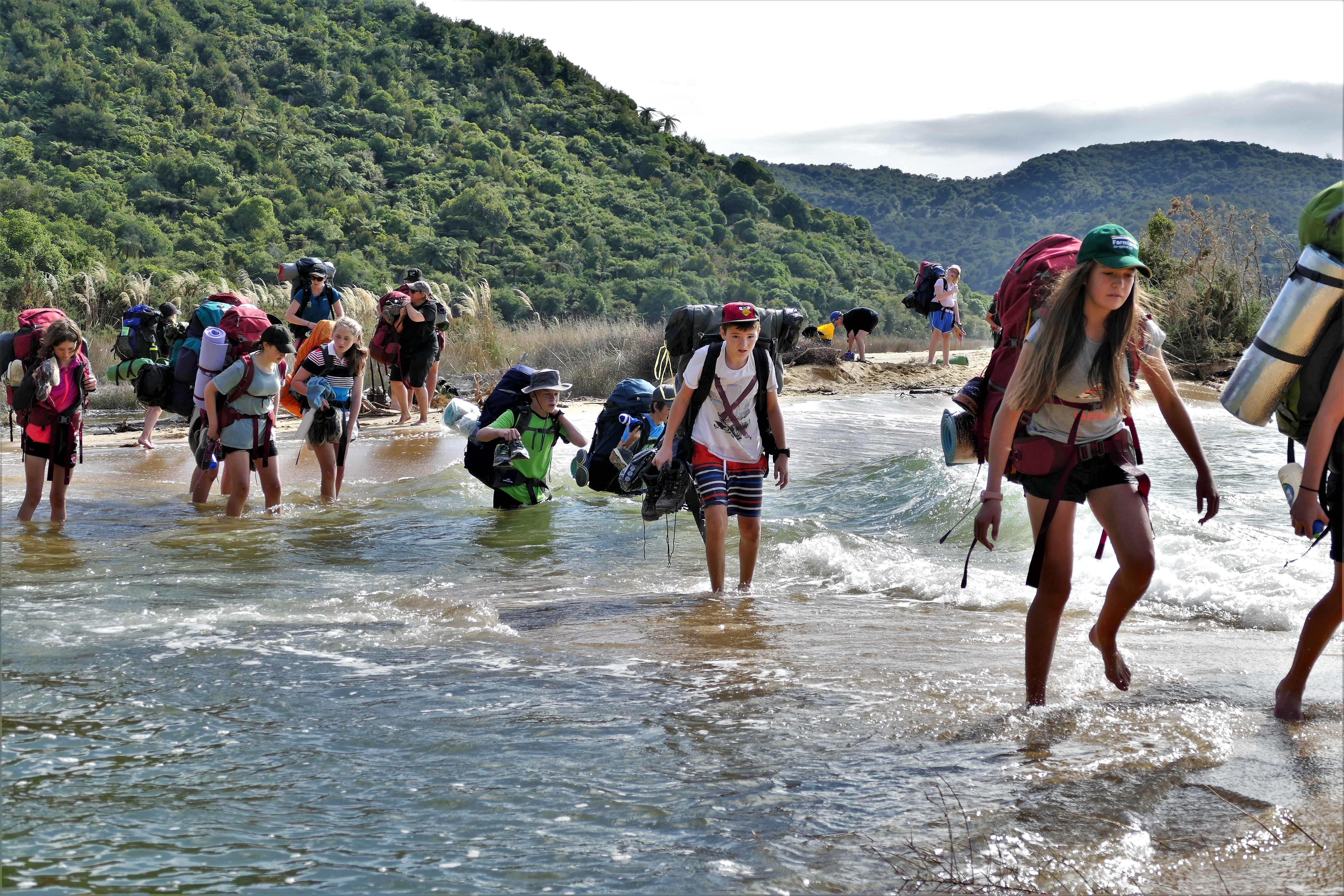
We looked around for the sign, and with the help of Google Maps to show direction, we headed northbound on the Coast Track. We walked up and down a hill, finding ourselves at the Onetahuti camp site. We followed a trail off into the woods, but it led to a dead end at a little babbling waterfall into a small natural pool. We tracked back to the camp site, and found the sign for the trail pointing to the beach. We walked along the beach northward, there was no visible trail as the water was closed to high tide. We found Craig and Betty who alerted us that the beach ahead had been washed out, leaving a section of the walking trail under water. There was a strong current there, making this impassable. We saw a water taxi pull up to the shore and let out a troop of several children, teenagers, and adults. Craig planned to wave down the boat and see if they could take us to the other side. Liz walked ahead to the washout, and I followed her. But this time, the troop was amassed at the other side. Undeterred by the current, an adult walked through, looking at the bottom, and made it to the other side. The troop then followed, with some of the kids finding water up to their armpits. The entire troop crossed, but some of the smaller ones had to be pulled from the water and carried across.
Liz and I decided to wait for the tide to pull back a bit, thinking it might take about 30 minutes. We took off our shoes and socks, and I waded out a bit to see where the deeper area was. While waiting, Liz put on sunscreen and Deet. I put on some sunscreen, but not the Deet, and the sand flies made a feast of my hand. Meanwhile, Craig and Betty got the attention of the pilot of the boat taxi, and after some discussion, got them picked up. I saw the boat go back to the other side of the beach and drop two people off, but I could not make them out to be Craig and Betty. Meanwhile, a younger man and woman with backpacks came to the washed out area. They appeared to be speaking French. The man stripped to his underwear and waded across, then returned. At that point, i talked with him and estimated that the water would come up to my thighs. The man said he was from Belgium and the woman was from France. Liz then ventured across, holding her back pack above her head. The woman stripped down to underwire and went across. I then crossed, with my back pack and camera above my head. The current was strong, knocking me off balance, but I got across without getting the camera wet. The French woman, seeing my wet jeans, asked why I did not take them off. I didn't tell her it was because I did not have designer underwear.
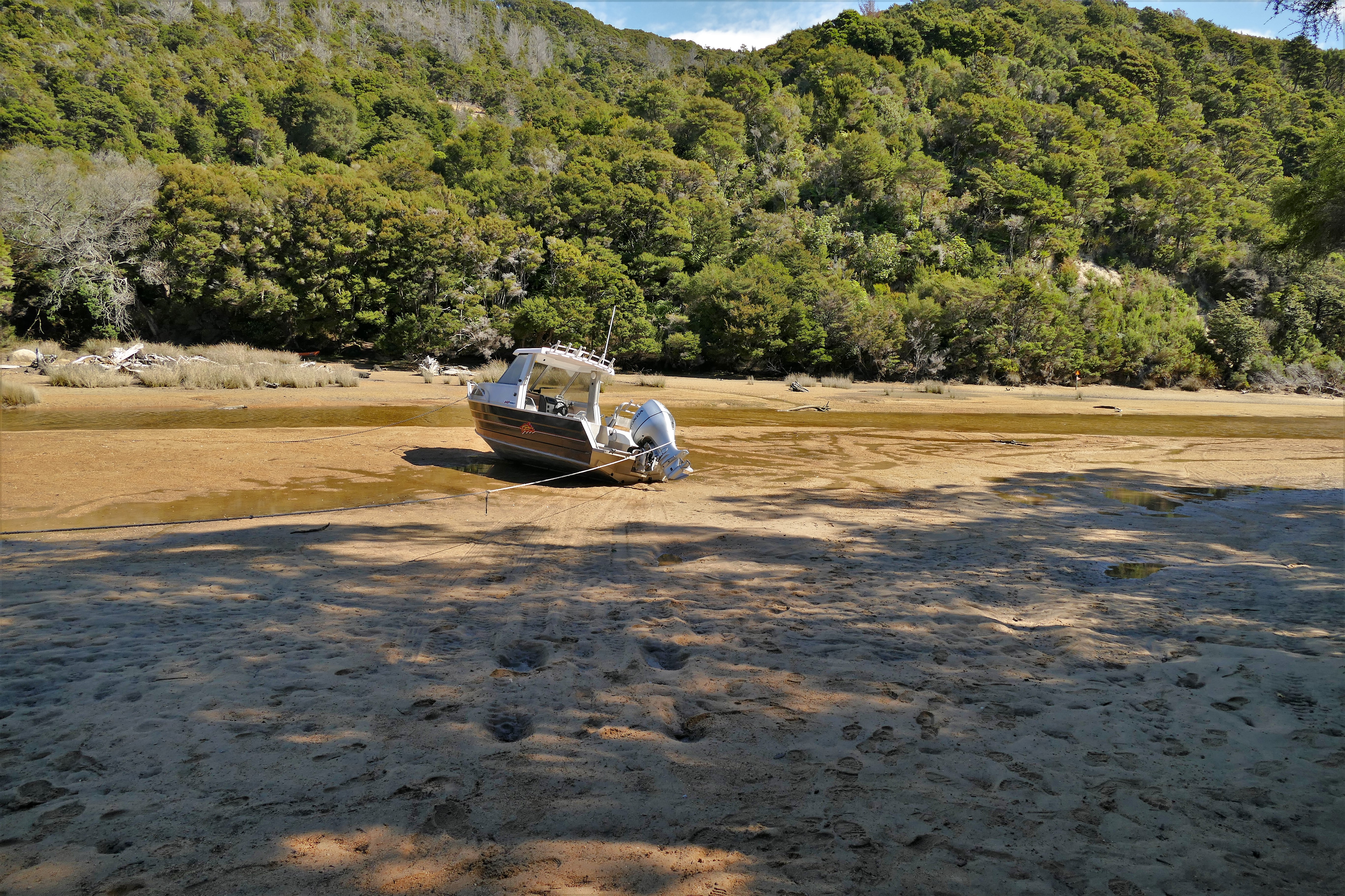
Liz and I walked further on the beach, over a foot bridge, the up one and down a hill, then up and down another. On top of the hills, we could look back at Onetahuti beach and take photos., We eventually made it to Awaroa Lodge, where we had lunch. The walk was supposed to be 1.75 hours, but it took us 3 hours due to the wait for the tide to lower. We explored further around Awaroa, found a grass runway with an airplane parked at the end, and found a dry creek inlet with a beached motorboat. When he boarded the 4 pm water shuttle, Craig and Betty were not there. We worried that they would miss the last shuttle, considering their plans to get married later that evening. We left without them, but were soon radioed that they had gotten on an earlier shuttle. Nick, Craig, and Betty were waiting for us at Totaranue, and we were driven back to the hotel.
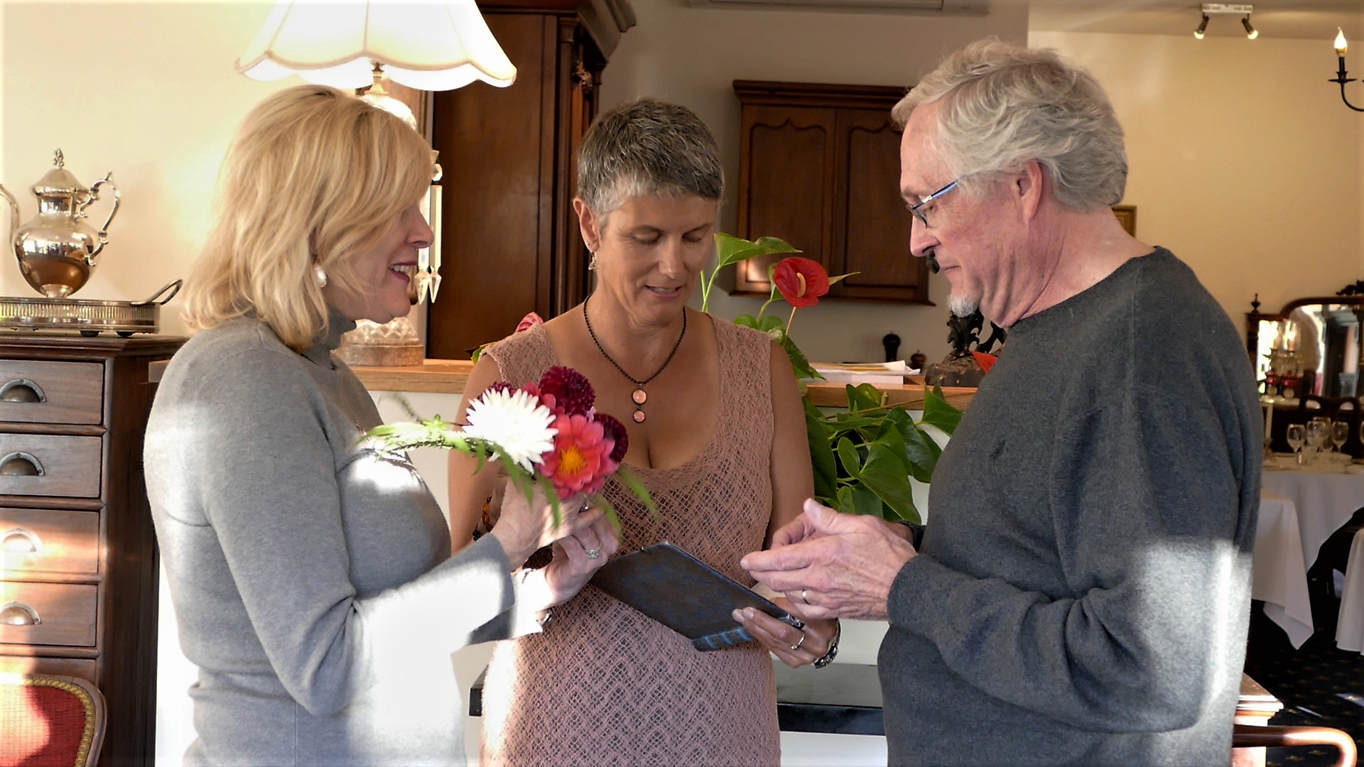
Craig and Betty did get married at the Ratanui Lodge before dinner that evening. This was their 4th marriage in the 4 months since their first marriage. This was a fully legal New Zealand wedding. Craig's rather romantic idea was that they would always be on their honeymoon. I hoped that they would never get divorced, since there would be so many jurisdictions to deal with.

3/29/17: Down the middle
We started the another great breakfast by Steve, then drove to Takana Airodrome.
(Day 9, flight 1) With Nick as the instructor in ZK-WAX, we departed NZGM and climbed to 2500. Following the coast eastbound around Tasman Bay, we were able to view where he hiked the day before at Able Tasman National Park. We contacted Nelson Airport tower and were cleared to transit their airspace as we followed the coast line. We had hoped to fly over and view Tawhitinui Reach, but found that this had been obscured by low clouds. We circled Okiwi Bay and were able to make a circling decent though the clouds then follow route 6 west along the Pelorus River, then south until reaching the grass runways of Omaka Blenham Airport NZOM. This aerodrome was close to Woodbourne Airport, so we contacted the tower before entering their airspace. We landed completing our 1 hour 20 minute flight.
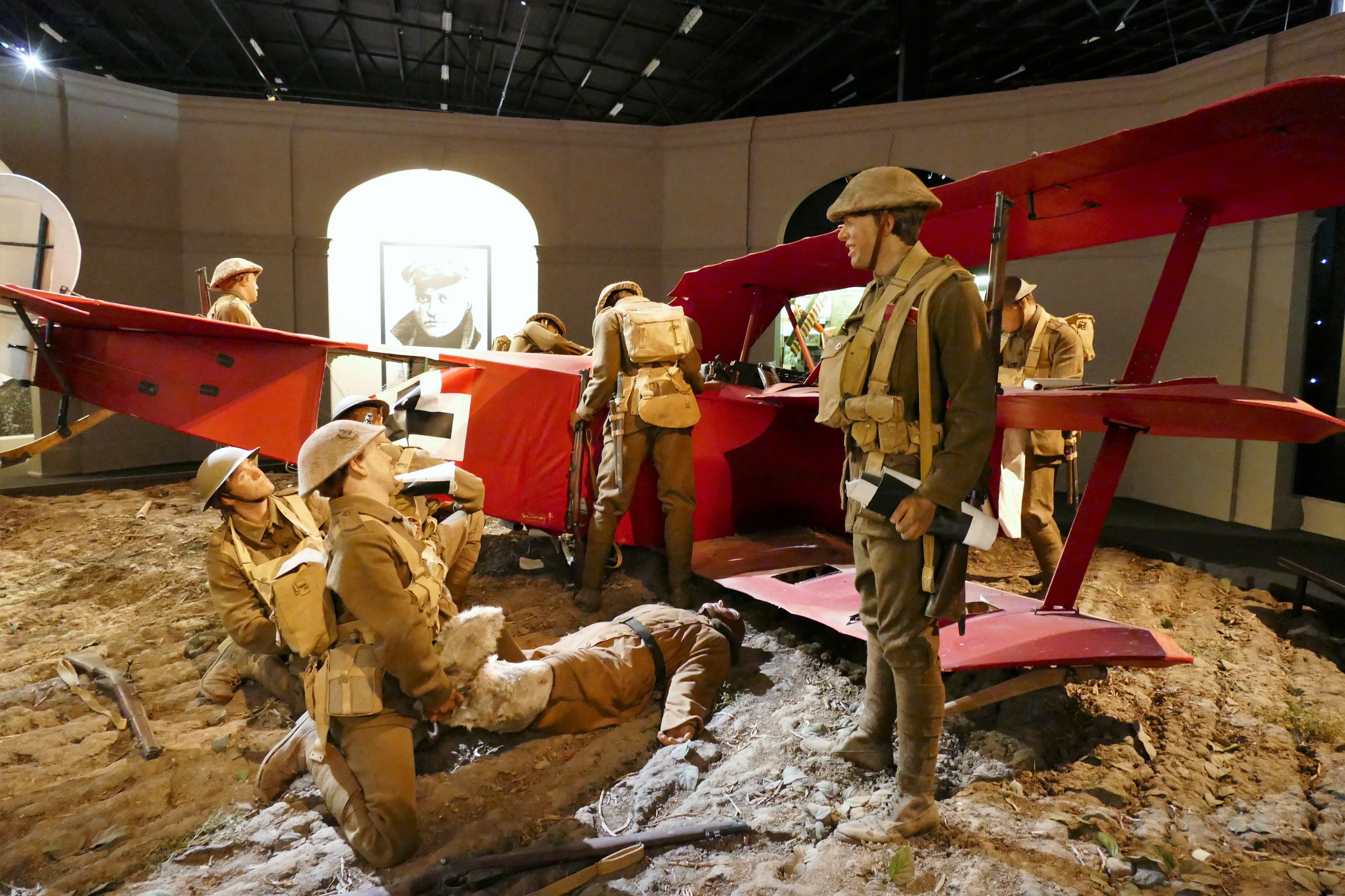
Woodbourne Airport has an amazing museum of warplanes from World War I and II. After eating lunch, we went to explore the World War I museum. They had the warplanes staged with scenes from the great war. Some airplanes were restored from the war, others were recreated. I was pleased to find a re-creation of the German Pfalz D.III, from The Blue Max, which is my favorite movie about flying
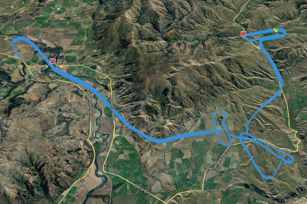
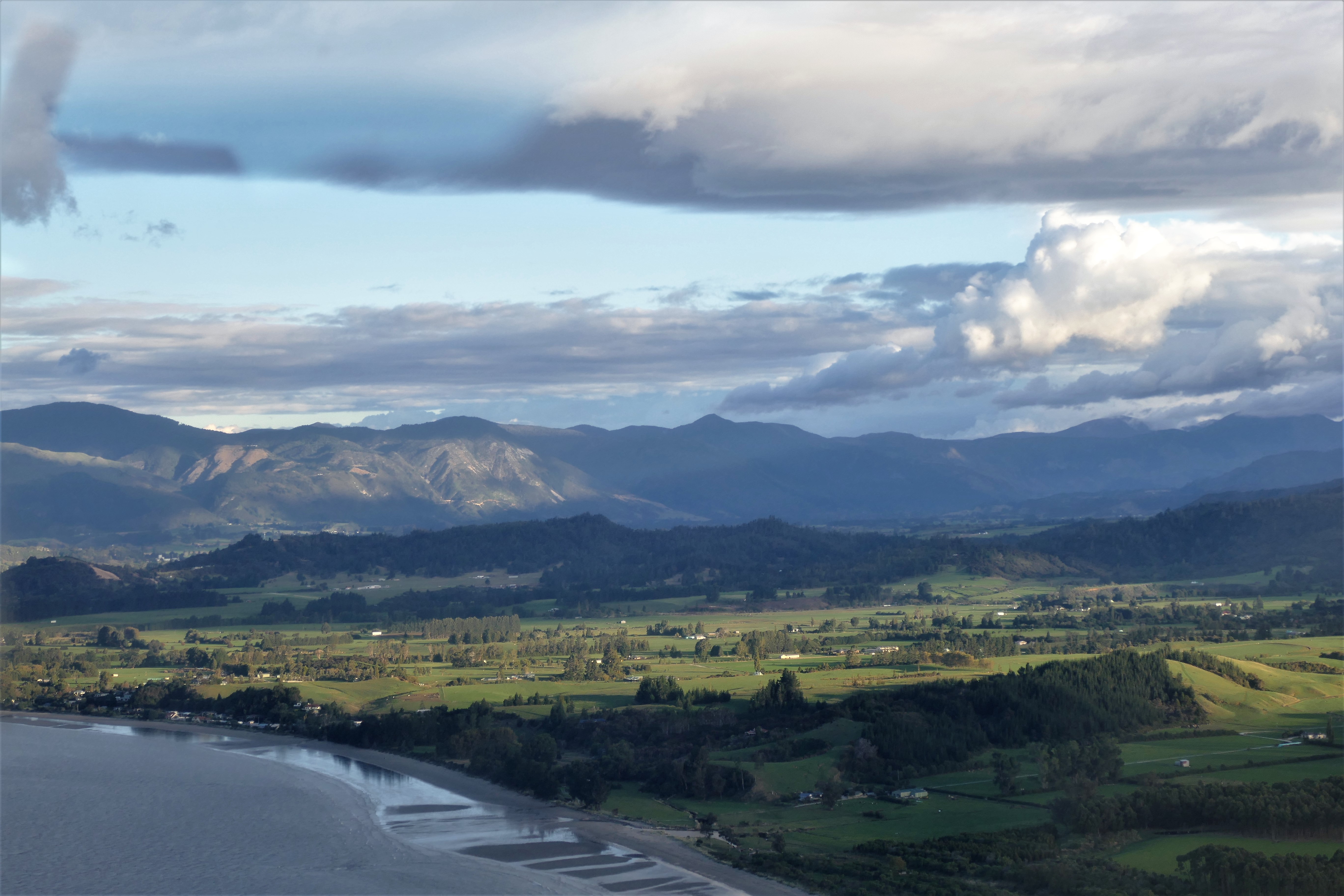
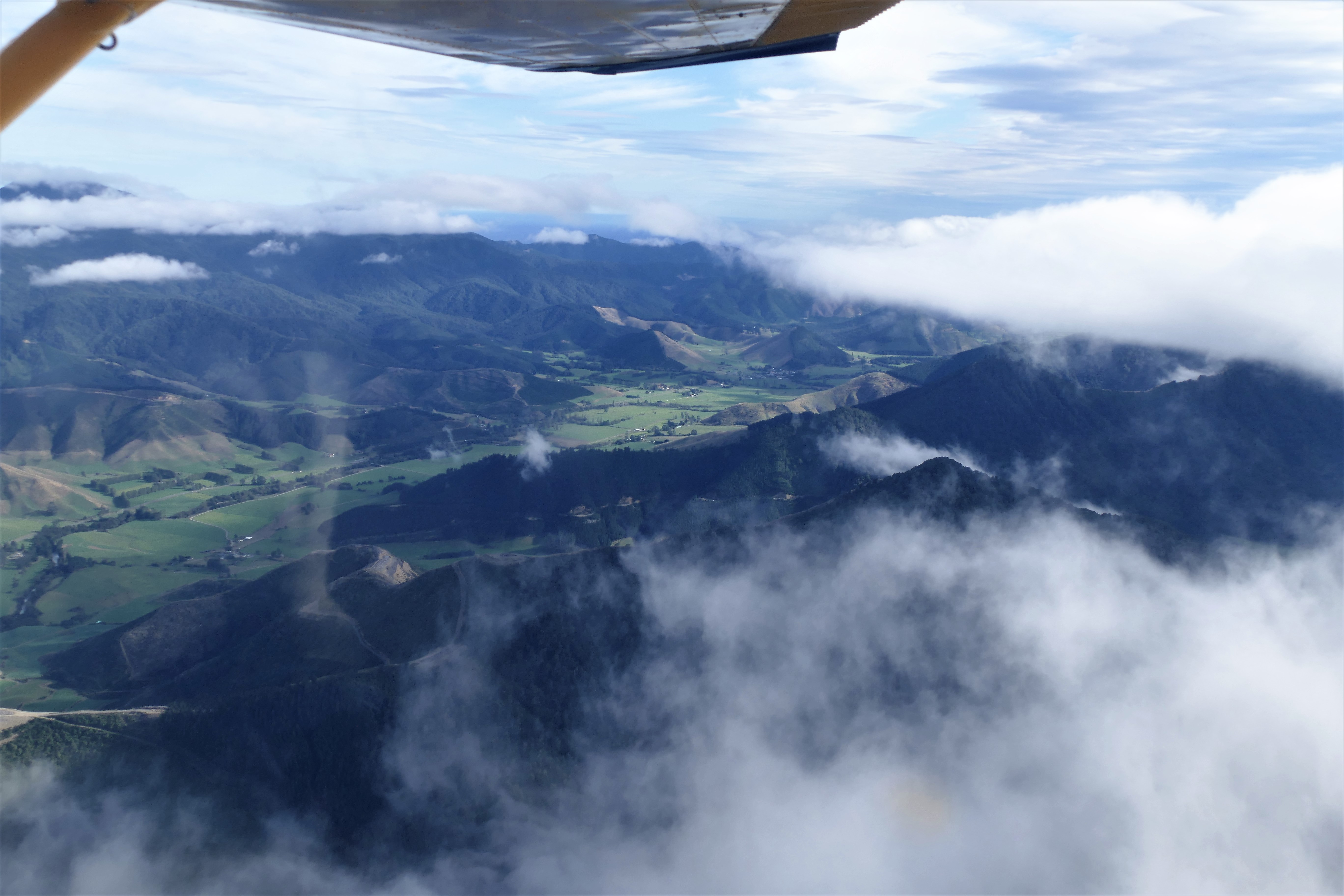
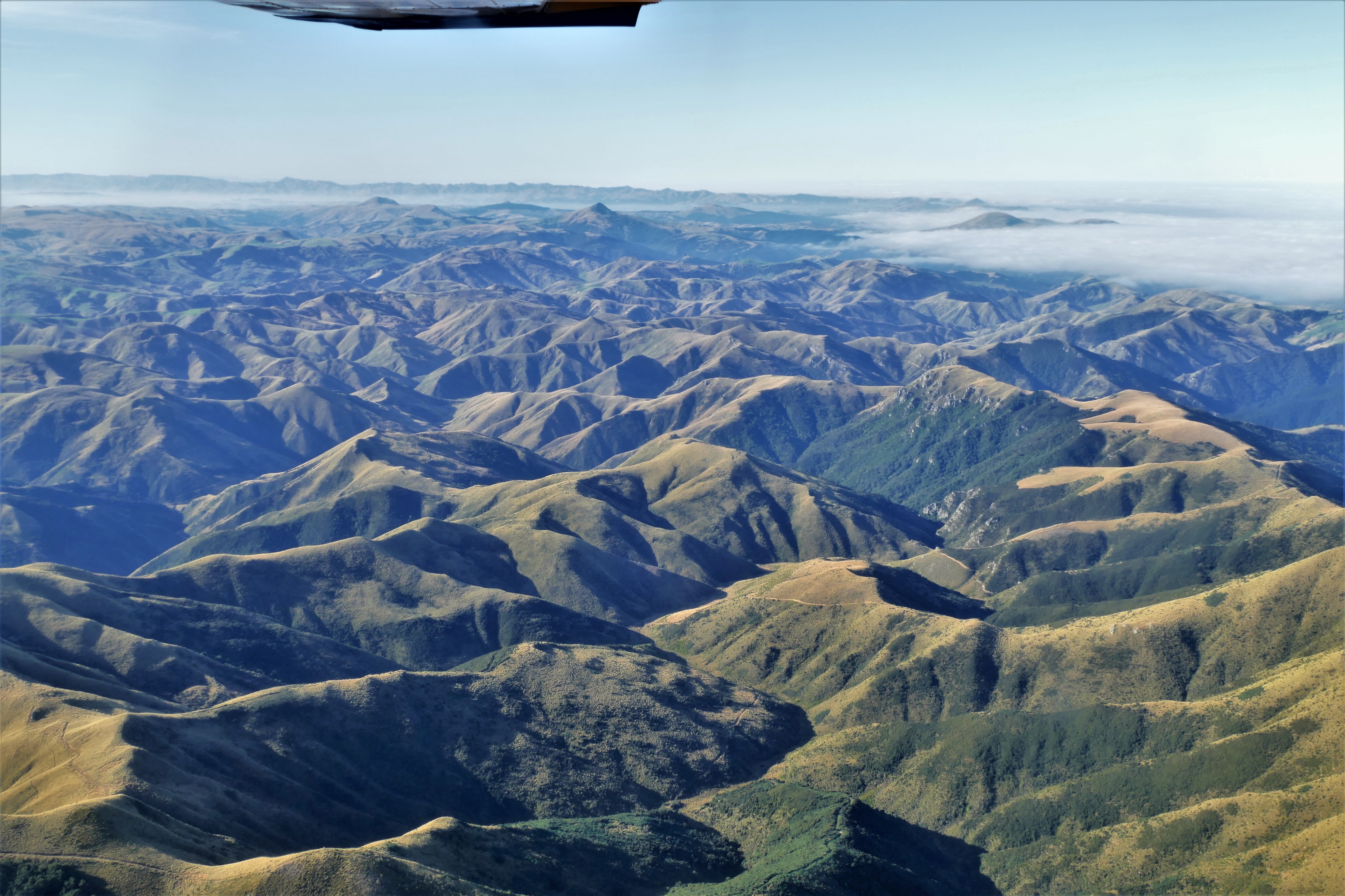
(Day 9, flight 2) I asked Nick if I could navigate down the harsh dry valleys of central New Zealand. He was fine with that, and we departed NZOM and contacted Woodbourne tower. We were cleared on a westerly course to the Domes reporting point, and we climbed to 2500. We then turned south, heading for mountains while climbing to 5500. It was a pretty nice day, with high clouds, but I maintained 5500 and used the moving map of AvPlan on my iPad to find a zig-zag course southbound through the mountains. We could have easily climbed to 7500, and flown direct well above the highest peaks But instead, I made a challenge for myself, pretending that the cloud bases were just above us and determined to not climb above 5500 feet. After the Domes, I turned southwest, following the Waihopai River and it's tributary, the Soray River to it's source. After a mountain saddle, I picked up Acheron River, then over a valley to the Waiau River which fed into the Hope River. Over another saddle, then Lake Sumner, through saddles in the Dampier Range. Then between the Black Range and Craigieburn Range, following the Harper River, north of Lake Coleridge, then the Rakaia River, west of Lake Heron and Lake Clearwater. I lost my challenge at the Two Thumb Range and had to climb to 6500 along Forest Creek to clear a saddle near the Tekapo Skifield checkpoint. Then, a decent over Tekapo Lake for a landing Tekapo/MacKenzie Airport, NZTL. We landed and fueled after the 2 hour 20 minute flight
Day 9, flight 3) We took off from NZTL and headed southeast, passing the Kellands Ponds and Killermont Station checkpoints. I navigated and handled the radios as we passed Omarama Airport. We approached Geordie Hill Station from the north via the Lindis Pass, and landed after a 40 minute flight.

3/30/17: Dunedin
The paperwork from the Civil Aviation Authority arrived permitting me to pilot a Cessna 172 as pilot in command in New Zealand for 6 months. I was able to log my flight time for the last 2 days as P-I-C. Before we took off that morning, Matt told us that our destination, Dunedin, was fogged in. We would go to an intermediate stop for coffee to wait for the fog to lift.
(Day 10, flight 1) With Pete as instructor in ZK-WAX, we took off the grass strip at Geordie Hill Station and turned west, climbing to 3500 feet to get a over a mountain saddle in the lower mountains to the east. We turned southeast to follow Dunstan Creek and ended the 35 minute flight landing in a grassy area at the decommissioned Wedderburn airport.
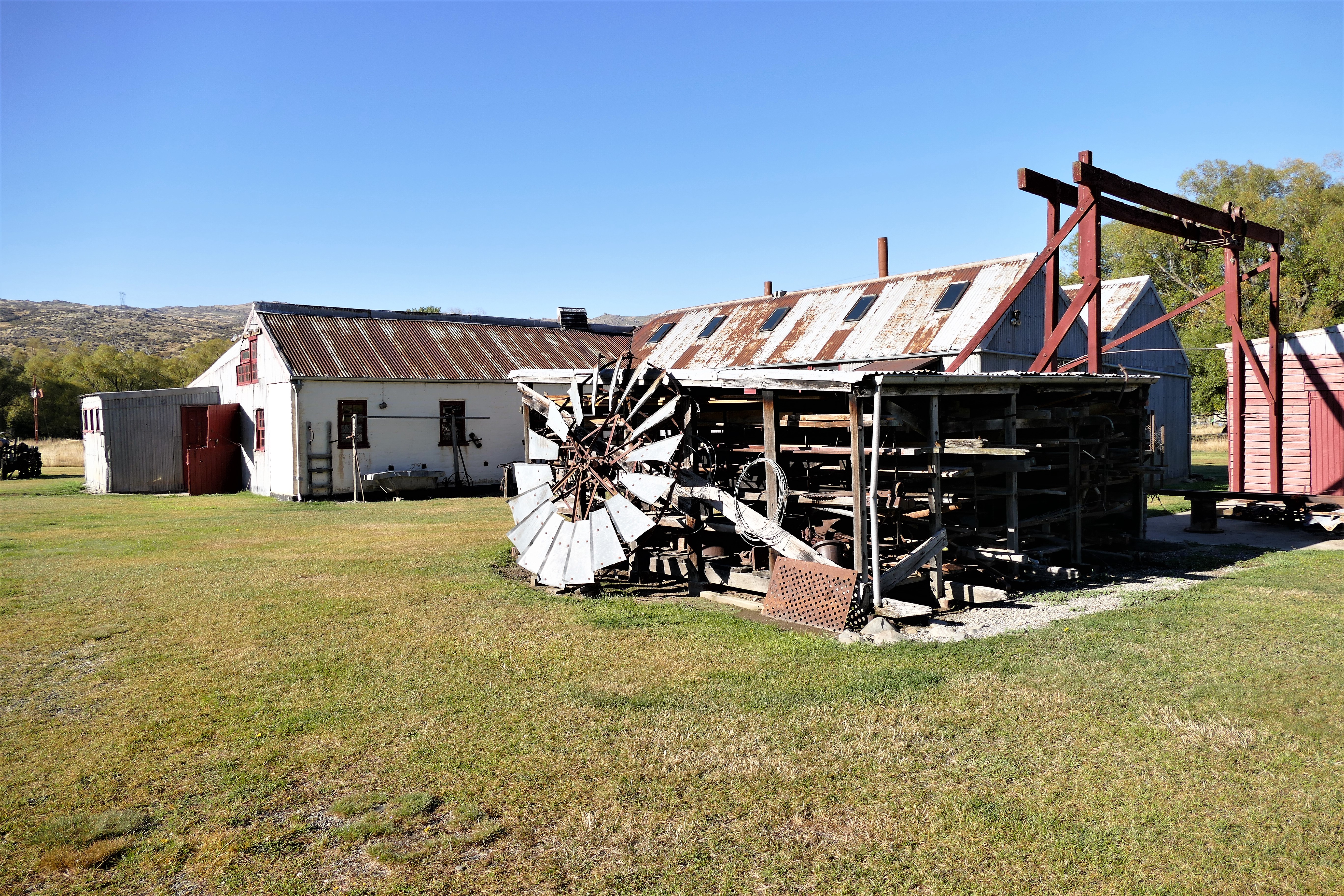
At Weddenburn, we were picked up and taken to Hayes Engineering Works and Homestead. It was the home and workshop of Earnest Hayes, an inventor during the 1920's. He was known for inventing a fencing wire strainer. There were interesting things to look at and photograph. Nick and Pete checked the weather, looking at several webcams in the Dunedin area.
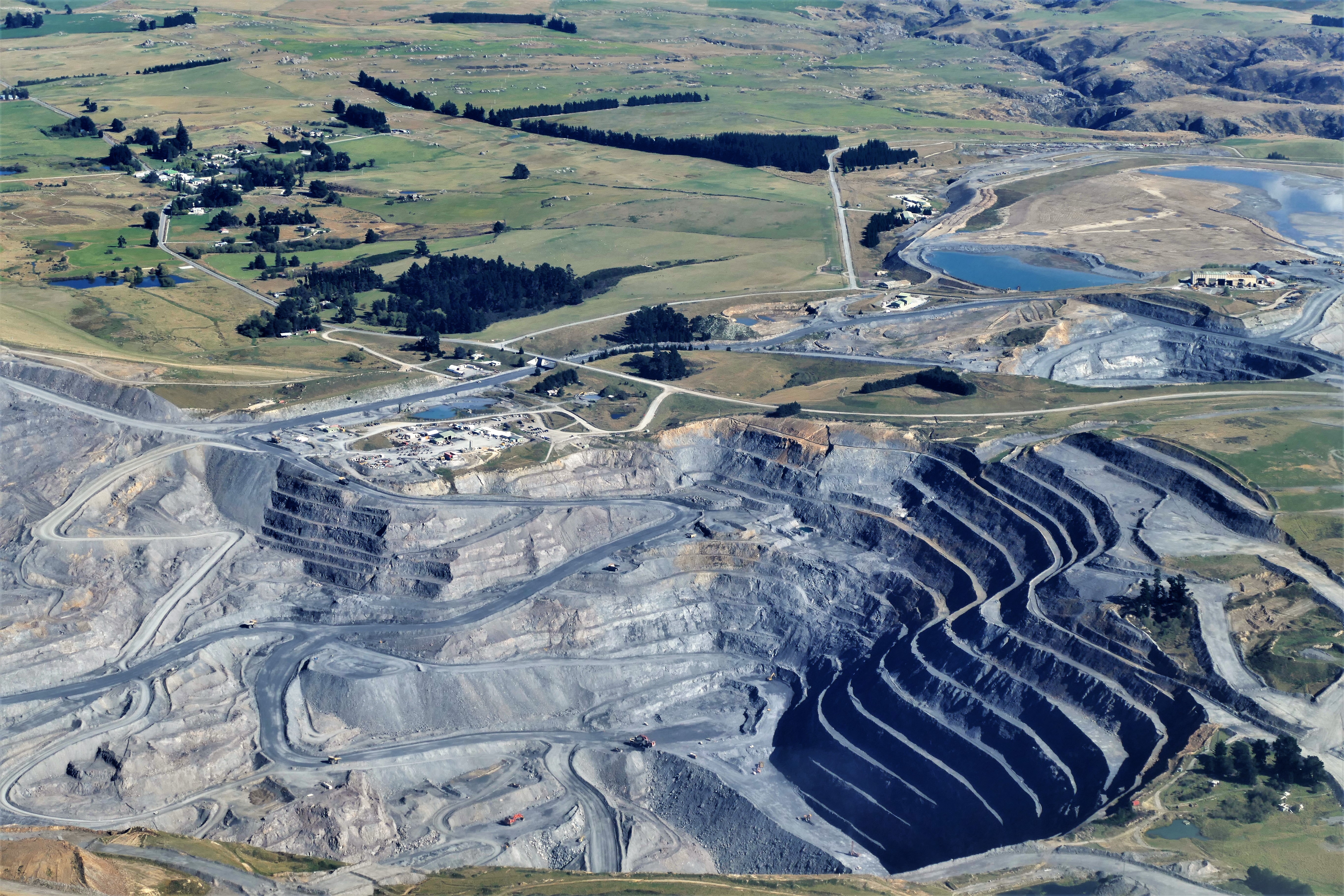
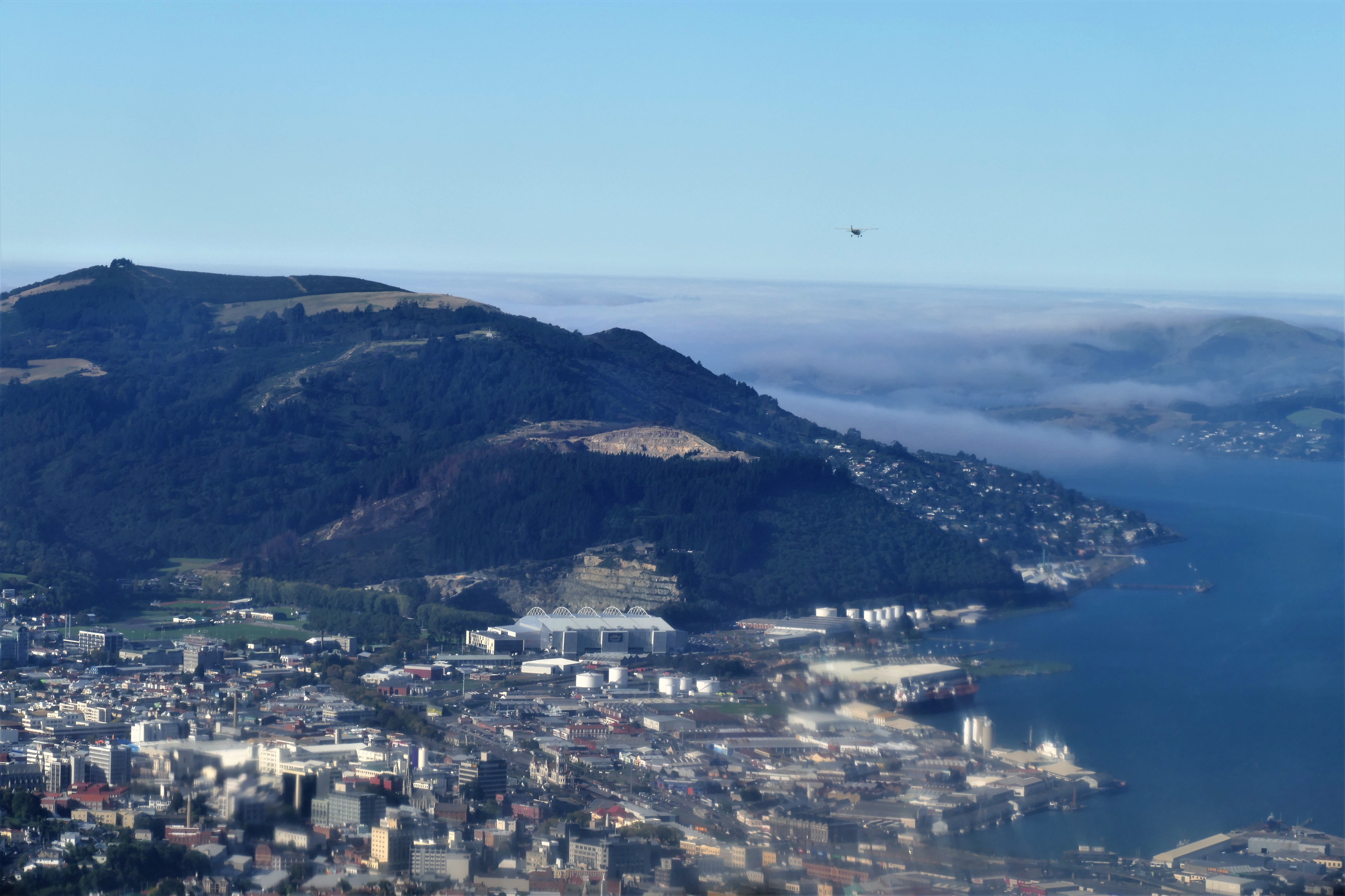
(Day 10, flight 2) We departed Wedderburn and turned southeast, viewing an open gold mine along the way. We hoped to see Otago Harbor before landing in Dunedin, but as we approached the coast, we could see that the harbor was under foggy low clouds as was Dunedin Airport southwest of the city. The city of Dunedin itself as well as Taieri Airport were in the clear. We contacted Dunedin tower, reported flying over the Northern Gap, and landed straight in at Taieri Airport, NZTI to complete the 50 minute flight.
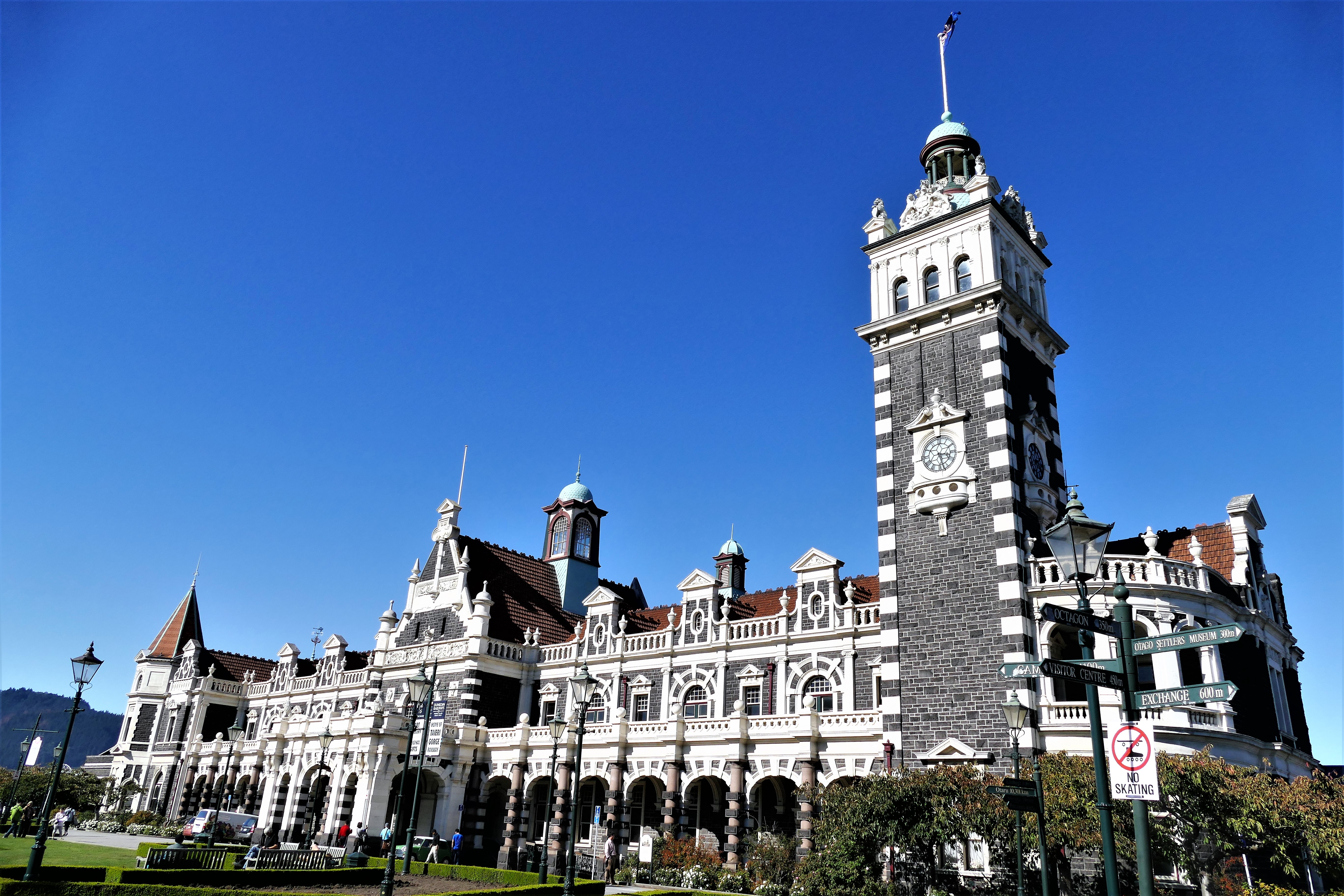
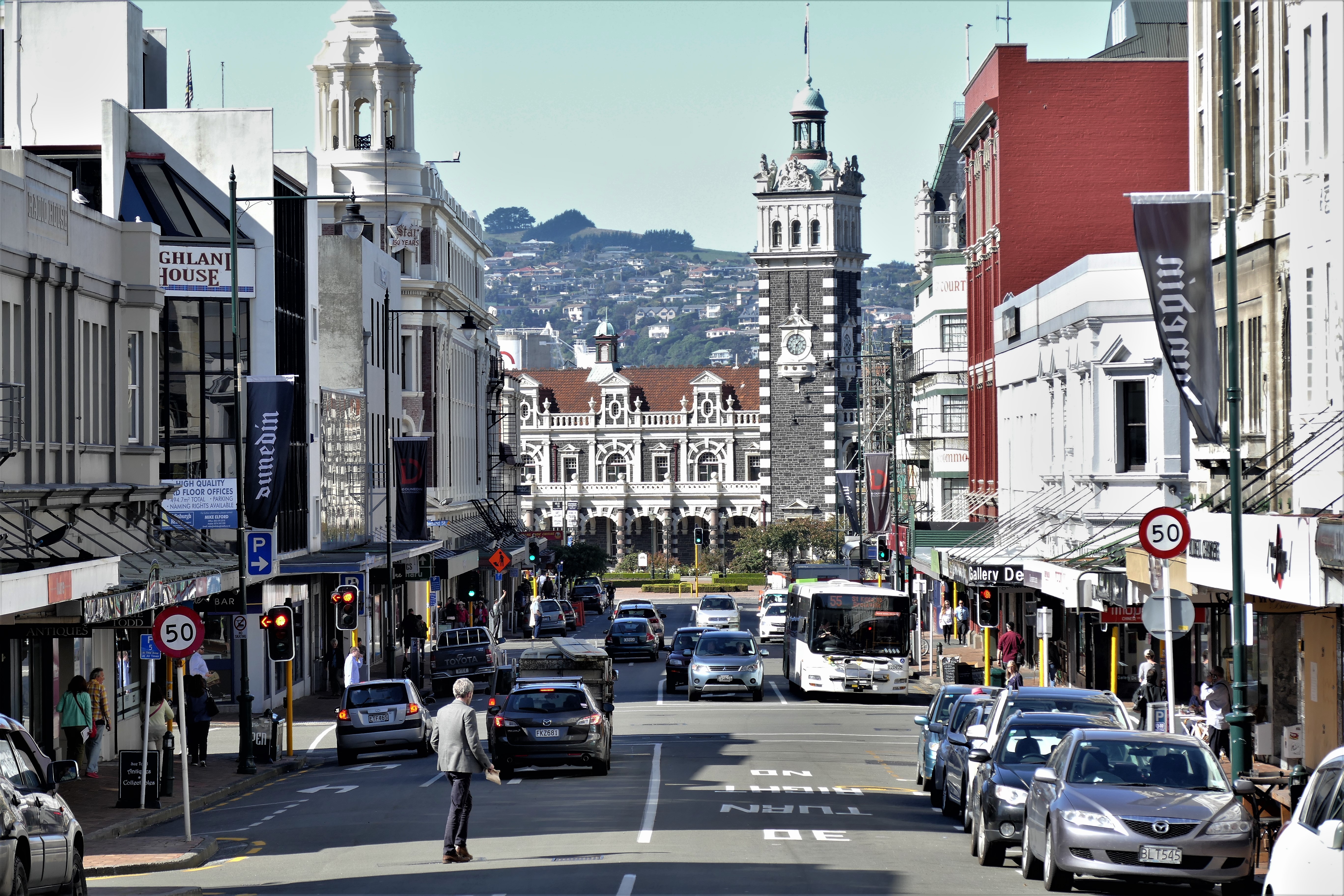
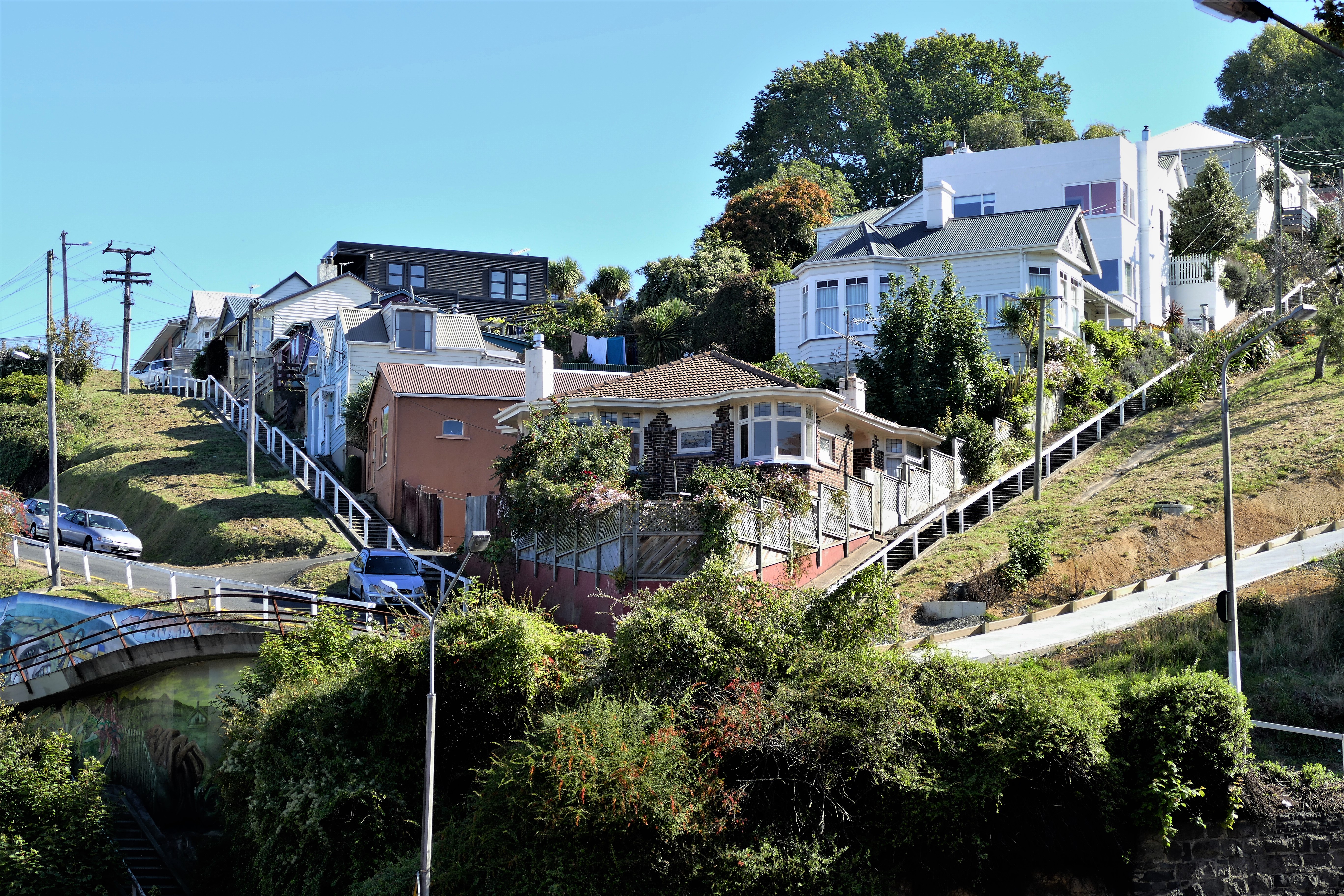
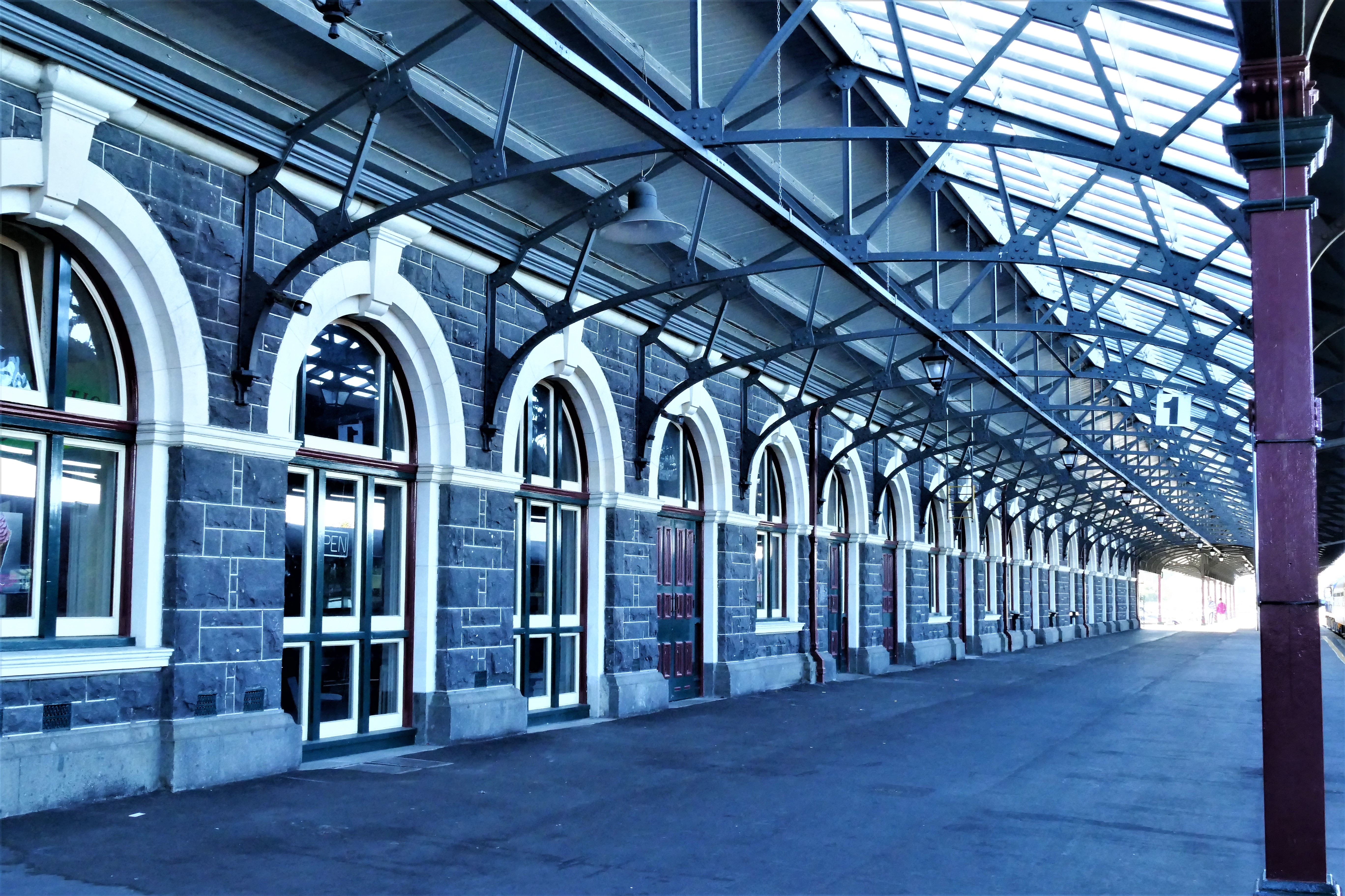
A rental car was ready at the airport, and we were drove downtown and parked in a small lot near the Otago Settlers Museum. Liz and I set off looking for lunch in the Octagon and the center of the city. After lunch, we climbed the steps of Saint Paul's Cathedral, an Episcopal Church. Inside, there was a young man playing the vast organ. Later, Craig told us that he got the young man to play Amazing Grace for him on that organ. Liz and I walked further up Stuart Street to get a better photo opportunity, then on Smith Street to Tennyson Street past the Otago Girls High School. We walked down a walkway onto Rattray Street, and found we were at the entrance of Speight's Brewery. Unfortunately, we were too late to get a tour, and more unfortunately, we were told by the man there that the only place in that United States that imported Speight's beer was Hawaii. We walked to Cumbertland Street, then back toward the train station. We explored the picturesque train station, then went across the street into the Inge Doesburg Gallery and Studio and found gifts for Mike and Amy at Christmas.
(Day 10, flight 3) We departed NZTI and turned west over the city of Dunedin and up Otaga Harbor which had cleared of clouds except at the mouth of the harbor. He climbed to 3500 and routed northeast to look at the dam at Poolburn Reservoir, then turned toward Tarras. We approached the Geordie Hill Station where I made my last landing at the station after a 1 hour 20 minute flight.
3/31/17: Last day
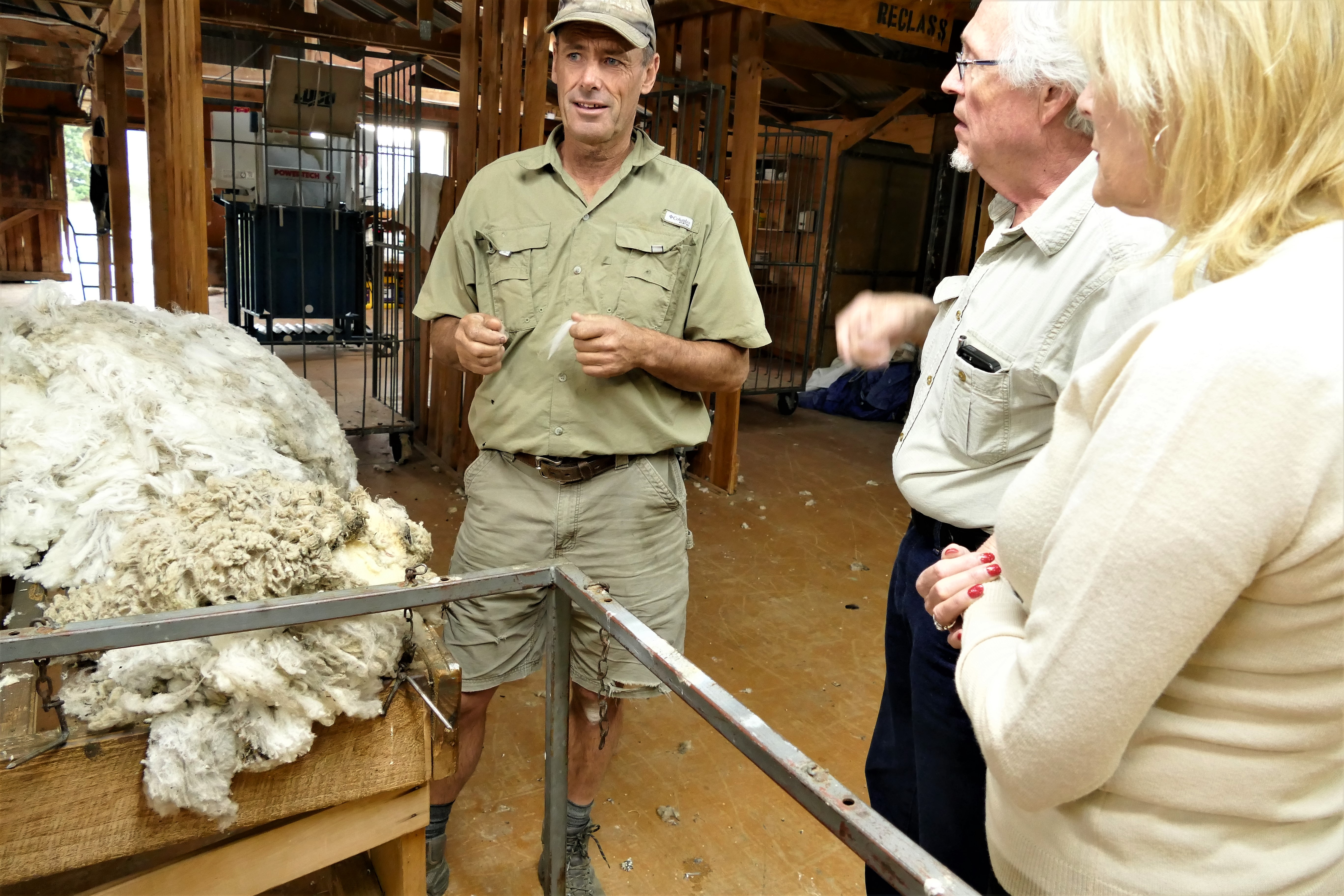
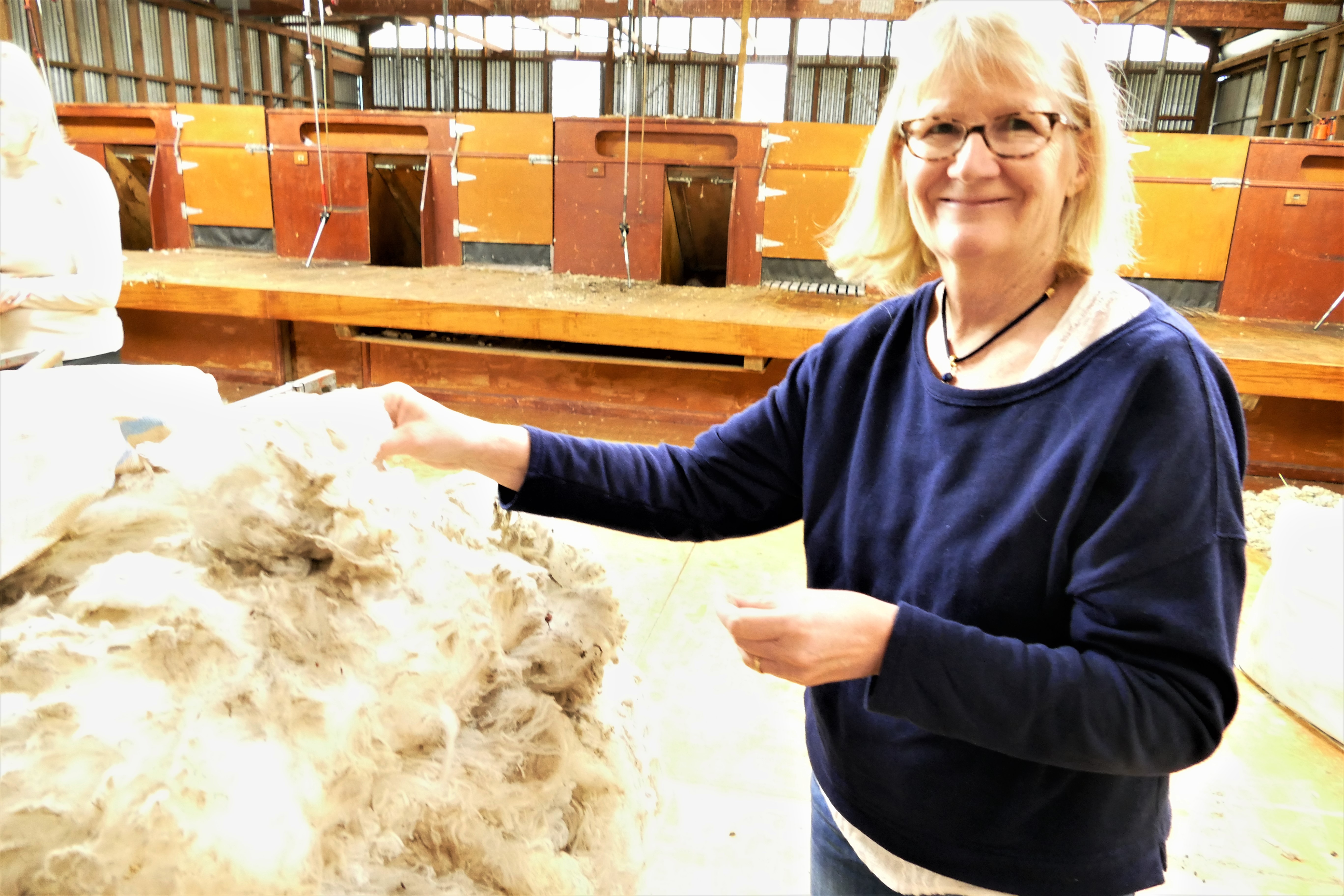
Matt offered to give us a tour of his farm, which we were excited to do. Matt
showed us where the sheep were sheared and we were able to feel what raw Merino
wool felt like. Matt told us that the lambs are kept in paddocks with green
grass, which was irrigated. This helped them grow better. The adult sheep
grazed the dry grass on the hills, which they preferred. It would soon be time
at Geordie Hill Station to set the rams loose into the paddocks with female
sheep. The sheep would be pregnant, with 1 or 2 lambs per ewe. They check the
pregnant sheep with ultrasounds. Five months later, during February,
"lambing" would occur. Weaning takes place 2 months later. Most male
lambs are castrated. About 18 months after birth, the lambs are sheared
because that is when they have the finest wool. Then most of the lambs are
sold for market before their first adult teeth come it, because after the adult
teeth grow in, their meat is mutton and only worth half as much. He explained the process of converting the raw wool into
clothes, and showed us a video from Reda, which had used wool from Geordie Hill
Station,
https://www.youtube.com/watch?v=_bb8EU793Aw.
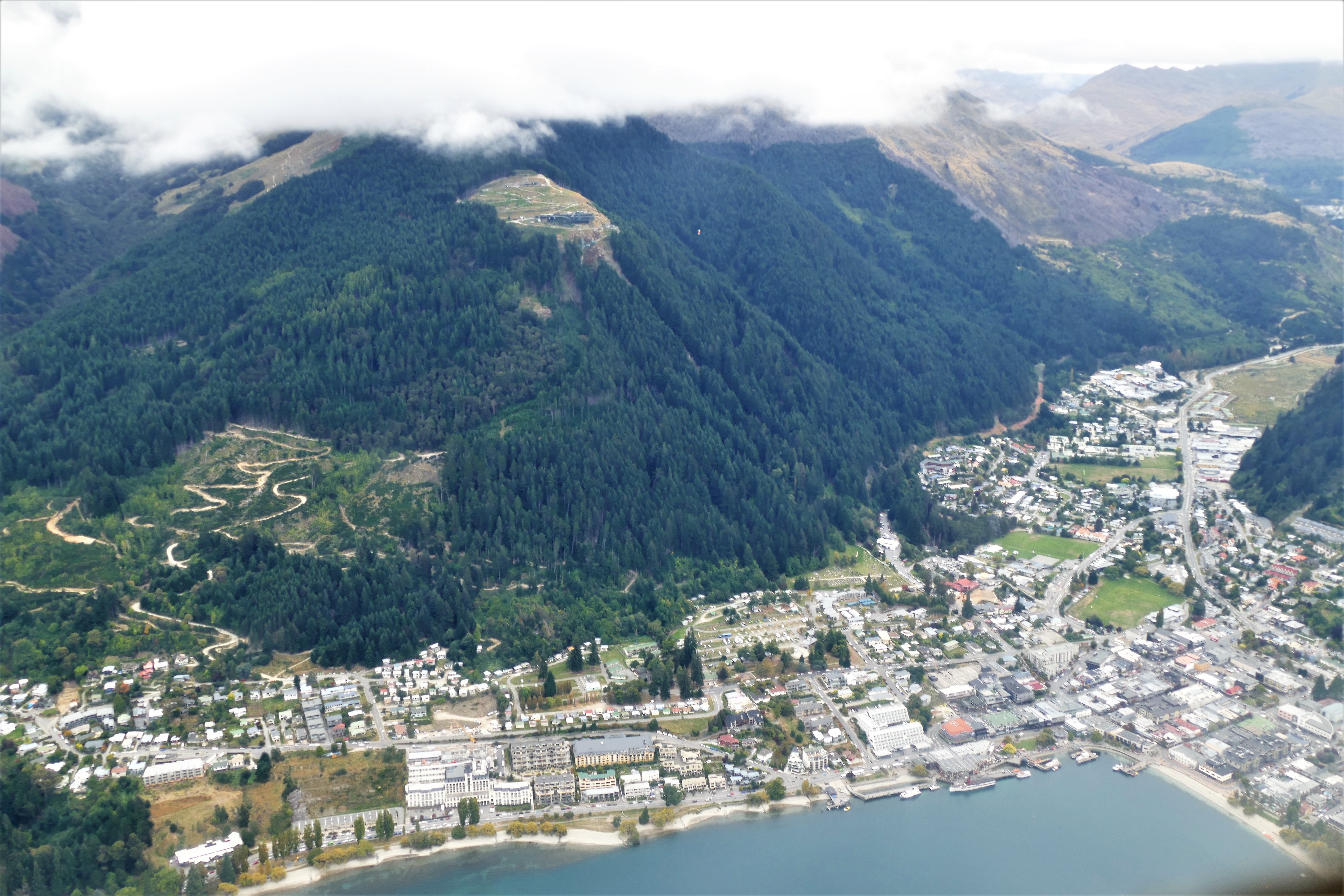
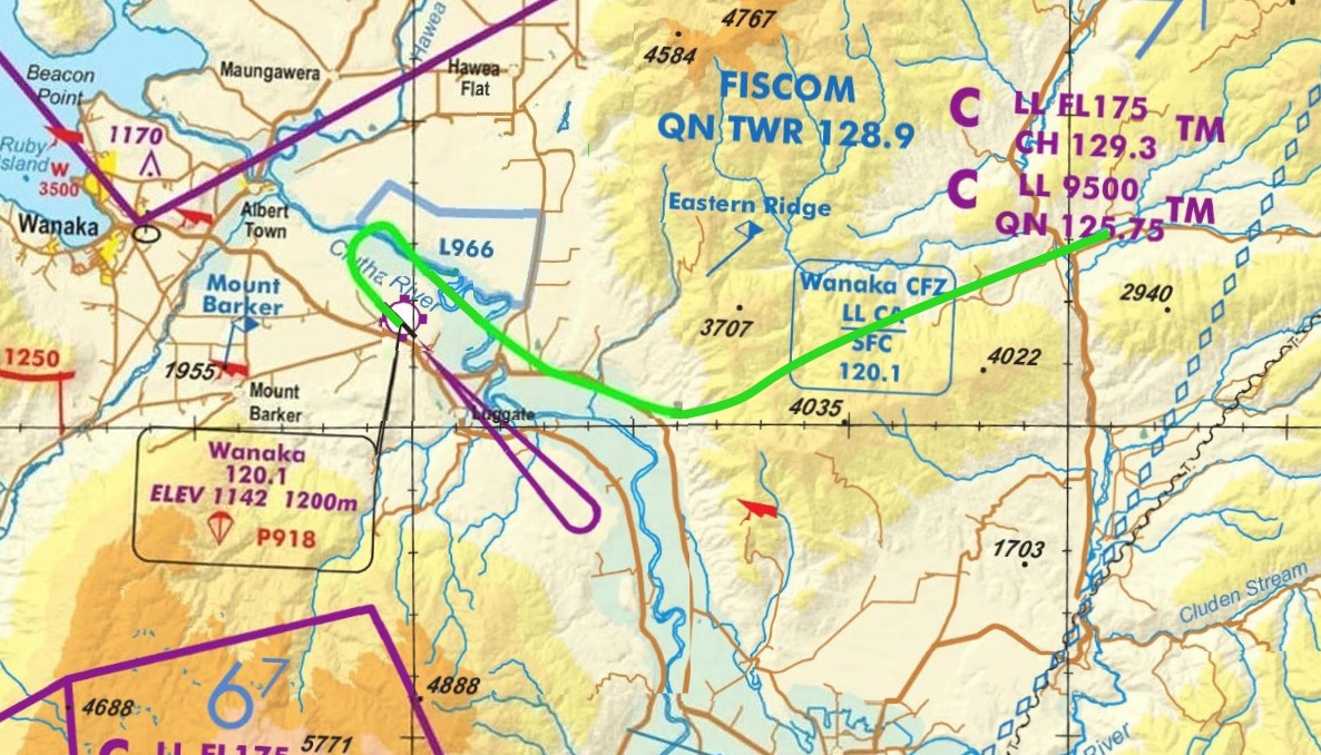
(Day 11, flight 1) With Nick as instructor in ZK-TRS, we took off and headed directly for Queenstown. There were high clouds and we climbed to 5500 feet to clear the mountains. I handled the radios, called Queenstown information at the Cardona Township checkpoint and Queenstown tower at the Cardona saddle. As we descended, we were initially cleared to Lake Hayes, then cleared to land. After a 35 minute flight, I made my last landing in New Zealand at Queenstown Airport, NZQN.
While in New Zealand, I flew 24.1 hours for 27 flights, with 3.2 hours as pilot in command. After 24.1 hours of instruction, mostly in mountain flying and short, soft field landings, I feel pretty confident flying in the mountains. I also feel confident with navigating and radio communication in New Zealand.
I'm not sure how applicable New Zealand flying is to the continental United States. The most Application mountain peaks are not higher than 5000 feet and it's easy to fly over them, but you need 2500 cloud bases to get though VFR. Except for interstate 10 (the "I fly road" type of IFR) in the south, the Rocky mountains are mostly impassable below 12,000 feet for about 700 miles from the 35° to the 47° parallel. Maybe there are 3 paths that can be flown through at 9000 feet. So when I'm in the United States and there are clouds covering the mountain ridges, I'll be filing an instrument flight plan and flying IFR.
 4/1/17: Return
home
4/1/17: Return
home

We left Queenstown at 7:00 am on Air New Zealand for a 2 hour flight to Auckland. While at Auckland, we found about 50 photos for our cell phones to show others back home. We left at 1:20 pm on United Airlines 916 and arrived in San Francisco at 6:30 am the same day (after crossing the international date line). After breakfast with Chris and his girlfriend, we flew an Airbus to Houston, and a regional jet back to Pensacola. The trip back involved flying 21 hours and 9276 miles, over 32 1/2 hours.